Category:Feanstermoune, Surhuisterveen
| Object location | | View all coordinates using: OpenStreetMap |
|---|
windmill in Surhuisterveen, Netherlands  | |||||
| Upload media | |||||
| Instance of | |||||
|---|---|---|---|---|---|
| Location | Surhuisterveen, Achtkarspelen, Friesland, Netherlands | ||||
| Street address |
| ||||
| Located on street |
| ||||
| Has use | |||||
| Heritage designation |
| ||||
| Source of energy | |||||
 | |||||
Nederlands: De Feanstermoune / De molen van Surhuisterveen
|
This is a category about rijksmonument number 511200
|
| Address |
|
Media in category "Feanstermoune, Surhuisterveen"
The following 11 files are in this category, out of 11 total.
-
 Bronsmotor Molen Koartwald Surhuisterveen.JPG 2,304 × 3,072; 3.32 MB
-
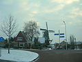 De molen in winterkleed. Kortwoude.JPG 2,592 × 1,944; 732 KB
-
 Feanstermoune Surhuisterveen.jpg 4,608 × 3,456; 2.5 MB
-
 Feanstermoune, Koartwâld 6, Surhuisterveen.JPG 4,608 × 3,456; 3.29 MB
-
 Koartwâld (Feanstermoune).jpg 2,048 × 1,536; 453 KB
-
 Molen Surhuisterveen.JPG 4,032 × 3,024; 4.64 MB
-
 Surhuisterveen 9.jpg 2,449 × 3,265; 1.65 MB
-
 Surhuisterveen, de door storm vernielde molen aan de molenweg.jpg 2,161 × 3,224; 1.35 MB
-
 Surhuisterveen, Feanstermoune.JPG 4,608 × 3,456; 3.8 MB
-
 Surhuisterveen-Molen Koartwald 2.jpg 1,500 × 1,000; 1.15 MB
-
 Surhuisterveen-Molen Koartwald.jpg 1,500 × 1,000; 1.15 MB


.jpg)


