Category:February 2006 in County Tyrone
English: Images taken in County Tyrone, Northern Ireland in this month of 2006 (not the date of the upload).
| Jan | Feb | Mar | Apr | May | Jun | Jul | Aug | Sep | Oct | Nov | Dec | ||
| ← | 301 | 291 | 688 | 258 | 324 | 109 | 276 | 154 | 243 | 330 | 180 | 92 | → |
|---|
Media in category "February 2006 in County Tyrone"
The following 200 files are in this category, out of 291 total.
(previous page) (next page)-
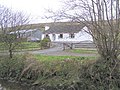
 "Rest and be Thankful" bench - geograph.org.uk - 116817.jpg 640 × 479; 175 KB
-
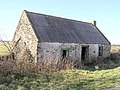
 Abandoned cottage - geograph.org.uk - 118462.jpg 640 × 479; 180 KB
-
 Abandoned farm at Kells, Newtownstewart. - geograph.org.uk - 126471.jpg 640 × 479; 157 KB
-
 Abbey Hall, Omagh - geograph.org.uk - 127258.jpg 640 × 479; 76 KB
-
 Abbey, Omagh - geograph.org.uk - 129695.jpg 640 × 453; 84 KB
-
 Alliance and Leicester, Omagh - geograph.org.uk - 129641.jpg 640 × 412; 96 KB
-
 Altataggart Bridge - geograph.org.uk - 124761.jpg 640 × 479; 146 KB
-
 Aughadarragh Townland - geograph.org.uk - 118418.jpg 640 × 479; 115 KB
-
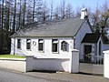
 Badoney Presbyterian Church - geograph.org.uk - 125526.jpg 640 × 406; 72 KB
-
 Bakewells, Omagh - geograph.org.uk - 129699.jpg 454 × 640; 87 KB
-
 Ballymalus Grove, Omagh - geograph.org.uk - 129575.jpg 640 × 479; 102 KB
-
 Ballynasollus Road. Plumbridge - geograph.org.uk - 128400.jpg 640 × 479; 70 KB
-
 Ballynasollus Townland - geograph.org.uk - 128403.jpg 640 × 479; 101 KB
-
 Ballynatubbrit Mountain - geograph.org.uk - 118033.jpg 640 × 479; 105 KB
-
 Banardos, Omagh - geograph.org.uk - 129553.jpg 640 × 479; 97 KB
-
 Barr Church of Ireland - geograph.org.uk - 123231.jpg 640 × 479; 104 KB
-
 BBC Radio Ulster - geograph.org.uk - 119220.jpg 475 × 640; 107 KB
-
 Bed Shop, Omagh - geograph.org.uk - 129722.jpg 640 × 464; 116 KB
-
 Beltany Upper - geograph.org.uk - 126116.jpg 640 × 479; 151 KB
-
 Beltrim - geograph.org.uk - 124753.jpg 640 × 479; 126 KB
-
 Beltrim and Lenamore Townland - geograph.org.uk - 124712.jpg 640 × 269; 77 KB
-
 Beltrim National School - geograph.org.uk - 124777.jpg 640 × 479; 135 KB
-
 Beltrim Townland - geograph.org.uk - 124729.jpg 640 × 479; 161 KB
-
 Beltrim Townland - geograph.org.uk - 124741.jpg 640 × 479; 162 KB
-
 Bennetts, Omagh - geograph.org.uk - 129644.jpg 640 × 457; 106 KB
-
 Bessy Bell - geograph.org.uk - 126119.jpg 640 × 479; 135 KB
-
 Bridge Street, Omagh - geograph.org.uk - 127198.jpg 640 × 479; 117 KB
-
 Bungalow at Greenan Mountain - geograph.org.uk - 118467.jpg 640 × 479; 170 KB
-
 Bus shelter at Derrynasser - geograph.org.uk - 120239.jpg 640 × 479; 110 KB
-
 Cairn on top of Mullaghcarn Mountain - geograph.org.uk - 116782.jpg 640 × 479; 122 KB
-
 Camderry Townland - geograph.org.uk - 118414.jpg 640 × 479; 134 KB
-
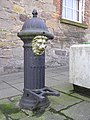 Cast iron Pump - geograph.org.uk - 125564.jpg 479 × 640; 124 KB
-
 Castle Place, Omagh - geograph.org.uk - 127245.jpg 640 × 479; 104 KB
-
 Castle Street, Omagh - geograph.org.uk - 127256.jpg 640 × 479; 109 KB
-
 Children's burial ground, Meenatumigan - geograph.org.uk - 126458.jpg 640 × 479; 185 KB
-
 Christ Church COI, Trillick - geograph.org.uk - 121964.jpg 640 × 479; 101 KB
-
 Church Hill, Omagh - geograph.org.uk - 127213.jpg 640 × 479; 99 KB
-
 Church Street, Omagh - geograph.org.uk - 127212.jpg 640 × 479; 90 KB
-
 Classic Urban, Omagh - geograph.org.uk - 129648.jpg 640 × 472; 107 KB
-
 Clements Villas, Omagh - geograph.org.uk - 129573.jpg 640 × 479; 83 KB
-
 Clinton Cards, Omagh - geograph.org.uk - 129646.jpg 640 × 476; 99 KB
-
 Coming down Rylagh Top - geograph.org.uk - 124669.jpg 640 × 479; 141 KB
-
 Coming down the mountain - geograph.org.uk - 120232.jpg 640 × 479; 173 KB
-
 Cool Lower - geograph.org.uk - 118453.jpg 640 × 479; 135 KB
-
 Cornavarrow Townland - geograph.org.uk - 118454.jpg 640 × 479; 104 KB
-
 Corrick Abbey - geograph.org.uk - 128545.jpg 640 × 479; 107 KB
-
 Corrick Gospel Hall - geograph.org.uk - 128492.jpg 640 × 479; 136 KB
-
 Corrick Outdoor Centre - geograph.org.uk - 128921.jpg 640 × 479; 97 KB
-
 Corrick Presbyterian Church - geograph.org.uk - 128495.jpg 640 × 479; 127 KB
-
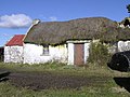
 Cottage at Cullion Townland - geograph.org.uk - 116743.jpg 640 × 479; 111 KB
-
-
 Cottage at Gortin - geograph.org.uk - 128359.jpg 640 × 479; 158 KB
-
 Cottage at Pubble, Newtownstewart - geograph.org.uk - 126446.jpg 640 × 479; 136 KB
-
 Cottage at Rylands, Gortin - geograph.org.uk - 125463.jpg 640 × 479; 118 KB
-
-
 County Tyrone sign - geograph.org.uk - 120259.jpg 640 × 479; 132 KB
-
 Crannog at Togherdoo Lough - geograph.org.uk - 121931.jpg 640 × 479; 177 KB
-
 Crocknaboortan Townland - geograph.org.uk - 123214.jpg 640 × 479; 131 KB
-
 Crocknakeeferty Mountain - geograph.org.uk - 124640.jpg 640 × 329; 76 KB
-
 Crockroe Orange Hall.jpg 640 × 479; 95 KB
-
 Crow Hill - geograph.org.uk - 125529.jpg 640 × 479; 161 KB
-
 Cullion Townland - geograph.org.uk - 118040.jpg 640 × 479; 88 KB
-
 Culvacullion Townland - geograph.org.uk - 128365.jpg 640 × 479; 102 KB
-
 Culvacullion Townland - geograph.org.uk - 128370.jpg 640 × 479; 107 KB
-
 Culvacullion Townland - geograph.org.uk - 128373.jpg 640 × 479; 163 KB
-
 Culvacullion Townland - geograph.org.uk - 128376.jpg 640 × 479; 135 KB
-
 Curraghamulkin Townland - geograph.org.uk - 118458.jpg 640 × 479; 113 KB
-
 Curraghamulkin Townland - geograph.org.uk - 118460.jpg 640 × 479; 138 KB
-
 Curraghchosaly Mountain - geograph.org.uk - 125465.jpg 640 × 479; 151 KB
-
 D A McLernon, Omagh - geograph.org.uk - 129681.jpg 640 × 479; 103 KB
-
 Day Today, Omagh - geograph.org.uk - 127270.jpg 443 × 640; 113 KB
-
 Dentist's Premises, Omagh - geograph.org.uk - 129611.jpg 640 × 479; 140 KB
-
 Devlin's shop, Omagh - geograph.org.uk - 127229.jpg 487 × 640; 136 KB
-
 Difficult driving conditions - geograph.org.uk - 129547.jpg 640 × 479; 133 KB
-
 Domestic Appliance Centre, Omagh - geograph.org.uk - 129615.jpg 640 × 479; 104 KB
-
 Dooish mountain - geograph.org.uk - 118456.jpg 640 × 311; 70 KB
-
 Droit Road, Dunbunraver - geograph.org.uk - 125539.jpg 640 × 479; 134 KB
-
 Droit Townland - geograph.org.uk - 125536.jpg 640 × 479; 135 KB
-
 Droit Townland - geograph.org.uk - 125537.jpg 640 × 479; 134 KB
-
 Drumlish Primary School - geograph.org.uk - 118410.jpg 640 × 479; 110 KB
-
 Drumlish Townland - geograph.org.uk - 118409.jpg 640 × 479; 125 KB
-
 Drumshell Townland - geograph.org.uk - 118407.jpg 640 × 479; 112 KB
-
 Drumskinny Townland - geograph.org.uk - 121929.jpg 640 × 479; 115 KB
-
 Dunbunraver Townland - geograph.org.uk - 125484.jpg 640 × 479; 158 KB
-
 Eatwells, Omagh - geograph.org.uk - 129704.jpg 640 × 479; 98 KB
-
 Edenagon Townland - geograph.org.uk - 121941.jpg 640 × 479; 144 KB
-
 Ennetta's, Omagh - geograph.org.uk - 129652.jpg 640 × 461; 107 KB
-
 Fairy Tree House - geograph.org.uk - 120257.jpg 640 × 479; 143 KB
-
 Farm at Castleroddy - geograph.org.uk - 118012.jpg 640 × 479; 128 KB
-
 Farm at Drumlish - geograph.org.uk - 118441.jpg 640 × 479; 109 KB
-
 Farmhouse at Freughmore - geograph.org.uk - 115788.jpg 640 × 479; 183 KB
-
 Filling station, Omagh - geograph.org.uk - 127273.jpg 640 × 374; 99 KB
-
 Forster Richardson, Omagh - geograph.org.uk - 129654.jpg 640 × 395; 95 KB
-
 Foundry Lane - geograph.org.uk - 119690.jpg 479 × 640; 122 KB
-
 Gallows Hill, Omagh - geograph.org.uk - 127220.jpg 640 × 479; 169 KB
-
 Geese at Mellon Homestead, Omagh - geograph.org.uk - 284059.jpg 640 × 479; 87 KB
-
 Georges Street - geograph.org.uk - 127210.jpg 640 × 479; 96 KB
-
 Glashygolgan Townland - geograph.org.uk - 128416.jpg 640 × 479; 115 KB
-
 Glengawna - geograph.org.uk - 116736.jpg 640 × 479; 188 KB
-
 Golan Townland - geograph.org.uk - 118411.jpg 640 × 479; 91 KB
-
 Gormley, Castle Street, Omagh - geograph.org.uk - 127237.jpg 431 × 640; 81 KB
-
 Gortin - geograph.org.uk - 125546.jpg 640 × 255; 53 KB
-
 Gortin Glen Forest Park - geograph.org.uk - 116761.jpg 640 × 479; 167 KB
-
 Gortin Glen Forest Park - geograph.org.uk - 116763.jpg 640 × 479; 113 KB
-
 Gortin Glen Forest Park - geograph.org.uk - 116765.jpg 640 × 479; 101 KB
-
 Gortin Glen Forest Park - geograph.org.uk - 116768.jpg 640 × 479; 113 KB
-
 Gortin Glen Forest Park - geograph.org.uk - 116799.jpg 640 × 479; 114 KB
-
 Gortin Glen Forest Park - geograph.org.uk - 116805.jpg 640 × 479; 150 KB
-
 Gortin Glens - geograph.org.uk - 124700.jpg 640 × 479; 136 KB
-
 Gortin Glens Forest Park - geograph.org.uk - 116752.jpg 640 × 479; 189 KB
-
 Gortin Glens Forest Park - geograph.org.uk - 116755.jpg 640 × 479; 135 KB
-
 Gortin Glens Forest Park - geograph.org.uk - 116767.jpg 640 × 479; 125 KB
-
 Gortin Glens Forest Park - geograph.org.uk - 116806.jpg 640 × 479; 149 KB
-
 Gortin Glens Forest Park - geograph.org.uk - 116812.jpg 640 × 479; 155 KB
-
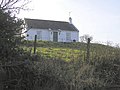
 Gortin Presbyterian Church - geograph.org.uk - 125549.jpg 462 × 640; 78 KB
-
 Gortin RC Church - geograph.org.uk - 124793.jpg 479 × 640; 93 KB
-
 Gortin, County Tyrone - geograph.org.uk - 124771.jpg 640 × 254; 58 KB
-
 Greenan and Tappaghan Mountains - geograph.org.uk - 120208.jpg 640 × 479; 146 KB
-
 Greenan Mountain - geograph.org.uk - 120252.jpg 640 × 317; 65 KB
-
 Greenan Mountain - geograph.org.uk - 120255.jpg 640 × 312; 72 KB
-
 Hair Affair, Omagh - geograph.org.uk - 129723.jpg 443 × 640; 76 KB
-

-
 Hill fort at Fintona, Co.Tyrone - geograph.org.uk - 123161.jpg 640 × 479; 122 KB
-
 Hill fort at Tattyreagh Glebe - geograph.org.uk - 115783.jpg 640 × 479; 149 KB
-
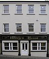 Hillview House, Omagh - geograph.org.uk - 127217.jpg 531 × 640; 88 KB
-
 Holmview Terrace, Omagh - geograph.org.uk - 127193.jpg 640 × 479; 110 KB
-
 Home Decor Centre, Omagh - geograph.org.uk - 129738.jpg 457 × 640; 126 KB
-
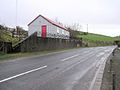
 Hood and Co, Newtownstewart, Co. Tyrone - geograph.org.uk - 126438.jpg 640 × 541; 113 KB
-
 House on Hospital Road, Omagh - geograph.org.uk - 129606.jpg 640 × 479; 143 KB
-
 Hynes of Omagh - geograph.org.uk - 129680.jpg 640 × 349; 77 KB
-
 IKON, Omagh - geograph.org.uk - 129725.jpg 640 × 479; 120 KB
-
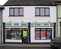 Internet Cafe, Omagh - geograph.org.uk - 127223.jpg 640 × 517; 122 KB
-
 Jack McGinn and Co, Omagh - geograph.org.uk - 129616.jpg 640 × 464; 94 KB
-
 Jinja Crafts, Omagh - geograph.org.uk - 129712.jpg 640 × 461; 111 KB
-

-

-
 Kampar Restaurant and Carry-out - geograph.org.uk - 127231.jpg 640 × 513; 88 KB
-
 Kevlin Road, Omagh - geograph.org.uk - 127215.jpg 640 × 479; 104 KB
-
 Kilknock Townland - geograph.org.uk - 123228.jpg 640 × 479; 157 KB
-
 Killymore Bridge - geograph.org.uk - 125523.jpg 640 × 479; 167 KB
-
 Killymore Townland - geograph.org.uk - 125499.jpg 640 × 479; 144 KB
-
 Knockaraven Townland - geograph.org.uk - 118416.jpg 640 × 479; 115 KB
-
 Larry's Barber Shop, Omagh - geograph.org.uk - 129701.jpg 640 × 483; 112 KB
-
 Learden Upper - geograph.org.uk - 128932.jpg 640 × 479; 142 KB
-
 Legacurry Townland - geograph.org.uk - 126121.jpg 640 × 479; 144 KB
-
 Lenamore Townland - geograph.org.uk - 124802.jpg 640 × 479; 137 KB
-
 Lenamore Townland - geograph.org.uk - 124807.jpg 640 × 479; 129 KB
-
 Lenamore Townland - geograph.org.uk - 124809.jpg 640 × 232; 58 KB
-
 Lenamore Townland - geograph.org.uk - 124813.jpg 640 × 479; 132 KB
-
 Lenamore Townland - geograph.org.uk - 124815.jpg 640 × 479; 134 KB
-
 Letterbrat, Plumbridge - geograph.org.uk - 128388.jpg 640 × 479; 151 KB
-
 Letterbrat, Plumbridge - geograph.org.uk - 128391.jpg 640 × 479; 94 KB
-
 Letterbrat, Plumbridge - geograph.org.uk - 128393.jpg 640 × 479; 97 KB
-
 Lime Kiln - geograph.org.uk - 116742.jpg 640 × 479; 183 KB
-
 Liscabble Mountain - geograph.org.uk - 125489.jpg 640 × 479; 151 KB
-
 Liscabble Primary School - geograph.org.uk - 125541.jpg 640 × 479; 102 KB
-
 Liscabble Townland - geograph.org.uk - 125494.jpg 640 × 479; 113 KB
-
 Lislap Forest - geograph.org.uk - 118039.jpg 640 × 479; 157 KB
-
 Lisnacreaght Townland - geograph.org.uk - 128383.jpg 640 × 479; 106 KB
-
 Lisnaharney Townland - geograph.org.uk - 118028.jpg 640 × 479; 110 KB
-
 Lisnaharney Townland - geograph.org.uk - 118037.jpg 640 × 479; 124 KB
-

-
 Mace shop, Omagh - geograph.org.uk - 127240.jpg 640 × 510; 111 KB
-
 Magic Moments, Omagh - geograph.org.uk - 127265.jpg 426 × 640; 97 KB
-
 Mandarin Kitchen, Omagh - geograph.org.uk - 129713.jpg 640 × 477; 109 KB
-
 Matrix, Omagh - geograph.org.uk - 129620.jpg 640 × 479; 90 KB
-
 McAleer Travel, Omagh - geograph.org.uk - 129623.jpg 640 × 479; 111 KB
-
 McClay Park, Omagh - geograph.org.uk - 129598.jpg 640 × 479; 77 KB
-
 McFadden, Omagh - geograph.org.uk - 129621.jpg 640 × 510; 128 KB
-

-
 Milan Clothing Company, Omagh - geograph.org.uk - 129715.jpg 640 × 481; 110 KB
-
 Monday Market, Omagh - geograph.org.uk - 118006.jpg 640 × 479; 100 KB
-
 Moneygar Townland - geograph.org.uk - 123229.jpg 640 × 479; 119 KB
-
 Mortgage and Property, Omagh - geograph.org.uk - 129708.jpg 407 × 640; 88 KB
-
 Mossey's Bar, Gortin - geograph.org.uk - 125554.jpg 640 × 479; 111 KB
-
 Mr Tumbles Fun House, Gortin Road, Omagh - geograph.org.uk - 116735.jpg 640 × 479; 111 KB
-
 Mullaghcarn Mountain - geograph.org.uk - 116796.jpg 640 × 269; 50 KB
-
 Mullaghcarn Mountain - geograph.org.uk - 116797.jpg 640 × 479; 102 KB
-

-
 Mullanboy Townland - geograph.org.uk - 118412.jpg 640 × 479; 129 KB
-
 Mullanboy Townland - geograph.org.uk - 118413.jpg 640 × 479; 106 KB
-
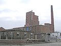 Nestles Factory, Beltany Road,Omagh - geograph.org.uk - 116423.jpg 640 × 479; 73 KB
-
 Nicholl and Chiels, Omagh - geograph.org.uk - 129718.jpg 640 × 358; 81 KB
-
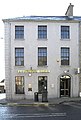 Northern Bank, Newtownstewart - geograph.org.uk - 126442.jpg 432 × 640; 98 KB
-
 Nursing Home, Omagh - geograph.org.uk - 129602.jpg 640 × 479; 82 KB
-
 Nylo, Omagh - geograph.org.uk - 129711.jpg 640 × 355; 75 KB
-
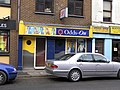 Odds-On, Omagh - geograph.org.uk - 129720.jpg 640 × 479; 117 KB
-
 Omagh Arts Centre - geograph.org.uk - 127201.jpg 640 × 479; 115 KB
-
 Omagh College, Mountjoy Road, Omagh - geograph.org.uk - 119206.jpg 640 × 333; 99 KB
-
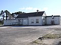
 Omagh Fire Station, Mountjoy Road, Omagh - geograph.org.uk - 119222.jpg 640 × 479; 125 KB
-
 Omagh street renovations. - geograph.org.uk - 119691.jpg 640 × 332; 107 KB
-

-
 Orthodontist, Omagh - geograph.org.uk - 129614.jpg 640 × 479; 79 KB
-
 OS NI Benchmark - geograph.org.uk - 116791.jpg 341 × 640; 105 KB
-
 Oxfam, Omagh - geograph.org.uk - 129742.jpg 640 × 562; 108 KB
-
 P. Cleary, Omagh - geograph.org.uk - 127208.jpg 456 × 640; 75 KB
-
 Perfect Pizza, Omagh - geograph.org.uk - 129746.jpg 394 × 640; 95 KB
-
 Pizzarama, Omagh - geograph.org.uk - 129747.jpg 422 × 640; 84 KB
-
 Plaque on wall - geograph.org.uk - 127211.jpg 640 × 479; 143 KB
-
 Pound Stretcher, Omagh - geograph.org.uk - 129555.jpg 640 × 479; 118 KB


,_Omagh_-_geograph.org.uk_-_129618.jpg)


