Category:February 2006 in Gloucestershire
Ceremonial counties of England: Berkshire · Buckinghamshire · Cambridgeshire · Cheshire · Cornwall · Cumbria · Derbyshire · Devon · Dorset · Durham · East Riding of Yorkshire · East Sussex · Essex · Gloucestershire · Greater London · Greater Manchester · Hampshire · Herefordshire · Hertfordshire · Isle of Wight · Kent · Lancashire · Leicestershire · Lincolnshire · Merseyside · Norfolk · North Yorkshire · Northamptonshire · Northumberland · Nottinghamshire · Oxfordshire · Rutland · Shropshire · Somerset · South Yorkshire · Staffordshire · Suffolk · Surrey · Tyne and Wear · Warwickshire · West Midlands · West Sussex · West Yorkshire · Wiltshire · Worcestershire
City-counties: Bristol ·
Former historic counties:
Other former counties:
City-counties: Bristol ·
Former historic counties:
Other former counties:
Deutsch: Bilder, die im Februar 2006 in Gloucestershire aufgenommen worden sind. Bitte beachten Sie, dass dies weder das Datum des Uploads noch das Datum des Scannens eines Fotos ist.
English: Images/pictures taken in Gloucestershire during February 2006. Note this is not the date of the upload, nor the date a photo was scanned.
Español: Fotografías o imágenes tomadas en Gloucestershire durante febrero 2006. No es la fecha de subida ni escaneo, sino la fecha en que las fotografías o imágenes se crearon.
Esperanto: Bildoj faritaj en Gloucestershire en februaro 2006. Tio ne estas la dato, kiam la bildoj estis alŝutitaj aŭ skanitaj.
Français : Photographies ou images prises en Gloucestershire durant février 2006. Ce n'est pas la date du téléchargement ou du scan.
Galego: Fotografías ou imaxes tomadas en Gloucestershire durante febreiro 2006. Non é a data de subida nin escaneamento, senón a data na que se crearon as fotografías ou imaxes.
Italiano: Fotografie o immagini scattate a Gloucestershire nel febbraio 2006. Nota bene: la data non si riferisce né a quella di upload né a quella in cui la foto è stata digitalizzata.
Norsk bokmål: Bilder tatt i Gloucestershire i løpet av februar 2006. Merk at dette ikke er datoen for opplasting, eller når et bilde har blitt skannet.
Norsk nynorsk: Bilete teke i Gloucestershire i løpet av februar 2006. Merk at dette ikkje er datoen for opplasting, eller når eit bilete har vorte skanna.
Русский: Изображения, сделанные в Gloucestershire в течение февраль 2006 (не дата загрузки изображения).
Українська: Зображення, зроблені в Gloucestershire протягом лютий 2006. Зауважте, що це не дата завантаження чи дата сканування фотографії.
| February 2005 | ← | February 2006 | → | February 2007 | |||||||
| Jan | Feb | Mar | Apr | May | Jun | Jul | Aug | Sep | Oct | Nov | Dec |
| 24 | 24 | 27 | 12 | 32 | 23 | 12 | 23 | 35 | 26 | 12 | 22 |
|---|---|---|---|---|---|---|---|---|---|---|---|
Media in category "February 2006 in Gloucestershire"
The following 24 files are in this category, out of 24 total.
-
 A riverside house in Framilode - geograph.org.uk - 120974.jpg 640 × 480; 111 KB
-
 Bridge under the M5 by Hollywood Tower - geograph.org.uk - 118670.jpg 640 × 478; 179 KB
-
 Charlton Common, Brentry - geograph.org.uk - 115781.jpg 640 × 480; 160 KB
-
 End of the road - geograph.org.uk - 118663.jpg 480 × 640; 151 KB
-
 Hallen Road passing under the M5 - geograph.org.uk - 118450.jpg 640 × 480; 189 KB
-
 Hill view Nurseries, Shurdington - geograph.org.uk - 129819.jpg 640 × 479; 71 KB
-
-
 Izod's fingerpost (detail) - geograph.org.uk - 122712.jpg 640 × 480; 82 KB
-

-

-
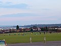 Playing Fields at Filton - geograph.org.uk - 121419.jpg 640 × 480; 95 KB
-

-
 Pylon and power lines - geograph.org.uk - 130421.jpg 640 × 426; 83 KB
-
 Pylons Poole Keynes - geograph.org.uk - 128681.jpg 480 × 640; 81 KB
-
 Saniger Sands from The Tack - geograph.org.uk - 367816.jpg 640 × 480; 51 KB
-
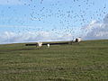 Seagulls and sheep on landfill site - geograph.org.uk - 123655.jpg 640 × 480; 99 KB
-

-
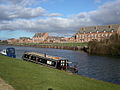
 Stroudwater canal at Saul bridge - geograph.org.uk - 124460.jpg 640 × 480; 151 KB
-
 Stroudwater canal in February - geograph.org.uk - 124466.jpg 640 × 480; 89 KB
-
 The Cross Poole Keynes - geograph.org.uk - 128632.jpg 480 × 640; 86 KB
-
 The summit of Hanging Hill - geograph.org.uk - 128528.jpg 640 × 480; 74 KB
-
 Thoresby Avenue Tuffley - geograph.org.uk - 126370.jpg 640 × 480; 68 KB
-
 Call a Halt - geograph.org.uk - 115868.jpg 640 × 480; 110 KB
-
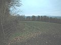 Draycott farmland - geograph.org.uk - 121851.jpg 640 × 480; 150 KB


_-_geograph.org.uk_-_122712.jpg)


