Category:February 2007 in County Durham
Ok
Deutsch: Bilder, die im Februar 2007 in County Durham aufgenommen worden sind. Bitte beachten Sie, dass dies weder das Datum des Uploads noch das Datum des Scannens eines Fotos ist.
English: Images/pictures taken in County Durham during February 2007. Note this is not the date of the upload, nor the date a photo was scanned.
Español: Fotografías o imágenes tomadas en County Durham durante febrero 2007. No es la fecha de subida ni escaneo, sino la fecha en que las fotografías o imágenes se crearon.
Esperanto: Bildoj faritaj en County Durham en februaro 2007. Tio ne estas la dato, kiam la bildoj estis alŝutitaj aŭ skanitaj.
Français : Photographies ou images prises en County Durham durant février 2007. Ce n'est pas la date du téléchargement ou du scan.
Galego: Fotografías ou imaxes tomadas en County Durham durante febreiro 2007. Non é a data de subida nin escaneamento, senón a data na que se crearon as fotografías ou imaxes.
Italiano: Fotografie o immagini scattate a County Durham nel febbraio 2007. Nota bene: la data non si riferisce né a quella di upload né a quella in cui la foto è stata digitalizzata.
Norsk bokmål: Bilder tatt i County Durham i løpet av februar 2007. Merk at dette ikke er datoen for opplasting, eller når et bilde har blitt skannet.
Norsk nynorsk: Bilete teke i County Durham i løpet av februar 2007. Merk at dette ikkje er datoen for opplasting, eller når eit bilete har vorte skanna.
Русский: Изображения, сделанные в County Durham в течение февраль 2007 (не дата загрузки изображения).
Українська: Зображення, зроблені в County Durham протягом лютий 2007. Зауважте, що це не дата завантаження чи дата сканування фотографії.
| February 2006 | ← | February 2007 | → | February 2008 | |||||||
| Jan | Feb | Mar | Apr | May | Jun | Jul | Aug | Sep | Oct | Nov | Dec |
| 21 | 17 | 13 | 31 | 12 | 29 | 38 | 24 | 16 | 11 | 28 | 15 |
|---|---|---|---|---|---|---|---|---|---|---|---|
Media in category "February 2007 in County Durham"
The following 17 files are in this category, out of 17 total.
-
 Barn at Amerston Hall - geograph.org.uk - 344680.jpg 640 × 480; 66 KB
-

-
 Disused station at Byers Green - geograph.org.uk - 341240.jpg 640 × 480; 103 KB
-
 Fence and Pasture, Thorpe Beck - geograph.org.uk - 332097.jpg 426 × 640; 85 KB
-
 Field on the South Bank of the Tees - geograph.org.uk - 339511.jpg 640 × 426; 102 KB
-
 Fields at Amerston Hill - geograph.org.uk - 344698.jpg 640 × 480; 44 KB
-
 Fields near Close Farm - geograph.org.uk - 344694.jpg 640 × 480; 79 KB
-
 Fields near Red Gap - geograph.org.uk - 344736.jpg 640 × 480; 86 KB
-
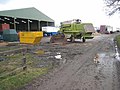
 Filling station at Helmington Row - geograph.org.uk - 338245.jpg 640 × 480; 55 KB
-
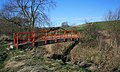 Footbridge over Thorpe Beck - geograph.org.uk - 332105.jpg 640 × 384; 88 KB
-
 Job Centre, Kingsway - geograph.org.uk - 405743.jpg 640 × 384; 66 KB
-
 Norton Signal Box - geograph.org.uk - 332106.jpg 640 × 384; 59 KB
-

-
 Pipebridge over Thorpe Beck - geograph.org.uk - 332110.jpg 640 × 384; 76 KB
-

-
 Station Road - geograph.org.uk - 333046.jpg 640 × 384; 45 KB
-
 Thorpe Beck - geograph.org.uk - 333414.jpg 640 × 384; 104 KB


