Category:February 2013 in York
Deutsch: Bilder, die im Februar 2013 in York aufgenommen worden sind. Bitte beachten Sie, dass dies weder das Datum des Uploads noch das Datum des Scannens eines Fotos ist.
English: Images/pictures taken in York during February 2013. Note this is not the date of the upload, nor the date a photo was scanned.
Español: Fotografías o imágenes tomadas en York durante febrero 2013. No es la fecha de subida ni escaneo, sino la fecha en que las fotografías o imágenes se crearon.
Esperanto: Bildoj faritaj en York en februaro 2013. Tio ne estas la dato, kiam la bildoj estis alŝutitaj aŭ skanitaj.
Français : Photographies ou images prises en York durant février 2013. Ce n'est pas la date du téléchargement ou du scan.
Galego: Fotografías ou imaxes tomadas en York durante febreiro 2013. Non é a data de subida nin escaneamento, senón a data na que se crearon as fotografías ou imaxes.
Italiano: Fotografie o immagini scattate a York nel febbraio 2013. Nota bene: la data non si riferisce né a quella di upload né a quella in cui la foto è stata digitalizzata.
Norsk bokmål: Bilder tatt i York i løpet av februar 2013. Merk at dette ikke er datoen for opplasting, eller når et bilde har blitt skannet.
Norsk nynorsk: Bilete teke i York i løpet av februar 2013. Merk at dette ikkje er datoen for opplasting, eller når eit bilete har vorte skanna.
Русский: Изображения, сделанные в York в течение февраль 2013 (не дата загрузки изображения).
Українська: Зображення, зроблені в York протягом лютий 2013. Зауважте, що це не дата завантаження чи дата сканування фотографії.
| February 2012 | ← | February 2013 | → | February 2014 | |||||||
| Jan | Feb | Mar | Apr | May | Jun | Jul | Aug | Sep | Oct | Nov | Dec |
| 31 | 88 | 97 | 43 | 370 | 202 | 370 | 41 | 62 | 113 | 234 | 82 |
|---|---|---|---|---|---|---|---|---|---|---|---|
Subcategories
This category has only the following subcategory.
D
- DNA Tour - York, February 8th, 2013 (262 F)
Media in category "February 2013 in York"
The following 87 files are in this category, out of 87 total.
-
 2013 - Little Mix DNA Tour date at York Barbican Centre York Barbican (8462533674).jpg 5,184 × 3,456; 21.38 MB
-
 4468 Mallard & 60008 Dwight D Eisenhower at the NRM, York (8499074641).jpg 5,673 × 3,782; 18.99 MB
-
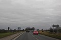 A59 approaching Red Lion Bridge - geograph.org.uk - 3348450.jpg 640 × 424; 29 KB
-
 A59 by junction with Sherley Avenue - geograph.org.uk - 3348463.jpg 640 × 420; 39 KB
-
 A59 by junction with Water End - geograph.org.uk - 3348468.jpg 640 × 450; 44 KB
-
 A59 by Longfield Grange - geograph.org.uk - 3348442.jpg 640 × 448; 44 KB
-
 A59 by Wheat Lands - geograph.org.uk - 3348455.jpg 640 × 436; 61 KB
-
 A59 passing The Fox - geograph.org.uk - 3348475.jpg 640 × 436; 63 KB
-
 Access to Heslington East - geograph.org.uk - 3344462.jpg 640 × 426; 83 KB
-
 All Saints' Pavement, York 01.jpg 1,936 × 2,592; 2.36 MB
-
 All Saints' Pavement, York 02.jpg 1,936 × 2,592; 2.41 MB
-
 All Saints' Pavement, York 03.jpg 1,936 × 2,592; 2.64 MB
-
 All Saints' Pavement, York 04.jpg 1,936 × 2,592; 2.08 MB
-
 Along Lakeside Way - geograph.org.uk - 3344348.jpg 640 × 426; 85 KB
-
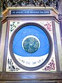
 Astronomical Clock at York Minster 01.jpg 1,936 × 2,592; 2.53 MB
-
 Astronomical Clock at York Minster 02.jpg 1,936 × 2,592; 3.15 MB
-
 Astronomical Clock at York Minster 03.jpg 1,936 × 2,592; 2.76 MB
-
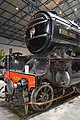
 Black 5 5000 (5441473814).jpg 3,416 × 1,924; 4.98 MB
-
 Black 5 Cab (5441663973).jpg 4,842 × 5,139; 14.68 MB
-
 Brian Cousans Hair Stylists, Livingstone Street, York (12th February 2013).jpg 3,872 × 2,176; 1.78 MB
-
 Bus stop, Livingstone Street, York (12th February 2013).jpg 2,176 × 3,872; 2.46 MB
-
 Chiming clock in the north transept of York Minster.jpg 1,936 × 2,592; 2.83 MB
-
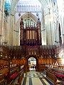 Choir and organ at York Minster.jpg 1,936 × 2,592; 2.62 MB
-
 City Wall - geograph.org.uk - 4130245.jpg 2,560 × 1,920; 2.81 MB
-
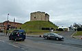 Clifford's Tower - geograph.org.uk - 4130427.jpg 2,560 × 1,575; 1.19 MB
-
 Construction on Heslington East - geograph.org.uk - 3344356.jpg 640 × 426; 94 KB
-
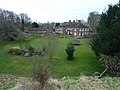 Deanery Garden from the wall - geograph.org.uk - 3358077.jpg 800 × 600; 124 KB
-
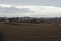
 Dusk at Monks Cross (geograph 3355309).jpg 768 × 1,024; 344 KB
-
 Flooded campus - geograph.org.uk - 3344388.jpg 640 × 426; 88 KB
-
 Four Alls, on the A64 - geograph.org.uk - 3348502.jpg 1,024 × 768; 136 KB
-
 Heslington East - geograph.org.uk - 3344410.jpg 640 × 426; 77 KB
-
 Heslington East Campus - geograph.org.uk - 3344475.jpg 640 × 426; 83 KB
-
 Heslington East Lake - geograph.org.uk - 3344337.jpg 640 × 426; 80 KB
-
 Kimberlow Hill - geograph.org.uk - 3344353.jpg 640 × 426; 87 KB
-
 Kings Arms, York - geograph.org.uk - 4130390.jpg 1,590 × 2,089; 1.15 MB
-
 Kyme Street from the rooftops - geograph.org.uk - 4129017.jpg 2,560 × 1,920; 2.86 MB
-
 Kyme Street from the wall - geograph.org.uk - 3356315.jpg 768 × 1,024; 189 KB
-
 Lakeside Way - geograph.org.uk - 3344332.jpg 640 × 426; 83 KB
-
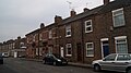
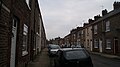
 Livingstone Street, York (12th February 2013) 001.jpg 3,872 × 2,176; 1.94 MB
-
 Livingstone Street, York (12th February 2013) 002.jpg 3,872 × 2,176; 2.06 MB
-
 Livingstone Street, York (12th February 2013) 003.JPG 3,872 × 2,176; 2.06 MB
-
 Livingstone Street, York (12th February 2013) 004.JPG 3,872 × 2,176; 2.63 MB
-
 LNER 2-6-2 V2 Class No 4771 Green Arrow (8499082023).jpg 4,000 × 6,016; 18.81 MB
-
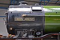 LNER 2-6-2 V2 Class No 4771 Green Arrow (8499088821).jpg 5,538 × 3,692; 13.36 MB
-
 LNER 4-6-2 A3 Class No 502 Flying Scotsman (8499110191).jpg 3,393 × 5,090; 14.13 MB
-
 LNER 4-6-2 A4 Class No 4468 Mallard (8499092779).jpg 6,016 × 4,000; 19.56 MB
-
 LNER 4-6-2 A4 Class No 4468 Mallard (8499100533).jpg 5,621 × 3,747; 19.13 MB
-
 LNER 4-6-2 A4 Class No 4468 Mallard (8500209990).jpg 4,804 × 3,203; 16.77 MB
-
 Memorial to John Baillie, York Minster.JPG 1,372 × 1,378; 1.38 MB
-
 Memorial to John Naylor (organist).jpg 1,405 × 1,145; 1.09 MB
-
 Memorial to Thomas Watson Wentworth in York Minster.JPG 2,592 × 1,936; 2.8 MB
-
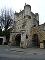
 Micklegate Bar - geograph.org.uk - 4131525.jpg 1,920 × 2,560; 1.89 MB
-
 Micklegate from the wall - geograph.org.uk - 4134772.jpg 1,600 × 1,200; 369 KB
-
 Monkgate Bar from the wall - geograph.org.uk - 4134794.jpg 768 × 1,024; 154 KB
-
 National Railway Museum, York - geograph.org.uk - 4798359.jpg 1,536 × 2,048; 1.09 MB
-
 National Railway Museum, York - geograph.org.uk - 4798375.jpg 2,048 × 1,536; 1.1 MB
-
 New Langwith - geograph.org.uk - 3344316.jpg 640 × 426; 86 KB
-
 Organ from the south transept at York Minster.jpg 1,936 × 2,592; 2.84 MB
-
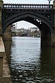
 Ouse Bridge and River Ouse - geograph.org.uk - 4130413.jpg 3,392 × 2,264; 3.64 MB
-
 Ouse Bridge, York - geograph.org.uk - 4130359.jpg 2,560 × 1,920; 2.84 MB
-
 Queen Adelaides Saloon No2 (8500213012).jpg 4,756 × 3,171; 14.57 MB
-
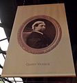 Queen Victoria (8542077687).jpg 2,032 × 2,172; 1.11 MB
-
 River Ouse - geograph.org.uk - 4130373.jpg 2,560 × 1,920; 2.82 MB
-
 River Ouse - geograph.org.uk - 4130422.jpg 2,264 × 3,392; 2.66 MB
-
 River Ouse and The Bonding Warehouse - geograph.org.uk - 4130386.jpg 2,459 × 1,662; 1.29 MB
-
 River Ouse and Woodsmill - geograph.org.uk - 4130356.jpg 2,560 × 1,920; 2.82 MB
-
 River Ouse from Lendal Bridge - geograph.org.uk - 4130401.jpg 2,560 × 1,920; 2.78 MB
-
 River Ouse looking towards Skeldergate Bridge - geograph.org.uk - 4130348.jpg 2,223 × 1,509; 957 KB
-
 Signalling model, National Railway Museum, York - geograph.org.uk - 4798449.jpg 2,048 × 1,536; 1.1 MB
-
 Skeldergate Bridge and the Ouse - geograph.org.uk - 4130254.jpg 3,392 × 2,264; 3.46 MB
-
 Sports Village - geograph.org.uk - 3344398.jpg 640 × 426; 91 KB
-
 St Mary's Abbey ruins - geograph.org.uk - 3356324.jpg 1,024 × 768; 237 KB
-
 Stamford Street West, York (12th February 2013) 002.JPG 3,872 × 2,176; 2.07 MB
-
 Stamford Street, West, York (12th February 2013) 001.JPG 3,872 × 2,176; 2.2 MB
-
 Temporary construction road - geograph.org.uk - 3344368.jpg 640 × 426; 102 KB
-
 The Leeman, Stamford Street West, York (12th February 2013) 001.JPG 3,872 × 2,176; 2.62 MB
-
 The Leeman, Stamford Street West, York (12th February 2013) 002.JPG 3,872 × 2,176; 2.3 MB
-
 The Leeman, Stamford Street West, York (12th February 2013) 003.JPG 2,176 × 3,872; 1.52 MB
-
 The Organists of York Minster.jpg 1,936 × 2,592; 2.95 MB
-
 The Warehouse, National Railway Museum, York - geograph.org.uk - 4798416.jpg 1,983 × 1,443; 793 KB
-
 Towards the Ron Cooke Hub - geograph.org.uk - 3344340.jpg 640 × 426; 93 KB
-
 Trees and Pylons - geograph.org.uk - 3344456.jpg 640 × 426; 60 KB
-
 Under wraps, The Minster from College Street - geograph.org.uk - 3356341.jpg 768 × 1,024; 205 KB
-
 W. H Auden plaque.jpg 3,264 × 2,448; 4.01 MB
-
 York Gate - geograph.org.uk - 4134805.jpg 1,920 × 2,560; 2.19 MB
-
 York Sports Village - geograph.org.uk - 3344403.jpg 640 × 426; 87 KB
-
 York sunset - geograph.org.uk - 4798512.jpg 2,048 × 1,536; 456 KB
.jpg)
.jpg)


.jpg)
.jpg)
.jpg)
.jpg)


.jpg)


_001.jpg)
_002.jpg)
_003.JPG)
_004.JPG)
.jpg)
.jpg)
.jpg)
.jpg)

.jpg)


.jpg)
.jpg)


_002.JPG)
_001.JPG)

_001.JPG)
_002.JPG)
_003.JPG)


.jpg)
.jpg)