Category:Fences in the City of Wakefield
Media in category "Fences in the City of Wakefield"
The following 169 files are in this category, out of 169 total.
-
 1 mile to Wakefield on the A642 Aberford Road - geograph.org.uk - 3363706.jpg 3,974 × 2,200; 1.57 MB
-
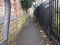
 A path leading to Featherstone - geograph.org.uk - 3052627.jpg 800 × 600; 97 KB
-
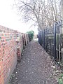
 A path leading to Friarwood Lane - geograph.org.uk - 3042666.jpg 800 × 600; 172 KB
-
 A path leading to Gagewell Lane - geograph.org.uk - 3096944.jpg 800 × 600; 185 KB
-
 A walk from Glass Houghton ^14 - geograph.org.uk - 1996670.jpg 800 × 600; 289 KB
-
 A walk from Glass Houghton ^19 - geograph.org.uk - 1996700.jpg 800 × 600; 263 KB
-
 A walk from Glass Houghton ^23 - geograph.org.uk - 1996723.jpg 800 × 600; 276 KB
-
 A walk from Glass Houghton ^27 - geograph.org.uk - 1996770.jpg 800 × 600; 291 KB
-
 A walk from Glass Houghton ^29 - geograph.org.uk - 1996782.jpg 800 × 600; 263 KB
-
 A walk from Glass Houghton ^32 - geograph.org.uk - 1996811.jpg 800 × 600; 235 KB
-
 A walk from Glass Houghton ^5 - geograph.org.uk - 1996620.jpg 800 × 600; 360 KB
-
 A walk from Glass Houghton ^6 - geograph.org.uk - 1996629.jpg 800 × 600; 319 KB
-
 A walk from Glass Houghton ^7 - geograph.org.uk - 1996632.jpg 800 × 600; 293 KB
-

-
 Addison Avenue - Snydale Road - geograph.org.uk - 1413696.jpg 640 × 480; 258 KB
-
 Aire ^ Calder Navigation - geograph.org.uk - 4656685.jpg 640 × 480; 65 KB
-
 Allotments, Castleford - geograph.org.uk - 3830236.jpg 1,920 × 1,297; 692 KB
-
 B6129 Flushdyke - geograph.org.uk - 5004383.jpg 800 × 600; 113 KB
-
 Balk Lane, Netherton - geograph.org.uk - 132393.jpg 480 × 640; 102 KB
-
 Barrier on Footpath - geograph.org.uk - 587186.jpg 640 × 480; 127 KB
-
 Bridleway - Manorfield Drive - geograph.org.uk - 4418356.jpg 640 × 480; 94 KB
-
 Bridleway to Woolley Village - geograph.org.uk - 415729.jpg 640 × 480; 88 KB
-
 By the M62 - geograph.org.uk - 5220594.jpg 1,024 × 768; 199 KB
-
 Calder Street - Thornes Lane Wharf - geograph.org.uk - 4272625.jpg 640 × 480; 67 KB
-
 Carleton Waste Water Treatment Works - geograph.org.uk - 3663245.jpg 1,600 × 1,200; 441 KB
-
 Carlton Croft - Barnsley Road - geograph.org.uk - 4678927.jpg 640 × 480; 77 KB
-
 Chemical Demolition - geograph.org.uk - 3028457.jpg 2,894 × 2,099; 734 KB
-
 Church on Stanley Road - geograph.org.uk - 2740858.jpg 640 × 460; 105 KB
-
 Coal Train leaving Ferrybridge Power Station - geograph.org.uk - 3245954.jpg 2,952 × 2,051; 1.15 MB
-
 Dead tree in snow - geograph.org.uk - 1209731.jpg 640 × 426; 46 KB
-
 Dog alley at Glass Houghton - geograph.org.uk - 2762167.jpg 800 × 600; 175 KB
-

-

-
 Favell Avenue - Snydale Road - geograph.org.uk - 1414375.jpg 640 × 480; 240 KB
-
 Fence to Railway cutting - geograph.org.uk - 608992.jpg 404 × 640; 96 KB
-
 Fenced path, Smalley Bight farm (1) - geograph.org.uk - 2468124.jpg 768 × 1,024; 546 KB
-
 Fenced path, Smalley Bight farm (2) - geograph.org.uk - 2468138.jpg 1,024 × 768; 793 KB
-
 Fenced path, Smalley Bight farm (3) - geograph.org.uk - 2468159.jpg 768 × 1,024; 718 KB
-
 Fenced path, Smalley Bight farm (4) - geograph.org.uk - 2468174.jpg 1,024 × 768; 743 KB
-
 Fenced path, Smalley Bight farm (5) - geograph.org.uk - 2468187.jpg 768 × 1,024; 798 KB
-
 Field by the B6135 - geograph.org.uk - 219847.jpg 640 × 480; 129 KB
-
 Field Head footpath, temporarily blocked - geograph.org.uk - 6357284.jpg 2,333 × 1,749; 1.46 MB
-
 Field, fence, foals - geograph.org.uk - 851540.jpg 640 × 480; 68 KB
-

-
 Footpath - Aberford Road - geograph.org.uk - 4321556.jpg 480 × 640; 96 KB
-
 Footpath - Athold Drive to Towngate - geograph.org.uk - 3954326.jpg 640 × 480; 78 KB
-
 Footpath - Beechwood Avenue - geograph.org.uk - 3900629.jpg 502 × 640; 91 KB
-
 Footpath - Bradford Road - geograph.org.uk - 3705559.jpg 480 × 640; 92 KB
-
 Footpath - Bradford Road - geograph.org.uk - 3705565.jpg 480 × 640; 123 KB
-
 Footpath - Castle Avenue - geograph.org.uk - 4559210.jpg 480 × 640; 93 KB
-
 Footpath - Church Lane - geograph.org.uk - 1890962.jpg 480 × 640; 84 KB
-
 Footpath - Coppice Close - geograph.org.uk - 3986425.jpg 480 × 640; 67 KB
-
 Footpath - Cutsyke Avenue - geograph.org.uk - 5126692.jpg 480 × 640; 92 KB
-
 Footpath - Cutsyke Road - geograph.org.uk - 1194354.jpg 480 × 640; 245 KB
-
 Footpath - Darnley Avenue - geograph.org.uk - 3739505.jpg 480 × 640; 118 KB
-
 Footpath - Dewsbury Road - geograph.org.uk - 1902368.jpg 480 × 640; 74 KB
-
 Footpath - end of Grasmere Road - geograph.org.uk - 3749186.jpg 640 × 480; 101 KB
-
 Footpath - end of Kirkham Avenue - geograph.org.uk - 3634921.jpg 480 × 640; 94 KB
-
 Footpath - Field Lane - geograph.org.uk - 4272649.jpg 480 × 640; 83 KB
-
 Footpath - Finch Avenue - geograph.org.uk - 4820560.jpg 480 × 640; 73 KB
-
 Footpath - Green Lane - geograph.org.uk - 5186354.jpg 480 × 640; 134 KB
-
 Footpath - Halfpenny Lane - geograph.org.uk - 5328349.jpg 640 × 480; 90 KB
-
 Footpath - Horbury Road - geograph.org.uk - 4517041.jpg 459 × 640; 87 KB
-
 Footpath - Hoyland Road - geograph.org.uk - 4829180.jpg 480 × 640; 81 KB
-
 Footpath - Jenkin Road - geograph.org.uk - 4475165.jpg 480 × 640; 100 KB
-
 Footpath - Kestrel Drive - geograph.org.uk - 4820550.jpg 480 × 640; 68 KB
-
 Footpath - Kingsley Avenue - geograph.org.uk - 4678941.jpg 480 × 640; 70 KB
-
 Footpath - Lake Lock Drive - geograph.org.uk - 4321749.jpg 480 × 640; 78 KB
-
 Footpath - Ledger Place - geograph.org.uk - 3680406.jpg 480 × 640; 85 KB
-
 Footpath - Longlands Road - geograph.org.uk - 3954338.jpg 480 × 640; 74 KB
-
 Footpath - Lumley Street - geograph.org.uk - 5159069.jpg 480 × 640; 112 KB
-
 Footpath - Milner Way - geograph.org.uk - 3745995.jpg 470 × 640; 73 KB
-
 Footpath - Milner Way - geograph.org.uk - 3745998.jpg 480 × 640; 78 KB
-
 Footpath - off Plumpton Road - geograph.org.uk - 3882142.jpg 480 × 640; 112 KB
-
 Footpath - off Plumpton Road - geograph.org.uk - 3882144.jpg 480 × 640; 112 KB
-
 Footpath - Park Lodge Lane - geograph.org.uk - 3974863.jpg 480 × 640; 98 KB
-
 Footpath - Park Square - geograph.org.uk - 4249086.jpg 480 × 640; 81 KB
-
 Footpath - Parker Road - geograph.org.uk - 4516942.jpg 480 × 640; 96 KB
-
 Footpath - Priory Road - geograph.org.uk - 3947252.jpg 480 × 640; 112 KB
-
 Footpath - Queen Elizabeth Street - geograph.org.uk - 3698438.jpg 480 × 640; 80 KB
-
 Footpath - Silcoates Lane - geograph.org.uk - 3646372.jpg 480 × 640; 112 KB
-
 Footpath - South Parade - geograph.org.uk - 3964638.jpg 480 × 640; 70 KB
-
 Footpath - Sunny Hill - geograph.org.uk - 3646267.jpg 480 × 640; 124 KB
-
 Footpath - Thornes Road - geograph.org.uk - 4266510.jpg 480 × 640; 126 KB
-
 Footpath - Towngate to Athold Drive - geograph.org.uk - 3954327.jpg 640 × 480; 84 KB
-
 Footpath - Wakefield Road - geograph.org.uk - 5328587.jpg 640 × 480; 93 KB
-
 Footpath - Waterton Road - geograph.org.uk - 3893000.jpg 480 × 640; 81 KB
-
 Footpath - West Wells Road - geograph.org.uk - 1903117.jpg 480 × 640; 108 KB
-
 Footpath - West Wells Road - geograph.org.uk - 3946370.jpg 480 × 640; 102 KB
-
 Footpath - Wharncliffe Road - geograph.org.uk - 4829386.jpg 640 × 480; 111 KB
-
 Footpath - Woodthorpe Lane - geograph.org.uk - 4678836.jpg 480 × 640; 94 KB
-

-
 Footpath and Tunnel under railway - geograph.org.uk - 3680411.jpg 3,216 × 4,288; 2.94 MB
-
 Footpath behind Windermere Drive - geograph.org.uk - 2476605.jpg 1,024 × 768; 199 KB
-
 Footpath between the houses in Ossett - geograph.org.uk - 5248228.jpg 6,000 × 4,000; 3.56 MB
-

-
 Footpath crossing the railway - geograph.org.uk - 3616763.jpg 1,600 × 1,200; 786 KB
-

-
 Footpath to Healey - geograph.org.uk - 6077359.jpg 1,024 × 768; 151 KB
-
 Footpath under a disused railway line - geograph.org.uk - 6184306.jpg 1,024 × 768; 323 KB
-
 Footpath, Trans Pennine Trail - geograph.org.uk - 1833034.jpg 480 × 640; 395 KB
-

-

-
 Former Public Library - Balne Lane - geograph.org.uk - 3738913.jpg 640 × 480; 92 KB
-
 Gallows Hill - geograph.org.uk - 3830915.jpg 1,920 × 1,440; 773 KB
-
 George Lane Notton - geograph.org.uk - 176135.jpg 640 × 480; 62 KB
-
 Haw Top - geograph.org.uk - 404640.jpg 640 × 480; 77 KB
-
 Holmfield Farm - geograph.org.uk - 3300415.jpg 3,925 × 2,911; 3.44 MB
-
 It is the mind... - geograph.org.uk - 5202626.jpg 1,024 × 768; 166 KB
-
 John Gully's Graveyard - geograph.org.uk - 1397993.jpg 640 × 480; 147 KB
-
 Kings Mead - geograph.org.uk - 4341463.jpg 2,560 × 1,920; 2.4 MB
-
 Methane gas vent (1) - geograph.org.uk - 1856589.jpg 480 × 640; 332 KB
-
 Methane gas vent (2) - geograph.org.uk - 1856590.jpg 480 × 640; 280 KB
-
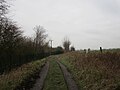
 Middle Field Lane - geograph.org.uk - 364036.jpg 640 × 480; 120 KB
-
 Milepost on Aberford Road, Wakefield (geograph 4851550).jpg 1,024 × 768; 190 KB
-
 Moorshutt Road, Hemsworth - geograph.org.uk - 306609.jpg 640 × 480; 54 KB
-
 Mornington Farm - geograph.org.uk - 534189.jpg 640 × 480; 90 KB
-
 Motorway Bridge over Knottingley Road - geograph.org.uk - 2342210.jpg 1,152 × 864; 852 KB
-
 New car dealer - geograph.org.uk - 5654694.jpg 3,456 × 4,608; 3.65 MB
-
 Normanton Railway Station - geograph.org.uk - 363035.jpg 640 × 480; 87 KB
-
 Obelisk Park hedgerow - geograph.org.uk - 1353908.jpg 640 × 480; 112 KB
-
 Old Fence Post in Stubbs Wood - geograph.org.uk - 686046.jpg 427 × 640; 272 KB
-
 On the Riverside Trail - geograph.org.uk - 4912822.jpg 800 × 600; 131 KB
-
 Orchardhead School Children's Centre - geograph.org.uk - 3533923.jpg 4,608 × 3,456; 3.26 MB
-
 Owlet Hall , looking from the north. - geograph.org.uk - 244611.jpg 640 × 480; 82 KB
-
 Park - Wakefield Road - geograph.org.uk - 5328766.jpg 640 × 480; 96 KB
-
 Park Avenue off Denby Dale Road, Wakefield (geograph 5747633).jpg 1,600 × 1,065; 613 KB
-
 Path along the Calder - geograph.org.uk - 5832435.jpg 683 × 1,024; 728 KB
-
 Path at Manor Farm, Knottingley - geograph.org.uk - 4119504.jpg 1,600 × 1,064; 625 KB
-
 Path off Newton Avenue, Wakefield - geograph.org.uk - 5746374.jpg 1,600 × 1,065; 761 KB
-
 Path towards Pinders Fields, Wakefield - geograph.org.uk - 5746698.jpg 1,600 × 1,065; 817 KB
-
 Picket fencing along Hessle Lane - geograph.org.uk - 1749075.jpg 518 × 389; 130 KB
-
-
 Posed machinery, Banner Plant and Tool Hire - geograph.org.uk - 2148797.jpg 1,024 × 768; 134 KB
-
 Protected steps onto the railway - geograph.org.uk - 1748989.jpg 518 × 389; 126 KB
-
 Public footpath - geograph.org.uk - 1837970.jpg 480 × 640; 336 KB
-
 Public Footpath - geograph.org.uk - 2358052.jpg 768 × 1,024; 836 KB
-
 Public footpath alongside St Anne's Drive - geograph.org.uk - 3885355.jpg 1,024 × 768; 161 KB
-

-
 Public footpath to Bradford Road, Wrenthorpe - geograph.org.uk - 5746294.jpg 1,065 × 1,600; 481 KB
-

-
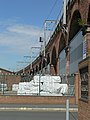 Railway Viaduct, Wakefield - geograph.org.uk - 284375.jpg 450 × 600; 92 KB
-
 Red Hill - geograph.org.uk - 4456713.jpg 2,560 × 1,920; 2.41 MB
-
 Shoe factory, Bottomboat - geograph.org.uk - 1848482.jpg 640 × 480; 261 KB
-
 Snapethorpe Primary School - geograph.org.uk - 875852.jpg 640 × 386; 53 KB
-

-
 St Faith's Manor, off Aberford Road, Wakefield - geograph.org.uk - 6018242.jpg 2,146 × 1,609; 1.32 MB
-

-
 Teva distribution centre - geograph.org.uk - 2746158.jpg 4,288 × 3,216; 2.63 MB
-
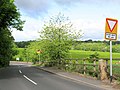
 The 'new' road, looking north-east - geograph.org.uk - 1651073.jpg 640 × 480; 60 KB
-
 The Croft - geograph.org.uk - 5264820.jpg 640 × 480; 55 KB
-
 The northern end of St Faith's Manor, Wakefield - geograph.org.uk - 6018254.jpg 2,453 × 1,839; 1.51 MB
-

-

-
 The top end of Mill Lane, Nevison - geograph.org.uk - 2475827.jpg 1,024 × 768; 137 KB
-
 Toll bar - geograph.org.uk - 3355044.jpg 640 × 427; 130 KB
-
 Track - Cutsyke Crest - geograph.org.uk - 5126297.jpg 640 × 480; 100 KB
-
 Track - end of Moorhouse Grove - geograph.org.uk - 4321463.jpg 640 × 480; 117 KB
-
 Track and footpath, Flushdyke - geograph.org.uk - 2148818.jpg 1,024 × 768; 141 KB
-
 Track by the railway - geograph.org.uk - 3831585.jpg 1,920 × 1,440; 538 KB
-
 Tree and fence shadows, Newton Hill - geograph.org.uk - 3280501.jpg 1,024 × 615; 136 KB
-
 Trough Well Lane. - geograph.org.uk - 118727.jpg 640 × 480; 173 KB
-

-
 Uphill footpath - geograph.org.uk - 865962.jpg 480 × 640; 76 KB
-
 Valley Centre - Valley Crescent - geograph.org.uk - 3566674.jpg 640 × 480; 74 KB
-
 Wakefield Westgate, now replaced - geograph.org.uk - 3861723.jpg 1,600 × 1,200; 555 KB
-
 Warning notice - geograph.org.uk - 3011223.jpg 640 × 480; 85 KB
-
 Wind damage, broken branch - geograph.org.uk - 2358042.jpg 768 × 1,024; 1,008 KB
-
 Yum, Tasty Lavatera^ - geograph.org.uk - 58818.jpg 640 × 480; 130 KB


_-_geograph.org.uk_-_2468124.jpg)
_-_geograph.org.uk_-_2468138.jpg)
_-_geograph.org.uk_-_2468159.jpg)
_-_geograph.org.uk_-_2468174.jpg)
_-_geograph.org.uk_-_2468187.jpg)


_-_geograph.org.uk_-_1856589.jpg)
_-_geograph.org.uk_-_1856590.jpg)

.jpg)


.jpg)


