Category:Feniton
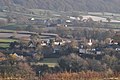
English: Feniton is a village and civil parish in the English county of Devon. It lies approximately 4 miles to the west of Honiton, 3 miles north of Ottery St Mary, and 2 miles east of Talaton. The parish of Feniton also incorporates the hamlets of Colesworthy, Higher Cheriton and Curscombe, and covers an area of 644 hectares (1591 acres).
village in United Kingdom  | |||||
| Upload media | |||||
| Instance of | |||||
|---|---|---|---|---|---|
| Location | East Devon, Devon, South West England, England | ||||
| Population |
| ||||
| Area |
| ||||
 | |||||
Subcategories
This category has the following 2 subcategories, out of 2 total.
A
F
- Feniton railway station (14 F)
Media in category "Feniton"
The following 200 files are in this category, out of 207 total.
(previous page) (next page)-
 A 30 near Battle of Fenny Bridges site - geograph.org.uk - 3621159.jpg 1,950 × 1,132; 1.16 MB
-
 Abandoned glasshouses at Burlands Mead - geograph.org.uk - 5339748.jpg 1,024 × 768; 240 KB
-
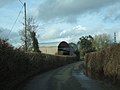
 Approach to Feniton - geograph.org.uk - 1617402.jpg 640 × 480; 138 KB
-
 Barn at Higher Cheriton - geograph.org.uk - 5338661.jpg 1,024 × 703; 183 KB
-
 Barn near Curscombe - geograph.org.uk - 2783412.jpg 640 × 480; 113 KB
-
 Barns at Shoots Barn Cross outside Colestocks - geograph.org.uk - 2257162.jpg 2,848 × 2,136; 1.43 MB
-

-
 Bridge over River Tale at Talewater - geograph.org.uk - 2880143.jpg 800 × 600; 494 KB
-
 Buckerell Cross - geograph.org.uk - 2356739.jpg 640 × 480; 89 KB
-

-
 Chapel at Fenny Bridges - geograph.org.uk - 175519.jpg 640 × 480; 121 KB
-
 Chapel, dovecote and mill, Fenny Bridges - geograph.org.uk - 3719135.jpg 1,920 × 1,440; 549 KB
-
 Chapel, Feniton - geograph.org.uk - 2356664.jpg 640 × 398; 53 KB
-
 Cheriton Hill - geograph.org.uk - 3409283.jpg 1,024 × 768; 137 KB
-
 Chestnut tree at the junction, Feniton - geograph.org.uk - 1320248.jpg 640 × 480; 125 KB
-
 Church Lane, Feniton - geograph.org.uk - 2356711.jpg 480 × 640; 143 KB
-
 Convenience store, Feniton - geograph.org.uk - 5339744.jpg 1,024 × 758; 280 KB
-
 Cottage near Feniton - geograph.org.uk - 2354742.jpg 500 × 640; 78 KB
-
 Cottage near Feniton - geograph.org.uk - 2356626.jpg 640 × 480; 115 KB
-
 Country road to Sherwood Farm - geograph.org.uk - 2257156.jpg 640 × 480; 64 KB
-
 Countryside near Sherwood Farm - geograph.org.uk - 2356590.jpg 640 × 413; 90 KB
-
 Countryside, Talewater - geograph.org.uk - 4560683.jpg 640 × 353; 31 KB
-
 Court Baron Cross - geograph.org.uk - 2425504.jpg 640 × 393; 54 KB
-
 Crowder's Cross - geograph.org.uk - 2356544.jpg 500 × 640; 76 KB
-
 Crowder's Cross - geograph.org.uk - 4957640.jpg 1,920 × 1,280; 784 KB
-
 Curscombe Cross - geograph.org.uk - 2136271.jpg 640 × 480; 133 KB
-
 Curscombe Cross - geograph.org.uk - 2783347.jpg 480 × 640; 114 KB
-
 Curscombe Cross - geograph.org.uk - 3409266.jpg 1,024 × 768; 225 KB
-
 East Devon , Country Lane - geograph.org.uk - 5766927.jpg 6,000 × 4,000; 6.81 MB
-
 East Devon , Country Lane - geograph.org.uk - 5766930.jpg 6,000 × 4,000; 6.94 MB
-
 East Devon , Country Lane - geograph.org.uk - 5766932.jpg 6,000 × 4,000; 6.46 MB
-
 East Devon , Country Lane - geograph.org.uk - 5777639.jpg 6,000 × 4,000; 5.92 MB
-
 East Devon , Country Road - geograph.org.uk - 2180460.jpg 4,288 × 2,848; 6.25 MB
-
 East Devon , Country Road ^ Feniton Sign - geograph.org.uk - 2180461.jpg 4,288 × 2,848; 6.52 MB
-
 East Devon , Crowder's Cross - geograph.org.uk - 5766936.jpg 6,000 × 4,000; 6.32 MB
-
 East Devon , Curscombe Lane - geograph.org.uk - 5777581.jpg 6,000 × 4,000; 6.52 MB
-
 East Devon , Curscombe Lane - geograph.org.uk - 5777584.jpg 6,000 × 4,000; 6.94 MB
-
 East Devon , Curscombe Lane - geograph.org.uk - 5777587.jpg 4,000 × 6,000; 7.54 MB
-
 East Devon , Curscombe Lane - geograph.org.uk - 5777588.jpg 6,000 × 4,000; 5.85 MB
-
 East Devon , Curscombe Lane - geograph.org.uk - 5777592.jpg 6,000 × 4,000; 6.57 MB
-
 East Devon , Curscombe Lane - geograph.org.uk - 5777595.jpg 6,000 × 4,000; 6.36 MB
-
 East Devon , Farm Track ^ Field - geograph.org.uk - 2180436.jpg 4,288 × 2,848; 5.37 MB
-
 East Devon , Farm Track ^ Gate - geograph.org.uk - 2180434.jpg 4,288 × 2,848; 6.16 MB
-
 East Devon , Fields Near Fenny Bridges - geograph.org.uk - 2180444.jpg 4,288 × 2,848; 5.88 MB
-
 East Devon , Footpath - geograph.org.uk - 5777627.jpg 4,000 × 6,000; 6.92 MB
-
 East Devon , Footpath - geograph.org.uk - 5777628.jpg 4,000 × 6,000; 6.58 MB
-
 East Devon , Footpath - geograph.org.uk - 5777629.jpg 6,000 × 4,000; 6.83 MB
-
 East Devon , Footpath - geograph.org.uk - 5777631.jpg 6,000 × 4,000; 7.05 MB
-
 East Devon , Footpath ^ Fields - geograph.org.uk - 2180445.jpg 4,288 × 2,848; 6.76 MB
-
 East Devon , Grassy Field - geograph.org.uk - 5766926.jpg 6,000 × 4,000; 6.98 MB
-
 East Devon , Grassy Field - geograph.org.uk - 5777638.jpg 6,000 × 4,000; 6.12 MB
-
 East Devon , Grassy Hillside - geograph.org.uk - 2180448.jpg 4,288 × 2,848; 6.32 MB
-
 East Devon , Higher Curscombe Farm - geograph.org.uk - 5777598.jpg 6,000 × 4,000; 7.75 MB
-
 East Devon , Longhorn Cattle - geograph.org.uk - 2180463.jpg 4,288 × 2,848; 5.56 MB
-
 East Devon , Longhorn Cattle in a Field - geograph.org.uk - 2180446.jpg 4,288 × 2,848; 6.15 MB
-
 East Devon , Muddy Field - geograph.org.uk - 2180438.jpg 4,288 × 2,848; 6.43 MB
-
 East Devon , Ploughed Field ^ Hedgerows - geograph.org.uk - 2180440.jpg 4,288 × 2,848; 6.48 MB
-
 East Devon , Prayer Book Rebellion Memorial - geograph.org.uk - 2180466.jpg 2,848 × 4,288; 6.37 MB
-
 East Devon , Road Junction ^ Signpost - geograph.org.uk - 2180464.jpg 4,288 × 2,848; 6.2 MB
-
 East Devon , Road Under the A30 - geograph.org.uk - 2180467.jpg 2,848 × 4,288; 6.43 MB
-
 East Devon , Road ^ A30 Bridge - geograph.org.uk - 2180465.jpg 4,288 × 2,848; 6.56 MB
-
 East Devon , Road ^ Railway Bridge - geograph.org.uk - 2180469.jpg 4,288 × 2,848; 6.91 MB
-
 East Devon , Scenery ^ A38 - geograph.org.uk - 2180447.jpg 4,288 × 2,848; 6.13 MB
-
 East Devon , Small Stream - geograph.org.uk - 2180462.jpg 4,288 × 2,848; 6.42 MB
-
 East Devon , Track - geograph.org.uk - 5777601.jpg 6,000 × 4,000; 6.37 MB
-
 East Devon , Track - geograph.org.uk - 5777605.jpg 6,000 × 4,000; 6.61 MB
-
 East Devon , Track - geograph.org.uk - 5777609.jpg 6,000 × 4,000; 6.49 MB
-
 East Devon , Track - geograph.org.uk - 5777610.jpg 4,000 × 6,000; 7.66 MB
-
 East Devon , Track - geograph.org.uk - 5777611.jpg 6,000 × 4,000; 6.13 MB
-
 East Devon , Track - geograph.org.uk - 5777613.jpg 6,000 × 4,000; 6.73 MB
-
 East Devon , Track - geograph.org.uk - 5777615.jpg 6,000 × 4,000; 6.53 MB
-
 East Devon , Track - geograph.org.uk - 5777616.jpg 6,000 × 4,000; 6.4 MB
-
 East Devon , Track - geograph.org.uk - 5777624.jpg 4,000 × 6,000; 5.95 MB
-
 East Devon , Track - geograph.org.uk - 5777632.jpg 6,000 × 4,000; 7.87 MB
-
 East Devon , Underneath the A30 - geograph.org.uk - 2180468.jpg 4,288 × 2,848; 4.4 MB
-
 East Devon , Uphill Public Footpath - geograph.org.uk - 2180449.jpg 4,288 × 2,848; 6.49 MB
-
 Express train at the level crossing - geograph.org.uk - 1320341.jpg 640 × 480; 60 KB
-
 Farm building and storage near Curscombe - geograph.org.uk - 3409249.jpg 1,024 × 768; 287 KB
-
 Farm buildings at Curscombe - geograph.org.uk - 3409275.jpg 1,024 × 768; 126 KB
-
 Farm buildings, Sowton Farm, Feniton - geograph.org.uk - 190032.jpg 640 × 480; 100 KB
-
 Feniton , Broad Road - geograph.org.uk - 2180453.jpg 4,288 × 2,848; 5.52 MB
-
 Feniton , Curscombe Lane - geograph.org.uk - 2180452.jpg 4,288 × 2,848; 6.8 MB
-
 Feniton , Dog Training Centre - geograph.org.uk - 2180413.jpg 4,288 × 2,848; 5.63 MB
-
 Feniton , Feniton Green - geograph.org.uk - 2180451.jpg 4,288 × 2,848; 6.43 MB
-
 Feniton , Feniton Post Office - geograph.org.uk - 2180450.jpg 4,288 × 2,848; 5.45 MB
-
 Feniton , Feniton Village Hall - geograph.org.uk - 2180454.jpg 4,288 × 2,848; 5.72 MB
-
 Feniton , Food Sign at Feniton Court - geograph.org.uk - 2180459.jpg 2,848 × 4,288; 6.17 MB
-
 Feniton , Greenacres Close - geograph.org.uk - 2180297.jpg 4,288 × 2,848; 5.98 MB
-
 Feniton , Greenhouses - geograph.org.uk - 2179169.jpg 4,288 × 2,848; 6.23 MB
-
 Feniton , Ottery Road ^ Green Lane - geograph.org.uk - 2180246.jpg 4,288 × 2,848; 5.93 MB
-
 Feniton , Railway Line - geograph.org.uk - 2180327.jpg 4,288 × 2,848; 6.14 MB
-
 Feniton , Rooftops from Green Lane - geograph.org.uk - 2180315.jpg 4,288 × 2,848; 6.16 MB
-
 Feniton , Wells Avenue - geograph.org.uk - 2180368.jpg 4,288 × 2,848; 4.81 MB
-
 Feniton - geograph.org.uk - 190043.jpg 640 × 480; 83 KB
-
 Feniton and the Nog Inn - geograph.org.uk - 2256932.jpg 2,848 × 2,136; 1.4 MB
-
 Feniton Court - geograph.org.uk - 5339143.jpg 1,024 × 768; 184 KB
-
 Feniton Mills from Fenny Bridge - geograph.org.uk - 174157.jpg 640 × 480; 91 KB
-
 Feniton post office - geograph.org.uk - 2679115.jpg 600 × 800; 367 KB
-
 Feniton Primary School - geograph.org.uk - 5339222.jpg 1,024 × 768; 251 KB
-
 Feniton railway station, Devon - geograph.org.uk - 4597554.jpg 1,600 × 1,200; 434 KB
-
 Feniton Village Hall - geograph.org.uk - 5339194.jpg 1,024 × 752; 130 KB
-
 Feniton, by Court Baron Cross - geograph.org.uk - 191062.jpg 640 × 427; 145 KB
-
 Feniton, Curscombe herd - geograph.org.uk - 191078.jpg 640 × 427; 198 KB
-
 Feniton, Exeter - Salisbury line - geograph.org.uk - 130362.jpg 640 × 427; 100 KB
-
 Feniton, Halls Farm - geograph.org.uk - 191074.jpg 640 × 427; 164 KB
-
 Feniton, Lower Curscombe Farm - geograph.org.uk - 191085.jpg 640 × 427; 240 KB
-

-
 Feniton, the old village centre - geograph.org.uk - 130375.jpg 640 × 427; 119 KB
-
 Feniton, the old village centre - geograph.org.uk - 2356708.jpg 640 × 480; 98 KB
-
 Feniton, the village - geograph.org.uk - 191067.jpg 640 × 427; 243 KB
-
 Fenny Bridges , B3117 Fenny Bridge - geograph.org.uk - 2178407.jpg 4,288 × 2,848; 5.83 MB
-
 Fenny Bridges , House ^ Christmas Decorations - geograph.org.uk - 2180470.jpg 4,122 × 2,570; 4.58 MB
-
 Fenny Bridges , Houses ^ Scenery - geograph.org.uk - 2180442.jpg 4,288 × 2,848; 5.62 MB
-
 Fenny Bridges , Small Building ^ Fields - geograph.org.uk - 2178391.jpg 4,288 × 2,848; 5.5 MB
-
 Fenny Bridges , The B3117 - geograph.org.uk - 2178365.jpg 4,288 × 2,848; 5.43 MB
-
 Fenny Bridges , The River Otter - geograph.org.uk - 2178417.jpg 4,288 × 2,848; 5.82 MB
-

-
 Field boundary near Crowder's Cross - geograph.org.uk - 2356381.jpg 480 × 640; 134 KB
-
 Field boundary, Colestock - geograph.org.uk - 1448039.jpg 640 × 480; 144 KB
-
 Field near Curscombe - geograph.org.uk - 2783327.jpg 640 × 443; 80 KB
-
 Field near Curscombe - geograph.org.uk - 2783377.jpg 640 × 480; 55 KB
-
 Field near Feniton - geograph.org.uk - 3720554.jpg 1,920 × 1,440; 458 KB
-
 Field, Fenny Meadow - geograph.org.uk - 4560685.jpg 640 × 426; 57 KB
-
 Footbridge over Vine Water, Feniton - geograph.org.uk - 190033.jpg 480 × 640; 113 KB
-
 Footpath at Curscombe - geograph.org.uk - 2783359.jpg 640 × 480; 99 KB
-
 Footpath north of Feniton church - geograph.org.uk - 3409288.jpg 1,024 × 768; 271 KB
-
 Footpath west of Curscombe Cross - geograph.org.uk - 3409273.jpg 1,024 × 768; 225 KB
-
 Former Chapel, Feniton - geograph.org.uk - 5339738.jpg 1,024 × 768; 147 KB
-
 Former Chapel, Fenny Bridges - geograph.org.uk - 5340090.jpg 1,024 × 787; 250 KB
-
 Green Lane - geograph.org.uk - 5339755.jpg 1,024 × 730; 195 KB
-
 Ha-ha at Feniton Court - geograph.org.uk - 190040.jpg 640 × 480; 131 KB
-
 Hillside, Buckerell Cross - geograph.org.uk - 3719189.jpg 2,048 × 1,536; 521 KB
-
 House on York Crescent - geograph.org.uk - 4560684.jpg 640 × 284; 25 KB
-
 Houses, old Feniton - geograph.org.uk - 5339102.jpg 1,024 × 768; 154 KB
-
 Industrial units at Talewater - geograph.org.uk - 2880141.jpg 800 × 600; 328 KB
-
 Kilroy woz 'ere - geograph.org.uk - 316289.jpg 640 × 480; 125 KB
-
 Lane approaching Crowder's Cross - geograph.org.uk - 2356391.jpg 640 × 480; 115 KB
-
 Lane at Higher Cheriton - geograph.org.uk - 2425516.jpg 640 × 480; 88 KB
-
 Lane from Buckerell Cross - geograph.org.uk - 2679105.jpg 600 × 800; 545 KB
-
 Lane from Feniton to Feniton - geograph.org.uk - 2356678.jpg 480 × 640; 119 KB
-
 Lane near Hall's Farm - geograph.org.uk - 2783097.jpg 640 × 480; 90 KB
-
 Lane to Colestocks - geograph.org.uk - 2356517.jpg 480 × 640; 136 KB
-
 Lane to Feniton - geograph.org.uk - 2356630.jpg 640 × 442; 58 KB
-
 Lane to Feniton - geograph.org.uk - 3719197.jpg 2,048 × 1,536; 707 KB
-
 Lane to Sherwood Cross - geograph.org.uk - 2356582.jpg 524 × 640; 87 KB
-
 Lane to Sherwood Cross - geograph.org.uk - 2356602.jpg 640 × 397; 75 KB
-
 Level crossing in Feniton - geograph.org.uk - 2256933.jpg 2,848 × 2,136; 1.41 MB
-
 Lower Curscombe Farm - geograph.org.uk - 5453098.jpg 1,024 × 768; 232 KB
-
 Monument to the 'Prayer Book Rebellion' 1549 - geograph.org.uk - 5453081.jpg 1,024 × 881; 372 KB
-
 Muddy road near Curscombe - geograph.org.uk - 3409258.jpg 768 × 1,024; 139 KB
-
 Nog Inn - geograph.org.uk - 1320356.jpg 640 × 480; 51 KB
-
 Nog Inn, Feniton - geograph.org.uk - 5339704.jpg 1,024 × 781; 123 KB
-

-
 Outbuildings at Curscombe Farm - geograph.org.uk - 5453100.jpg 1,024 × 760; 155 KB
-
 Pasture east of Curscombe - geograph.org.uk - 2783397.jpg 640 × 427; 86 KB
-
 Platform view, Feniton Railway Station - geograph.org.uk - 5339727.jpg 1,024 × 768; 181 KB
-
 Post office at Fenniton, Devon. (2532615166) (2).jpg 1,130 × 938; 245 KB
-

-
 Railway bridge, Fenny Bridges - geograph.org.uk - 2356743.jpg 640 × 439; 93 KB
-
 Railway Bridge, Fenny Bridges - geograph.org.uk - 5340084.jpg 1,024 × 789; 255 KB
-
 Red soil, Talewater - geograph.org.uk - 4550992.jpg 640 × 361; 32 KB
-
 Red soil, Talewater - geograph.org.uk - 4560679.jpg 640 × 426; 44 KB
-
 Reservoir on Cheriton Hill - geograph.org.uk - 5338670.jpg 1,024 × 767; 239 KB
-
 River Otter - geograph.org.uk - 5340082.jpg 1,024 × 729; 205 KB
-
 River Otter at Fenny Bridges - geograph.org.uk - 174158.jpg 640 × 480; 113 KB
-
 River Otter at Fenny Bridges - geograph.org.uk - 2356746.jpg 480 × 640; 102 KB
-
 River Otter at Fenny Bridges - geograph.org.uk - 3719162.jpg 1,536 × 2,048; 635 KB
-
 River Otter at Fenny Bridges - geograph.org.uk - 5340085.jpg 1,024 × 743; 316 KB
-
 Road cutting leading into Feniton - geograph.org.uk - 3409290.jpg 1,024 × 769; 251 KB
-
 Road down the Vine Water valley - geograph.org.uk - 2356734.jpg 640 × 480; 134 KB
-
 Road narrows as it leaves Feniton - geograph.org.uk - 2136242.jpg 640 × 480; 87 KB
-
 Road to Curscombe - geograph.org.uk - 2136259.jpg 640 × 480; 105 KB
-
 Ruined barn, Fenny Bridges - geograph.org.uk - 3719119.jpg 1,920 × 1,440; 528 KB
-

-
 Sewage works at Buckerell Cross - geograph.org.uk - 3719589.jpg 2,048 × 1,536; 608 KB
-
 Sheep near Sherwood Farm - geograph.org.uk - 2356569.jpg 640 × 438; 83 KB
-
 Sherwood Cross - geograph.org.uk - 2356642.jpg 640 × 412; 56 KB
-
 Sherwood Farm - geograph.org.uk - 2356608.jpg 640 × 420; 76 KB
-
 Shoots Barn Cross at Colestocks - geograph.org.uk - 2257163.jpg 2,848 × 2,136; 1.39 MB
-
 Sign for Colestocks - geograph.org.uk - 2257168.jpg 2,848 × 2,136; 1.39 MB
-
 Signpost at Lower Cheriton - geograph.org.uk - 3409308.jpg 1,024 × 768; 153 KB
-
 Signpost, Crowder's Cross - geograph.org.uk - 2356563.jpg 480 × 640; 114 KB
-
 Small bridge near Halls Farm - geograph.org.uk - 3409280.jpg 1,024 × 768; 206 KB
-
 Sowton Farm, Feniton - geograph.org.uk - 190031.jpg 640 × 480; 84 KB
-
 Spar, Feniton - geograph.org.uk - 2356674.jpg 640 × 466; 120 KB
-
 Speed derestriction signs north of Feniton - geograph.org.uk - 2257152.jpg 2,848 × 2,136; 1.39 MB
-
 St Andrew's church, lych gate - geograph.org.uk - 4360719.jpg 1,024 × 768; 324 KB
-
 Stable block, Feniton Court - geograph.org.uk - 5339156.jpg 1,024 × 768; 159 KB
-
 Terraced houses on Station Road, Feniton - geograph.org.uk - 5339690.jpg 1,024 × 815; 151 KB
-
 Thatched cottages in old Feniton - geograph.org.uk - 5339113.jpg 1,024 × 768; 184 KB
-
 The A30 - geograph.org.uk - 3043597.jpg 640 × 387; 30 KB
-
 The Nog Inn, Feniton - geograph.org.uk - 1780676.jpg 1,074 × 1,600; 256 KB
-
 The road through Old Feniton - geograph.org.uk - 4043874.jpg 640 × 480; 78 KB
-
 The road to Feniton from Buckerell Cross - geograph.org.uk - 2679112.jpg 800 × 600; 437 KB
-
 Towards Curscombe Farm - geograph.org.uk - 2783313.jpg 640 × 407; 79 KB
-
 Towards Hall's Farm - geograph.org.uk - 2783141.jpg 640 × 434; 88 KB
-
 Trees by the Vine Water - geograph.org.uk - 2783154.jpg 640 × 480; 101 KB
-
 Turning for Colestocks - geograph.org.uk - 5338645.jpg 1,024 × 660; 174 KB
-
 Turning for Ottery St Mary - geograph.org.uk - 5339094.jpg 1,024 × 784; 219 KB
-
 Two bridges - geograph.org.uk - 4360741.jpg 1,024 × 768; 369 KB


_(2).jpg)


