Category:Fenton, South Kesteven
English: Fenton is located south of Stubton, off the A17 in Lincolnshire, England. Its coordinates are .
village and civil parish in South Kesteven, Lincolnshire, UK  | |||||
| Upload media | |||||
| Instance of | |||||
|---|---|---|---|---|---|
| Location | South Kesteven, Lincolnshire, East Midlands, England | ||||
| Different from | |||||
 | |||||
Media in category "Fenton, South Kesteven"
The following 68 files are in this category, out of 68 total.
-
 Abandoned track, Fenton - geograph.org.uk - 6437473.jpg 1,024 × 768; 263 KB
-
 Bend in the track - geograph.org.uk - 6437486.jpg 1,024 × 768; 162 KB
-
 Blackthorn in flower near Fenton - geograph.org.uk - 6437544.jpg 1,024 × 768; 150 KB
-
 Bridleway to Fenton - geograph.org.uk - 6325130.jpg 1,024 × 768; 179 KB
-
 Confluence of two drains near Fen Farm - geograph.org.uk - 6425280.jpg 1,024 × 768; 226 KB
-
 Cottage, Fenton - geograph.org.uk - 1944516.jpg 800 × 600; 92 KB
-
 Crop field near Fenton - geograph.org.uk - 2909970.jpg 640 × 480; 49 KB
-
 Culvert under a farm track near Fenton - geograph.org.uk - 6437532.jpg 1,024 × 768; 275 KB
-
 Entering Fenton on Fenton Road - geograph.org.uk - 3295869.jpg 2,256 × 1,504; 1 MB
-
 Entry into Fenton - geograph.org.uk - 1944514.jpg 800 × 600; 110 KB
-
 Exit from Fenton - geograph.org.uk - 1944507.jpg 800 × 600; 156 KB
-

-
 Farm track, Fenton - geograph.org.uk - 6437477.jpg 1,024 × 768; 174 KB
-
 Farm track, Fenton - geograph.org.uk - 6437478.jpg 1,024 × 768; 153 KB
-
 Farm track, Fenton - geograph.org.uk - 6437481.jpg 1,024 × 768; 186 KB
-
 Farm track, Fenton - geograph.org.uk - 6437484.jpg 1,024 × 768; 168 KB
-
 Farm track, Fenton - geograph.org.uk - 6437489.jpg 1,024 × 768; 176 KB
-
 Farm track, Fenton - geograph.org.uk - 6437491.jpg 1,024 × 768; 191 KB
-
 Farm track, Fenton - geograph.org.uk - 6437512.jpg 1,024 × 768; 198 KB
-
 Farm track, Fenton - geograph.org.uk - 6437519.jpg 1,024 × 768; 166 KB
-
 Farm track, Fenton - geograph.org.uk - 6437522.jpg 1,024 × 768; 232 KB
-
 Farm track, Fenton - geograph.org.uk - 6437538.jpg 1,024 × 768; 140 KB
-
 Farm track, Fenton - geograph.org.uk - 6437547.jpg 1,024 × 768; 129 KB
-
 Farm track, Fenton - geograph.org.uk - 6437550.jpg 1,024 × 768; 225 KB
-
 Farmland near Fenton - geograph.org.uk - 2909956.jpg 640 × 480; 66 KB
-
 Field edge near Fenton - geograph.org.uk - 6437490.jpg 1,024 × 768; 154 KB
-
 Field edge near Fenton - geograph.org.uk - 6437496.jpg 1,024 × 768; 152 KB
-
 Field edge near Stragglethorpe - geograph.org.uk - 3008720.jpg 1,024 × 768; 182 KB
-
 Fields near Fenton - geograph.org.uk - 6437494.jpg 1,024 × 768; 134 KB
-
 Footbridge on the edge of Fenton - geograph.org.uk - 6325133.jpg 1,024 × 768; 241 KB
-
 Footpath into Fenton - geograph.org.uk - 6437552.jpg 1,024 × 768; 271 KB
-
 Footpath to Barnby in the Willows - geograph.org.uk - 6465956.jpg 1,024 × 768; 277 KB
-
 Footpath to Barnby in the Willows - geograph.org.uk - 6465984.jpg 1,024 × 768; 229 KB
-
 Footpath to Fenton - geograph.org.uk - 6247320.jpg 1,024 × 768; 122 KB
-
 Footpath to Fenton - geograph.org.uk - 6425649.jpg 1,024 × 768; 263 KB
-

-
 Hedgerow near Fenton - geograph.org.uk - 2909966.jpg 640 × 480; 78 KB
-
 House for sale, Fenton - geograph.org.uk - 2909975.jpg 640 × 480; 70 KB
-
 Like extracted teeth - geograph.org.uk - 1944519.jpg 800 × 600; 124 KB
-
 Looking towards Fenton - geograph.org.uk - 1944501.jpg 800 × 600; 103 KB
-
 Looking towards Sutton - geograph.org.uk - 1944503.jpg 800 × 600; 112 KB
-
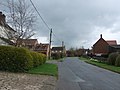 Main Street, Fenton - geograph.org.uk - 2909980.jpg 640 × 480; 72 KB
-

-
 Manor Farmhouse, Fenton (geograph 6714364).jpg 1,024 × 768; 127 KB
-
 Muddy farm track near Fenton - geograph.org.uk - 2909959.jpg 640 × 480; 72 KB
-
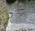 Ordnance Survey Cut Mark - geograph.org.uk - 4982668.jpg 640 × 568; 157 KB
-
 Permissive path near Fenton - geograph.org.uk - 6465973.jpg 1,024 × 768; 245 KB
-
 Permissive path near Fenton - geograph.org.uk - 6465976.jpg 1,024 × 768; 268 KB
-
 Plantation near Fenton - geograph.org.uk - 6437541.jpg 1,024 × 768; 140 KB
-
 Pond in Fenton - geograph.org.uk - 2909994.jpg 640 × 480; 97 KB
-
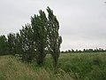
 Poplars in the wind - geograph.org.uk - 3008740.jpg 1,024 × 768; 187 KB
-
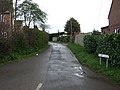
 Pump lane, Fenton - geograph.org.uk - 1944512.jpg 800 × 600; 132 KB
-
 Pump Lane, Fenton - geograph.org.uk - 2909984.jpg 640 × 480; 85 KB
-
 Pump Lane, Fenton - geograph.org.uk - 3295964.jpg 2,256 × 1,504; 1.1 MB
-
 Rectory Farm and Sutton Dyke - geograph.org.uk - 6425078.jpg 1,024 × 768; 186 KB
-
 Road running south towards Fenton - geograph.org.uk - 2909962.jpg 640 × 480; 50 KB
-
 Sprayed field near Fenton - geograph.org.uk - 6465980.jpg 1,024 × 768; 196 KB
-
 Stile and Rectory Farm - geograph.org.uk - 6325122.jpg 1,024 × 768; 293 KB
-
 Sutton Dyke and farm track - geograph.org.uk - 6425065.jpg 1,024 × 768; 213 KB
-
 Sutton Dyke at Sutton - geograph.org.uk - 6425231.jpg 1,024 × 768; 284 KB
-
 Sutton Road - geograph.org.uk - 3295973.jpg 2,256 × 1,504; 2.53 MB
-
 The difference a few weeks makes - geograph.org.uk - 6465966.jpg 1,024 × 768; 188 KB
-
 Very muddy track near Rectory Farm - geograph.org.uk - 6325125.jpg 1,024 × 768; 233 KB
-
 View from the end of the path - geograph.org.uk - 3008717.jpg 1,024 × 768; 161 KB
-
 Village Pond, Fenton - geograph.org.uk - 77798.jpg 640 × 480; 168 KB
-
 Waterlogged field near Fenton - geograph.org.uk - 6437502.jpg 1,024 × 768; 156 KB
-
 Wheat field and poplar trees - geograph.org.uk - 6247201.jpg 1,024 × 768; 186 KB
-
 Wheat to the horizon - geograph.org.uk - 6247312.jpg 1,024 × 768; 228 KB


.jpg)


