Category:Ferme Courbet
| Object location | | View all coordinates using: OpenStreetMap |
|---|
.JPG) | |||||
| Upload media | |||||
| Instance of | |||||
|---|---|---|---|---|---|
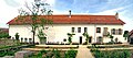
| Location | Flagey, canton of Amancey | ||||
| Owned by | |||||
| Date of official opening |
| ||||
 | |||||
Media in category "Ferme Courbet"
The following 2 files are in this category, out of 2 total.
-
 Flagey, la ferme Courbet.jpg 3,001 × 1,319; 3.47 MB
-
 La ferme de la famille Courbet à Flagey (Doubs).JPG 3,264 × 2,448; 3.15 MB
