Category:Fetlar
| Object location | | View all coordinates using: OpenStreetMap |
|---|
island of the Shetland Islands, Scotland, UK   | |||||
| Upload media | |||||
| Instance of | |||||
|---|---|---|---|---|---|
| Part of | |||||
| Location |
| ||||
| Located in or next to body of water | |||||
| Highest point |
| ||||
| Population |
| ||||
| Area |
| ||||
 | |||||
Subcategories
This category has the following 20 subcategories, out of 20 total.
A
- Aith, Fetlar (10 F)
B
- B9088 road (Scotland) (7 F)
- Brough Lodge (13 F)
C
- Colgrave Sound (3 F)
E
- Everland, Shetland Islands (2 F)
F
- Fetlar (civil parish) (350 F)
- Fetlar Airstrip (1 F)
G
- Geira (ship, 1988) (8 F)
H
- Haltadans (1 F)
- Hamars Ness (11 F)
- Head of Lambhoga (11 F)
O
- Outer Brough (4 F)
P
- Papil Water (5 F)
T
- The Clett (5 F)
- Tresta, Fetlar (22 F)
U
- Urie Ness (2 F)
Media in category "Fetlar"
The following 150 files are in this category, out of 150 total.
-
 Aith Ness - geograph.org.uk - 534775.jpg 640 × 480; 76 KB
-
 Aith Ness from Wick of Tresta - geograph.org.uk - 1930446.jpg 640 × 427; 36 KB
-
 Aithbank, Fetlar - geograph.org.uk - 710716.jpg 402 × 640; 94 KB
-

-
 Banks, Doo Cove - geograph.org.uk - 3824694.jpg 640 × 360; 225 KB
-
 Beach at Ugasta, near Brough Lodge - geograph.org.uk - 3478988.jpg 1,024 × 682; 210 KB
-
 Beach, Aith Wick - geograph.org.uk - 3824897.jpg 640 × 360; 225 KB
-
 Bobby Tulloch and snowy owl nest site, Fetlar, Shetland, 1967.jpg 935 × 955; 168 KB
-
-
 Cleft in the cliff, Strandburgh Ness, Fetlar - geograph.org.uk - 6193754.jpg 1,065 × 1,600; 658 KB
-
 Clett Stack, Fetlar - geograph.org.uk - 6193695.jpg 1,600 × 1,065; 419 KB
-
 Coast near Head of Hosta, Fetlar - geograph.org.uk - 6193786.jpg 1,600 × 1,065; 726 KB
-
 Coast north of Little Brae Geo, Fetlar - geograph.org.uk - 6194703.jpg 1,600 × 1,065; 806 KB
-
 Coastline at Ugasta, Brough Lodge, Fetlar - geograph.org.uk - 4971786.jpg 1,024 × 681; 184 KB
-
-
 Coastline east of Hamars Ness, Fetlar - geograph.org.uk - 1028608.jpg 640 × 426; 104 KB
-
 Cogi Geos, Strandburgh Ness, Fetlar - geograph.org.uk - 4970803.jpg 1,024 × 681; 236 KB
-
 Corbie Head - geograph.org.uk - 2157732.jpg 2,848 × 2,136; 3.09 MB
-
 Corbie Head, Lambhoga - geograph.org.uk - 1936072.jpg 800 × 533; 140 KB
-
 Cruss Waters - geograph.org.uk - 627941.jpg 640 × 377; 68 KB
-
 Dilapidated pier at Ugasta, near Brough Lodge - geograph.org.uk - 3478985.jpg 1,024 × 682; 222 KB
-
 Drystane dyke, Oddsta, Fetlar - geograph.org.uk - 1028215.jpg 640 × 426; 70 KB
-

-
 Eroding cliff at Sheep Pund, Funzie - geograph.org.uk - 3478365.jpg 1,024 × 681; 250 KB
-
 Feal, Houbie, Fetlar - geograph.org.uk - 1028438.jpg 640 × 426; 88 KB
-
 Feelie dyke above Burn of Feal, Fetlar - geograph.org.uk - 1028347.jpg 640 × 426; 142 KB
-
 Fetlar Gardens - geograph.org.uk - 4791.jpg 640 × 295; 162 KB
-
 Fetlar Garths of Tresta.jpg 640 × 427; 58 KB
-
 Fetlar kirk - geograph.org.uk - 1350192.jpg 640 × 426; 72 KB
-
 Fetlar Primary School - geograph.org.uk - 1028425.jpg 640 × 438; 77 KB
-
 Fetlar Primary School - geograph.org.uk - 534770.jpg 640 × 480; 66 KB
-
 Fetlar Telephone Exchange - geograph.org.uk - 1028543.jpg 640 × 444; 108 KB
-
 Fetlar, a hole in the Furra Stacks - geograph.org.uk - 3558654.jpg 640 × 480; 77 KB
-
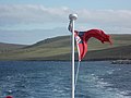 Fetlar, ferry flag aflutter - geograph.org.uk - 3558669.jpg 640 × 480; 55 KB
-
 Fetlar, Sand of Tresta - geograph.org.uk - 3558658.jpg 640 × 480; 57 KB
-
 Fetlar.PNG 272 × 388; 9 KB
-
 Fishfarm beside Daaey, Fetlar - geograph.org.uk - 6193647.jpg 1,600 × 1,068; 481 KB
-

-

-
 Funzie conglomerate.jpg 2,227 × 2,958; 1.72 MB
-
 Furra Stacks, Funzie - geograph.org.uk - 3478373.jpg 1,024 × 682; 154 KB
-
 Galloway Dyke on Fetlar.jpg 3,648 × 2,736; 4.82 MB
-
 Garths of Tresta, Fetlar - geograph.org.uk - 1350149.jpg 640 × 426; 48 KB
-
 Geo of Litlaland, Funzie Ness, Fetlar - geograph.org.uk - 6193833.jpg 1,600 × 1,065; 685 KB
-
 Geological Map of Stackaberg Thrust Fetlar, Published 1931.jpg 1,776 × 2,826; 428 KB
-
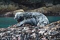 Grey Seal (Halichoreus grypeus), Nousta Ness, Fetlar - geograph.org.uk - 6193823.jpg 1,600 × 1,065; 545 KB
-
 Haroldswick from Sothers Field - geograph.org.uk - 735311.jpg 640 × 426; 47 KB
-
 Head of Cumla, Fetlar - geograph.org.uk - 6193762.jpg 1,600 × 1,065; 627 KB
-
 Headland on Funzie Ness - geograph.org.uk - 3478357.jpg 1,024 × 682; 108 KB
-
 Holm of Tressaness, Fetlar, from the sea - geograph.org.uk - 5207858.jpg 1,024 × 684; 91 KB
-
 Houlls geo, Fetlar - geograph.org.uk - 335137.jpg 640 × 439; 62 KB
-
 Il Holm - geograph.org.uk - 2155074.jpg 3,456 × 1,893; 1.92 MB
-
 Il Holm, Fetlar - geograph.org.uk - 6193661.jpg 1,600 × 1,065; 515 KB
-
 Leagarth and Feal, Fetlar - geograph.org.uk - 1028356.jpg 640 × 426; 131 KB
-
 Leagarth, Houbie, Fetlar - geograph.org.uk - 1028457.jpg 640 × 417; 63 KB
-
 Line of ruined stone enclosures - geograph.org.uk - 534748.jpg 640 × 480; 89 KB
-

-

-
 Low headland east of Tressa Ness, Fetlar - geograph.org.uk - 6193678.jpg 1,600 × 1,065; 828 KB
-
 Mediterranean skies, Tresta, Fetlar - geograph.org.uk - 1350199.jpg 640 × 426; 47 KB
-
 Mid Yell IMG 4838 (14127089136).jpg 4,191 × 2,318; 2.3 MB
-
 Midberg, Fetlar, from the sea - geograph.org.uk - 5796975.jpg 1,600 × 1,065; 446 KB
-
 Mire at Brough Lodge, Fetlar - geograph.org.uk - 1028577.jpg 640 × 422; 81 KB
-
 Moo Wick - geograph.org.uk - 3824720.jpg 640 × 360; 209 KB
-
 Moorland north of Hill of Reafirth - geograph.org.uk - 1058878.jpg 640 × 426; 94 KB
-
 Moorland north of North Sandwick - geograph.org.uk - 688535.jpg 640 × 426; 66 KB
-

-
 Multi-coloured cliff, Bight of Raabis, Fetlar - geograph.org.uk - 6193838.jpg 1,600 × 1,065; 775 KB
-
 Muness - geograph.org.uk - 311536.jpg 600 × 398; 41 KB
-
 Natural Arch at base of Busta Pund - geograph.org.uk - 2157003.jpg 3,456 × 2,304; 2.63 MB
-
 Natural arch at Ruvrapund, Fetlar - geograph.org.uk - 6193706.jpg 1,600 × 1,065; 668 KB
-
 Natural arch in Muckle Stack, Strandburgh Ness, Fetlar - geograph.org.uk - 6193738.jpg 1,065 × 1,600; 772 KB
-
 Ness of Gruting, Fetlar - geograph.org.uk - 6193713.jpg 1,600 × 1,065; 459 KB
-
 Ness of Snabrough - geograph.org.uk - 2157698.jpg 3,456 × 2,304; 3.03 MB
-
 Ness of Snabrough, Fetlar, from the sea - geograph.org.uk - 5795816.jpg 1,600 × 1,065; 438 KB
-
 North of Hoganeap, Lambhoga, Fetlar - geograph.org.uk - 6193857.jpg 1,600 × 1,065; 231 KB
-
 Northdale, Fetlar - geograph.org.uk - 1028251.jpg 640 × 449; 77 KB
-
 Noust of Helliersness, Fetlar, from the sea - geograph.org.uk - 5796971.jpg 1,600 × 1,065; 551 KB
-
 Nousta Ness, Fetlar - geograph.org.uk - 6193822.jpg 1,600 × 1,065; 757 KB
-

-
 Ordnance Survey One-Inch Sheet 1 Shetland, Published 1961.jpg 8,274 × 9,927; 6.77 MB
-
 Outer Brough, Strandburgh Ness, Fetlar - geograph.org.uk - 4970933.jpg 1,024 × 681; 212 KB
-
 Outflow from Papil Water - geograph.org.uk - 3470262.jpg 640 × 480; 81 KB
-
 Oxna Geo, near Strandburgh Ness, Fetlar - geograph.org.uk - 4971339.jpg 682 × 1,024; 200 KB
-

-
 Papil Water - geograph.org.uk - 135358.jpg 640 × 427; 68 KB
-
 Papil Water, Fetlar - geograph.org.uk - 1350183.jpg 640 × 426; 61 KB
-
 Papil Water, Fetlar - geograph.org.uk - 1350190.jpg 640 × 426; 48 KB
-

-
 Peerie Stack, Ness of Strandburgh, Fetlar - geograph.org.uk - 6193736.jpg 1,600 × 1,065; 530 KB
-
 Planticrubs, Burn of Feal, Fetlar - geograph.org.uk - 1028338.jpg 640 × 426; 110 KB
-
 Rams Ness - geograph.org.uk - 874160.jpg 640 × 426; 52 KB
-
 Rams Ness, Fetlar - geograph.org.uk - 5796968.jpg 1,600 × 1,065; 461 KB
-
 Rock below Butsa, Funzie Ness - geograph.org.uk - 3477620.jpg 1,024 × 682; 202 KB
-
 Russetter, Fetlar - geograph.org.uk - 6193830.jpg 1,600 × 1,065; 539 KB
-
 Sand of Paradise, Gruting, Fetlar - geograph.org.uk - 6193717.jpg 1,600 × 1,065; 432 KB
-
 Scarf Stack, Hawks Ness, Uyea Isle - geograph.org.uk - 1497905.jpg 640 × 426; 40 KB
-
 Selchie Geo, Funzie Ness - geograph.org.uk - 3478551.jpg 1,024 × 681; 266 KB
-
 Shags (Phalacrocorax aristotelis), Muckle Cupla, Fetlar - geograph.org.uk - 6193840.jpg 1,600 × 1,068; 525 KB
-
 Sheep-pund Geo, Fetlar - geograph.org.uk - 6193656.jpg 1,600 × 1,065; 607 KB
-
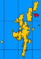
 Shetland Fetlar locator.svg 832 × 1,582; 1.64 MB
-
 Shetland North Isles 1795 map.jpg 1,164 × 1,623; 1.05 MB
-

-
 Skerry off Horn of Ramsness - geograph.org.uk - 1930433.jpg 481 × 321; 55 KB
-
 Small rock off the Horn of Ramsness, Fetlar - geograph.org.uk - 6193900.jpg 1,600 × 1,065; 382 KB
-
 Smithfield, Gruting, Fetlar - geograph.org.uk - 6193715.jpg 1,600 × 1,065; 335 KB
-
 Snow shower over Fetlar, from Clivocast - geograph.org.uk - 2186850.jpg 800 × 533; 107 KB
-
 Southdale, Fetlar - geograph.org.uk - 1028528.jpg 640 × 426; 86 KB
-
 Stack of Birrier - geograph.org.uk - 2155081.jpg 3,456 × 2,304; 3.35 MB
-

-
 Stack of Bresdale, Fetlar - geograph.org.uk - 6194709.jpg 1,600 × 1,065; 487 KB
-
 Stacks at Corbie Head, Fetlar - geograph.org.uk - 6194670.jpg 1,600 × 1,065; 281 KB
-

-
 Strandburgh Ness from Kegga - geograph.org.uk - 134823.jpg 640 × 427; 74 KB
-
 Strandburgh Ness, Fetlar, from the sea - geograph.org.uk - 6193721.jpg 1,600 × 1,067; 246 KB
-
 SW of Tresta towards Silda Wick - geograph.org.uk - 124728.jpg 640 × 480; 84 KB
-
 Swarta Skerry, Fetlar - geograph.org.uk - 6193701.jpg 1,600 × 1,065; 574 KB
-
 The cairn on the Holm of Heogland - geograph.org.uk - 805354.jpg 640 × 426; 80 KB
-
 The Clett - geograph.org.uk - 2156976.jpg 3,456 × 2,304; 2.74 MB
-
 The Clett and Busta Pund, Fetlar - geograph.org.uk - 4970744.jpg 1,024 × 682; 104 KB
-
 The Clett and Busta Pund, Fetlar - geograph.org.uk - 6193698.jpg 1,600 × 1,065; 471 KB
-
 The Clett, off Busta Pund, Fetlar - geograph.org.uk - 3477590.jpg 1,024 × 684; 51 KB
-
 The hill of Stackaberg - geograph.org.uk - 534761.jpg 640 × 480; 57 KB
-

-
 The Mires of Oddsetter - geograph.org.uk - 534323.jpg 640 × 480; 90 KB
-
 The Old Manse, Tresta, Fetlar - geograph.org.uk - 1350134.jpg 640 × 426; 51 KB
-

-

-
-
 The Tind - geograph.org.uk - 3823622.jpg 640 × 480; 258 KB
-
 The Tind, Fetlar - geograph.org.uk - 6193814.jpg 1,600 × 1,065; 850 KB
-

-
 Tiny rock off Rams Ness, Fetlar - geograph.org.uk - 5795813.jpg 1,600 × 1,067; 259 KB
-
 Tonga of Croosmel, Wick of Gruting, Fetlar - geograph.org.uk - 4970708.jpg 1,024 × 682; 133 KB
-
 Tressa Ness, Fetlar - geograph.org.uk - 6193655.jpg 1,600 × 1,065; 483 KB
-

-
 Urie Ness, Fetlar - geograph.org.uk - 1028209.jpg 640 × 418; 76 KB
-
 Urielingey.jpg 640 × 247; 28 KB
-
 Uyea Hall.jpg 640 × 393; 30 KB
-

-
 View from Uyea Breck towards Uyea and Fetlar - geograph.org.uk - 5102797.jpg 1,024 × 681; 107 KB
-

-
-
 View towards Stackaberg, Fetlar - geograph.org.uk - 1028256.jpg 640 × 426; 53 KB
-
 VK Fetlar.PNG 698 × 551; 10 KB
-
 Wall above Yogli Geo, Fetlar - geograph.org.uk - 6193707.jpg 1,600 × 1,065; 617 KB
-
 West Neap - geograph.org.uk - 874168.jpg 640 × 426; 49 KB
-
 Whale Geo, near Strandburgh Ness, Fetlar - geograph.org.uk - 4971352.jpg 1,024 × 682; 188 KB
-
 Winyadepla east shore. - geograph.org.uk - 627931.jpg 439 × 640; 78 KB
-


,_Nousta_Ness,_Fetlar_-_geograph.org.uk_-_6193823.jpg)


.jpg)


,_near_Staves_Geo,_Funzie_Ness_-_geograph.org.uk_-_3478858.jpg)


,_Hesta_Ness,_Fetlar_-_geograph.org.uk_-_4970774.jpg)


,_Muckle_Cupla,_Fetlar_-_geograph.org.uk_-_6193840.jpg)


_on_the_southern_tip_of_the_Holm_of_Heogland_-_geograph.org.uk_-_1378879.jpg)


