Category:Field name maps of Germany
Media in category "Field name maps of Germany"
The following 20 files are in this category, out of 20 total.
-
 KOCH(1896) p024 Flurnamen.jpg 1,001 × 1,105; 633 KB
-
 Bachtelweiher Bachtelmühle historische Flurkarte.png 1,467 × 862; 2.38 MB
-
 Barbarossaquelle.PNG 2,026 × 1,310; 219 KB
-
 Corres mit Flurnamen.png 1,000 × 998; 993 KB
-
 Einfallsgraben.PNG 1,100 × 780; 71 KB
-
 Flurkarte 1877 Gegen den Brunnen.png 243 × 182; 108 KB
-
 Flurnamenkarte Ermershausen.png 6,300 × 4,668; 23.72 MB
-
 Flurnamenkarte Ruethen.JPG 3,188 × 3,456; 4.69 MB
-

-
 Franzkat 0867-2-003 (Schwarzenbach).jpg 8,149 × 6,769; 4.99 MB
-
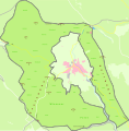
 Gemeindefreies Gebiet Heinrichsthaler Forst (Details).svg 2,800 × 2,664; 679 KB
-
 Gemeindefreies Gebiet Schöllkrippener Forst (Details).svg 1,672 × 2,315; 544 KB
-
 Gemeindefreies Gebiet Wiesener Forst (Details).svg 2,134 × 2,163; 529 KB
-
 HistorischeFlurnamenWendershagen.png 552 × 670; 183 KB
-
 Krebsjauche 1760.png 1,382 × 1,309; 2.87 MB
-

-
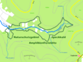 NSG Amphibienfreistätte Speckkahl.PNG 2,296 × 1,724; 177 KB
-
 NSG Weihersgrund.PNG 2,336 × 1,722; 293 KB
-
 Reichenau Gemarkungsplan 1876.jpg 4,114 × 3,396; 2 MB
-
 Sölzert.PNG 3,164 × 3,098; 1.01 MB
_p024_Flurnamen.jpg)


._Karte_von_einem_Teil_des_Kurf%C3%BCrstentums_Sachse.jpg)
.jpg)
.svg)
.svg)
.svg)


.jpg)


