Category:Fields in Murton CP
English: Fields in Murton civil parish, York.
Media in category "Fields in Murton CP"
The following 24 files are in this category, out of 24 total.
-
-
 Barn - geograph.org.uk - 131612.jpg 640 × 480; 62 KB
-
 Beck off Moor Lane - geograph.org.uk - 2384437.jpg 1,600 × 1,200; 565 KB
-
 Bridleway and track to the Stamford Bridge road - geograph.org.uk - 5759970.jpg 1,024 × 768; 199 KB
-
 Bridleway leading to Murton - geograph.org.uk - 6517784.jpg 1,024 × 683; 466 KB
-
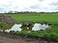
 Cattle near Moor Lane - geograph.org.uk - 6516777.jpg 1,024 × 683; 443 KB
-
 Close to Murton - geograph.org.uk - 131623.jpg 479 × 640; 122 KB
-
 Cyclist heading north on Moor Lane - geograph.org.uk - 5759986.jpg 1,024 × 768; 148 KB
-
 Farm track off Moor Lane - geograph.org.uk - 2384429.jpg 1,600 × 1,200; 457 KB
-
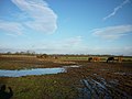
 Farmland drained by Osbaldwick Beck - geograph.org.uk - 5771087.jpg 1,024 × 576; 94 KB
-
 Fence near Moor Lane - geograph.org.uk - 6516778.jpg 1,024 × 683; 463 KB
-
 Gate on a bridleway - geograph.org.uk - 6517783.jpg 1,024 × 683; 468 KB
-
 Grazing in Murton - geograph.org.uk - 6419639.jpg 1,024 × 768; 443 KB
-
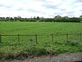
 Hedged fields, south of Murton - geograph.org.uk - 5757376.jpg 1,024 × 768; 186 KB
-
 Manor Farm - geograph.org.uk - 425230.jpg 640 × 478; 143 KB
-
 Mud, mud glorious mud - geograph.org.uk - 2224927.jpg 800 × 600; 246 KB
-
 Muddy Footpath - geograph.org.uk - 105236.jpg 640 × 479; 54 KB
-
 Murton Church - geograph.org.uk - 284891.jpg 640 × 479; 62 KB
-
 Murton Grange - geograph.org.uk - 52491.jpg 640 × 479; 110 KB
-
 Murton Moor farmland drained by Osbaldwick Beck - geograph.org.uk - 5771058.jpg 1,024 × 768; 158 KB
-
 Murton Way, about to pass under the A64 - geograph.org.uk - 5757364.jpg 1,024 × 768; 257 KB
-
 Osbaldwick Beck - geograph.org.uk - 3362940.jpg 3,264 × 2,448; 1.7 MB
-
 Snow covered footpath - geograph.org.uk - 131620.jpg 640 × 479; 109 KB
-
 Trough on waterlogged ground, north of Murton - geograph.org.uk - 5759977.jpg 1,024 × 768; 218 KB


