Category:Fields in the United States
Countries of the Americas: Argentina · Bolivia · Brazil · Canada · Chile · Colombia · Costa Rica · Cuba · Ecuador · El Salvador · Guatemala · Mexico · Nicaragua · Paraguay · Peru · Suriname · United States of America · Uruguay · Venezuela
Other areas: Guadeloupe
Other areas: Guadeloupe
Subcategories
This category has the following 9 subcategories, out of 9 total.
Media in category "Fields in the United States"
The following 200 files are in this category, out of 253 total.
(previous page) (next page)-

-
 Aerial view of contour farming. Missouri - NARA - 286180.jpg 3,000 × 2,077; 1.9 MB
-
 20111110-OC-AMW-0034 - Flickr - USDAgov.jpg 4,744 × 3,576; 7.65 MB
-
 2013-05-06 18 47 12 View across a plowed field in Point Mountain Reservation.jpg 3,264 × 2,448; 2.07 MB
-
 20140402-APHIS-UNK-0011 (13592610573).jpg 3,072 × 2,304; 2.94 MB
-
 2015-10-19 15 13 46 Field with brown grass along Old Ox Road in Sterling, Virginia.jpg 3,264 × 2,448; 3.2 MB
-

-

-

-

-

-
-

-

-

-

-

-

-

-

-

-

-

-

-

-

-
-

-
-

-

-

-

-

-
-
-

-

-
-

-

-

-

-
 A field in Arna Township at sunrise.JPG 3,264 × 2,448; 2.21 MB
-
 A Field of Shepherd’s-purse.jpg 1,812 × 2,048; 648 KB
-
 "A Florida Backyard in Mid Winter" (10836942803).jpg 600 × 390; 174 KB
-
 AbanFarm.JPG 2,304 × 1,728; 994 KB
-
 Alapaha River Wildlife Management Area dove field.jpg 5,184 × 3,456; 5.85 MB
-
 America (6154386431).jpg 3,670 × 2,053; 4.19 MB
-
 Autumn field in Michigan (30162633516).jpg 4,468 × 2,752; 5.05 MB
-
 Bales of hay in a snow-covered field at dusk.JPG 3,872 × 2,592; 3.51 MB
-
 Bales of hay in an open field at sunset.JPG 3,872 × 2,592; 3.66 MB
-
 Barn grass mountains fence.jpg 1,000 × 750; 169 KB
-
 Barn-field-fall-trees - West Virginia - ForestWander.jpg 4,000 × 3,000; 2.56 MB
-
 Bright Winter Morning - panoramio.jpg 1,656 × 1,242; 1.05 MB
-
 Bundesarchiv Bild 137-032698, USA, Minnesota, Felder.jpg 800 × 445; 65 KB
-

-
 Calvary, Field where Mule Day is held.jpg 5,184 × 3,456; 7.25 MB
-
 Catskill Escarpment from US 9 in Livingston, NY, with crepuscular rays.jpg 4,576 × 1,362; 2.22 MB
-
 Closeup of field in Mahoning Township, Montour County, Pennsylvania.JPG 2,256 × 1,504; 1.74 MB
-
 Clover Field NGM-v31-p567.jpg 1,516 × 2,215; 1.57 MB
-
 Collard green field in North Centre Township, Columbia County, Pennsylvania.JPG 2,256 × 1,504; 2.75 MB
-
 Cows in a field in Luzerne County, Pennsylvania 1.JPG 3,076 × 1,624; 1.74 MB
-
 Cows in a field in Luzerne County, Pennsylvania 2.JPG 2,975 × 2,056; 1.96 MB
-
 Deer-field - West Virginia - ForestWander.jpg 1,209 × 806; 199 KB
-
 Deer-field-1 - West Virginia - ForestWander.jpg 1,209 × 806; 243 KB
-
 Deer-field-2 - West Virginia - ForestWander.jpg 1,209 × 806; 225 KB
-
-
 Eastrupert.jpg 2,048 × 1,536; 2.14 MB
-

-

-

-

-
 Evening-country-field-highfreeland-wv - West Virginia - ForestWander.jpg 5,616 × 3,744; 1.52 MB
-
 Fall-barn - West Virginia - ForestWander.jpg 4,000 × 3,000; 3.16 MB
-
-
 Farm West of Dodgeville - panoramio.jpg 4,896 × 3,672; 6.71 MB
-
 Farming and maintaining terraces.jpg 1,123 × 641; 322 KB
-
 Farmland in the Catskill country1a34567v.jpg 1,024 × 827; 342 KB
-
 Field - NARA - 528936.jpg 3,000 × 2,311; 1.65 MB
-

-
 Field in Derry Township, Montour County, Pennsylvania.JPG 2,256 × 1,504; 1.93 MB
-
 Field in Dorrance Township, Luzerne County, Pennsylvania.JPG 3,088 × 2,056; 1.87 MB
-
 Field in Forks with elk.JPG 4,288 × 3,216; 2.73 MB
-
 Field in Madison Township, Columbia County, Pennsylvania.JPG 1,952 × 1,504; 1.8 MB
-
 Field in Roaring Creek Township, Columbia County, Pennsylvania 1.JPG 2,256 × 1,504; 2.57 MB
-
 Field in Roaring Creek Township, Columbia County, Pennsylvania 2.JPG 2,256 × 1,504; 2.48 MB
-
 Field on Miles Ranch looking easterly (oats) - NARA - 298157.jpg 3,000 × 2,292; 1.67 MB
-

-
 Field or pasture1a34437v.jpg 1,024 × 728; 270 KB
-
 Field with farm equipment in distance1a34446v.jpg 1,024 × 720; 190 KB
-
 Field-foliage - West Virginia - ForestWander.jpg 1,209 × 806; 437 KB
-
 Field-foliage-2 - West Virginia - ForestWander.jpg 1,209 × 806; 232 KB
-
 Field-sky - West Virginia - ForestWander.jpg 1,209 × 806; 193 KB
-
 Field-sky-2 - West Virginia - ForestWander.jpg 1,209 × 806; 177 KB
-
 Field-sky-3 - West Virginia - ForestWander.jpg 1,209 × 806; 146 KB
-
 Field1.jpg 2,992 × 3,200; 2.19 MB
-
 FieldatStarkCityMo.jpg 1,408 × 1,056; 129 KB
-
 Fields at the Riverton Site.jpg 2,816 × 1,584; 2.46 MB
-
 Fields from the Cobb Bridge at Paducah.jpg 2,816 × 1,584; 920 KB
-
 FieldVirginia2.jpg 1,280 × 720; 352 KB
-
 Flickr - Nicholas T - Country Road.jpg 4,608 × 2,673; 7.06 MB
-
 Flickr - Nicholas T - Farming Valley (2).jpg 4,608 × 3,191; 13.6 MB
-
 Flickr - Nicholas T - Road Less Traveled.jpg 4,320 × 2,571; 4.2 MB
-
 Flickr - Nicholas T - Roundtop.jpg 3,579 × 2,174; 6.19 MB
-
 Flickr - Nicholas T - Rural Route.jpg 4,256 × 3,040; 7.5 MB
-
 Flickr - Nicholas T - Valley View (1).jpg 4,608 × 3,267; 9.93 MB
-
 Flickr - Nicholas T - Valley View (2).jpg 4,608 × 3,027; 9.06 MB
-
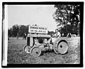
 Ford tractor demonstration LCCN2016823779.jpg 6,402 × 5,135; 3.87 MB
-
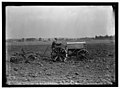
 Ford tractor demonstration LCCN2016823780.jpg 6,371 × 5,123; 4.13 MB
-
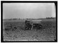
 Ford tractor demonstration LCCN2016823782.jpg 6,371 × 5,153; 3.78 MB
-
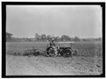
 Ford tractor demonstration LCCN2016823783.jpg 6,408 × 5,165; 3.86 MB
-
 Ford tractor demonstration LOC npcc.05090.jpg 5,416 × 4,380; 3.43 MB
-
 Ford tractor demonstration LOC npcc.05091.jpg 5,446 × 4,368; 3.2 MB
-
 Ford tractor demonstration LOC npcc.05092.jpg 5,458 × 4,432; 3.12 MB
-
 Ford tractor demonstration LOC npcc.05093.jpg 5,410 × 4,379; 3.48 MB
-
 Ford tractor demonstration LOC npcc.05094.jpg 5,440 × 4,391; 3.31 MB
-
 FORD TRACTOR LCCN2016867728.jpg 10,358 × 7,684; 11.33 MB
-
 FORD TRACTOR LCCN2016867728.tif 10,358 × 7,684; 151.83 MB
-
 FORD TRACTOR LCCN2016867729.jpg 10,375 × 7,692; 10.3 MB
-
 FORD TRACTOR LCCN2016867729.tif 10,375 × 7,692; 152.23 MB
-

-
 Gatch Site.jpg 2,816 × 2,112; 3.37 MB
-
 Geese in a field at Muscatatuck NWR.jpg 2,816 × 2,112; 2.93 MB
-
 Gettysburg National Military Park 23.JPG 3,072 × 2,304; 2.72 MB
-
 Gettysburg National Military Park 25.JPG 3,072 × 2,304; 3.14 MB
-
 Gettysburg National Military Park 54.JPG 3,072 × 2,304; 2.31 MB
-
 Gettysburg National Military Park 61.JPG 3,072 × 2,304; 2.38 MB
-
 Gettysburg National Military Park 68.JPG 3,072 × 2,304; 2.71 MB
-
 Grass field west of Mount Pisgah.JPG 4,608 × 3,456; 3.41 MB
-
 Hawaii Hanalei Taro fields.png 3,264 × 2,448; 22.9 MB
-
 Haymaking 1 mowing.jpg 2,592 × 1,944; 2.17 MB
-
 Haymaking 3 windrows and bales.jpg 2,592 × 1,944; 2.31 MB
-
 Henry Blackhawk, a new cow-man, looks for a hard winter - NARA - 298576.jpg 3,000 × 1,843; 1.03 MB
-
 High Banks Works.jpg 2,816 × 2,112; 3.22 MB
-
 High Grain - Worton (Betterton) MD - panoramio.jpg 3,490 × 2,242; 2.67 MB
-
 Hopeton Earthworks overview from behind gate.jpg 2,816 × 2,112; 1.79 MB
-
 Hopeton Earthworks wall.jpg 2,816 × 1,584; 1.01 MB
-
 Hormel Stadium; Medford, MA.JPG 4,608 × 3,456; 6.13 MB
-

-

-

-
 Jeff Fennell - Devils Tower (by).jpg 3,031 × 2,048; 5.87 MB
-
 JUST BEFORE RAIN-NEAR MURPHYSBORO - NARA - 552515.jpg 3,000 × 2,031; 812 KB
-
 Kelso-field-tn1.jpg 4,288 × 2,848; 2.02 MB
-
 Kenna New Mexico Ranch Gate.jpg 2,048 × 1,360; 1.47 MB
-
 Late summer rural landscape, off Sisson Highway, Town of Collins, New York - 20210824.jpg 4,032 × 2,419; 4.55 MB
-

-
 Locust Site overview.jpg 2,816 × 2,112; 2.32 MB
-
 Lone Tree - panoramio.jpg 1,656 × 1,242; 508 KB
-
 Lone tree near Perrydale Oregon.JPG 3,872 × 1,369; 1.48 MB
-
 Maine fall 3 (3030347948).jpg 1,024 × 628; 261 KB
-
 Meadow at Crown Point Ferry Crossing.jpg 4,000 × 3,000; 5.05 MB
-
 Megan Mailloux looking across field (5413351700).jpg 4,416 × 2,480; 5.43 MB
-
 MIGRANT WORKERS IN FIELD - NARA - 543845.jpg 3,000 × 2,034; 616 KB
-
 MIGRANT WORKERS WEED SUGAR BEETS FROM DAWN TO DUSK FOR $2.00 AN HOUR - NARA - 543862.jpg 3,000 × 2,034; 1.08 MB
-
 MIGRANTS WEED SUGAR BEETS FOR $2.00 AN HOUR - NARA - 543858.jpg 3,000 × 2,030; 888 KB
-
 Mississinawa Township, Darke County, Ohio.jpg 2,576 × 1,920; 1.69 MB
-
 Monmouth Battlefield State Park First Day Hike 2015 open fields turn.jpg 3,264 × 2,448; 3.24 MB
-
 Monmouth Battlefield State Park First Day Hike 2016 ahead of the pack.jpg 3,024 × 4,032; 2.96 MB
-
 Mount Magazine from southeast.JPG 3,648 × 2,736; 4.37 MB
-
 NAPI Alfalfa.jpg 2,400 × 1,800; 3.09 MB
-
-
-
 Newlove Road scene with woods.jpg 2,816 × 2,112; 2.14 MB
-
 NRCSDC01013 - District of Columbia (1781)(NRCS Photo Gallery).jpg 2,100 × 1,440; 4.12 MB
-
 NRCSDC01013 - District of Columbia (1781)(NRCS Photo Gallery).tif 2,100 × 1,440; 11.54 MB
-
 NRCSDE01004 - Delaware (1801)(NRCS Photo Gallery).jpg 2,100 × 1,500; 6.74 MB
-
 NRCSFL07008 - Florida (715590)(NRCS Photo Gallery).jpg 2,700 × 1,800; 3.82 MB
-
 NRCSFL07008 - Florida (715590)(NRCS Photo Gallery).tif 2,700 × 1,800; 13.94 MB
-
 NRCSIA99132 - Iowa (2967)(NRCS Photo Gallery).jpg 2,100 × 1,500; 6.57 MB
-
 NRCSIA99134 - Iowa (2969)(NRCS Photo Gallery).jpg 2,100 × 1,500; 6.85 MB
-
 NRCSIA99148 - Iowa (2997)(NRCS Photo Gallery).jpg 2,100 × 1,500; 5.99 MB
-
 NRCSIA99162 - Iowa (3025)(NRCS Photo Gallery).jpg 2,100 × 1,500; 6.23 MB
-
 NRCSTN83003 - Tennessee (6251)(NRCS Photo Gallery).jpg 2,100 × 1,500; 6.19 MB
-
 NRCSTN83008 - Tennessee (6261)(NRCS Photo Gallery).jpg 2,100 × 1,500; 6.38 MB
-
 NRCSWI01008 - Flickr - USDAgov.jpg 2,039 × 1,416; 230 KB
-
 NY 14, Lyons, New York - 20200611.jpg 4,032 × 3,024; 3.58 MB
-
 Old combine harvester.jpg 976 × 653; 499 KB
-
 Old-fence-field - West Virginia - ForestWander.jpg 1,209 × 806; 480 KB
-
 Old-Salem-fields-tn1.jpg 4,194 × 2,787; 2.25 MB
-

-
 OntarioSnowField.jpg 2,272 × 1,704; 1.12 MB
-
 Palouse hills - 9591.jpg 2,848 × 3,189; 2.98 MB
-
 Panorama, bales of hay in a snow-covered field at dawn.jpg 3,232 × 1,384; 583 KB
-
 Pastoral scenery along Lake Road in Porter, New York - "Cloverfield West" - 20200524.jpg 4,032 × 2,419; 3.59 MB
-
 Pastoral scenery off US 62, Dayton, New York - 20210418.jpg 4,032 × 2,419; 3.66 MB
-
 Photograph of a Man and a Dog in a Field - NARA - 7829567.jpg 3,472 × 2,177; 1.48 MB
-
 Photograph of a Man Standing in a Field - NARA - 7829565.jpg 3,472 × 2,177; 1.49 MB
-
 Photograph of Two Horses in a Field - NARA - 7829566.jpg 3,472 × 2,177; 1.61 MB
-
 Photos-OutdoorImage-AdobeStock-Fiedl1.jpg 2,581 × 1,936; 7.96 MB
-
 Pickaway Settlements Battlesite.jpg 2,816 × 2,112; 2.8 MB
-
 Pictures Kept by Supt. L. S. Bonnin, Cheyenne and Arapaho Agency - NARA - 268471.jpg 3,000 × 2,383; 4.19 MB
-
 Pictures Kept by Supt. L. S. Bonnin, Cheyenne and Arapaho Agency - NARA - 268471.tif 3,000 × 2,383; 6.82 MB
-
 Planted field in Lula, Mississippi, on June 2, 2006.jpg 1,600 × 1,200; 288 KB
-
 PLANTED FIELD IN ZEARING - NARA - 552466.jpg 3,000 × 2,043; 862 KB
-
 Plowed land 1r.jpg 1,000 × 750; 785 KB
-
 Pluribus field wiki.jpg 460 × 290; 72 KB
-
 Powerlines travel south near Illiopolis Illinois.jpg 3,456 × 2,304; 590 KB
-
 Pumpkin pollination4365.jpg 300 × 225; 30 KB
_412-DSP-2-WEDarials_071.jpg_-_DPLA_-_a8d3f54d9fa6dda58805fb4c9d94739a.jpg)


.jpg)

_near_the_shore_of_Saint_Catherine_Sound_of_the_Potomac_River_in_Bushwood,_St._Mary%27s_County,_Maryland.jpg)

_near_Bel_Air_in_Allegany_County,_Maryland.jpg)
_near_Virginia_State_Secondary_Route_615_(Lindsay_Road).jpg)
_near_Virginia_State_Secondary_Route_615_(Lindsay_Road).jpg)
_near_Virginia_State_Secondary_Route_615_(Lindsay_Road).jpg)
_near_Virginia_State_Secondary_Route_615_(Lindsay_Road).jpg)
_in_Sterling,_Loudoun_County,_Virginia.jpg)
_just_east_of_Mount_Zion_Road_in_Baltimore_County,_Maryland.jpg)
_just_east_of_Mount_Zion_Road_in_Baltimore_County,_Maryland.jpg)
_in_Sterling,_Loudoun_County,_Virginia.jpg)
_near_Popham_Run_in_Etlan,_Madison_County,_Virginia.jpg)
_near_Popham_Run_in_Etlan,_Madison_County,_Virginia.jpg)
_near_Popham_Run_in_Etlan,_Madison_County,_Virginia.jpg)
_near_Popham_Run_in_Etlan,_Madison_County,_Virginia.jpg)
_near_Popham_Run_in_Etlan,_Madison_County,_Virginia.jpg)
_near_Popham_Run_in_Etlan,_Madison_County,_Virginia.jpg)

_just_north_of_Sullivan_Road_in_Cranberry,_Carroll_County,_Maryland.jpg)
_just_north_of_Sullivan_Road_in_Cranberry,_Carroll_County,_Maryland.jpg)
_just_north_of_Sullivan_Road_in_Cranberry,_Carroll_County,_Maryland.jpg)
_in_Wentz,_Carroll_County,_Maryland.jpg)
_near_Wilt_Road_in_Marston,_Carroll_County,_Maryland.jpg)
_near_Wilt_Road_in_Marston,_Carroll_County,_Maryland.jpg)
_near_Wilt_Road_in_Marston,_Carroll_County,_Maryland.jpg)
_and_U.S._Route_15_(James_Madison_Highway)_just_southwest_of_Culpeper_in_Culpeper_County,_Virginia.jpg)
_just_southwest_of_Washington_in_Rappahannock_County,_Virginia.jpg)
_at_Debold_Road_in_Sabillasville,_Frederick_County,_Maryland.jpg)
_just_north_of_Gapland_Road_in_southwestern_Frederick_County,_Maryland.jpg)
_in_the_Dulles_section_of_Sterling,_Loudoun_County,_Virginia.jpg)
_near_Gloucester_County_Route_610_(Whig_Lane)_in_Elk_Township,_Gloucester_County,_New_Jersey.jpg)
_near_Gloucester_County_Route_610_(Whig_Lane)_in_Elk_Township,_Gloucester_County,_New_Jersey.jpg)


.jpg)


.jpg)
.jpg)


_(harDA0032a).jpg)


.jpg)


_-_NARA_-_298157.jpg)


.jpg)


.jpg)
.jpg)


.jpg)


_MD_-_panoramio.jpg)


.jpg)


.jpg)

.jpg)


(NRCS_Photo_Gallery).jpg)
(NRCS_Photo_Gallery).jpg)
(NRCS_Photo_Gallery).jpg)
(NRCS_Photo_Gallery).jpg)
(NRCS_Photo_Gallery).jpg)
(NRCS_Photo_Gallery).jpg)
(NRCS_Photo_Gallery).jpg)
(NRCS_Photo_Gallery).jpg)
(NRCS_Photo_Gallery).jpg)


_near_Virginia_State_Secondary_Route_615_(Lindsay_Road).jpg)
_near_Popham_Run_in_Etlan,_Madison_County,_Virginia.jpg)
_at_Cedar_Ridge_Road_in_Pinesburg,_Washington_County,_Maryland.jpg)
_at_Cedar_Ridge_Road_in_Pinesburg,_Washington_County,_Maryland.jpg)
_just_north_of_Sullivan_Road_in_Cranberry,_Carroll_County,_Maryland.jpg)