Category:Files with coordinates missing SDC location of creation (53° N, 1° W)
Media in category "Files with coordinates missing SDC location of creation (53° N, 1° W)"
The following 200 files are in this category, out of 3,071 total.
(previous page) (next page)-
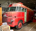 "039EB" 1957 Bedford.jpg 4,105 × 3,547; 1.92 MB
-
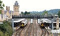
 "50034 Furious" (50 007) Common Lane Welton LC 221222.jpg 4,843 × 2,425; 1.59 MB
-
 "50034 Furious" (50 007) Welton LC 221222.jpg 5,221 × 1,961; 1.97 MB
-
 "Breakfast in Bun" and "Mushrooms Scrambled Eggs" by The Old Tram Station, Hull.jpg 3,024 × 4,032; 3.53 MB
-
 "Lauga" at Barrow Haven.jpg 3,648 × 2,736; 4.4 MB
-
 "Shed One" Forward Control Land Rover fire tender RAF.jpg 3,919 × 3,049; 1.58 MB
-
 "Shed Two" Thorneycroft crash tender RAF.jpg 3,391 × 3,600; 2 MB
-

-

-
 'Punch's Library' Louth Museum.jpg 3,024 × 4,032; 3.21 MB
-
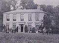 'Ridgmont', Burstwick 1865 (archive ref DDX1713-1) (29122663726).jpg 816 × 592; 147 KB
-

-
 - I collect old cameras - Rolleicord (explored) - Flickr - philhearing.jpg 2,880 × 2,160; 3.43 MB
-
 02AY22 MK11 Scammell Super Major 6×6 Gloster Saro Crash Tender.jpg 4,441 × 3,469; 1.86 MB
-
 1, Castle Hill, Lincoln.jpg 1,350 × 1,800; 908 KB
-
 1, Nichol Hill, Louth.jpg 4,052 × 3,070; 2.19 MB
-
 1-3 Market Place, Southwell.jpg 1,280 × 1,280; 387 KB
-
 10 and 12, Eastgate, Louth.jpg 4,000 × 3,000; 2.68 MB
-
 10 Church Lane, Navenby (geograph 7519412).jpg 1,024 × 768; 241 KB
-
 10 Church Street, Nettleham (geograph 6123127).jpg 2,473 × 2,473; 3.8 MB
-
 10 Westgate, Southwell.jpg 1,280 × 960; 342 KB
-
 10, Upgate, Louth.jpg 4,000 × 3,000; 5.98 MB
-
 11 Westgate, Southwell.jpg 1,280 × 1,280; 410 KB
-
 11-15 Queen Street, Southwell.jpg 959 × 1,280; 356 KB
-
 117 High Street, Brant Broughton (geograph 7574934).jpg 1,024 × 768; 215 KB
-
 12 Appleton Gate, Newark.jpg 1,024 × 768; 179 KB
-
 12 King Street, Southwell.jpg 953 × 1,280; 264 KB
-
 13 and 15 Market Place, Southwell.jpg 1,280 × 1,280; 389 KB
-
 13 Church Street, Southwell.jpg 1,280 × 960; 348 KB
-
 13, Upgate, Louth 01.jpg 3,000 × 4,000; 2.45 MB
-
 13, Upgate, Louth 02.jpg 4,000 × 3,000; 2.1 MB
-
 13, Upgate, Louth 03.jpg 4,000 × 3,000; 2.15 MB
-
 14 to 24 Northgate, Newark.jpg 1,024 × 683; 179 KB
-
 14 Westgate, Southwell.jpg 960 × 1,280; 372 KB
-
 14, 16 and 18 Northgate, Newark.jpg 1,024 × 758; 208 KB
-
 14, Mercer Row, Louth.jpg 3,206 × 4,152; 2.51 MB
-
 14th-century carving- chained bear?.jpg 2,816 × 1,584; 2.4 MB
-
 14th-century carvings.jpg 1,584 × 2,816; 1.41 MB
-
 15 and 15A King Street, Southwell.jpg 928 × 1,280; 321 KB
-
 15 Westgate, Southwell.jpg 1,280 × 1,280; 312 KB
-
 15, Minster Yard, Lincoln.jpg 4,000 × 3,000; 4.93 MB
-
 15-19, Upgate. Louth.jpg 4,000 × 3,000; 6.08 MB
-
 153319 at Althorpe.jpg 1,280 × 849; 475 KB
-
 153357 Finningly.jpg 5,118 × 2,913; 1.76 MB
-
 156405 156919 Lincoln Central 190820.jpg 4,586 × 2,766; 2.33 MB
-
 156497 East Midlands Trains Croxton.jpg 5,472 × 3,648; 3.76 MB
-
 156902 Brayford Wharf LC Lincoln 190820.jpg 4,865 × 3,129; 2.09 MB
-
 156919 195002 ZH101 Lincoln Central 190820.jpg 4,383 × 2,927; 1.57 MB
-
 158765 at Althorpe on 18th June 2002.jpg 1,850 × 1,294; 1.03 MB
-
 158792 Welton LC 221222.jpg 4,933 × 2,167; 1.47 MB
-
 158849 Welton LC 221222.jpg 5,797 × 3,307; 2.62 MB
-
 16 and 18 Market Place, Southwell.jpg 1,280 × 1,280; 434 KB
-
 16 Middlegate, Newark.jpg 1,024 × 768; 187 KB
-
 16, Upgate, Louth.jpg 3,000 × 4,000; 1.94 MB
-
 17 and 18, Market Place, Louth.jpg 3,000 × 4,000; 1.76 MB
-
 17 Market Place, Southwell.jpg 1,159 × 1,280; 368 KB
-
 17 Parliament Street, Newark.jpg 673 × 1,024; 149 KB
-
 17.09.13 Barnetby 153.381 (9791085016).jpg 6,016 × 4,000; 12.91 MB
-
 17.09.13 Barnetby 66083 (9791092586).jpg 6,016 × 4,000; 12.09 MB
-
 170475 Welton LC 221222.jpg 3,955 × 2,089; 1.44 MB
-
 18 and 20, Mercer Row, Louth.jpg 3,000 × 4,000; 5.96 MB
-
 18 and 20, Upgate, Louth.jpg 4,052 × 3,070; 1.92 MB
-
 18 Westgate, Southwell.jpg 1,280 × 986; 349 KB
-
 185 135 and 153 332 at Cleetrhorpes.jpg 5,472 × 3,648; 6.23 MB
-
 185125 Cleethorpes 130821.jpg 3,685 × 2,497; 1.33 MB
-
 185132 Welton LC 221222.jpg 4,681 × 2,406; 1.5 MB
-
 185137 Croxton 161217.jpg 4,873 × 2,647; 2.66 MB
-
 1868 Fire Pump and Ladder.jpg 3,626 × 5,012; 2.23 MB
-
 19, Minster Yard, Lincoln.jpg 3,000 × 4,000; 1.22 MB
-
 1910 Rinek V8 Aero Engine (5582472513).jpg 4,340 × 2,916; 8.06 MB
-
 1929 Rolls-Royce 20-25 Lincs Steam Rally 170819.jpg 4,146 × 2,766; 1.81 MB
-
 1932 Rolls-Royce 20-25 sports saloon by H J Mulliner.jpg 4,286 × 3,021; 1.92 MB
-
 195002 High St LC Lincoln 190820.jpg 5,118 × 3,053; 1.72 MB
-
 2 and 4, Nichol Hill, Louth.jpg 4,000 × 3,000; 6.02 MB
-
 20190728-Preserved-C45HDT.jpg 5,328 × 4,000; 8.63 MB
-
 23AJ99 Bedford "mini Angus" Truck Fire Fighting 4 x 2 Domestic Water.jpg 4,614 × 3,227; 1.85 MB
-
 27.5.16 1 Beverley Minster 07 (27272069241).jpg 6,016 × 4,000; 8.29 MB
-
 27.5.16 1 Beverley Minster 08 (26735233014).jpg 4,000 × 6,016; 8.82 MB
-
 27.5.16 1 Beverley Minster 12 (26735306314).jpg 4,000 × 6,016; 7.47 MB
-
 27.5.16 1 Beverley Minster 21 (27067784890).jpg 4,000 × 6,016; 9.06 MB
-
 27.5.16 1 Beverley Minster 26 (27067855360).jpg 6,016 × 4,000; 5.29 MB
-
 27.5.16 1 Beverley Minster 31 (26736503243).jpg 4,000 × 6,016; 5.9 MB
-
 27.5.16 1 Beverley Minster 34 (27272626861).jpg 4,000 × 6,016; 8.46 MB
-
 27.5.16 1 Beverley Minster 36 (26736614263).jpg 4,000 × 6,016; 7.22 MB
-
 27.5.16 2 Beverley 1 (26735804804).jpg 6,016 × 4,000; 7.92 MB
-
 27.5.16 2 Beverley 4 (27310021736).jpg 6,016 × 4,000; 6.67 MB
-
 27.5.16 3 Beverley St Marys 04 (27343073825).jpg 6,016 × 4,000; 5.68 MB
-
 27.5.16 3 Beverley St Marys 06 (27309953206).jpg 6,016 × 4,000; 5.6 MB
-
 27.5.16 4 BeverleyToll Gavel United Church 2 (26735963724).jpg 6,016 × 4,000; 4.54 MB
-
 28.5.16 Hull (27273094021).jpg 6,016 × 4,000; 5.58 MB
-
 28AG00 Land Rover Helicopter Support Vehicle.jpg 3,577 × 3,145; 2.59 MB
-
 30 Degrees (36740983504).jpg 4,752 × 3,168; 5.15 MB
-
 321 Saab Safir.jpg 5,420 × 1,851; 1.38 MB
-
 321-G-BKPY (15410575878).jpg 2,304 × 1,536; 903 KB
-
 329BRF 1954 Thorneycroft Fire Tender Staffordshire Brigade.jpg 4,296 × 2,501; 1.17 MB
-
 37423 & Inspection Saloon 975025 Caroline (1).jpg 2,959 × 1,993; 1.22 MB
-
 37423 & Inspection Saloon 975025 Caroline.jpg 2,948 × 2,185; 1.35 MB
-
 40145 Cromwell Lane Crossing.jpg 2,048 × 1,365; 468 KB
-
 43050 Cleethorpes.jpg 4,993 × 3,393; 1.61 MB
-
 43059 Cleethorpes.jpg 5,472 × 3,648; 6.61 MB
-
 43238 , Carlton on Trent.jpg 3,442 × 2,252; 1.15 MB
-
 43302 Cromwell Lane Crossing (3032926426).jpg 2,048 × 1,365; 450 KB
-
 458 Mig 23ML Newark Museum.jpg 5,257 × 2,101; 1.81 MB
-
 458 Mig 23ML side Newark Museum.jpg 5,286 × 1,821; 1.5 MB
-
 46 RN 53 Dennis, RNAD Broughton Moor HMU11.jpg 3,648 × 5,472; 3.09 MB
-
 47580 , North Muskham.jpg 3,600 × 2,554; 1.83 MB
-
 50049 "Defiance" Common Lane, Welton LC 221222.jpg 2,149 × 1,102; 523 KB
-
 50049 & 50007 1Z50.jpg 6,016 × 4,016; 17.39 MB
-
 50049 Defiance Welton LC 221222.jpg 3,973 × 2,025; 1.4 MB
-
 51-9036 Lockheed T33A Newark.jpg 4,996 × 1,906; 1.45 MB
-
 53 Bargate (10766326683).jpg 3,456 × 4,608; 4.7 MB
-
 54-2223 NA F100F Super Sabre Newark.jpg 5,141 × 1,906; 1.22 MB
-
 56018 at New Barnetby 2.jpg 2,120 × 1,383; 871 KB
-
 6, Upgate, Louth.jpg 4,000 × 3,000; 6 MB
-
 60 091 backs down onto The Lincolnshire Coaster for the return journey to London.jpg 3,320 × 2,100; 1.01 MB
-
 60 099 at Cleethorpes.jpg 2,317 × 3,559; 1.04 MB
-

-
 60047 with Drax biomass Hensall 221222.jpg 4,087 × 2,497; 1.23 MB
-
 617 Squadron "Dambusters" HQ building, RAF Scampton.jpg 4,861 × 2,509; 1.84 MB
-
 66 063 at Immingham Depot.jpg 3,285 × 1,605; 918 KB
-
 66 080 at Metheringham 1.jpg 1,481 × 1,631; 558 KB
-
 66 111 filthy on Holten le Moor LC.jpg 5,535 × 2,221; 1,014 KB
-
 66 175 with signal at Discharge Point 2.jpg 5,314 × 2,570; 2.21 MB
-
 66 764 Drax with kerb.jpg 4,117 × 3,543; 2.84 MB
-
 66015 Barnetby 160822.jpg 4,681 × 2,625; 1.63 MB
-
 66051 East Holmes 190820.jpg 2,941 × 2,779; 1.19 MB
-
 66068 & 66 088 Caistor Lane LC B 160822.jpg 5,281 × 3,537; 3.5 MB
-
 66068 66088 Caistor Lane LC 160822.jpg 5,073 × 2,897; 1.9 MB
-
 66084 at Barnetby - 6091736097.jpg 1,280 × 980; 390 KB
-
 66111 changing ends.jpg 4,051 × 2,286; 1.85 MB
-
 66111 with RHTT Holten Le Moor.jpg 3,686 × 2,661; 1.93 MB
-
 66114 filthy on Holten Le Moor LC.jpg 5,453 × 2,341; 1.1 MB
-
 66114 Holten Le Moor Lc 041120.jpg 4,828 × 2,601; 1.95 MB
-
 66127 Caistor Lane LC 160822.jpg 5,161 × 3,617; 4.03 MB
-
 66127 Caistor Lane LC B 160822.jpg 4,449 × 2,809; 2.22 MB
-
 666162 Maritime Intermodal 5 east of Lincoln 110821.jpg 4,901 × 1,716; 1.05 MB
-
 666162 Maritime Intermodal 5 Lincoln 110821.jpg 3,753 × 2,010; 1.75 MB
-
 66716 , Cromwell Moor.jpg 3,000 × 2,069; 3.27 MB
-
 67020 , Weston.jpg 3,000 × 1,939; 1.49 MB
-
 67030 , Sutton on Trent.jpg 3,603 × 2,276; 1.76 MB
-
 71 MiG 27 Newark.jpg 4,896 × 1,981; 1.37 MB
-
 8, Upgate, Louth 01.jpg 4,000 × 3,000; 5.93 MB
-
 8, Upgate, Louth 02.jpg 4,000 × 3,000; 6.04 MB
-
 800 208 High St LC Lincoln 190820.jpg 5,460 × 2,997; 1.8 MB
-
 800 208 Lincoln High St 190820.jpg 4,569 × 2,985; 1.41 MB
-
 802304 William Wilberforce Common Lane Welton LC 221222.jpg 3,715 × 1,783; 1.34 MB
-
 802304 William Wilberforce Welton LC 221222.jpg 4,927 × 3,337; 2.42 MB
-
 82217 Norwell Lane Crossing.jpg 2,376 × 1,584; 1.41 MB
-
 83 8-MS Dassault Mystere IVA Newark.jpg 4,286 × 1,881; 987 KB
-
 87022 Weston on Trent.jpg 1,200 × 839; 249 KB
-
 90035 , Flyfish Crossing.jpg 5,184 × 3,456; 1.87 MB
-
 Lizzie, Maine Coon, 2018 (44326302621) (cropped 2024).jpg 3,024 × 3,024; 1.97 MB
-
 A brace of Vulcans - Waddington 2013 (9223640373).jpg 2,698 × 1,799; 4.51 MB
-
 A busy afternoon at Cleethorpes.jpg 5,472 × 3,648; 5.74 MB
-
 A Doorway, St Mary's Church, Etton - geograph.org.uk - 699160.jpg 460 × 640; 104 KB
-

-
 A path leading to Hathersage Road - geograph.org.uk - 3221644.jpg 800 × 600; 118 KB
-
 A path leading to Jalland Street - geograph.org.uk - 3209984.jpg 800 × 600; 179 KB
-
 A path leaves the Trans Pennine Trail - geograph.org.uk - 3221394.jpg 800 × 600; 163 KB
-
 A path towards Wynburg Street - geograph.org.uk - 3210124.jpg 800 × 600; 99 KB
-
 A peep at Southwell Minster's tower - geograph.org.uk - 257727.jpg 511 × 640; 200 KB
-
 A Solitary Walker in Comber Dale - geograph.org.uk - 926574.jpg 552 × 640; 125 KB
-
 A tenfoot towards Wynburg Street - geograph.org.uk - 3210144.jpg 800 × 600; 112 KB
-
 A Train from Hull approaching Goole - geograph.org.uk - 1391345.jpg 480 × 640; 170 KB
-
 A view from the motte of Skipsea Castle (geograph 7109988).jpg 2,000 × 1,331; 2.94 MB
-
 A view from the motte of Skipsea Castle (geograph 7109991).jpg 2,000 × 1,331; 2.94 MB
-
 A view from the motte of Skipsea Castle (geograph 7109997).jpg 2,000 × 1,331; 3.02 MB
-
 A view from the motte of Skipsea Castle towards Skipsea (geograph 7109995).jpg 2,000 × 1,331; 3.02 MB
-
 A1031 Tetney Road looking north - geograph.org.uk - 3672075.jpg 640 × 480; 84 KB
-
 A1034 towards Market Weighton - geograph.org.uk - 1601029.jpg 640 × 480; 78 KB
-
 A180 layby heading East from Grimsby - geograph.org.uk - 3185610.jpg 1,024 × 660; 85 KB
-
 Abandoned ASDA trolley (geograph 6869485).jpg 1,280 × 960; 594 KB
-
 Abandoned in the Hedge - geograph.org.uk - 752621.jpg 640 × 425; 184 KB
-
 Abandoned wrecked Trawler lies midway between New Holland and Goxhill Haven - Feb. 2010.jpg 2,854 × 2,619; 4.15 MB
-
 Acacia Drive off Laburnum Avenue, Hull - geograph.org.uk - 3221216.jpg 800 × 600; 100 KB
-
 ACE High Tropospheric scattering dishes, RAF Stenigot (13971445705).jpg 1,909 × 781; 152 KB
-
 Acklams Coaches ‘Elite’ E14 ACK (TGT 65).jpg 3,232 × 2,424; 3.95 MB
-

-
 AEC RAF fire appliance.jpg 3,324 × 4,387; 2.5 MB
-
 Aerial view of Beverley Railway Station - geograph.org.uk - 324102.jpg 640 × 427; 126 KB
-
 Aero L-159 ALCA (Czech Air Force) Waddington 2013 (9276763636).jpg 3,872 × 2,592; 3.9 MB
-
 Aero L-159C Albatros 6063 (9244196922).jpg 2,249 × 1,499; 3.26 MB
-
 Albermarle Avenue, Kingswood, Hull (geograph 6779573).jpg 5,456 × 3,632; 1.3 MB
-
 Alfred Gelder Street, Kingston upon Hull - geograph.org.uk - 4279082.jpg 3,081 × 2,261; 2.68 MB
-
 All Saints church, Hessle - geograph.org.uk - 3222026.jpg 1,200 × 1,600; 348 KB
-
 All Saints, Harby, Nottinghamshire - 51977596296.jpg 3,122 × 3,520; 5.54 MB
-
 All Saints, Harby, Nottinghamshire - 51977597356.jpg 2,789 × 4,843; 4.51 MB
-
 All Saints, Harby, Nottinghamshire - 51977597496.jpg 3,455 × 3,572; 3.95 MB
-
 All Saints, Harby, Nottinghamshire - 51977598156.jpg 3,706 × 5,150; 12.26 MB
-
 All Saints, Harby, Nottinghamshire - 51977598226.jpg 2,913 × 2,223; 4.18 MB
-
 All Saints, Harby, Nottinghamshire - 51977670878.jpg 3,218 × 3,595; 6.13 MB
-
 All Saints, Harby, Nottinghamshire - 51977671218.jpg 3,464 × 4,600; 8.22 MB
-
 All Saints, Harby, Nottinghamshire - 51977672003.jpg 2,845 × 4,078; 4.77 MB
-
 All Saints, Harby, Nottinghamshire - 51977876019.jpg 3,648 × 5,472; 7.26 MB
-
 All Saints, Harby, Nottinghamshire - 51977876294.jpg 3,282 × 3,492; 5.43 MB
-
 All Saints, Harby, Nottinghamshire - 51977876769.jpg 3,353 × 4,223; 6.06 MB
-
 All Saints, Harby, Nottinghamshire - 51977877724.jpg 2,893 × 5,441; 6.43 MB
-
 All Saints, Harby, Nottinghamshire - 51978160265.jpg 3,102 × 5,061; 10.21 MB
-
 All Saints, Harby, Nottinghamshire - 51978160645.jpg 3,430 × 4,932; 10.25 MB
-
 All Saints, Harby, Nottinghamshire.jpg 3,648 × 5,472; 7.18 MB

_Common_Lane_Welton_LC_221222.jpg)


)_(26140356882).jpg)
_(31980136551).jpg)

_(29122663726).jpg)

_-_Flickr_-_philhearing.jpg)


.jpg)
.jpg)


.jpg)


.jpg)
.jpg)


.jpg)


.jpg)
.jpg)
.jpg)
.jpg)
.jpg)
.jpg)
.jpg)
.jpg)
.jpg)
.jpg)
.jpg)
.jpg)
.jpg)
.jpg)

.jpg)
.jpg)

.jpg)


.jpg)


.jpg)


_(cropped_2024).jpg)
.jpg)


.jpg)
.jpg)
.jpg)
.jpg)


.jpg)


.jpg)


_Waddington_2013_(9276763636).jpg)
.jpg)
.jpg)


&diffonly=true&filefrom=Allison+Lane%2C+Ulrome+%28geograph+7206948%29.jpg#mw-category-media)
_Welton_LC_221222.jpg)
.jpg)