Category:Files with coordinates missing SDC location of creation (55° N, 2° W)
Media in category "Files with coordinates missing SDC location of creation (55° N, 2° W)"
The following 200 files are in this category, out of 925 total.
(previous page) (next page)-
 "Grand Phoenix" , North Promenade , Tynemouth (7268496974).jpg 3,890 × 2,880; 4.66 MB
-

-

-

-
-

-
-
 'Winnie S' fishing coble, Cullercoats - geograph.org.uk - 1636377.jpg 640 × 480; 103 KB
-
 0 Carduelis carduelis, East Chevington.jpg 4,000 × 3,000; 2.63 MB
-
 1, Percy Terrace.jpg 3,179 × 3,010; 2.55 MB
-
 1, South Street.jpg 4,160 × 3,120; 4.09 MB
-
 1-7, Prudhoe Street.jpg 4,160 × 3,120; 3.84 MB
-
 10 and 11, Percy Terrace.jpg 4,160 × 3,120; 3.83 MB
-
 12 And 14, Green Batt.jpg 4,160 × 3,120; 3.75 MB
-
 13, Percy Terrace.jpg 3,120 × 4,160; 3.52 MB
-
 14, Bailiffgate.jpg 3,120 × 4,160; 3.29 MB
-
 144004 Lionheart 070821 (51366833776).jpg 4,894 × 2,794; 2.81 MB
-
 15.08.21 Lionheart 144014 (51400299284).jpg 5,915 × 3,554; 13.43 MB
-
 15.08.21 Middle Engine Lane 08915 (51399822753).jpg 6,016 × 3,323; 13.21 MB
-
 16-20, Bailiffgate.jpg 4,124 × 2,626; 4.57 MB
-
 18, Narrowgate.jpg 2,458 × 3,686; 6.08 MB
-

-
 19-23, Green Batt.jpg 4,160 × 3,120; 2.9 MB
-
 1965 Massey Fergusson tractor - 51367566779.jpg 4,628 × 2,962; 1.46 MB
-
 1965 Massey Fergusson tractor.jpg 3,725 × 3,123; 1.27 MB
-
 220029 Alnmouth (51367566354).jpg 3,585 × 2,438; 1.18 MB
-
 220033 Alnmouth (51366071192).jpg 5,223 × 2,710; 1.87 MB
-
 220033 Alnmouth (51367842450).jpg 4,831 × 2,584; 1.82 MB
-
 37 884 Christon Bank level crossing.jpg 4,607 × 2,780; 1.42 MB
-
 43208 at Chathill, Aberdeen-KX Service.jpg 4,845 × 2,696; 1.38 MB
-
 640DYE AEC RM Lionheart 070821 - 51366071562.jpg 5,097 × 2,668; 1.33 MB
-
 640DYE AEC RM Lionheart 070821.jpg 3,361 × 2,899; 1.16 MB
-
 640DYE RM Bus and J94.jpg 4,354 × 2,752; 1.15 MB
-
 801 208 Alnmouth (51367842330).jpg 5,472 × 3,648; 2.29 MB
-
 801208 Alnmouth (51366071117).jpg 4,733 × 2,822; 2.06 MB
-
 801208 Alnmouth (51366832936).jpg 3,893 × 2,472; 1.64 MB
-
 82208 at Chathill, KX-Edinburgh service.jpg 3,459 × 1,961; 1.14 MB
-
 90 039 and 801 208 Alnmouth (51366832826).jpg 3,830 × 3,445; 1.86 MB
-
 90 039 and 801 208 Alnmouth (51367050383).jpg 5,006 × 3,074; 2.32 MB
-
 90039 Alnmouth (51366833891).jpg 4,033 × 2,522; 1.38 MB
-
 A Glimpse of Cragside - geograph.org.uk - 976583.jpg 426 × 640; 373 KB
-
 A smiling fox - Eshott Heugh Animal Park, Felton, Northumberland (7169703605).jpg 3,888 × 2,592; 2.12 MB
-

-

-
 Air Uk NCL 170480.jpg 541 × 288; 31 KB
-
 Alfred Thompson - Flickr - Tyne & Wear Archives & Museums.jpg 1,000 × 1,377; 1.06 MB
-
 Alice Caush - Flickr - Tyne & Wear Archives & Museums.jpg 1,000 × 1,349; 976 KB
-
 Alnmouth Golf Links - geograph.org.uk - 69732.jpg 640 × 480; 76 KB
-
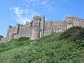
 Alnwick Castle - 19823032564.jpg 3,468 × 2,312; 2.65 MB
-
 Alnwick Castle - 19824203113.jpg 3,888 × 2,592; 2.99 MB
-
 Alnwick Castle - 20258169519.jpg 3,888 × 2,592; 3.06 MB
-
 Alnwick Castle - 20437398372.jpg 3,888 × 2,592; 3.36 MB
-
 Alnwick Castle - 20444915055.jpg 3,815 × 2,544; 2.44 MB
-
 Alnwick Castle state rooms exterior, 2010.jpg 3,008 × 2,000; 4.54 MB
-
 Alnwick Castle, Northumberland - 51367751651.jpg 3,686 × 2,126; 1.95 MB
-
 Alnwick Castle, Northumberland - 51367971203.jpg 3,456 × 2,081; 1.81 MB
-
 Alnwick Castle, Northumberland - 51368488359.jpg 3,566 × 1,221; 960 KB
-
 Alnwick Castle, Northumberland - 51368760095.jpg 3,561 × 2,011; 1.52 MB
-
 Alnwick Castle, Northumberland.jpg 3,721 × 1,351; 1.04 MB
-
 Alnwick Lionheart Station environs - 51366990132.jpg 2,673 × 2,141; 1.89 MB
-
 Alnwick Lionheart Station environs - 51366990247.jpg 1,666 × 1,076; 511 KB
-
 Alnwick Lionheart Station environs - 51367751551.jpg 2,861 × 1,431; 966 KB
-
 Alnwick Lionheart Station environs - 51367971303.jpg 3,371 × 2,096; 1.84 MB
-
 Alnwick Lionheart Station environs - 51367971348.jpg 2,731 × 1,865; 1.64 MB
-
 Alnwick Lionheart Station environs - 51367971458.jpg 3,696 × 1,686; 1.88 MB
-
 Alnwick Lionheart Station environs - 51368760020.jpg 3,561 × 2,166; 2.11 MB
-
 Alnwick Lionheart Station environs.jpg 3,491 × 1,925; 1.12 MB
-
 Along the trackbed towards the viaduct (geograph 6234932).jpg 1,024 × 683; 620 KB
-
 Amble Harbour Panorama – Northumberland (31135351171).jpg 3,125 × 874; 2.34 MB
-
 Approaching Howick Burn - geograph.org.uk - 3210924.jpg 4,320 × 3,240; 5.06 MB
-
 Arable field - geograph.org.uk - 1830701.jpg 640 × 480; 59 KB
-
 Arable Field by Low Stead Links - geograph.org.uk - 3210871.jpg 4,320 × 3,240; 2.36 MB
-
 Arbour in Seaton Delaval Hall gardens (geograph 1922916).jpg 2,048 × 1,536; 1.33 MB
-
 Arched Bridge (50449191308).jpg 4,032 × 3,024; 2.95 MB
-
 Arctic Tern - Farne Is - FJ0A3086 (35525149773).jpg 1,280 × 640; 240 KB
-
 Arctic Tern - Farne Is - FJ0A3104 (35525150623).jpg 1,280 × 640; 219 KB
-
 Arctic Tern - Farne Is - FJ0A3917 (35498002344).jpg 1,280 × 853; 241 KB
-
 Arctic Tern - Farne Is - FJ0A3922 (35498003164).jpg 1,280 × 853; 199 KB
-
 Arctic Tern - Farne Is - FJ0A4181 (36165089872).jpg 1,280 × 853; 214 KB
-
 Arctic Tern - Farne Is - FJ0A4258 (36165090392).jpg 1,280 × 853; 219 KB
-
 Arctic Tern - Farne Is -FJ0A2270 (35497987024).jpg 1,280 × 853; 268 KB
-
 Arctic Tern - Farne Is FJ0A4087 (35937283840).jpg 1,280 × 853; 221 KB
-
 Arctic Tern chick - Farne Is - FJ0A3857 (35525541483).jpg 1,280 × 853; 272 KB
-
 Armstrong Cross, Rothbury.jpg 2,448 × 3,264; 1.5 MB
-
 Ashington Industrial Cooperative Society (6690874003).jpg 3,552 × 2,368; 3.9 MB
-
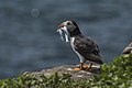
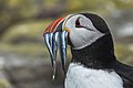
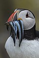
 Atlantic Puffin - Farne Is - FJ0A1339 (36333616265).jpg 1,280 × 853; 228 KB
-
 Atlantic Puffin - Farne Is - FJ0A2041 (36197213661).jpg 1,280 × 853; 292 KB
-
 Atlantic Puffin - Farne Is - FJ0A2583 (36333609365).jpg 1,280 × 853; 270 KB
-
 Atlantic Puffin - Farne Is - FJ0A2680 (36164960592).jpg 853 × 1,280; 249 KB
-
 Atlantic Puffin - Farne Is - FJ0A4576 (35497855334).jpg 853 × 1,280; 271 KB
-
 Atlantic Puffin - Farne Is - FJ0A4578 (35497855204).jpg 853 × 1,280; 282 KB
-
 Atlantic Puffin - Farne Is - FJ0A4626 (36197232561).jpg 1,280 × 853; 211 KB
-
 Atlantic Puffin - Farne Is - FJ0A4842 (35937180110).jpg 1,280 × 853; 243 KB
-
 Atlantic Puffin - Farne Is - FJ0A4858 (36197181501).jpg 853 × 1,280; 298 KB
-
 Atlantic Puffin - Farne Is - FJ0A4924 (35497859894).jpg 1,280 × 853; 239 KB
-
 Atlantic Puffin - Farne Is - FJ0A6037 (36333635305).jpg 1,280 × 853; 217 KB
-
 Atlantic Puffin - Farne Is - FJ0A6135 (36333643985).jpg 1,280 × 853; 213 KB
-
 Atlantic Puffin - Farne Is - FJ0A6228 (36164970472).jpg 1,280 × 853; 296 KB
-
 Autumn Colours - Cragside, Rothbury, Northumberland.jpg 4,032 × 3,024; 6.08 MB
-
 Bambrugh sunrise (8329665910).jpg 5,177 × 2,926; 5.27 MB
-
 Bamburgh Castle - geograph.org.uk - 948320.jpg 640 × 480; 100 KB
-
 Bamburgh Castle - geograph.org.uk - 950437.jpg 640 × 480; 70 KB
-
 Bamburgh Castle - geograph.org.uk - 950444.jpg 640 × 480; 94 KB
-
 Bamburgh Castle 0.jpg 4,000 × 3,000; 1.7 MB
-
 Bamburgh Castle 06.jpg 1,280 × 960; 559 KB
-
 Bamburgh Castle 3 (1215943045).jpg 3,019 × 1,867; 3.79 MB
-
 Bamburgh Castle clock tower (9475879121).jpg 3,872 × 2,592; 6.95 MB
-
 Bamburgh Castle on a sunny day - geograph.org.uk - 948311.jpg 640 × 480; 86 KB
-
 Bamburgh Castle War Memorial (9325271621).jpg 2,336 × 3,504; 2.82 MB
-
 Bamburgh Castle.jpg 1,080 × 890; 216 KB
-

-
 Bamburgh MMB 01 Bamburgh Castle.jpg 4,530 × 2,397; 2.45 MB
-

-
 Bamburgh War Memorial - geograph.org.uk - 950442.jpg 640 × 480; 114 KB
-
 BamburghCastleAtNight(ChristineMatthews)Oct2000.jpg 640 × 290; 38 KB
-
Barn Swallow - Hirundo rustica.ogv 37 s, 912 × 512; 22.74 MB
-
 Beach (8279541641).jpg 5,184 × 3,456; 7.8 MB
-
 Beach at Old Hartley - August 1958 - geograph.org.uk - 3221932.jpg 2,369 × 1,659; 578 KB
-
 Beach closeups St Mary's Lighthouse (12598797153).jpg 4,928 × 3,264; 3.51 MB
-
 Beach near Seaton Point - geograph.org.uk - 3210572.jpg 4,320 × 3,240; 2.02 MB
-
 Berwick upon Tweed beacon - geograph.org.uk - 741439.jpg 640 × 480; 61 KB
-
 Berwick-upon-Tweed walls (two churches) - geograph.org.uk - 741427.jpg 640 × 480; 146 KB
-
 Berwick-upon-Tweed walls (Barracks) - geograph.org.uk - 741429.jpg 640 × 480; 81 KB
-

-

-
 Berwick-upon-Tweed walls - geograph.org.uk - 741425.jpg 640 × 480; 104 KB
-
 Berwick-upon-Tweed walls - geograph.org.uk - 741443.jpg 640 × 480; 98 KB
-
 Bewick's Swans at Big Waters.jpg 2,087 × 1,392; 2.23 MB
-
 Birdwatchers in Staples Is - Farne Is - FJ0A1492 (35498707004).jpg 1,280 × 853; 280 KB
-
 Blyth Harbour Wind Turbine (48586308682).jpg 3,888 × 5,184; 2.49 MB
-
 Blyth industry-6.psd (40923892361).jpg 5,184 × 3,456; 1.05 MB
-
 Blyth pier (8279550073).jpg 2,047 × 1,363; 308 KB
-
 Blyth pier - HDR (8279754151).jpg 2,047 × 1,361; 336 KB
-
 Blyth pier2 (8279541007).jpg 5,199 × 3,461; 12.7 MB
-
 Boat anchored off Staple Island - geograph.org.uk - 2678297.jpg 640 × 430; 48 KB
-
 Boats in the gut (8545104884).jpg 5,184 × 3,456; 1.65 MB
-
 Boulmer Haven - geograph.org.uk - 3210607.jpg 4,320 × 3,240; 4.49 MB
-
 Boys Brigade building, Morpeth - geograph.org.uk - 948298.jpg 640 × 480; 87 KB
-
 Bradley Wiggins - Beaumont Trophy 2009 AB1.jpg 2,592 × 3,888; 3.88 MB
-
 Breeding birds, East Wideopen - geograph.org.uk - 2678022.jpg 640 × 430; 54 KB
-

-
 British Isles rural and coastal British Isles urban (5562343738).jpg 4,288 × 2,848; 3.49 MB
-

-
 Cambois Staithes 2 (Explored) - Flickr - wazimu0.jpg 5,010 × 2,783; 3.49 MB
-
 Cannon From The Collingwood Memorial (20760211863).jpg 1,600 × 1,600; 1.77 MB
-
 Cantharis cf. nigricans - Flickr - S. Rae.jpg 1,930 × 1,762; 459 KB
-

-
 Carlisle Park and Coat of Arms - geograph.org.uk - 943732.jpg 640 × 480; 91 KB
-

-
 Catherine O Brien - Flickr - Tyne & Wear Archives & Museums.jpg 954 × 1,329; 1.14 MB
-
 Chathill ex-Post Office NE67 5DF.jpg 3,466 × 4,313; 1.79 MB
-
 Chathill running-in board.jpg 5,174 × 2,787; 1.92 MB
-
 Chathill Signal Box, station and Level Crossing.jpg 5,472 × 3,648; 7.51 MB
-
 Chathill Station, North Eastern Railway.jpg 5,472 × 3,648; 7.51 MB
-
 Chisholm Bookmakers, Market Square - geograph.org.uk - 943710.jpg 640 × 480; 91 KB
-
 Class 10 No.12088 350HP 0-6-0DE.jpg 4,502 × 2,360; 1.45 MB
-
 Classic Car show 2005 (2600811257).jpg 2,856 × 2,142; 2.32 MB
-
 Classic Car show 2005 (2600830843).jpg 2,856 × 2,142; 3.18 MB
-
 Classic Car show 2005 (2600860181).jpg 2,856 × 2,142; 3.24 MB
-
 Classic Car show 2005 (2600963977).jpg 2,856 × 1,904; 2.36 MB
-
 Classic Car show 2005 (2600988049).jpg 2,856 × 1,904; 2.54 MB
-
 Classic Car show 2005 (2600998337).jpg 2,856 × 1,904; 2.1 MB
-
 Classic Car show 2005 (2601600686).jpg 2,856 × 2,142; 3.24 MB
-
 Classic Car show 2005 (2601721722).jpg 2,856 × 1,904; 2.91 MB
-
 Classic Car show 2005 (2601782010).jpg 2,856 × 1,904; 2.56 MB
-
 Cliff House, Cullercoats - geograph.org.uk - 1635200.jpg 640 × 481; 85 KB
-
 Close-up of the inscription (OpenBenches 1412).jpg 4,128 × 3,096; 4.3 MB
-
 Coastal erosion (12599117254).jpg 4,928 × 3,264; 3.06 MB
-
 Coble at Boulmer - geograph.org.uk - 1607744.jpg 600 × 450; 292 KB
-
 Common Guillemot - Farne Is - FJ0A4774 (36290042336).jpg 853 × 1,280; 234 KB
-
 Common Guillemot - Farne Is -FJ0A5474 (35937301400).jpg 1,280 × 853; 239 KB
-
 Common Guillemot - Farne Is -FJ0A6556 (35525178193).jpg 1,280 × 853; 251 KB
-
 Common Guillemots - Farne Is - FJ0A3467 (35498726764).jpg 1,280 × 640; 244 KB
-
 Common Guillemots - Farne Is - FJ0A3615 (35498729774).jpg 1,280 × 640; 269 KB
-
 Common Guillemots - Farne Is - FJ0A3628 (35526014213).jpg 1,280 × 640; 243 KB
-
 Common Kittiwake - Farne Is - FJ0A4778 (36290053076).jpg 853 × 1,280; 237 KB
-
 Common Kittiwake - Farne Is - FJ0A5481 (35525170633).jpg 1,280 × 853; 270 KB
-
 Construction of Greenrigg Halt (geograph 6234983).jpg 1,024 × 683; 487 KB
-
 Corn field02 (8141387604).jpg 5,201 × 3,463; 12.98 MB
-
 Cottage in Walton (geograph 3200015).jpg 3,181 × 2,189; 1.66 MB
-
 Courtyard of the visitor centre Cragside - geograph.org.uk - 919934.jpg 640 × 480; 104 KB
-
 Courtyard of the visitor centre Cragside - geograph.org.uk - 919939.jpg 640 × 557; 152 KB
-
 Cow statue - Blagdon Hall Estate, Blagdon, Northumberland.jpg 3,616 × 2,712; 3.36 MB
-
 Cragside (208097687).jpg 600 × 800; 151 KB
-
 Cragside (31764049498).jpg 6,016 × 4,000; 21.56 MB
-
 Cragside (50449188373).jpg 4,032 × 3,024; 2.86 MB
-
 Cragside - geograph.org.uk - 248211.jpg 640 × 434; 87 KB
-
 Cragside and Sloping Garden - geograph.org.uk - 576421.jpg 480 × 640; 159 KB
-
 Cragside Estate - geograph.org.uk - 920040.jpg 480 × 640; 122 KB
-

-
 Cragside from the Debdon Burn - geograph.org.uk - 475087.jpg 640 × 423; 72 KB
-
 Cragside house (50449197898).jpg 4,032 × 3,024; 2.24 MB
-
 Cragside House - geograph.org.uk - 1193749.jpg 640 × 480; 96 KB
-
 Cragside House - geograph.org.uk - 1254346.jpg 640 × 480; 127 KB
-
 Cragside House - geograph.org.uk - 920153.jpg 480 × 640; 94 KB
-
 Cragside House - geograph.org.uk - 920156.jpg 640 × 480; 133 KB
-
 Cragside House - geograph.org.uk - 950756.jpg 640 × 434; 87 KB
-
 Cragside house and the Iron Bridge - geograph.org.uk - 1387553.jpg 600 × 429; 132 KB
-
 Cragside House from below - geograph.org.uk - 950759.jpg 640 × 429; 92 KB
-
 Cragside House from the Burn - geograph.org.uk - 950786.jpg 436 × 640; 87 KB
.jpg)


.jpg)
.jpg)
.jpg)


,_Tyne_and_Wear_Metro_depot_open_day,_8_August_2010.jpg)


.jpg)
.jpg)
.jpg)


.jpg)
.jpg)
.jpg)

.jpg)
.jpg)
.jpg)

.jpg)


.jpg)


.jpg)
.jpg)
.jpg)
.jpg)
.jpg)
.jpg)
.jpg)
.jpg)
.jpg)
.jpg)
.jpg)

.jpg)
.jpg)
.jpg)
.jpg)
.jpg)
.jpg)
.jpg)
.jpg)
.jpg)
.jpg)
.jpg)
.jpg)
.jpg)
.jpg)

.jpg)


.jpg)
.jpg)

.jpg)


Oct2000.jpg)
.jpg)

.jpg)

_-_geograph.org.uk_-_741427.jpg)
_-_geograph.org.uk_-_741429.jpg)
_-_geograph.org.uk_-_741438.jpg)
_-_geograph.org.uk_-_741449.jpg)


.jpg)
.jpg)
.jpg)
.jpg)
.jpg)
.jpg)

.jpg)


.jpg)
.jpg)
_-_Flickr_-_wazimu0.jpg)
.jpg)


.jpg)
.jpg)
.jpg)
.jpg)
.jpg)
.jpg)
.jpg)
.jpg)
.jpg)

.jpg)
.jpg)

.jpg)
.jpg)
.jpg)
.jpg)
.jpg)
.jpg)
.jpg)
.jpg)
.jpg)
.jpg)
.jpg)


.jpg)
.jpg)
.jpg)


.jpg)

.jpg)


&diffonly=true&filefrom=Cragside+House%2C+Rothbury%2C+Morpeth%2C+Northumberland+-+geograph.org.uk+-+1410.jpg#mw-category-media)
.jpg)