Category:Finchampstead
village in Berkshire, United Kingdom  | |||||
| Upload media | |||||
| Instance of | |||||
|---|---|---|---|---|---|
| Location | Wokingham, Berkshire, South East England, England | ||||
| Population |
| ||||
| Said to be the same as | Finchampstead (Wikimedia duplicated page, civil parish) | ||||
| official website | |||||
 | |||||
- Photographs of the parish of Finchampstead, Berkshire.
Subcategories
This category has the following 7 subcategories, out of 7 total.
B
C
- California Country Park (4 F)
- California, Berkshire (2 F)
F
- St James' Church, Finchampstead (17 F)
- Finchampstead War Memorial (3 F)
P
Media in category "Finchampstead"
The following 200 files are in this category, out of 435 total.
(previous page) (next page)-
 1 - panoramio (54).jpg 2,592 × 1,936; 6.95 MB
-
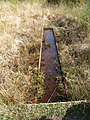 A rust coloured sediment catcher^ - geograph.org.uk - 2352021.jpg 480 × 640; 173 KB
-
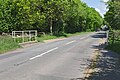
 A321 Sandhurst Road - geograph.org.uk - 6236102.jpg 1,024 × 684; 429 KB
-
 A321 Sandhurst Road - geograph.org.uk - 6236112.jpg 1,024 × 684; 359 KB
-
 A321 Sandhurst Road - geograph.org.uk - 6236123.jpg 1,024 × 684; 356 KB
-
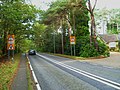
 A327 near Farley Hill - geograph.org.uk - 2353265.jpg 640 × 412; 46 KB
-
 A327, Reading Road - Eversley - geograph.org.uk - 2353340.jpg 640 × 418; 98 KB
-
 Abandoned gravel pit - geograph.org.uk - 3634043.jpg 2,048 × 1,536; 1.41 MB
-
 Access to California Country Park - geograph.org.uk - 2351024.jpg 800 × 600; 191 KB
-
 Arborfield, Berks - Hogwood Farm - geograph.org.uk - 2212119.jpg 3,504 × 2,336; 489 KB
-
 Arborfield, Berkshire - geograph.org.uk - 2212117.jpg 3,504 × 2,336; 495 KB
-

-
 B3016 Finchampstead Road - geograph.org.uk - 6236116.jpg 1,024 × 684; 455 KB
-
 B3016 Longwater Road, Finchampstead - geograph.org.uk - 6235912.jpg 1,024 × 684; 384 KB
-
 B3016 towards Wokingham - geograph.org.uk - 6235921.jpg 1,024 × 684; 526 KB
-
 B3016, Longwater Road - geograph.org.uk - 4965285.jpg 2,000 × 1,333; 3.23 MB
-
 B3430 Nine Mile Ride - geograph.org.uk - 6235929.jpg 1,024 × 684; 354 KB
-
 Bare trees, Moor Green Nature Reserve - geograph.org.uk - 4749571.jpg 2,000 × 1,333; 3.1 MB
-
 Barkham Ride, Finchampstead - geograph.org.uk - 6236133.jpg 1,024 × 684; 377 KB
-
 Barn near North Court Farm - geograph.org.uk - 4652356.jpg 2,000 × 1,333; 2.74 MB
-
 Barns by Finchampstead - geograph.org.uk - 2236766.jpg 2,560 × 1,920; 1.77 MB
-

-
 Bend on Reading Road, Eversley - geograph.org.uk - 4856162.jpg 2,048 × 1,536; 1.51 MB
-
 Blackwater Valley Footpath - geograph.org.uk - 2355204.jpg 2,272 × 1,704; 3.01 MB
-
 Blackwater Valley Path - geograph.org.uk - 3635616.jpg 2,048 × 1,536; 1.42 MB
-
 Blackwater View - geograph.org.uk - 2237000.jpg 2,560 × 1,920; 2.4 MB
-
 Blind summit on the A321 - geograph.org.uk - 4209478.jpg 800 × 600; 169 KB
-
 Bridge, Manor Farm - geograph.org.uk - 4966307.jpg 2,000 × 1,333; 2.88 MB
-
 Bridleway approaches Commonfield Lane - geograph.org.uk - 4209631.jpg 800 × 600; 171 KB
-
 Bridleway by autumn trees - geograph.org.uk - 4209627.jpg 800 × 600; 232 KB
-
 Bridleway by Longmoor Bog looking east - geograph.org.uk - 4209628.jpg 800 × 600; 208 KB
-
 Bridleway by Longmoor Lake - geograph.org.uk - 2542575.jpg 640 × 480; 138 KB
-
 Bridleway by Longmoor Lake - geograph.org.uk - 2542585.jpg 640 × 480; 159 KB
-
 Bridleway by The Ridges - geograph.org.uk - 2236779.jpg 2,560 × 1,920; 2.18 MB
-
 Bridleway enters Simon's Wood - geograph.org.uk - 3697534.jpg 4,320 × 3,240; 3.42 MB
-

-
 Bridleway in Finchampstead Ridges - geograph.org.uk - 2236802.jpg 2,560 × 1,920; 2.44 MB
-
 Bridleway near North Court Farm - geograph.org.uk - 3699321.jpg 4,320 × 3,240; 2.87 MB
-

-
 Bridleway turns right near Longmoor Lake - geograph.org.uk - 4209624.jpg 800 × 600; 205 KB
-
 Broadmoor Hospital, aerial 2013 - geograph.org.uk - 3515371.jpg 640 × 427; 66 KB
-
 By Fleet Copse - geograph.org.uk - 2239442.jpg 2,560 × 1,920; 2.15 MB
-
 Byway at Handpost Corner or The Throat - geograph.org.uk - 1587742.jpg 480 × 640; 124 KB
-
 Cafe - California Country Park - geograph.org.uk - 2351996.jpg 640 × 480; 80 KB
-
 Car park - California Country Park - geograph.org.uk - 2542598.jpg 640 × 480; 131 KB
-
 Car park, The Tally Ho - geograph.org.uk - 3876535.jpg 640 × 480; 165 KB
-
 Car track - California Country Park - geograph.org.uk - 2351653.jpg 640 × 480; 96 KB
-
 Catherine Bramwell Booth 1977.jpg 1,775 × 2,470; 1.01 MB
-
 Chevrolet Caprice, Berkshire, UK (16638045213).jpg 3,552 × 2,000; 3.95 MB
-
 Christingles.jpg 2,304 × 3,072; 2.77 MB
-
 Church Road at the junction of Reading Road - geograph.org.uk - 5891890.jpg 1,920 × 1,280; 1.18 MB
-
 Co-op Food on Finchampstead Road - geograph.org.uk - 5891896.jpg 1,864 × 1,190; 1.44 MB
-
 Columbia Court, Finchampstead - geograph.org.uk - 5420573.jpg 3,888 × 2,592; 2.75 MB
-
 Confluence by Eversley Cross - geograph.org.uk - 2238176.jpg 1,920 × 2,560; 2.14 MB
-
 Conveyor Belt at Manor Farm - geograph.org.uk - 2238197.jpg 2,560 × 1,920; 2.43 MB
-
 Conveyor Belt by Eversley Cross - geograph.org.uk - 2239340.jpg 2,560 × 1,920; 2.38 MB
-
 Conveyor Belt by Eversley Cross - geograph.org.uk - 2239401.jpg 2,560 × 1,920; 2.45 MB
-
 Conveyor belt ridge - geograph.org.uk - 1892735.jpg 3,648 × 2,736; 5.46 MB
-
 Conveyor belt, Manor Farm gravel pit - geograph.org.uk - 4966323.jpg 2,000 × 1,333; 3.01 MB
-
 Cows on a hillside - geograph.org.uk - 5420927.jpg 3,888 × 2,219; 2.35 MB
-
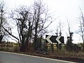
 Crossroads on A327 - geograph.org.uk - 3875099.jpg 640 × 480; 192 KB
-
 Danger Sign by Finchampstead - geograph.org.uk - 2239423.jpg 2,560 × 1,920; 2.22 MB
-
 Danger. No Entry - geograph.org.uk - 2238334.jpg 2,560 × 1,920; 2.37 MB
-
 Dell Road is closed - geograph.org.uk - 3874982.jpg 640 × 480; 124 KB
-
 Dell Road, Finchampstead - geograph.org.uk - 4652093.jpg 2,000 × 1,333; 3.24 MB
-
 Disused gravel pit near Yateley - geograph.org.uk - 4750068.jpg 2,000 × 1,333; 2.44 MB
-
 Disused Gravel Pits, Blackwater River Valley - geograph.org.uk - 4750077.jpg 2,000 × 1,333; 2.8 MB
-
 Double roundabout - geograph.org.uk - 3902391.jpg 2,048 × 1,536; 1.29 MB
-
 Dozzell's Well (site of), Finchampstead - geograph.org.uk - 2058077.jpg 1,800 × 1,200; 379 KB
-
 Drive to West Court - geograph.org.uk - 3875077.jpg 640 × 480; 197 KB
-
 Driveway to Woodcray Cottages - geograph.org.uk - 4723587.jpg 2,000 × 1,333; 3.91 MB
-
 Driveway to Woodcray Cottages - geograph.org.uk - 4723659.jpg 2,000 × 1,333; 3.46 MB
-
 Easter-Wood Alpaca Stud - geograph.org.uk - 2239693.jpg 2,560 × 1,920; 2.18 MB
-
 End of the walkway - geograph.org.uk - 2468015.jpg 640 × 480; 138 KB
-
 Entrance to California Country Park - geograph.org.uk - 2542596.jpg 640 × 480; 141 KB
-
 Entrance to Woodcray Cottage - geograph.org.uk - 4209450.jpg 800 × 600; 180 KB
-
 Everglades boardwalk - geograph.org.uk - 2350999.jpg 800 × 585; 211 KB
-
 Eversley - Footpath - geograph.org.uk - 5263302.jpg 1,920 × 2,560; 3.3 MB
-
 Eversley Bridge - The Tally Ho - geograph.org.uk - 5263267.jpg 2,560 × 1,920; 2.93 MB
-
 Eversley Telephone Exchange (1) - geograph.org.uk - 4902715.jpg 2,592 × 1,944; 1.41 MB
-
 Eversley Telephone Exchange (2) - geograph.org.uk - 4902726.jpg 2,592 × 1,944; 1.37 MB
-
 Eversley Telephone Exchange (3) - geograph.org.uk - 4902737.jpg 2,592 × 1,944; 1.38 MB
-
 Eversley, Hampshire - geograph.org.uk - 2896600.jpg 3,355 × 2,237; 971 KB
-
 Fallow ground, Silverstock Farm - geograph.org.uk - 4723865.jpg 2,000 × 1,333; 3.73 MB
-
 Fields off Wick Hill Lane - geograph.org.uk - 4652368.jpg 2,000 × 1,333; 2.44 MB
-
 Finch Cafe - geograph.org.uk - 2239724.jpg 2,560 × 1,920; 2.09 MB
-
 Finchampsread Baptist Chapel - geograph.org.uk - 1534681.jpg 640 × 471; 84 KB
-
 Finchampstead - California Crossroads - geograph.org.uk - 2100293.jpg 3,504 × 2,336; 347 KB
-
 Finchampstead - Farmland - geograph.org.uk - 2075968.jpg 864 × 648; 148 KB
-
 Finchampstead - geograph.org.uk - 288.jpg 640 × 427; 41 KB
-
 Finchampstead - geograph.org.uk - 289.jpg 640 × 427; 46 KB
-
 Finchampstead - geograph.org.uk - 294.jpg 640 × 398; 38 KB
-
 Finchampstead - Memorial Ground - geograph.org.uk - 2066246.jpg 1,800 × 1,200; 303 KB
-
 Finchampstead - Nine Mile Ride - geograph.org.uk - 2100311.jpg 3,504 × 2,336; 408 KB
-
 Finchampstead - Queen's Oak Tree - geograph.org.uk - 2066048.jpg 3,504 × 2,336; 1.15 MB
-
 Finchampstead - Queen's Oak Tree plaque - geograph.org.uk - 2066052.jpg 3,504 × 2,336; 936 KB
-
 Finchampstead - Reading Road - geograph.org.uk - 2182906.jpg 3,504 × 2,336; 1.07 MB
-
 Finchampstead - Rectory Farm - geograph.org.uk - 2076140.jpg 2,832 × 2,128; 1.7 MB
-
 Finchampstead - St James' Church - geograph.org.uk - 2216641.jpg 1,800 × 1,200; 205 KB
-
 Finchampstead - St James' Church Centre - geograph.org.uk - 2065987.jpg 1,800 × 1,200; 406 KB
-
 Finchampstead - view from B3016 - geograph.org.uk - 2066057.jpg 3,504 × 2,336; 862 KB
-
 Finchampstead - View over countryside - geograph.org.uk - 2067201.jpg 800 × 533; 111 KB
-
 Finchampstead - Warren Lane - geograph.org.uk - 2100286.jpg 3,504 × 2,336; 461 KB
-
 Finchampstead - Warren Wood - geograph.org.uk - 2100280.jpg 3,504 × 2,336; 561 KB
-
 Finchampstead Baptist Centre - geograph.org.uk - 3593665.jpg 2,885 × 1,886; 1.3 MB
-
 Finchampstead Memorial Hall - geograph.org.uk - 1620672.jpg 640 × 360; 44 KB
-
 Finchampstead Park - geograph.org.uk - 2236017.jpg 2,560 × 1,920; 1.87 MB
-
 Finchampstead Ridges - geograph.org.uk - 2236915.jpg 2,560 × 1,920; 2.39 MB
-
 Finchampstead Ridges - geograph.org.uk - 4359863.jpg 2,560 × 1,920; 1.98 MB
-
 Finchampstead Ridges - geograph.org.uk - 4651487.jpg 2,000 × 1,333; 3.08 MB
-
 Finchampstead Ridges - geograph.org.uk - 4651514.jpg 2,000 × 1,333; 3.05 MB
-
 Finchampstead Ridges entrance - geograph.org.uk - 4651506.jpg 2,000 × 1,333; 3.33 MB
-
 Finchampstead Road, Barkham - geograph.org.uk - 6405101.jpg 1,920 × 1,280; 2.25 MB
-
 Finchampstead, Berks - geograph.org.uk - 483.jpg 640 × 427; 49 KB
-
 Finchampstead, Berks. - geograph.org.uk - 2236004.jpg 2,560 × 1,920; 1.72 MB
-
 Finchampstead, Berkshire - geograph.org.uk - 2216569.jpg 3,504 × 2,336; 499 KB
-
 Finchampstead, Berkshire - geograph.org.uk - 2244781.jpg 1,800 × 1,200; 485 KB
-
 Finchampstead, Berkshire - geograph.org.uk - 2921995.jpg 3,504 × 2,336; 986 KB
-
 Finchampstead, houses near St James' Church - geograph.org.uk - 2066041.jpg 1,800 × 1,200; 372 KB
-
 Fleet Hill - geograph.org.uk - 2239712.jpg 2,560 × 1,920; 2.22 MB
-
 Fleet Hill at the junction of Reading Road - geograph.org.uk - 4359868.jpg 2,560 × 1,920; 2.05 MB
-
 Fleet Hill, Eversley - geograph.org.uk - 4359920.jpg 2,560 × 1,920; 1.9 MB
-
 Fleet Hill, Finchampstead - geograph.org.uk - 4359923.jpg 2,560 × 1,920; 1.89 MB
-
 Fleet Hill, Finchampstead - geograph.org.uk - 4359925.jpg 2,560 × 1,920; 2.03 MB
-
 Fleethill Farm gravel pit entrance - geograph.org.uk - 4967130.jpg 2,000 × 1,333; 2.74 MB
-
 Fleethill Gravel Pit near Yateley - geograph.org.uk - 4965270.jpg 2,000 × 1,333; 2.77 MB
-
 Flooded Gravel Pit by Eversley Cross - geograph.org.uk - 2239407.jpg 2,560 × 1,920; 2.29 MB
-
 Footbridge on the Blackwater Valley Way - geograph.org.uk - 2238345.jpg 2,560 × 1,920; 2.31 MB
-
 Footbridge over stream - geograph.org.uk - 2352009.jpg 480 × 640; 123 KB
-
 Footbridge, Blackwater River - geograph.org.uk - 4750727.jpg 2,000 × 1,333; 3.33 MB
-
 Footbridge, Heath Pond - geograph.org.uk - 3899043.jpg 2,048 × 1,536; 1.56 MB
-
 Footpath across the fields - geograph.org.uk - 760178.jpg 640 × 480; 126 KB
-
 Footpath at Wick Hill - geograph.org.uk - 1215199.jpg 640 × 480; 156 KB
-
 Footpath barriers, Finchampstead Ridges - geograph.org.uk - 4651501.jpg 2,000 × 1,333; 3.32 MB
-
 Footpath beside the Blackwater - geograph.org.uk - 2249506.jpg 640 × 427; 189 KB
-
 Footpath by Sand Martins golf course - geograph.org.uk - 4029271.jpg 2,048 × 1,536; 1.46 MB
-
 Footpath going south from "The Throat" - geograph.org.uk - 4209493.jpg 800 × 600; 196 KB
-
 Footpath leads out of Oregon Walk - geograph.org.uk - 4209615.jpg 600 × 800; 219 KB
-
 Footpath near Tintagel Farm - geograph.org.uk - 4723590.jpg 2,000 × 1,333; 3.59 MB
-
 Footpath near Woodcray Cottages - geograph.org.uk - 4723460.jpg 2,000 × 1,333; 3.51 MB
-
 Footpath reaches Sandhurst Road - geograph.org.uk - 4209468.jpg 800 × 600; 192 KB
-
 Footpath through the woods - geograph.org.uk - 1220474.jpg 640 × 480; 141 KB
-
 Footpath to nowhere - geograph.org.uk - 1220463.jpg 454 × 640; 127 KB
-
 Footpath to Wick Hill - geograph.org.uk - 1264522.jpg 640 × 480; 104 KB
-

-
 Footpath to Wick Hill, Finchampstead - geograph.org.uk - 1215196.jpg 640 × 480; 140 KB
-
 Footpaths near Moor Green - geograph.org.uk - 4750073.jpg 2,000 × 1,333; 3.77 MB
-
 Former Church of St John, California, Finchampstead - geograph.org.uk - 3593639.jpg 3,648 × 2,736; 2.64 MB
-
 Former gravel pit - geograph.org.uk - 3635660.jpg 2,048 × 1,536; 1.44 MB
-
 Former gravel pit near Yateley - geograph.org.uk - 4750082.jpg 2,000 × 1,333; 2.9 MB
-
 Former Scout Hut - geograph.org.uk - 2351989.jpg 640 × 480; 112 KB
-
 Foxcote junction, Finchampstead - geograph.org.uk - 4723595.jpg 2,000 × 1,333; 2.96 MB
-
 Furze Hill - geograph.org.uk - 2355220.jpg 2,272 × 1,704; 2.1 MB
-
 Geese by Longmoor Lake - geograph.org.uk - 5427379.jpg 3,725 × 2,446; 2.55 MB
-
 Gibbs Close, Finchampstead - geograph.org.uk - 5420943.jpg 1,600 × 1,028; 469 KB
-

-
 Gorse Ride North - geograph.org.uk - 1349964.jpg 640 × 480; 96 KB
-
 Gorse Ride North, Finchampstead - geograph.org.uk - 5420580.jpg 1,600 × 1,130; 458 KB
-
 Gravel Pits south of Finchampstead - geograph.org.uk - 2238357.jpg 2,560 × 1,920; 2.31 MB
-
 Grazing land at Moor Green Farm - geograph.org.uk - 1294272.jpg 640 × 480; 124 KB
-
 Grazing land near The Leas - geograph.org.uk - 1335519.jpg 640 × 480; 95 KB
-
 Grove Lake - geograph.org.uk - 3635626.jpg 2,048 × 1,536; 1.52 MB
-
 Hall Farm - geograph.org.uk - 2236968.jpg 2,560 × 1,920; 2.32 MB
-
 Heath Pond island - geograph.org.uk - 3898517.jpg 2,048 × 1,536; 1.69 MB
-
 Heath Pond, Simon's Wood - geograph.org.uk - 1215202.jpg 640 × 480; 122 KB
-
 Heath Pond, Simons Wood - geograph.org.uk - 3897185.jpg 2,011 × 1,507; 1.05 MB
-
 Heath Pond, Simons Wood - geograph.org.uk - 3898506.jpg 2,048 × 1,536; 1.69 MB
-
 Heath Pond, Simons Wood - geograph.org.uk - 3898513.jpg 1,950 × 1,462; 1.25 MB
-
 Heath Pond, Simons Wood - geograph.org.uk - 3899047.jpg 2,004 × 1,504; 1.06 MB
-
 Heath Ride junction - geograph.org.uk - 4654424.jpg 2,000 × 1,333; 2.89 MB
-
 Heath Ride, Wick Hill - geograph.org.uk - 4654431.jpg 2,000 × 1,333; 2.81 MB
-
 Heath Ride, Wick Hill - geograph.org.uk - 4655162.jpg 2,000 × 1,333; 2.81 MB
-
 Heathland near Heath Pond - geograph.org.uk - 1220459.jpg 640 × 480; 130 KB
-
 Heathland path, Simons Wood - geograph.org.uk - 3899037.jpg 2,048 × 1,536; 1.56 MB
-
 Hogwood Industrial Estate, Partridges - geograph.org.uk - 826343.jpg 640 × 484; 143 KB
-
 Hogwood Industrial Estate, The Girl ^ - geograph.org.uk - 826368.jpg 640 × 480; 86 KB
-
 Hogwood Industrial Estate, View 1 - geograph.org.uk - 826389.jpg 640 × 480; 86 KB
-
 Hogwood Industrial Estate, View 2 - geograph.org.uk - 826403.jpg 640 × 480; 65 KB
-
 Hogwood Industrial Estate, View 3 - geograph.org.uk - 826412.jpg 640 × 480; 62 KB
-
 Hollybush Ride - geograph.org.uk - 3898475.jpg 2,016 × 1,512; 825 KB
-
 Hollybush Ride - geograph.org.uk - 3898483.jpg 2,048 × 1,536; 1.53 MB
-
 Hollybush Ride - geograph.org.uk - 3899025.jpg 2,048 × 1,536; 1.61 MB
-
 House on Dell Road, Finchampstead - geograph.org.uk - 5891894.jpg 1,852 × 1,170; 1.39 MB
-
 House on Dell Road, Finchampstead - geograph.org.uk - 5891895.jpg 1,876 × 1,210; 1.4 MB
-
 Houses on Finchampstead Road - geograph.org.uk - 6405097.jpg 1,920 × 1,280; 1.68 MB
-
 Houses on Reading Road, Eversley - geograph.org.uk - 4858680.jpg 2,048 × 1,536; 1.3 MB
-
 Houses, Heath Ride - geograph.org.uk - 4655719.jpg 2,000 × 1,333; 3.27 MB
-
 Houses, Wick Hill Lane - geograph.org.uk - 4654435.jpg 2,000 × 1,333; 3.07 MB
-
 Housing Development, Finchampstead - geograph.org.uk - 2239705.jpg 2,560 × 1,920; 2.31 MB
-
 John Watson grave.jpg 720 × 960; 260 KB
-
 Jubilee Road, Finchampstead - geograph.org.uk - 4359932.jpg 2,482 × 1,812; 1.4 MB
-

-
 Kiln Lane, Finchampstead - geograph.org.uk - 4723584.jpg 2,000 × 1,333; 3.45 MB
-
 Kiln Ride, Finchampstead - geograph.org.uk - 4723422.jpg 2,000 × 1,333; 3.59 MB
-
 Kiln Ride, Finchampstead - geograph.org.uk - 4723463.jpg 2,000 × 1,333; 3.09 MB
-
 Lane in Blackwater River Valley - geograph.org.uk - 2236986.jpg 1,920 × 2,560; 2.14 MB
-
 Lea Farm, Finchampstead, Berkshire - geograph.org.uk - 2836994.jpg 3,504 × 2,336; 1.03 MB
-
 Long Moor - geograph.org.uk - 2352017.jpg 640 × 480; 110 KB
-
 Longmoor Bog Nature Reserve - geograph.org.uk - 1350093.jpg 640 × 480; 134 KB
-
 Longmoor Lake - geograph.org.uk - 2351015.jpg 800 × 600; 130 KB
.jpg)


.jpg)


,_Finchampstead_-_geograph.org.uk_-_2058077.jpg)


_-_geograph.org.uk_-_4902715.jpg)
_-_geograph.org.uk_-_4902726.jpg)
_-_geograph.org.uk_-_4902737.jpg)


