Category:Fiskerton, Nottinghamshire
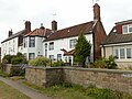
English: Fiskerton is a small village in Nottinghamshire, England on the west bank of the River Trent about 3 miles southeast of Southwell. The civil parish is Fiskerton cum Morton. The population of this civil parish at the 2011 Census was 902. The waterfront is home to million-pound residential properties, previously residences of merchants and businessmen who commuted in the 1800s to nearby Nottingham by rail from Fiskerton Station. (→Fiskerton, Nottinghamshire)
Polski: Fiskerton – wieś w Anglii, w hrabstwie Nottinghamshire. Leży 20 km na północny wschód od miasta Nottingham i 180 km na północ od Londynu. Fiskerton jest wspomniana w Domesday Book (1086) jako Fiscartune. (→Fiskerton (Nottinghamshire))

village in Nottinghamshire, United Kingdom | |||||
| Upload media | |||||
| Instance of | |||||
|---|---|---|---|---|---|
| Location | Fiskerton cum Morton, Newark and Sherwood, Nottinghamshire, East Midlands, England | ||||
 | |||||
Media in category "Fiskerton, Nottinghamshire"
The following 48 files are in this category, out of 48 total.
-
 Banks of the Trent near Fiskerton - geograph.org.uk - 2450310.jpg 1,024 × 768; 194 KB
-
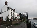 Bromley Arms, Fiskerton - geograph.org.uk - 1058273.jpg 640 × 480; 53 KB
-
 Bromley Arms, Fiskerton.jpg 800 × 490; 92 KB
-
 Crossover at Fiskerton - geograph.org.uk - 3136977.jpg 1,280 × 960; 266 KB
-
 Eagle Cottage and Anchordown, Fiskerton.jpg 1,280 × 960; 379 KB
-

-
 Farm track near Fiskerton Lodge - geograph.org.uk - 1843651.jpg 640 × 480; 104 KB
-
 Farmland near Fiskerton - geograph.org.uk - 2657031.jpg 1,600 × 1,200; 264 KB
-
 Fiskerton - geograph.org.uk - 1980235.jpg 640 × 426; 87 KB
-
 Fiskerton 1907.jpg 400 × 251; 18 KB
-
 Fiskerton Mill - geograph.org.uk - 647109.jpg 640 × 480; 109 KB
-
 Fiskerton Mill through the trees - geograph.org.uk - 2865553.jpg 1,024 × 768; 289 KB
-
 Fiskerton waterfront - geograph.org.uk - 1980298.jpg 640 × 426; 90 KB
-
 Fiskerton Wharf - geograph.org.uk - 2450197.jpg 1,024 × 768; 213 KB
-

-

-
 Former ground frame cabin at Fiskerton Junction - geograph.org.uk - 3136969.jpg 1,280 × 960; 348 KB
-
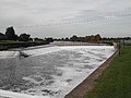 Hazelford Weir - geograph.org.uk - 50214.jpg 640 × 480; 95 KB
-
 Kelham Farmhouse, Fiskerton.jpg 1,280 × 960; 426 KB
-
 Main Street at Fiskerton - geograph.org.uk - 1843459.jpg 480 × 640; 83 KB
-
 Passing Fiskerton Junction - geograph.org.uk - 3136975.jpg 1,280 × 960; 212 KB
-

-
 Picnicking at Fiskerton riverside informal parking area.JPG 1,280 × 960; 216 KB
-
 River Trent - geograph.org.uk - 588988.jpg 640 × 427; 39 KB
-
 River Trent at Fiskerton - geograph.org.uk - 50218.jpg 640 × 480; 81 KB
-
 River Trent at Fiskerton - geograph.org.uk - 74196.jpg 640 × 480; 98 KB
-
 River Trent, Fiskerton. - geograph.org.uk - 394705.jpg 640 × 424; 116 KB
-
 River Trent. - geograph.org.uk - 394709.jpg 424 × 640; 70 KB
-
 Road junction at Fiskerton Station - geograph.org.uk - 1445790.jpg 640 × 480; 79 KB
-
 Rose Cottage, Fiskerton.jpg 960 × 1,280; 380 KB
-
 Signal box at Fiskerton - geograph.org.uk - 1802536.jpg 640 × 480; 67 KB
-
 Swinging the gates, Fiskerton Junction - geograph.org.uk - 3136974.jpg 1,280 × 960; 198 KB
-
 The Bromley Arms at Fiskerton - geograph.org.uk - 641984.jpg 640 × 480; 81 KB
-
 The Bromley Arms, Fiskerton - geograph.org.uk - 2657023.jpg 1,600 × 1,200; 313 KB
-
 The River Trent, Fiskerton - geograph.org.uk - 2657021.jpg 1,600 × 1,200; 414 KB
-
 Trent House, Fiskerton.jpg 1,280 × 1,013; 454 KB
-
 Trent Valley Way - geograph.org.uk - 1428364.jpg 640 × 426; 82 KB
-
 Trent Valley Way south of Fiskerton - geograph.org.uk - 2450179.jpg 1,024 × 768; 271 KB
-
 Trent Valley Way towards Fiskerton - geograph.org.uk - 1058237.jpg 640 × 480; 88 KB
-

-

-
 Village shop at Fiskerton - geograph.org.uk - 1843640.jpg 640 × 480; 104 KB
-
 Walkers at Fiskerton.jpg 960 × 1,280; 470 KB
-
 Watching the world go by - geograph.org.uk - 588984.jpg 640 × 427; 64 KB
-

-
 Gravelly Lane, Fiskerton Village - geograph.org.uk - 50217.jpg 640 × 480; 121 KB
-
 Morton Grange - geograph.org.uk - 50239.jpg 640 × 480; 163 KB
-
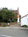
 South West end of Fiskerton Village - geograph.org.uk - 50215.jpg 640 × 480; 145 KB


