Category:Fittleworth
English: Fittleworth is a village and civil parish in the District of Chichester in West Sussex, England located seven kilometres (3 miles) west from Pulborough on the A283 road and three miles south east from Petworth. The village has an Anglican church, a primary school and one pub, the Swan.It is within the ancient divisions of the Bury Hundred and the Rape of Arundel.The village is bounded south by the Rother Navigation .
village in West Sussex, England, UK  | |||||
| Upload media | |||||
| Instance of | |||||
|---|---|---|---|---|---|
| Location | Chichester, West Sussex, South East England, England | ||||
| Area |
| ||||
| Said to be the same as | Fittleworth (Wikimedia duplicated page, civil parish) | ||||
 | |||||
Subcategories
This category has the following 7 subcategories, out of 7 total.
B
F
- Fittleworth Bridge (10 F)
- Fittleworth railway station (6 F)
- Flexham Park (17 F)
S
- The Swan, Fittleworth (6 F)
Media in category "Fittleworth"
The following 200 files are in this category, out of 347 total.
(previous page) (next page)-
 A cottage at Bedham - geograph.org.uk - 3674669.jpg 2,048 × 1,360; 704 KB
-
 A dull March afternoon in Church Lane - geograph.org.uk - 1778350.jpg 640 × 480; 135 KB
-
 A House on the "Highstreet" Bedham - geograph.org.uk - 3674635.jpg 2,048 × 1,360; 669 KB
-
 A seasonal scene in Bedham Lane - geograph.org.uk - 3770469.jpg 640 × 480; 103 KB
-
 A283 north of Fittleworth Common - geograph.org.uk - 3991440.jpg 3,464 × 2,255; 2.02 MB
-
 A283, Hesworth Common - geograph.org.uk - 5631940.jpg 640 × 426; 103 KB
-

-

-
 Advent at St Agatha, Coates (a) - geograph.org.uk - 6005713.jpg 480 × 640; 92 KB
-
 Advent at St Agatha, Coates (b) - geograph.org.uk - 6005714.jpg 480 × 640; 50 KB
-
 Amen from narrow lane - geograph.org.uk - 1259498.jpg 640 × 480; 107 KB
-
 Ancient Yew tree, Fittleworth parish church - geograph.org.uk - 4167371.jpg 1,200 × 1,600; 528 KB
-
 Animal burrow - geograph.org.uk - 258271.jpg 640 × 480; 106 KB
-
 Approaching Birch Wood - geograph.org.uk - 4914415.jpg 4,608 × 3,456; 6.17 MB
-
 Approaching Tripp Hill Farm - geograph.org.uk - 5953172.jpg 1,024 × 768; 244 KB
-

-
 B2138 south out of Fittleworth - geograph.org.uk - 2005443.jpg 1,600 × 1,200; 479 KB
-
 B2138, Fittleworth Bridge - geograph.org.uk - 5631915.jpg 640 × 426; 62 KB
-

-
 Bean Field - geograph.org.uk - 4914379.jpg 4,608 × 3,456; 6.11 MB
-

-
 Bedham Lane - geograph.org.uk - 4133109.jpg 1,600 × 1,200; 787 KB
-

-
 Bedham Lane near Fittleworth - geograph.org.uk - 3395913.jpg 800 × 557; 213 KB
-
 Bedham Lane, Fittleworth - geograph.org.uk - 5848047.jpg 2,048 × 1,536; 2.35 MB
-
 Been waiting long^ - geograph.org.uk - 1029789.jpg 640 × 480; 138 KB
-
 Before and after in Walters Plantation coppice - geograph.org.uk - 2007177.jpg 2,592 × 1,944; 2.19 MB
-
 Bend in Stretch Hill outside entrance to Fitzleroi Farm - geograph.org.uk - 2008436.jpg 2,592 × 1,944; 2.31 MB
-
 Bend on the River Rother - geograph.org.uk - 2005524.jpg 1,600 × 1,200; 786 KB
-
 Birch trees along the Serpent Trail on Hesworth Common - geograph.org.uk - 2004125.jpg 1,600 × 1,200; 790 KB
-
 Bluebells en masse - geograph.org.uk - 2395841.jpg 800 × 600; 164 KB
-
 Bognor Common quarry (1) - geograph.org.uk - 2093145.jpg 640 × 396; 197 KB
-
 Bognor Common quarry (2) - geograph.org.uk - 2093156.jpg 640 × 360; 197 KB
-
 Bognor Common quarry (3) - geograph.org.uk - 2093173.jpg 640 × 480; 287 KB
-
 Bognor Common quarry (4) - geograph.org.uk - 2093186.jpg 640 × 426; 270 KB
-
 Bognor Common sand pit and quarry - geograph.org.uk - 1264341.jpg 640 × 480; 79 KB
-
 Bracken, Hesworth Common - geograph.org.uk - 2427054.jpg 640 × 480; 95 KB
-
 Branches and bracken on Hesworth Common - geograph.org.uk - 2009888.jpg 2,592 × 1,944; 1.84 MB
-
 Bridleway descending into Hammonds Wood - geograph.org.uk - 1258390.jpg 640 × 480; 149 KB
-
 Bridleway junction in Fittleworth Wood - geograph.org.uk - 2007200.jpg 2,592 × 1,944; 2.55 MB
-
 Bridleway north to Fittleworth Wood - geograph.org.uk - 2007184.jpg 2,592 × 1,944; 1.4 MB
-
 Bridleway, Fittleworth Wood - geograph.org.uk - 4132302.jpg 1,600 × 1,200; 598 KB
-
 Brinkwells Farm - geograph.org.uk - 4132365.jpg 1,600 × 1,200; 414 KB
-
 Brinkwells, Fittleworth - geograph.org.uk - 4132402.jpg 1,600 × 1,200; 554 KB
-
 Brinkwells, Fittleworth - geograph.org.uk - 4132460.jpg 1,600 × 1,200; 633 KB
-
 Bus stop at Hesworth House, Little Bognor, Fittleworth - geograph.org.uk - 4910387.jpg 4,608 × 3,456; 5.27 MB
-
 Cableway across the River Rother - geograph.org.uk - 2423358.jpg 640 × 480; 106 KB
-
 Choice of path - geograph.org.uk - 3254329.jpg 4,000 × 3,000; 4.41 MB
-

-
 Church entrance - geograph.org.uk - 6378225.jpg 1,600 × 1,096; 693 KB
-
 Church Lane - geograph.org.uk - 1778496.jpg 640 × 480; 130 KB
-
 Church of St. Mary the Virgin, Fittleworth - geograph.org.uk - 4167107.jpg 1,200 × 892; 231 KB
-
 Coates church and churchyard - geograph.org.uk - 4694131.jpg 1,024 × 765; 289 KB
-
 Coates church from the south-east - geograph.org.uk - 4694107.jpg 1,024 × 768; 183 KB
-
 Coates church from the west - geograph.org.uk - 4694134.jpg 768 × 1,024; 176 KB
-
 Coates Manor House - geograph.org.uk - 4693711.jpg 1,024 × 770; 209 KB
-
 Coates Manor House, from St Agatha's churchyard - geograph.org.uk - 4698966.jpg 1,024 × 781; 216 KB
-
 Coates Manor House, from the south - geograph.org.uk - 4693225.jpg 1,024 × 761; 210 KB
-
 Coates Manor House, from the south-east - geograph.org.uk - 4693638.jpg 1,024 × 760; 205 KB
-
 Coates Manor House, north wing - geograph.org.uk - 4698969.jpg 734 × 1,024; 242 KB
-
 Colourful crops SE of Little Bognor - geograph.org.uk - 1259537.jpg 640 × 480; 64 KB
-
 Coppiced Sweet Chestnuts on bridleway to Limbourne Farm - geograph.org.uk - 2007169.jpg 2,592 × 1,944; 1.93 MB
-
 Cottage at Amen Corner - geograph.org.uk - 4133116.jpg 1,600 × 1,200; 437 KB
-
 Cottage in Bedham Lane, Fittleworth - geograph.org.uk - 4133722.jpg 1,600 × 1,200; 555 KB
-
 Cottage in Fittleworth - geograph.org.uk - 980980.jpg 640 × 480; 114 KB
-
 Cottage on Bedham Lane, Fittleworth - geograph.org.uk - 5846769.jpg 2,048 × 1,536; 1.98 MB
-
 Cottages at Little Bognor - geograph.org.uk - 4133164.jpg 1,600 × 1,269; 574 KB
-
 Cottages at Lower Horncroft - geograph.org.uk - 5953168.jpg 1,024 × 768; 229 KB
-
 Cottages at Tripp Hill, Lower Horncroft - geograph.org.uk - 4695200.jpg 1,024 × 765; 142 KB
-
 Cottages in Little Bognor - geograph.org.uk - 2234477.jpg 800 × 600; 103 KB
-
 Cottages, Upper Street, Fittleworth - geograph.org.uk - 528266.jpg 640 × 479; 155 KB
-
 Country Lane towards Hesworth Farm - geograph.org.uk - 1453530.jpg 640 × 480; 134 KB
-
 Cricket Field, Fittleworth - geograph.org.uk - 980932.jpg 640 × 480; 110 KB
-
 Crossing the A283 - geograph.org.uk - 6381667.jpg 1,600 × 1,109; 785 KB
-
 Crowsole Mill - geograph.org.uk - 4927612.jpg 2,399 × 1,599; 620 KB
-
 Derelict Chapel - geograph.org.uk - 1029809.jpg 640 × 480; 141 KB
-
 Detail of Flush Bracket S6408 - geograph.org.uk - 3214877.jpg 1,200 × 1,600; 671 KB
-
 Disused Mission Church and School - geograph.org.uk - 3228499.jpg 3,648 × 2,048; 2.65 MB
-
 Double hairpin bends on the road to Hesworth Grange - geograph.org.uk - 2009849.jpg 2,592 × 1,944; 2.11 MB
-
 Douglaslake Farm, Fittleworth - geograph.org.uk - 4133450.jpg 1,600 × 1,134; 475 KB
-
 Douglaslake Farm, Fittleworth - geograph.org.uk - 4133698.jpg 1,600 × 1,200; 470 KB
-
 Driveway off Wakestone Lane - geograph.org.uk - 2395846.jpg 800 × 600; 202 KB
-
 Duttons, Hesworth Lane - geograph.org.uk - 5516951.jpg 640 × 459; 188 KB
-

-
 Entrance to Fitzleroi Farm - geograph.org.uk - 1259514.jpg 640 × 480; 111 KB
-

-
 Farm at Amen Corner - geograph.org.uk - 4133131.jpg 1,600 × 1,200; 469 KB
-
 Farmland at Fittleworth - geograph.org.uk - 4133707.jpg 1,600 × 1,200; 429 KB
-
 Farmland NE of Fitzleroi Farm - geograph.org.uk - 1259469.jpg 640 × 480; 101 KB
-
 Fields at Little Bognor - geograph.org.uk - 4133446.jpg 1,600 × 1,200; 479 KB
-
 Fields near Birch Wood - geograph.org.uk - 5953020.jpg 1,600 × 1,200; 689 KB
-
 Fields near Tripp Hill Farm - geograph.org.uk - 5953176.jpg 1,600 × 1,200; 554 KB
-
 Fittleworth - geograph.org.uk - 1930.jpg 640 × 480; 74 KB
-
 Fittleworth bridge over the River Rother - geograph.org.uk - 2005467.jpg 1,600 × 1,200; 639 KB
-
 Fittleworth C.E Village School - geograph.org.uk - 3772105.jpg 640 × 480; 79 KB
-
 Fittleworth Common - geograph.org.uk - 1239537.jpg 480 × 640; 188 KB
-
 Fittleworth Common - geograph.org.uk - 1239540.jpg 640 × 480; 149 KB
-
 Fittleworth Common - geograph.org.uk - 4131079.jpg 1,600 × 1,200; 541 KB
-
 Fittleworth cottage 1.JPG 2,816 × 2,112; 1.46 MB
-
 Fittleworth entrance sign - geograph.org.uk - 2450250.jpg 640 × 418; 97 KB
-
 Fittleworth Evangelical Free Church - geograph.org.uk - 3254647.jpg 4,000 × 3,000; 3.33 MB
-
 Fittleworth from the south.JPG 1,280 × 960; 479 KB
-
 Fittleworth geograph-3390652-by-Ben-Brooksbank.jpg 831 × 498; 777 KB
-
 Fittleworth House seen from Bedham Lane - geograph.org.uk - 2339909.jpg 600 × 800; 163 KB
-
 Fittleworth Mill - geograph.org.uk - 4762917.jpg 2,399 × 1,599; 969 KB
-
 Fittleworth Millennium gateway and the Swan Inn sign - geograph.org.uk - 2005431.jpg 1,600 × 1,200; 455 KB
-
 Fittleworth Parish Council - geograph.org.uk - 3254665.jpg 4,000 × 3,000; 4.53 MB
-
 Fittleworth Telephone Exchange - geograph.org.uk - 3161442.jpg 3,072 × 2,304; 1.78 MB
-
 Fittleworth war memorial and church - geograph.org.uk - 2423270.jpg 640 × 480; 146 KB
-
 Fittleworth Watermill - geograph.org.uk - 1239501.jpg 480 × 640; 132 KB
-
 Fittleworth Wood near Brinkwells - geograph.org.uk - 4132308.jpg 1,600 × 1,200; 476 KB
-
 Fittleworth, full steam ahead - geograph.org.uk - 2107205.jpg 640 × 480; 53 KB
-

-
 Fittleworth, phone box by the Swan Inn - geograph.org.uk - 2107180.jpg 480 × 640; 103 KB
-
 Fittleworth, postbox and phone box - geograph.org.uk - 2107185.jpg 480 × 640; 139 KB
-
 Fittleworth, postbox № RH20 38 - geograph.org.uk - 2107176.jpg 480 × 640; 137 KB
-
 Fittleworth, Swan Inn pub sign - geograph.org.uk - 2107193.jpg 640 × 480; 34 KB
-
 Fitzleroi Farm - geograph.org.uk - 1259549.jpg 640 × 480; 69 KB
-
 Fitzleroi Farm - geograph.org.uk - 4133140.jpg 4,608 × 3,456; 3.81 MB
-
 Footpath 674 reaches the A283 - geograph.org.uk - 2423791.jpg 640 × 480; 176 KB
-
 Footpath across Hesworth Common - geograph.org.uk - 4911261.jpg 4,606 × 3,454; 7.89 MB
-
 Footpath approach to the B2138 - geograph.org.uk - 2004313.jpg 1,600 × 1,200; 430 KB
-
 Footpath between bean fields - geograph.org.uk - 4911320.jpg 4,608 × 3,456; 5.69 MB
-
 Footpath between field beans and hedge - geograph.org.uk - 4914399.jpg 4,608 × 3,456; 5.7 MB
-
 Footpath FP670-688 - geograph.org.uk - 3214937.jpg 1,600 × 1,200; 722 KB
-
 Footpath FP678 - geograph.org.uk - 3214923.jpg 1,600 × 1,200; 934 KB
-
 Footpath FP685-1 - geograph.org.uk - 3214934.jpg 1,600 × 1,200; 802 KB
-
 Footpath FP686 off A283 - geograph.org.uk - 3214860.jpg 4,000 × 3,000; 4.64 MB
-
 Footpath FP828 - geograph.org.uk - 3214903.jpg 4,000 × 3,000; 3.67 MB
-
 Footpath in Hammonds Wood - geograph.org.uk - 3092233.jpg 600 × 800; 182 KB
-
 Footpath leaving Hesworth Farm - geograph.org.uk - 5953026.jpg 1,600 × 1,200; 679 KB
-
 Footpath on Bognor Common - geograph.org.uk - 2234473.jpg 800 × 600; 202 KB
-
 Footpath on Hesworth Common - geograph.org.uk - 4910615.jpg 4,608 × 3,456; 7.69 MB
-
 Footpath signs at Riverhill (2) - geograph.org.uk - 2234444.jpg 800 × 600; 177 KB
-
 Footpath south from Sandy Lane - geograph.org.uk - 2340052.jpg 600 × 800; 228 KB
-
 Footpath to Fittleworth - geograph.org.uk - 4911285.jpg 4,608 × 3,456; 7.31 MB
-

-
 Footpath to Hesworth Common - geograph.org.uk - 5953145.jpg 1,600 × 1,200; 640 KB
-
 Footpath to Hesworth Farm - geograph.org.uk - 5953019.jpg 1,600 × 1,200; 756 KB
-
 Free range in the Rother Valley - geograph.org.uk - 2340038.jpg 800 × 600; 131 KB
-
 Free range pigs - geograph.org.uk - 92726.jpg 640 × 480; 49 KB
-
 Gate at Fittleworth House - geograph.org.uk - 2339891.jpg 800 × 600; 164 KB
-
 Georgian Post Box - geograph.org.uk - 3211355.jpg 4,000 × 3,000; 4.46 MB
-
 Greensand outcrop - geograph.org.uk - 5953144.jpg 1,024 × 768; 366 KB
-
 Hairpin bend near Hesworth Farm - geograph.org.uk - 1453535.jpg 640 × 480; 109 KB
-
 Hairpin bend on the SW edge of Hesworth Common - geograph.org.uk - 2009860.jpg 2,592 × 1,944; 2.21 MB
-
 Hard days work - geograph.org.uk - 92728.jpg 640 × 480; 37 KB
-
 Harmony in the woods - geograph.org.uk - 2008381.jpg 2,592 × 1,944; 1.82 MB
-
 Heather on Hesworth Common - geograph.org.uk - 1453518.jpg 640 × 480; 84 KB
-
 Hedgerow in November Sun - geograph.org.uk - 280717.jpg 426 × 640; 149 KB
-
 Hesworth Common - geograph.org.uk - 2427043.jpg 640 × 480; 75 KB
-
 Hesworth Common - geograph.org.uk - 4910836.jpg 4,608 × 3,456; 7.78 MB
-
 Hesworth Cottage - geograph.org.uk - 5953022.jpg 1,600 × 1,200; 597 KB
-
 Hesworth Farm - geograph.org.uk - 1453545.jpg 640 × 480; 116 KB
-
 Hesworth Lane - geograph.org.uk - 5516069.jpg 640 × 480; 193 KB
-
 High Hedge - geograph.org.uk - 5953156.jpg 1,024 × 768; 185 KB
-
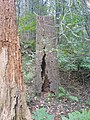 Hollow tree - geograph.org.uk - 1062482.jpg 480 × 640; 130 KB
-
 Holly tree in Egdean access land - geograph.org.uk - 2008775.jpg 2,592 × 1,944; 2.35 MB
-
 Horses in farm near Fittleworth - geograph.org.uk - 4133713.jpg 1,600 × 1,200; 498 KB
-
 House on the north side of Lord's Piece, Sussex - geograph.org.uk - 6386651.jpg 1,323 × 744; 523 KB
-
 Incised road on south side of Hesworth Common - geograph.org.uk - 5515602.jpg 4,032 × 3,024; 3.81 MB
-
 Inside St Mary, Fittleworth (A) - geograph.org.uk - 3770657.jpg 640 × 480; 56 KB
-
 Inside St Mary, Fittleworth (C) - geograph.org.uk - 3770660.jpg 480 × 640; 74 KB
-
 Interior of Fittleworth parish church, West Sussex - geograph.org.uk - 4166919.jpg 1,200 × 1,600; 275 KB
-
 Junction of Bedham Lane and Stretch Hill - geograph.org.uk - 2339868.jpg 800 × 600; 151 KB
-

-
 Junction of Church Lane and the B2138 - geograph.org.uk - 1778346.jpg 640 × 480; 143 KB
-
 Junction of lanes near Little Bognor - geograph.org.uk - 2234467.jpg 800 × 600; 180 KB
-
 Junction of narrow lanes - geograph.org.uk - 1259479.jpg 640 × 480; 102 KB
-
 Junction on Bedham Lane - geograph.org.uk - 2339839.jpg 800 × 600; 152 KB
-
 Lane by Hesworth Common - geograph.org.uk - 4911047.jpg 4,602 × 3,448; 7.72 MB
-
 Lane junction NE of Little Bognor - geograph.org.uk - 2008464.jpg 2,592 × 1,944; 2.11 MB
-
 Lane through Hesworth Common - geograph.org.uk - 4910818.jpg 4,608 × 3,456; 7.56 MB
-
 Lee Cottage - geograph.org.uk - 1239531.jpg 640 × 480; 84 KB
-
 Limbourne farm - geograph.org.uk - 4132290.jpg 1,600 × 1,200; 603 KB
-
 Limbourne farm buildings - geograph.org.uk - 4131096.jpg 1,600 × 1,200; 488 KB
-
 Limbourne Lane meets the A283 at Fittleworth - geograph.org.uk - 2496942.jpg 4,000 × 3,000; 3.43 MB
-
 Linton, Fittleworth.png 873 × 650; 816 KB
-
 Lithersgate Common - geograph.org.uk - 4132466.jpg 1,600 × 1,200; 543 KB
-
 Little Bognor House - geograph.org.uk - 4133148.jpg 1,600 × 1,200; 498 KB
-
 Looking after his family - geograph.org.uk - 2004173.jpg 1,600 × 1,200; 609 KB
-

-
-

-
 Lord's Piece, Sussex - geograph.org.uk - 6386654.jpg 4,029 × 2,266; 4.12 MB
-
 Lord's Piece, West Sussex - geograph.org.uk - 6378683.jpg 3,909 × 2,199; 1.41 MB
-
 Lower Fittleworth - geograph.org.uk - 5953148.jpg 1,024 × 768; 154 KB
-
 Lower Fittleworth - geograph.org.uk - 92803.jpg 541 × 480; 36 KB
-
 Lower Street - geograph.org.uk - 1239510.jpg 640 × 480; 94 KB
-
 Lower Street at The Swan - geograph.org.uk - 981044.jpg 640 × 480; 103 KB
-
 Lower Street, Fittleworth - geograph.org.uk - 980996.jpg 640 × 480; 109 KB
-
 Malthouse Cottage from the south - geograph.org.uk - 1259667.jpg 640 × 480; 82 KB
-
 Mill cottages, Lower Fittleworth - geograph.org.uk - 4695095.jpg 1,024 × 770; 170 KB
-
 Mill Cottages, Lower Street - geograph.org.uk - 1239506.jpg 480 × 640; 76 KB
-
 Mill House - geograph.org.uk - 4762920.jpg 2,399 × 1,599; 604 KB
-
 Millstream, Lower Fittleworth - geograph.org.uk - 981030.jpg 480 × 640; 108 KB
-
 Mind your head - geograph.org.uk - 4911311.jpg 4,608 × 3,456; 6.99 MB
-
 Mixture of old trees near Mitfords Copse - geograph.org.uk - 1264384.jpg 640 × 480; 151 KB
-
 New Barn and Stone Cottage - geograph.org.uk - 338104.jpg 640 × 428; 98 KB
-
 No Horses - geograph.org.uk - 337962.jpg 640 × 428; 179 KB


_-_geograph.org.uk_-_2093210.jpg)
_-_geograph.org.uk_-_2093223.jpg)
_-_geograph.org.uk_-_6005713.jpg)
_-_geograph.org.uk_-_6005714.jpg)


_-_geograph.org.uk_-_2093145.jpg)
_-_geograph.org.uk_-_2093156.jpg)
_-_geograph.org.uk_-_2093173.jpg)
_-_geograph.org.uk_-_2093186.jpg)


_-_geograph.org.uk_-_2234444.jpg)


_-_geograph.org.uk_-_3770657.jpg)
_-_geograph.org.uk_-_3770660.jpg)


