Category:Fleam Dyke
linear earthwork and Site of Special Scientific Interest  | |||||
| Upload media | |||||
| Instance of | |||||
|---|---|---|---|---|---|
| Location | Fulbourn, South Cambridgeshire, Cambridgeshire, East of England, England | ||||
| Heritage designation |
| ||||
 | |||||
Media in category "Fleam Dyke"
The following 33 files are in this category, out of 33 total.
-

-
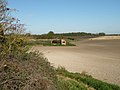 Barn and fields near Fleam Dyke - geograph.org.uk - 1017042.jpg 640 × 480; 86 KB
-
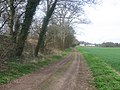
 Barn near Fleam Dyke - geograph.org.uk - 1017030.jpg 640 × 480; 70 KB
-
 Break in Fleam Dyke - geograph.org.uk - 1017202.jpg 640 × 480; 94 KB
-
 Cambridge Water Company Fleam Dyke - geograph.org.uk - 994822.jpg 640 × 480; 61 KB
-

-
 Edge of the Fens - geograph.org.uk - 1161129.jpg 640 × 480; 101 KB
-
 Fields beside Fleam Dyke - geograph.org.uk - 1017284.jpg 640 × 480; 54 KB
-
 Fleam Dyke approaching Mutlow Hill - geograph.org.uk - 182255.jpg 640 × 480; 101 KB
-
 Fleam Dyke at Mutlow Hill - geograph.org.uk - 1259231.jpg 427 × 640; 92 KB
-
 Fleam dyke footbridge over A11 motorway, Cambridgeshire. - panoramio.jpg 1,600 × 1,200; 695 KB
-
 Fleam Dyke looking NW - geograph.org.uk - 1017317.jpg 640 × 480; 103 KB
-
 Fleam Dyke looking SE - geograph.org.uk - 1017280.jpg 640 × 480; 60 KB
-
 Fleam dyke near Balsham, Cambridgeshire. - panoramio (1).jpg 1,600 × 1,200; 1,022 KB
-
 Fleam Dyke near Dungate Farm - geograph.org.uk - 306836.jpg 640 × 480; 109 KB
-
 Fleam dyke path northwest of A11 crossing, Cambridgeshire. - panoramio.jpg 1,200 × 1,600; 1.01 MB
-
 Fleam Dyke Pumping Station - geograph.org.uk - 1017123.jpg 640 × 480; 94 KB
-
 Fleam Dyke Pumping Station from the SE - geograph.org.uk - 1017213.jpg 640 × 480; 101 KB
-

-
 Fleam dyke, Mutlow Hill tumulus, Cambridgeshire. - panoramio.jpg 1,600 × 1,163; 774 KB
-
 Fleam Dyke, near Fulbourn - geograph.org.uk - 1259202.jpg 427 × 640; 102 KB
-
 Fleam Dyke.jpg 640 × 480; 106 KB
-
 Footbridge across the A11 - geograph.org.uk - 1259235.jpg 640 × 427; 54 KB
-
 Footbridge over A11 - geograph.org.uk - 1017271.jpg 640 × 480; 61 KB
-
 Footpath junction - geograph.org.uk - 1016729.jpg 640 × 480; 99 KB
-
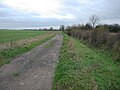
 Footpath on top of Fleam Dyke - geograph.org.uk - 1017068.jpg 640 × 480; 109 KB
-
 Hedgerow and signpost - geograph.org.uk - 1016944.jpg 640 × 480; 107 KB
-
 Juniper fleam dyke.jpg 1,224 × 1,632; 457 KB
-
 Phone lines seen from Fleam Dyke - geograph.org.uk - 1017074.jpg 640 × 480; 97 KB
-
 The edge of the Fens - geograph.org.uk - 1046562.jpg 640 × 480; 112 KB
-
 Tree on the line of Fleam Dyke - geograph.org.uk - 1017242.jpg 640 × 480; 135 KB
-
 View NE from Fleam Dyke - geograph.org.uk - 1017054.jpg 640 × 480; 125 KB
-
 Reaching out and touching Harcamlow Way - geograph.org.uk - 349239.jpg 640 × 480; 155 KB


.jpg)


