Category:Floodplains in England
Subcategories
This category has only the following subcategory.
Media in category "Floodplains in England"
The following 10 files are in this category, out of 10 total.
-
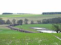
 A21, Tonbridge Bypass flyover - geograph.org.uk - 1526423.jpg 640 × 430; 132 KB
-
 A46 improvement near Farndon - geograph.org.uk - 1620221.jpg 640 × 479; 76 KB
-
 Broken footbridge at Brandon - geograph.org.uk - 1332229.jpg 640 × 480; 117 KB
-
 Clyst floodplain 1 - geograph.org.uk - 1605965.jpg 640 × 480; 246 KB
-
 Floodplain of the River Wear - geograph.org.uk - 148386.jpg 640 × 480; 80 KB
-

-
 The Thames floodplain, Sonning - geograph.org.uk - 670227.jpg 640 × 480; 126 KB
-
 The Thames floodplain, Sonning - geograph.org.uk - 671117.jpg 640 × 480; 79 KB
-
 Waveney meadows east from Shipmeadow toward Barsham, Suffolk.jpg 4,608 × 3,456; 3.3 MB
-
 The Loddon floodplain, Shinfield - geograph.org.uk - 664485.jpg 640 × 480; 145 KB


