Category:Floodplains in Iran
Media in category "Floodplains in Iran"
The following 29 files are in this category, out of 29 total.
-
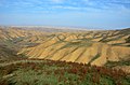
 Dalaki River رود دالکی - panoramio.jpg 2,592 × 1,944; 938 KB
-
 Doroudzan - Dashtak ^ Hesar - panoramio (cropped).jpg 2,692 × 1,784; 1.93 MB
-
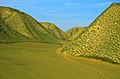
 Doroudzan - Dashtak ^ Hesar - panoramio.jpg 4,750 × 3,150; 4.44 MB
-
 Fars - Dorudzan - Dashtak - panoramio (1).jpg 1,400 × 2,000; 1.91 MB
-
 Galoobardakan Forest Hadi Karimi.jpg 8,000 × 3,525; 2.47 MB
-
 Galoobardakan-Hadi Karimi.jpg 9,356 × 4,123; 3.06 MB
-
 Golestan - Torkaman Sahra - panoramio (1).jpg 4,928 × 3,264; 6.58 MB
-
 Golestan - Torkaman Sahra - panoramio.jpg 4,928 × 3,264; 4.1 MB
-
 Golestan - Turkaman Sahra - Khaled nabi road - panoramio.jpg 4,928 × 3,264; 4.86 MB
-
 Idalik.jpg 800 × 450; 194 KB
-
 Marvdasht - Dorudzan - Dashtak - panoramio.jpg 4,928 × 3,264; 2.83 MB
-
 Mond River رود مند - panoramio.jpg 3,072 × 2,304; 1.15 MB
-
 Posht ghaleh abdanan.jpg 500 × 375; 32 KB
-
 Poshtghaleabdanankkk.jpg 614 × 476; 91 KB
-
 Qazvin - Alamout - Razemian Valley - Shahrestan-e-Sofla - panoramio.jpg 4,928 × 3,264; 5.72 MB
-
 Qazvin - Razemiyan - panoramio.jpg 4,928 × 3,264; 6.26 MB
-
 Qazvin - Razemiyan - Taj Darreh - panoramio.jpg 4,928 × 3,264; 6.38 MB
-
 Shapur cave outside view.JPG 3,648 × 2,736; 1.02 MB
-
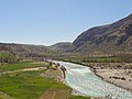
 Shiraz - Bushehr Road - Dalaki - panoramio.jpg 2,400 × 1,600; 3.61 MB
-
 Shiraz - Bushehr Road - Dalaki valley ^ River - panoramio.jpg 1,000 × 700; 745 KB
-
 ایدلیک ۱.jpg 4,160 × 3,120; 6.87 MB
-
 ایدلیک.jpg 1,280 × 960; 277 KB
-
 دور نمای ایدلیک.jpg 1,280 × 720; 421 KB
-
 دورنمای ایدلیک.jpg 1,280 × 720; 227 KB
-
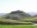
 دورنمایی از روستای حصار - panoramio.jpg 1,500 × 1,045; 1.1 MB
-
 رودخانه در کهکیلویه و بویراحمد - panoramio (1).jpg 3,648 × 2,736; 4.05 MB
-
 رودخانه در کهکیلویه و بویراحمد - panoramio.jpg 3,648 × 2,736; 4.17 MB
-
 پانورامای طبیعت در کهکیلویه و بویراحمد - panoramio.jpg 7,152 × 1,080; 3.25 MB
-
 کلاته ایدلیک.jpg 4,608 × 3,456; 5.72 MB

.jpg)

.jpg)


.jpg)


.jpg)

