Category:Floods in Kingston upon Hull
Media in category "Floods in Kingston upon Hull"
The following 58 files are in this category, out of 58 total.
-
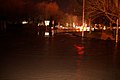
 A policewomen on point duty in a blackout - geograph.org.uk - 3768376.jpg 1,024 × 681; 183 KB
-
 Barriers close off the riverside path - geograph.org.uk - 5253264.jpg 1,200 × 799; 321 KB
-
 Bodmin Road, Roebank - geograph.org.uk - 538342.jpg 459 × 640; 98 KB
-
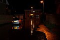
 Bristol Road, Hull - geograph.org.uk - 543721.jpg 640 × 447; 92 KB
-
 Castle Street Rush Hour - geograph.org.uk - 3769614.jpg 640 × 480; 66 KB
-
 Castle Street, A63 closed due to flooding - geograph.org.uk - 3768363.jpg 1,024 × 681; 179 KB
-
 Corporation Pier, Hull City Centre - geograph.org.uk - 3768344.jpg 1,024 × 681; 143 KB
-
 East Carr, Sutton on Hull, Yorkshire (geograph 5634193).jpg 2,592 × 1,944; 2.86 MB
-
 East Carr, Sutton on Hull, Yorkshire (geograph 5634195).jpg 2,536 × 1,868; 2.62 MB
-
 East Carr, Sutton on Hull, Yorkshire (geograph 5634197).jpg 2,552 × 1,890; 2.27 MB
-
 Ferensway, Hull, black out and floods - geograph.org.uk - 3769145.jpg 1,024 × 681; 211 KB
-
 Flooded fields near Great Culvert Pumping Station (geograph 4870282).jpg 1,024 × 768; 181 KB
-
 Flooded land, Noddle Hill Local Nature Reserve (geograph 4870299).jpg 1,024 × 768; 186 KB
-
 Floods in Hull -25June2007.jpg 2,048 × 1,536; 1 MB
-
 Footpath Victoria Dock - geograph.org.uk - 3768494.jpg 640 × 480; 54 KB
-
 Ha'Penny Bridge Way, Victoria Dock Village, Hull - geograph.org.uk - 3769042.jpg 1,024 × 681; 151 KB
-
 Hull City Centre at gridlock - geograph.org.uk - 3768414.jpg 1,024 × 681; 211 KB
-
 Hull city centre under flood water - geograph.org.uk - 3768399.jpg 1,024 × 681; 249 KB
-
 Hull city centre under flood water - geograph.org.uk - 3768407.jpg 1,024 × 681; 237 KB
-
 Hull city centre under flood water - geograph.org.uk - 3768411.jpg 1,024 × 681; 197 KB
-
 No way out - geograph.org.uk - 3768381.jpg 1,024 × 681; 198 KB
-
 Ocean Boulevard, Victoria Dock Village, Hull - geograph.org.uk - 3769051.jpg 1,024 × 681; 197 KB
-
 Ocean Boulevard, Victoria Dock Village, Hull - geograph.org.uk - 3769075.jpg 1,024 × 681; 238 KB
-
 Pier one hour before high tide - geograph.org.uk - 3768488.jpg 640 × 480; 41 KB
-
 Pier underwater - geograph.org.uk - 3768489.jpg 640 × 480; 21 KB
-
 Pilots Way Victoria Dock - geograph.org.uk - 3768493.jpg 640 × 480; 33 KB
-
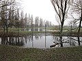 Playing fields off Bishop Alcock Road, Hull (geograph 3306741).jpg 800 × 600; 176 KB
-

-
 Priory Rd - Flooded - geograph.org.uk - 546180.jpg 640 × 480; 86 KB
-
 Priory Rd-Priory Drive Flood - geograph.org.uk - 546175.jpg 640 × 480; 111 KB
-
 River walk towards Pier underwater - geograph.org.uk - 3768491.jpg 640 × 480; 32 KB
-
 Stranded cars on Ferensway, Hull - geograph.org.uk - 3769120.jpg 1,024 × 681; 166 KB
-
 The lock gates at Hull Marina - geograph.org.uk - 3768349.jpg 1,024 × 681; 161 KB
-
 The River Hull near the Deep - geograph.org.uk - 3768317.jpg 1,024 × 681; 241 KB
-
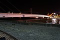
 Tidal Barrier on the River Hull - geograph.org.uk - 5253279.jpg 1,200 × 799; 285 KB
-
 Tidal Barrier on the River Hull - geograph.org.uk - 5253325.jpg 1,200 × 799; 259 KB
-
 Tidal Surge on the River Hull - geograph.org.uk - 5253273.jpg 1,200 × 799; 249 KB
-
 Tidal Surge on the River Hull - geograph.org.uk - 5253322.jpg 1,200 × 799; 236 KB
-
 Tidal Surge on the River Humber - geograph.org.uk - 5252550.jpg 1,200 × 799; 253 KB
-
 Tidal Surge on the River Humber - geograph.org.uk - 5252561.jpg 1,200 × 799; 349 KB
-
 Tidal Surge on the River Humber - geograph.org.uk - 5252565.jpg 1,200 × 799; 344 KB
-
 Victoria Dock overtopping.jpg 1,024 × 681; 272 KB
-
 Victoria Dock Village at Crane Road, Hull - geograph.org.uk - 3768967.jpg 1,024 × 681; 194 KB
-
 Victoria Dock Village at Crane Road, Hull - geograph.org.uk - 3768973.jpg 1,024 × 681; 237 KB
-
 Victoria Dock Village at Plimsoll Way, Hull - geograph.org.uk - 3769022.jpg 1,024 × 681; 229 KB
-

-
 Victoria Dock Village near Spinnaker Close, Hull - geograph.org.uk - 3768906.jpg 1,024 × 681; 193 KB
-
 Victoria Dock Village river front, Hull - geograph.org.uk - 3768281.jpg 1,024 × 681; 305 KB
-
 Victoria Dock Village river front, Hull - geograph.org.uk - 3768283.jpg 1,024 × 681; 365 KB
-
 Victoria Dock Village river front, Hull - geograph.org.uk - 3768287.jpg 1,024 × 681; 250 KB
-
 Victoria Dock Village river front, Hull - geograph.org.uk - 3768288.jpg 1,024 × 681; 265 KB
-
 Victoria Dock Village river front, Hull - geograph.org.uk - 3768290.jpg 1,024 × 681; 234 KB
-
 Victoria Dock Village river front, Hull - geograph.org.uk - 3768307.jpg 1,024 × 681; 223 KB
-
 Victoria Dock Village river front, Hull - geograph.org.uk - 3768309.jpg 1,024 × 681; 270 KB
-
 Victoria Dock Village river front, Hull - geograph.org.uk - 3768902.jpg 1,024 × 681; 248 KB
-
 Victoria Dock Village towards Plimsoll Way, Hull - geograph.org.uk - 3769018.jpg 1,024 × 681; 202 KB
-
 Walkway from Pier to Barrier - geograph.org.uk - 3768492.jpg 640 × 480; 62 KB
-
 Westbourne Avenue East - geograph.org.uk - 527928.jpg 640 × 476; 111 KB


.jpg)
.jpg)
.jpg)

.jpg)
.jpg)


.jpg)


