Category:Floods in Quebec
Provinces and territories of Canada: Alberta · British Columbia · Manitoba · New Brunswick · Ontario · Quebec · Saskatchewan · Yukon
Subcategories
This category has the following 7 subcategories, out of 7 total.
Media in category "Floods in Quebec"
The following 26 files are in this category, out of 26 total.
-
 Chemin près du pont Taché pendant les inondations de 1928, Alma (Québec).jpg 3,498 × 2,460; 1.06 MB
-
 Coup d'eau de mai 1947, Alma (Québec).jpg 2,323 × 1,575; 1.66 MB
-
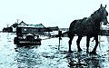
 Crue printaniere dans le village de Pointe-Gatineau, 1947.jpg 657 × 685; 99 KB
-
 Destruction du pont Taché lors des inondations de 1928, Alma (Québec).jpg 3,498 × 2,446; 626 KB
-
 Disaster area (34725531921).jpg 2,400 × 1,800; 1.24 MB
-
 Démembrement du pont Taché à Alma, (Québec).jpg 3,498 × 2,460; 675 KB
-
 Déversoir 7 lors des inondations de 1928, Alma (Québec).jpg 6,448 × 3,567; 1.09 MB
-
 Grande Décharge au début des inondations de 1928, Alma (Québec).jpg 826 × 643; 322 KB
-
 Inondation a Longue-Pointe en 1928.jpg 1,600 × 1,151; 300 KB
-
 Inondation a Maniwaki, 1929.jpg 1,238 × 737; 250 KB
-
 Inondation de juin 1947, Alma (Québec).jpg 1,566 × 2,312; 1.7 MB
-
 InondationRangQuatreSaintLiboire.jpg 860 × 492; 143 KB
-
 Inondations à Saint-Joseph-d'Alma (Québec) en 1928.jpg 3,304 × 2,534; 606 KB
-
 La Grande Décharge au moment des inondations de 1928, Alma (Québec).jpg 3,567 × 5,891; 1.07 MB
-
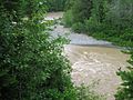
 La riviere massawippi deborde - panoramio.jpg 4,608 × 2,592; 740 KB
-
 La rue principale a Roberval, inondation de 1928.jpg 872 × 560; 343 KB
-
 Lac Saint-Jean 1928.jpg 751 × 470; 284 KB
-

-
 Massawippi river spring overflow - panoramio.jpg 4,672 × 1,184; 1.45 MB
-
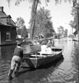
 MP-0000.352 (7638485246).jpg 599 × 768; 171 KB
-
 North pabos flooding.jpg 1,600 × 1,200; 895 KB
-
 Notre-Dame-de-Stanbridge.jpg 640 × 435; 84 KB
-
 Pont taché au moment des inondations de 1928, Alma (Québec).jpg 3,549 × 2,017; 1.37 MB
-
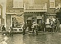
 Saint-Joseph-de-Beauce - Innondation 1922.jpg 976 × 606; 174 KB
-

-
 Terre rendue mer - panoramio.jpg 4,640 × 1,168; 898 KB
.jpg)
.jpg)

.jpg)
.jpg)
.jpg)
.jpg)
.jpg)


.jpg)

_en_1928.jpg)
.jpg)


.jpg)


.jpg)

