Category:Floods in Somerset
Ceremonial counties of England: Cambridgeshire · Cornwall · Derbyshire · Devon · Dorset · East Riding of Yorkshire · Gloucestershire · Greater London · Hampshire · Lancashire · Leicestershire · Lincolnshire · Norfolk · North Yorkshire · Northamptonshire · Nottinghamshire · Oxfordshire · Shropshire · Somerset · South Yorkshire · Staffordshire · Surrey · Warwickshire · West Midlands · West Sussex · West Yorkshire · Worcestershire
City-counties:
Former historic counties:
Other former counties:
City-counties:
Former historic counties:
Other former counties:
Media in category "Floods in Somerset"
The following 29 files are in this category, out of 29 total.
-
 A shallower bit (323807900).jpg 1,282 × 1,603; 818 KB
-
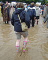
 Barefoot is best (323807381).jpg 1,330 × 1,796; 962 KB
-
 Batheaston Gardens flood - geograph.org.uk - 3789851.jpg 4,896 × 3,672; 7.21 MB
-
-
 Cogload Junction - FGW 150131 passing flooded fields.jpg 1,024 × 683; 277 KB
-
 Cogload Junction - FGW 43071 passing flooded fields.jpg 1,024 × 768; 339 KB
-
 Flooded Levels - geograph.org.uk - 93979.jpg 640 × 480; 65 KB
-
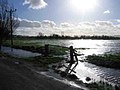
 Flooded moor near Muchelney - geograph.org.uk - 479857.jpg 640 × 427; 68 KB
-
 Longrun Meadow flood 2012.jpg 1,024 × 768; 226 KB
-
 Longrun Meadow flood and cyclist.jpg 1,368 × 1,824; 990 KB
-

-
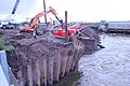
 Pumps at Dunball February 2014 10.JPG 3,456 × 2,304; 1.86 MB
-
 Pumps at Dunball February 2014 11.JPG 3,456 × 2,304; 1.57 MB
-
 Pumps at Dunball February 2014 12.JPG 3,456 × 2,304; 1.36 MB
-
 Pumps at Dunball February 2014 13.JPG 3,456 × 2,304; 1.67 MB
-
 Pumps at Dunball February 2014 2.JPG 3,456 × 2,304; 1.14 MB
-
 Pumps at Dunball February 2014 3.JPG 3,456 × 2,304; 1.3 MB
-
 Pumps at Dunball February 2014 4.JPG 3,456 × 2,304; 1.97 MB
-
 Pumps at Dunball February 2014 5.JPG 3,456 × 2,304; 1.82 MB
-
 Pumps at Dunball February 2014 6.JPG 3,456 × 2,304; 1.52 MB
-
 Pumps at Dunball February 2014 7.JPG 2,304 × 3,456; 1.82 MB
-
 Pumps at Dunball February 2014 8.JPG 2,304 × 3,456; 1.55 MB
-
 Pumps at Dunball February 2014 9.JPG 3,456 × 2,304; 1.43 MB
-
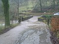
 Swinford Lock - geograph.org.uk - 85261.jpg 573 × 430; 128 KB
-
 Taunton - FGW 150129 passing flooded River Tone.jpg 1,024 × 768; 463 KB
-
 Taunton Bridge with the River Tone in flood.jpg 1,024 × 768; 179 KB
-
 The pathway now open, but not the towpath - geograph.org.uk - 3805990.jpg 1,704 × 2,304; 1.7 MB
-
 Wet land south of Glastonbury - geograph.org.uk - 730915.jpg 640 × 395; 80 KB
-
 Winford Flash Flood July 2007 - geograph.org.uk - 556960.jpg 640 × 427; 109 KB
.jpg)
.jpg)


