Category:Flowers in the East Riding of Yorkshire
Ceremonial counties of England: Bedfordshire · Berkshire · Buckinghamshire · Cambridgeshire · Cheshire · Cornwall · Cumbria · Derbyshire · Devon · Dorset · Durham · East Riding of Yorkshire · East Sussex · Essex · Gloucestershire · Greater London · Greater Manchester · Hampshire · Herefordshire · Hertfordshire · Kent · Lancashire · Leicestershire · Lincolnshire · Merseyside · Norfolk · North Yorkshire · Northamptonshire · Northumberland · Nottinghamshire · Oxfordshire · Shropshire · Somerset · South Yorkshire · Staffordshire · Suffolk · Surrey · Warwickshire · West Midlands · West Sussex · West Yorkshire · Wiltshire · Worcestershire
City-counties: City of London
Former historic counties: Huntingdonshire ·
Other former counties:
City-counties: City of London
Former historic counties: Huntingdonshire ·
Other former counties:
Subcategories
This category has the following 8 subcategories, out of 8 total.
G
T
Media in category "Flowers in the East Riding of Yorkshire"
The following 184 files are in this category, out of 184 total.
-
 A Flower beside the Hudson Way - geograph.org.uk - 544586.jpg 640 × 480; 44 KB
-
 A Memorial Seat - geograph.org.uk - 208283.jpg 640 × 480; 105 KB
-
 Acer Palmatum 'Red Pygmy'.jpg 4,928 × 3,264; 9.95 MB
-
 All Saints Church, Kilnwick (geograph 5946513).jpg 1,064 × 1,600; 562 KB
-
 All Saints Mappleton - geograph.org.uk - 1801509.jpg 4,000 × 3,000; 2.82 MB
-

-
 Back Lane Danthorpe.jpg 467 × 640; 126 KB
-
 Barmby Cutting - geograph.org.uk - 576980.jpg 640 × 480; 143 KB
-
 Beck Bank, Cottingham IMG 5347 - panoramio.jpg 933 × 1,400; 592 KB
-
 Bee on the Bank of Burstwick Drain - geograph.org.uk - 1409361.jpg 640 × 490; 96 KB
-
 Bees on Thistle IMG 5963 - panoramio.jpg 1,084 × 1,200; 250 KB
-
 Beverley (33363697154).jpg 4,000 × 3,000; 2.61 MB
-
 Beverley, floral display by the minster - geograph.org.uk - 1295791.jpg 480 × 640; 107 KB
-
 Beverley, HU17 (geograph 3554461).jpg 2,811 × 3,640; 2.12 MB
-
 Beverley, North Bar - geograph.org.uk - 1295818.jpg 480 × 640; 91 KB
-
 Black Bull.jpg 800 × 600; 39 KB
-
 Black Mill grazing cattle and buttercups (geograph 4999135).jpg 4,608 × 3,456; 4.95 MB
-
 Bluebell near the A1079 south of Beverley (geograph 4464866).jpg 495 × 640; 162 KB
-
 Bramble - geograph.org.uk - 844596.jpg 640 × 480; 61 KB
-
 Bridge Over Gypsey Race - geograph.org.uk - 1215590.jpg 640 × 480; 134 KB
-
 Bridleway at Little Wauldby Farm (geograph 5220654).jpg 1,200 × 772; 387 KB
-
 Bugthorpe - geograph.org.uk - 389750.jpg 640 × 480; 136 KB
-
 Burton Agnes Balk - geograph.org.uk - 1233501.jpg 640 × 480; 82 KB
-
 Burton Agnes Hall - geograph.org.uk - 463179.jpg 640 × 467; 130 KB
-
 Burton Bushes bluebells IMG 1362.JPG - panoramio.jpg 1,600 × 891; 832 KB
-
 Busy Bee - geograph.org.uk - 379612.jpg 640 × 480; 97 KB
-
 Buttercup field near Beverley (geograph 3001414).jpg 3,872 × 2,592; 5.22 MB
-
 Celandine near Scale Nab - geograph.org.uk - 1205035.jpg 640 × 427; 337 KB
-
 Celandines and Snowdrops - geograph.org.uk - 706529.jpg 640 × 262; 81 KB
-
 Charles III Proclamation Hull City Hall.jpg 3,232 × 2,424; 4.4 MB
-
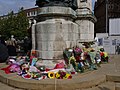 Charles III Proclamation Hull Floral Tributes 1.jpg 3,232 × 2,424; 4.35 MB
-
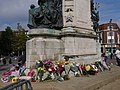 Charles III Proclamation Hull Floral Tributes 2.jpg 3,232 × 2,424; 4.27 MB
-
 Charles III Proclamation Hull Floral Tributes 3.jpg 3,232 × 2,424; 4.4 MB
-
 Cherry Blossom in the churchyard - geograph.org.uk - 808004.jpg 640 × 435; 160 KB
-
 Clematis - geograph.org.uk - 809548.jpg 375 × 640; 189 KB
-
 Cliffe Road, Market Weighton - geograph.org.uk - 934213.jpg 583 × 640; 184 KB
-
 Common Spotted Orchid - geograph.org.uk - 870011.jpg 480 × 640; 99 KB
-
 Cornflowers in a corn field (geograph 3065844).jpg 1,024 × 768; 233 KB
-
 Cottage on Northgate - geograph.org.uk - 595053.jpg 427 × 640; 95 KB
-
 Cottages in Applegarth Lane, Bainton - geograph.org.uk - 804549.jpg 640 × 344; 167 KB
-
 Cottingham 3514 - panoramio.jpg 1,200 × 1,800; 322 KB
-
 Cottingham Cemetery - geograph.org.uk - 805662.jpg 640 × 480; 199 KB
-
 Cottingham IMG 0719 - panoramio.jpg 1,198 × 1,600; 1.01 MB
-
 Cottingham IMG 4919.CR2 - panoramio.jpg 1,600 × 1,067; 615 KB
-
 Cow Parsley against the Sun - geograph.org.uk - 843871.jpg 439 × 640; 32 KB
-
 Cradle Head, Flamborough - geograph.org.uk - 835477.jpg 502 × 640; 144 KB
-
 Cradle Head, Flamborough - geograph.org.uk - 835480.jpg 475 × 640; 88 KB
-
 Cradle Head, Flamborough - geograph.org.uk - 835483.jpg 640 × 503; 139 KB
-
 Cultivated Poppies - geograph.org.uk - 379603.jpg 640 × 480; 159 KB
-
 Daffodils near Hotham - geograph.org.uk - 365795.jpg 640 × 480; 155 KB
-
-
 Daisies - panoramio (1).jpg 1,940 × 2,910; 1.92 MB
-
 Deep Red Poppy - geograph.org.uk - 858264.jpg 640 × 480; 58 KB
-
 Door - Ye Olde White Harte - geograph.org.uk - 236957.jpg 425 × 640; 180 KB
-
 Driffield Station - geograph.org.uk - 784407.jpg 640 × 450; 91 KB
-
 Driffield Station Platform - geograph.org.uk - 1180609.jpg 480 × 640; 116 KB
-
 East Riding Crematorium - geograph.org.uk - 1258562.jpg 640 × 480; 93 KB
-
-
 Entering Everthorpe.jpg 640 × 466; 206 KB
-
 Entering Hotham.jpg 640 × 480; 104 KB
-
 Entrance to Fish Ponds Wood - geograph.org.uk - 1217390.jpg 640 × 480; 126 KB
-
 Entrance to Holiday Centre - geograph.org.uk - 1420773.jpg 640 × 480; 61 KB
-
 Evidence of Logging - geograph.org.uk - 198088.jpg 640 × 480; 136 KB
-
 Farm Flowers - geograph.org.uk - 1335083.jpg 480 × 640; 186 KB
-
 Ferry Road, Wawne (geograph 5483440).jpg 1,600 × 1,065; 493 KB
-
 Field Bindweed - geograph.org.uk - 481158.jpg 640 × 463; 153 KB
-
 Field of Wheat^ - geograph.org.uk - 910178.jpg 640 × 480; 189 KB
-
 Floral display, Bridlington Station - geograph.org.uk - 1424371.jpg 640 × 480; 207 KB
-
 Floral display, Bridlington Station - geograph.org.uk - 1428527.jpg 640 × 480; 219 KB
-
 Flower Trail - geograph.org.uk - 912201.jpg 480 × 640; 119 KB
-
 Forest Edge, Houghton Moor - geograph.org.uk - 181426.jpg 640 × 480; 118 KB
-
 Foxglove with visitor - geograph.org.uk - 844495.jpg 640 × 480; 54 KB
-
 Goole's Clock Tower.jpg 1,024 × 627; 278 KB
-
 Grindale Church - geograph.org.uk - 1215300.jpg 640 × 480; 80 KB
-
 Grindale Mere.jpg 640 × 480; 118 KB
-
 Gypsey Race, Near Boynton Hall - geograph.org.uk - 1215588.jpg 640 × 480; 103 KB
-
 Half Moon, Skidby - panoramio.jpg 1,200 × 786; 407 KB
-
 Hallgate Cottingham IMG 0743 - panoramio.jpg 1,067 × 1,600; 1.07 MB
-
 Hariff Lane Farm - geograph.org.uk - 765440.jpg 470 × 640; 138 KB
-
 Highgate, near Cherry Burton - geograph.org.uk - 761390.jpg 480 × 640; 193 KB
-
 Historic Railway Sign - geograph.org.uk - 1208787.jpg 640 × 480; 124 KB
-
 Holderness Drain, Kingston upon Hull (geograph 5597560).jpg 1,370 × 1,847; 635 KB
-
 Hornsea Church - geograph.org.uk - 1260527.jpg 428 × 640; 149 KB
-
 Hotham In The Spring.jpg 640 × 480; 109 KB
-
 Houghton Moor bridleway - geograph.org.uk - 1183747.jpg 640 × 426; 233 KB
-
 House near Willitoft - geograph.org.uk - 1247320.jpg 640 × 480; 90 KB
-
 It wasnt real love!! (4469140323).jpg 5,070 × 2,766; 3.39 MB
-
 Kelwell Farm - geograph.org.uk - 32509.jpg 640 × 480; 100 KB
-
 Kilnsea Church - geograph.org.uk - 1257027.jpg 428 × 640; 101 KB
-
 Lilies on the lake - geograph.org.uk - 876861.jpg 640 × 345; 91 KB
-
 Livingstone Daisy - panoramio.jpg 1,300 × 928; 309 KB
-
 Loglands Nature Reserve, Kingston upon Hull (geograph 5596449).jpg 2,112 × 2,816; 1.45 MB
-
 Loglands Nature Reserve, Kingston upon Hull (geograph 5598798).jpg 2,816 × 2,112; 2.3 MB
-
 Londesborough Road, Market Weighton - geograph.org.uk - 1231339.jpg 640 × 426; 180 KB
-
 Longbrough Lane and Wild Poppies - geograph.org.uk - 496207.jpg 640 × 480; 149 KB
-
 Low Drewton, South Cave - geograph.org.uk - 827605.jpg 640 × 450; 129 KB
-
 Main Street, Wawne, Yorkshire (geograph 3677324).jpg 3,242 × 2,420; 2.78 MB
-
 Market Green, Cottingham IMG 5374 - panoramio.jpg 1,001 × 1,400; 383 KB
-
 Marsh Woundwort, Stachys palustris - geograph.org.uk - 895772.jpg 480 × 640; 95 KB
-
 Marton Road, New Ellerby - geograph.org.uk - 721563.jpg 468 × 640; 120 KB
-
 May Blossom - geograph.org.uk - 182422.jpg 640 × 480; 102 KB
-
 May Blossom - geograph.org.uk - 182713.jpg 480 × 640; 106 KB
-
 Memorial Stone to Christine Egan - geograph.org.uk - 5121188.jpg 1,065 × 1,600; 855 KB
-
 Memorial Stone to Michael Egan - geograph.org.uk - 5121200.jpg 1,065 × 1,600; 764 KB
-
 Mill Beck and footpath, Goodmanham - geograph.org.uk - 1231341.jpg 640 × 426; 208 KB
-
 Mires Beck, near North Cave - geograph.org.uk - 752850.jpg 480 × 640; 185 KB
-
 More Rhododendrons Coming into View - geograph.org.uk - 198084.jpg 640 × 480; 146 KB
-
 New Growth - geograph.org.uk - 198097.jpg 640 × 480; 114 KB
-
 North Cliffe Wood IMG 3490 - panoramio.jpg 800 × 1,200; 446 KB
-

-
 North Street, Driffield - geograph.org.uk - 784403.jpg 640 × 475; 118 KB
-
 Northside Road Hollym.jpg 523 × 640; 184 KB
-
 Owstwick Hill - geograph.org.uk - 447071.jpg 491 × 640; 166 KB
-
 Owstwick Hill - geograph.org.uk - 447075.jpg 640 × 469; 175 KB
-
 Polygonia c-album (geograph 5598100).jpg 2,816 × 2,112; 1.43 MB
-
 Primitive Methodist Church, Burstwick - geograph.org.uk - 209349.jpg 423 × 640; 100 KB
-

-

-
 Pulsatilla vulgaris - Burnby Hall.jpg 4,817 × 3,099; 7.59 MB
-
 Pyronia tithonus IMG 5365 - panoramio.jpg 856 × 1,200; 285 KB
-
 Queensgate Cemetery, Beverley (geograph 4400983).jpg 1,600 × 1,062; 786 KB
-
 Queensgate Cemetery, Beverley (geograph 4401151).jpg 1,600 × 1,062; 827 KB
-
 Queensgate Cemetery, Beverley (geograph 4401156).jpg 1,600 × 1,062; 933 KB
-
 Rachel Garth, Sproatley - geograph.org.uk - 428511.jpg 640 × 453; 126 KB
-

-

-
 Rhododendrons on Houghton Moor - geograph.org.uk - 181422.jpg 640 × 480; 87 KB
-
 Roadside Blossom - geograph.org.uk - 414500.jpg 486 × 640; 76 KB
-
 Rosebay Willowherb and Wolds scenery (geograph 3066591).jpg 1,024 × 768; 261 KB
-

-

-
 Spen House, HOSM - geograph.org.uk - 234181.jpg 640 × 426; 155 KB
-
 St Helen's Well, Market Weighton - geograph.org.uk - 739705.jpg 640 × 504; 156 KB
-
 St Mary's Church, Elloughton - geograph.org.uk - 570956.jpg 476 × 640; 93 KB
-
 St Oswalds Church Flamborough.jpg 480 × 640; 157 KB
-
 St. Mary's church, Huggate - geograph.org.uk - 1393727.jpg 480 × 640; 61 KB
-
 Stamford Bridge Longboat.jpg 876 × 598; 358 KB
-
 Stile and Impatiens - geograph.org.uk - 249089.jpg 640 × 426; 428 KB
-
 Sunflowers (geograph 1981861).jpg 800 × 600; 209 KB
-
 Sunflowers at Belsom Farm - geograph.org.uk - 211229.jpg 640 × 479; 52 KB
-
 Sunflowers on Watton Carrs (geograph 5090030).jpg 640 × 452; 125 KB
-
 Swine Village - geograph.org.uk - 759711.jpg 640 × 480; 120 KB
-
 The Elusive Pimpernel - geograph.org.uk - 471915.jpg 640 × 469; 161 KB
-
 The First of the Rhododendrons - geograph.org.uk - 198085.jpg 640 × 480; 149 KB
-

-
 The Graveyard at Aughton Church - geograph.org.uk - 388511.jpg 640 × 480; 140 KB
-
 The Molescroft Inn, Molescroft - geograph.org.uk - 1508409.jpg 640 × 379; 62 KB
-
 The Plant Centre on Piggy Lane, Withernsea (geograph 3611296).jpg 1,024 × 768; 167 KB
-
 The Rhododendrons Survive - geograph.org.uk - 198092.jpg 640 × 480; 136 KB
-
 The Rose and Crown - geograph.org.uk - 1411183.jpg 640 × 480; 85 KB
-
 The Station Buffet, Bridlington - geograph.org.uk - 1428524.jpg 640 × 480; 204 KB
-

-

-
 This is What We Came to See - geograph.org.uk - 198087.jpg 640 × 480; 149 KB
-
 Thorn Dale - geograph.org.uk - 1380109.jpg 480 × 640; 94 KB
-
 Tibthorpe Village Pump - geograph.org.uk - 823969.jpg 640 × 427; 101 KB
-
 Toll Gavel, Beverley - geograph.org.uk - 877869.jpg 460 × 640; 88 KB
-
 Towards Rudstone Walk - geograph.org.uk - 727182.jpg 640 × 480; 194 KB
-
 Track Through Fish Ponds Wood - geograph.org.uk - 1217396.jpg 640 × 480; 124 KB
-
 Track up to Elmswell Wood Farm - geograph.org.uk - 1270962.jpg 640 × 480; 58 KB
-
 Trackside Wild Rose - geograph.org.uk - 859028.jpg 632 × 640; 70 KB
-
 Vanessa cardui (geograph 5830000).jpg 1,024 × 810; 781 KB
-
 View Down Church Lane - geograph.org.uk - 1215308.jpg 640 × 480; 92 KB
-

-

-
 Water Treatment Works - geograph.org.uk - 199277.jpg 640 × 480; 155 KB
-
 WaterLily, Burnby Hall Gardens - geograph.org.uk - 876869.jpg 640 × 600; 66 KB
-
 West End, Swanland - geograph.org.uk - 1000417.jpg 640 × 477; 88 KB
-
 West Green IMG 2584 - panoramio.jpg 1,145 × 1,600; 1.18 MB
-
 West of Grindale - geograph.org.uk - 195318.jpg 480 × 640; 169 KB
-
 Wheat Field with Wild Flowers - geograph.org.uk - 930237.jpg 640 × 604; 155 KB
-
 Wilberfoss In Bloom 2009 - geograph.org.uk - 1253333.jpg 640 × 480; 139 KB
-
 Wild Cherry blossom along Swin Dale - geograph.org.uk - 1360214.jpg 640 × 480; 109 KB
-
 Wild Flowers in the Crop - geograph.org.uk - 1335072.jpg 640 × 480; 209 KB
-
 Wild Ragwort Flowers near Kilnsea - geograph.org.uk - 516234.jpg 640 × 480; 147 KB
-
 Wild Rose Flower on Hedon Flyover - geograph.org.uk - 1360886.jpg 640 × 570; 72 KB
-

-
 Wold House Farm - geograph.org.uk - 154262.jpg 640 × 480; 102 KB
-
 Wolds' Wild Flowers - geograph.org.uk - 551341.jpg 640 × 480; 109 KB
-
 Woodland trail and foxglove - geograph.org.uk - 844486.jpg 480 × 640; 158 KB
-
 Ye Olde Star Inn - geograph.org.uk - 518163.jpg 640 × 480; 119 KB
-
 Yellow.Kd.jpg 2,048 × 1,536; 381 KB
-
 Young Trees and Daffodils - geograph.org.uk - 402798.jpg 640 × 480; 89 KB
-
 Zygaena sp. - geograph.org.uk - 173236.jpg 480 × 640; 137 KB


.jpg)


.jpg)

.jpg)


.jpg)
.jpg)


.jpg)


.jpg)


.jpg)


.jpg)


.jpg)


.jpg)


.jpg)


.jpg)
.jpg)


.jpg)


.jpg)

_(27174078411).jpg)
_(26636441574).jpg)


.jpg)
.jpg)
.jpg)


.jpg)
,_the_Red_Bus_Gallery,_Burton_Agnes_Hall,_Yorkshire,_25_June_2010.jpg)


.jpg)

.jpg)


.jpg)


.jpg)


.jpg)


