Category:Fluvial erosion in Ohio
States of the United States: Alabama · Alaska · Arizona · Arkansas · California · Colorado · Connecticut · Delaware · Florida · Georgia · Hawaii · Idaho · Illinois · Indiana · Iowa · Kansas · Kentucky · Louisiana · Maine · Maryland · Massachusetts · Michigan · Minnesota · Mississippi · Missouri · Montana · Nebraska · Nevada · New Hampshire · New Jersey · New Mexico · New York · North Carolina · North Dakota · Ohio · Oklahoma · Oregon · Pennsylvania · Rhode Island · South Carolina · South Dakota · Tennessee · Texas · Utah · Vermont · Virginia · Washington · West Virginia · Wisconsin · Wyoming – Washington, D.C.
Subcategories
This category has the following 10 subcategories, out of 10 total.
Media in category "Fluvial erosion in Ohio"
The following 12 files are in this category, out of 12 total.
-
 Cambria Creek upstream in Greenfield Township.jpg 6,016 × 4,000; 6.35 MB
-
 Cedar Falls (31865098294).jpg 4,978 × 2,486; 3.58 MB
-
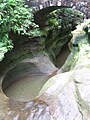 Devil's Bathtub IV.JPG 1,944 × 2,592; 1.1 MB
-
 Devil's Bathtub X.JPG 1,944 × 2,592; 1.11 MB
-
 East Fork Black River Lodi Ohio.JPG 3,000 × 2,008; 5.88 MB
-
 Salt Creek (Haynes, Hocking County, Ohio, USA) 11 (38211791214).jpg 4,000 × 3,000; 5.23 MB
-
 Salt Creek (Haynes, Hocking County, Ohio, USA) 14 (24062568597).jpg 4,000 × 3,000; 5.89 MB
-
 Salt Creek (Haynes, Hocking County, Ohio, USA) 18 (38040462295).jpg 4,000 × 3,000; 5.67 MB
-
 Salt Creek (Haynes, Hocking County, Ohio, USA) 19 (25055284478).jpg 4,000 × 3,000; 4.65 MB
-
 Tiffin River at Goll Woods State Nature Preserve in Ohio.jpg 2,048 × 1,360; 1.27 MB
-
 Trail damage (27 March 2020) (Black Hand Gorge, Toboso, Ohio, USA).jpg 1,500 × 975; 2.27 MB
-
 Wakatomika Creek (Muskingum County, Ohio, USA) 1 (26474817125).jpg 4,000 × 3,000; 4.5 MB

.jpg)


_11_(38211791214).jpg)
_14_(24062568597).jpg)
_18_(38040462295).jpg)
_19_(25055284478).jpg)

_(Black_Hand_Gorge,_Toboso,_Ohio,_USA).jpg)
_1_(26474817125).jpg)