Category:Footbridges in the London Borough of Bromley

Media in category "Footbridges in the London Borough of Bromley"
The following 105 files are in this category, out of 105 total.
-

-
 2005-03-30 - London - Crystal Palace - Bridge 1 4887760440.jpg 1,800 × 1,200; 3.19 MB
-
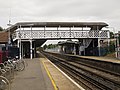
 Anerley station southbound look north.JPG 1,600 × 1,200; 500 KB
-
 Avenue Road tramstop entrance proper.JPG 2,592 × 1,944; 1.22 MB
-
 Bridge over Croydon Tramlink at Avenue Road - geograph.org.uk - 1967828.jpg 1,000 × 667; 218 KB
-

-

-
 Bridge over the Little Quaggy - geograph.org.uk - 2415376.jpg 640 × 480; 131 KB
-

-

-

-
 Chelsfield station - geograph.org.uk - 3203292.jpg 4,000 × 3,000; 4.02 MB
-
 Chelsfield station look north2.JPG 1,600 × 1,200; 474 KB
-
 Chelsfield station look south1.JPG 1,600 × 1,200; 475 KB
-

-
 2018 at Crystal Palace station - footbridge to platforms 1 and 2.JPG 1,366 × 910; 470 KB
-
 Elmers End stn high southbound.JPG 1,600 × 1,200; 509 KB
-
 Elmers End stn look south.JPG 1,600 × 1,200; 424 KB
-
-

-
 Footbridge crosses the mainline - geograph.org.uk - 1947620.jpg 640 × 352; 79 KB
-
 Footbridge in Willet Memorial Wood - geograph.org.uk - 2535028.jpg 2,304 × 3,072; 2.68 MB
-
 Footbridge near Chislehurst Station - geograph.org.uk - 1910644.jpg 640 × 480; 119 KB
-

-

-

-

-
 Footbridge over A20 - geograph.org.uk - 3192019.jpg 640 × 428; 84 KB
-
 Footbridge over A21, Bromley - geograph.org.uk - 2671724.jpg 640 × 428; 84 KB
-
 Footbridge over Chaffinch Brook (Elmer's End Offshoot) - geograph.org.uk - 2654213.jpg 4,288 × 3,216; 7.18 MB
-
 Footbridge over Chislehurst Junction - geograph.org.uk - 3683795.jpg 640 × 430; 115 KB
-
 Footbridge over railway near Towncourt Lane - geograph.org.uk - 2577104.jpg 4,288 × 3,216; 6.13 MB
-
 Footbridge over River Cray - geograph.org.uk - 2521066.jpg 3,072 × 2,304; 3.19 MB
-
 Footbridge over River Cray - geograph.org.uk - 2527307.jpg 3,072 × 2,304; 3.42 MB
-
 Footbridge over the A20 - geograph.org.uk - 3704738.jpg 640 × 430; 75 KB
-
 Footbridge over the A21 - geograph.org.uk - 2080745.jpg 640 × 430; 143 KB
-

-

-

-

-

-

-

-

-

-

-

-

-

-

-

-

-

-

-

-

-

-

-

-

-

-

-

-

-
 Footbridge over the lake in Kelsey Park - geograph.org.uk - 2391599.jpg 640 × 480; 122 KB
-

-

-

-

-
 Footbridge over the railway - geograph.org.uk - 2180646.jpg 2,304 × 3,072; 2.58 MB
-
-
 Footbridge over the railway near May's Hill Road - geograph.org.uk - 2581592.jpg 4,288 × 3,216; 7.02 MB
-
 Footbridge over the railway, Orpington - geograph.org.uk - 2665530.jpg 4,288 × 3,216; 4.89 MB
-
 Footbridge over the railway, Shortlands - geograph.org.uk - 2392476.jpg 640 × 430; 108 KB
-

-
-

-

-

-

-

-

-

-

-

-
 Footbridge to Hayes Hill - geograph.org.uk - 2581141.jpg 4,288 × 3,216; 6.72 MB
-
 Footbridge to Walnuts Leisure Centre - geograph.org.uk - 2532070.jpg 3,072 × 2,304; 1.93 MB
-
 Footbridge, northern lake, Kelsey Park - geograph.org.uk - 2242167.jpg 640 × 480; 128 KB
-
 Glimpse of the footbridge to Hayes Hill - geograph.org.uk - 2581148.jpg 4,288 × 3,216; 6.29 MB
-
 Kelsey Footbridge - geograph.org.uk - 1325857.jpg 640 × 480; 117 KB
-
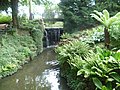
 Kelsey Waterfall - geograph.org.uk - 1325888.jpg 480 × 640; 149 KB
-

-
 Orpington railway station MMB 10.jpg 3,876 × 2,421; 3.2 MB
-
 Orpington station platform 2 look south.JPG 1,600 × 1,200; 628 KB
-
 Penge East stn look west.JPG 1,600 × 1,200; 470 KB
-
 Penge West - geograph.org.uk - 5616306.jpg 3,264 × 2,448; 2.4 MB
-
 Penge West stn southbound looking north.JPG 1,600 × 1,200; 493 KB
-
 Petts Wood Possession new bridge to be installed (32821767672).jpg 4,896 × 3,672; 6.8 MB
-
 Sundridge Park Station - geograph.org.uk - 3495175.jpg 640 × 467; 105 KB
-
 Sundridge Park stn look south2.JPG 1,600 × 1,200; 502 KB
-

-
 View of Crystal Palace Park 01.jpg 5,184 × 3,456; 15.43 MB
-
 Waterfall outlet for main lake in Kelsey Park - geograph.org.uk - 2528760.jpg 4,000 × 3,000; 4.13 MB
-
 West Wickham railway station footbridge - geograph.org.uk - 4106232.jpg 1,024 × 768; 169 KB
-
 West Wickham stn look northbound.JPG 1,600 × 1,200; 494 KB
_footbridge_over_the_River_Ravensbourne_in_Norman_Park_-_geograph.org.uk_-_2260817.jpg)


_-_geograph.org.uk_-_2418513.jpg)


.jpg)


_-_geograph.org.uk_-_1655265.jpg)


_-_geograph.org.uk_-_2297098.jpg)


_-_geograph.org.uk_-_2654213.jpg)


_-_geograph.org.uk_-_2392253.jpg)


_-_geograph.org.uk_-_2398249.jpg)


_-_geograph.org.uk_-_2435840.jpg)


_-_geograph.org.uk_-_2434728.jpg)

_-_geograph.org.uk_-_2434818.jpg)


_-_geograph.org.uk_-_2427224.jpg)


_-_geograph.org.uk_-_2422240.jpg)
_-_geograph.org.uk_-_2422250.jpg)


_-_geograph.org.uk_-_2271072.jpg)


.jpg)


