Category:Forests in Herefordshire
Subcategories
This category has the following 5 subcategories, out of 5 total.
Media in category "Forests in Herefordshire"
The following 200 files are in this category, out of 258 total.
(previous page) (next page)-
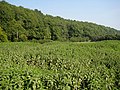 A sea of nettles - geograph.org.uk - 973902.jpg 640 × 480; 202 KB
-
 Aconbury Hill - geograph.org.uk - 60978.jpg 640 × 424; 109 KB
-
 Alien weeds, Fishpools Valley - geograph.org.uk - 1461568.jpg 640 × 480; 165 KB
-
 Altbough Wood - geograph.org.uk - 973909.jpg 640 × 480; 155 KB
-
 Autumn Colour - geograph.org.uk - 604499.jpg 426 × 640; 135 KB
-
 Beech wood, Fishpools Valley - geograph.org.uk - 1461572.jpg 640 × 480; 178 KB
-
 Belt of woodland, Eastnor Park - geograph.org.uk - 745368.jpg 640 × 445; 116 KB
-
 Between fields near Aconbury - geograph.org.uk - 1469033.jpg 480 × 640; 242 KB
-
 Bluebells at Castle Coppice - geograph.org.uk - 915923.jpg 640 × 480; 149 KB
-
 Bluebells in Lower Brienton woods - geograph.org.uk - 454349.jpg 640 × 480; 152 KB
-
 Bluebells in Yatton Wood - geograph.org.uk - 166623.jpg 640 × 426; 179 KB
-
 Bridle path near Blackhill Farm - geograph.org.uk - 85125.jpg 480 × 640; 210 KB
-
 Burrington Outlet - geograph.org.uk - 797135.jpg 640 × 480; 159 KB
-

-
 Chase Wood - geograph.org.uk - 1229409.jpg 640 × 412; 93 KB
-
 Choose wisely^ - geograph.org.uk - 846878.jpg 640 × 480; 112 KB
-
 Christmas tree farm. Burghope. - geograph.org.uk - 146393.jpg 640 × 480; 119 KB
-
 Clearing in Deep Wood - geograph.org.uk - 1191293.jpg 640 × 426; 124 KB
-
 Cwarelau Wood - geograph.org.uk - 451152.jpg 640 × 427; 238 KB
-
 Derelict hut in woodland - geograph.org.uk - 943521.jpg 640 × 480; 124 KB
-
 Dudale's Wood - geograph.org.uk - 909428.jpg 640 × 480; 121 KB
-
 Dudale's Wood - geograph.org.uk - 910350.jpg 640 × 359; 97 KB
-
 Dulas Brook and Cockshoot Wood - geograph.org.uk - 448884.jpg 640 × 427; 231 KB
-
 Edge of Hayfield Grove - geograph.org.uk - 618397.jpg 640 × 480; 87 KB
-
 Edge of Ox Lodge Wood - geograph.org.uk - 1804305.jpg 640 × 480; 257 KB
-
 Fairy Wood - geograph.org.uk - 1045566.jpg 480 × 640; 104 KB
-
 Fallen tree near Barnett Wood - geograph.org.uk - 1175400.jpg 640 × 480; 178 KB
-
 Fields north of Whitney - geograph.org.uk - 486258.jpg 640 × 480; 53 KB
-
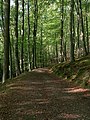
 Footpath through the Wood - geograph.org.uk - 135114.jpg 480 × 640; 176 KB
-
 Forest at Symonds Yat (9761).jpg 2,848 × 4,288; 6.34 MB
-
 Forest road, Croft Ambrey - geograph.org.uk - 1291407.jpg 640 × 359; 107 KB
-
 Good to see you - geograph.org.uk - 980349.jpg 640 × 480; 220 KB
-
 Heath Wood and Ashen Stream - geograph.org.uk - 618404.jpg 640 × 480; 103 KB
-
 Hom Plantation - geograph.org.uk - 975577.jpg 640 × 480; 156 KB
-
 Hungry Dean - geograph.org.uk - 60361.jpg 640 × 479; 105 KB
-
 Kempley Road 1 - geograph.org.uk - 1156921.jpg 640 × 480; 214 KB
-
 Kempley Road 2 - geograph.org.uk - 1156934.jpg 640 × 480; 217 KB
-
 Kempley Road 3 - geograph.org.uk - 1156984.jpg 640 × 480; 200 KB
-
 Kempley Road 4 - geograph.org.uk - 1157002.jpg 640 × 480; 202 KB
-
 Kempley Road 5 - geograph.org.uk - 1157011.jpg 640 × 480; 211 KB
-
 Linton Wood in Autumn 1 - geograph.org.uk - 1043920.jpg 640 × 513; 184 KB
-
 Linton Woods - geograph.org.uk - 990176.jpg 640 × 480; 165 KB
-
 Logging in beech wood - geograph.org.uk - 1056491 cropped.jpg 580 × 420; 427 KB
-
 Logging in beechwood - geograph.org.uk - 1056476.jpg 640 × 480; 151 KB
-
 Logs Stacked Up - geograph.org.uk - 744493.jpg 640 × 424; 105 KB
-
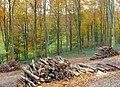
 Logs, Midsummer Hill - geograph.org.uk - 690142.jpg 640 × 427; 325 KB
-
 Lyonshall Park - geograph.org.uk - 64674.jpg 640 × 457; 40 KB
-
 Merryhill Wood - geograph.org.uk - 167958.jpg 640 × 480; 73 KB
-
 Moreton Ride - geograph.org.uk - 1265852.jpg 426 × 640; 135 KB
-
 Oaker Wood - geograph.org.uk - 1758947.jpg 640 × 480; 154 KB
-
 Open woodland, Bircher Common - geograph.org.uk - 1290025.jpg 640 × 480; 96 KB
-
 Oxleasow Coppice - geograph.org.uk - 206163.jpg 640 × 480; 74 KB
-
 Path descending to Coldwell Rocks - geograph.org.uk - 1048483.jpg 480 × 640; 199 KB
-
 Path junction in Beacon Hill Wood - geograph.org.uk - 759319.jpg 640 × 480; 151 KB
-
 Path through bluebells - geograph.org.uk - 1310217.jpg 640 × 426; 133 KB
-
 Path Through the Trees on Midsummer Hill - geograph.org.uk - 689731.jpg 640 × 427; 343 KB
-
 Path, Moreton Ride - geograph.org.uk - 1611391.jpg 640 × 480; 148 KB
-
 Pencraig Court Wood - geograph.org.uk - 1436178.jpg 426 × 640; 124 KB
-
 Peregrine and cliffs at Symonds Yat (9759).jpg 4,288 × 2,848; 6.25 MB
-
 Prior's Wood and Dulas Church - geograph.org.uk - 448867.jpg 640 × 417; 257 KB
-
 Queens Wood - geograph.org.uk - 1042483.jpg 640 × 480; 142 KB
-
 Queens Wood, Herefordshire, England (Unsplash).jpg 5,184 × 3,456; 6.91 MB
-
 Road to Kempley passes Linton Wood - geograph.org.uk - 1042493.jpg 640 × 472; 267 KB
-
 Rough ground and farmland - geograph.org.uk - 635795.jpg 640 × 480; 97 KB
-
 Rowburrow Wood - geograph.org.uk - 34571.jpg 640 × 479; 78 KB
-
 Sheep pasture near Massington Farm - geograph.org.uk - 650053.jpg 640 × 480; 82 KB
-
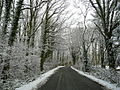
 Snowy track into Linton Woods - geograph.org.uk - 1156999.jpg 640 × 480; 213 KB
-

-
 The treeline near Lawns Farm - geograph.org.uk - 508792.jpg 640 × 450; 403 KB
-
 Track and Bridleway, Great Doward - geograph.org.uk - 1208192.jpg 426 × 640; 109 KB
-
 Track and path in Moreton Ride - geograph.org.uk - 1265863.jpg 426 × 640; 149 KB
-
 Track heading West through Haugh Wood - geograph.org.uk - 1205488.jpg 480 × 640; 128 KB
-
 Track into Linton Wood - geograph.org.uk - 1042497.jpg 480 × 640; 256 KB
-
 Track junction, Old Wood - geograph.org.uk - 746705.jpg 640 × 426; 96 KB
-
 Track through Beacon Hill Wood - geograph.org.uk - 759329.jpg 640 × 480; 133 KB
-
 Track through Capler Wood - geograph.org.uk - 547559.jpg 640 × 480; 139 KB
-
 Track through Linton Wood - geograph.org.uk - 1804283.jpg 800 × 600; 362 KB
-

-
 Track to Hollybush car park. - geograph.org.uk - 735193.jpg 640 × 480; 105 KB
-
 Tractor entering Beans Butts Wood - geograph.org.uk - 1434512.jpg 640 × 426; 127 KB
-
 Tree clearance above Daren Brook - geograph.org.uk - 714523.jpg 640 × 480; 238 KB
-
 Undergrowth mowing on Chase End Hill - geograph.org.uk - 734520.jpg 640 × 480; 100 KB
-
 Upper Bolstone Wood - geograph.org.uk - 1778176.jpg 480 × 640; 255 KB
-

-
 View downhill towards Nether Wood - geograph.org.uk - 627991.jpg 640 × 480; 121 KB
-
 Cross in Hom Plantation - geograph.org.uk - 1438701.jpg 426 × 640; 125 KB
-
 Welcome sign in Little Doward woods - geograph.org.uk - 797628.jpg 564 × 640; 302 KB
-
 Wellington Wood - geograph.org.uk - 267000.jpg 640 × 427; 153 KB
-
 Wellington Wood. - geograph.org.uk - 146389.jpg 640 × 480; 90 KB
-
 Church at Welsh Bicknor.jpg 640 × 452; 431 KB
-
 Welsh Bicknor Church - geograph.org.uk - 1151627.jpg 640 × 481; 179 KB
-
 Welsh Bicknor Church - geograph.org.uk - 1151715.jpg 640 × 484; 171 KB
-
 Welsh Bicknor church - geograph.org.uk - 1657912.jpg 640 × 425; 126 KB
-
 Welsh Bicknor Church - geograph.org.uk - 1658441.jpg 640 × 426; 128 KB
-
 West Wood from the Holme Lacy Bridge - geograph.org.uk - 530236.jpg 640 × 480; 70 KB
-
 Wild daffodils in Ox Lodge Wood - geograph.org.uk - 1804325.jpg 1,024 × 768; 651 KB
-
 Within Big Wood - geograph.org.uk - 618418.jpg 640 × 480; 122 KB
-
 Within How Caple Wood - geograph.org.uk - 1456331.jpg 640 × 480; 273 KB
-
 Woodbury Hill Wood - geograph.org.uk - 635786.jpg 640 × 480; 52 KB
-
 Wooded hillside by the A449 - geograph.org.uk - 636473.jpg 640 × 480; 188 KB
-
 Wooded slopes of Little Doward - geograph.org.uk - 755286.jpg 640 × 480; 153 KB
-
 Woodhampton Wood - geograph.org.uk - 1175407.jpg 640 × 480; 101 KB
-
 Woodland and trees in Herefordshire landscape.JPG 2,848 × 2,136; 2.96 MB
-
 Woodland edge north of Fownhope - geograph.org.uk - 722501.jpg 640 × 480; 105 KB
-
 Woodland near Clencher's Mill - geograph.org.uk - 755320.jpg 640 × 426; 145 KB
-
 Woodland path - geograph.org.uk - 604508.jpg 426 × 640; 146 KB
-
 Woodland walk - geograph.org.uk - 604526.jpg 640 × 426; 138 KB
-
 Woodland, Hatfield - geograph.org.uk - 1298188.jpg 640 × 480; 169 KB
-
 Wye valley at Symonds Yat (9760).jpg 4,288 × 2,848; 6.61 MB
-
 Yatton Wood - geograph.org.uk - 166625.jpg 426 × 640; 177 KB
-
 Yeld Wood - geograph.org.uk - 71865.jpg 640 × 480; 112 KB
-
 Young Plantation, Swinyard Hill - geograph.org.uk - 652953.jpg 640 × 427; 331 KB
-
-
 A449 passes through mixed woodland - geograph.org.uk - 636471.jpg 640 × 480; 226 KB
-
 Ant hill in Haugh Wood - geograph.org.uk - 450649.jpg 426 × 640; 149 KB
-
 Arable and woods at Gatley - geograph.org.uk - 802746.jpg 640 × 337; 64 KB
-
 Ashbed Wood - geograph.org.uk - 585053.jpg 640 × 480; 102 KB
-
 Badley Wood - geograph.org.uk - 123922.jpg 640 × 479; 130 KB
-
 Bagburrow Wood - geograph.org.uk - 324922.jpg 640 × 427; 217 KB
-
 Barnett Wood - geograph.org.uk - 315054.jpg 640 × 480; 162 KB
-
 Baynham's Hill Wood - geograph.org.uk - 468698.jpg 640 × 426; 102 KB
-
 Bike tracks, Deepwood - geograph.org.uk - 205935.jpg 640 × 480; 132 KB
-
 Bluebell woods above Mordiford - geograph.org.uk - 467431.jpg 640 × 480; 152 KB
-
 Bluebells in Yatton Wood - geograph.org.uk - 166622.jpg 426 × 640; 167 KB
-
 Bracken in Badnage Wood - geograph.org.uk - 470898.jpg 640 × 426; 176 KB
-
 Brambles, Sasel Wood - geograph.org.uk - 206208.jpg 640 × 480; 164 KB
-
 Brick Kiln Wood - geograph.org.uk - 208598.jpg 640 × 427; 85 KB
-
 Bridleway by Moreton Wood - geograph.org.uk - 152864.jpg 640 × 479; 90 KB
-
 Bridleway through Round Oak Wood - geograph.org.uk - 468662.jpg 426 × 640; 169 KB
-
 Brightall Common - geograph.org.uk - 1463149.jpg 640 × 480; 186 KB
-
 Bringewood Chase - geograph.org.uk - 65771.jpg 456 × 300; 40 KB
-

-
 Byton Common - geograph.org.uk - 18114.jpg 500 × 375; 78 KB
-
 Chaff Wood - geograph.org.uk - 506882.jpg 640 × 480; 77 KB
-
 Charlotte's Wood - geograph.org.uk - 618359.jpg 640 × 480; 89 KB
-
 Clearing On Mary Knoll - geograph.org.uk - 644871.jpg 640 × 426; 43 KB
-
 Coldborough Park - geograph.org.uk - 642028.jpg 640 × 328; 42 KB
-
 Conigree Wood, southern entrance - geograph.org.uk - 32110.jpg 640 × 479; 164 KB
-
 Coronation Plantation - geograph.org.uk - 86621.jpg 640 × 426; 46 KB
-
 Credenhill Park Wood - geograph.org.uk - 167975.jpg 640 × 480; 46 KB
-
 Cwm y Cotterell Wood - geograph.org.uk - 350017.jpg 640 × 480; 87 KB
-
 Daffodils in Hall Wood - geograph.org.uk - 360239.jpg 640 × 427; 349 KB
-
 Dam Wood - geograph.org.uk - 1419679.jpg 640 × 480; 246 KB
-

-
 Deep Leasow Wood - geograph.org.uk - 33049.jpg 640 × 479; 79 KB
-
 Dinmore woods - geograph.org.uk - 42340.jpg 426 × 640; 171 KB
-
 Dionscourt Hill - geograph.org.uk - 175688.jpg 640 × 480; 166 KB
-
 Edge of Ashperton Park Woods - geograph.org.uk - 100897.jpg 640 × 479; 122 KB
-
 Edge of Childer Wood - geograph.org.uk - 101614.jpg 640 × 479; 123 KB
-
 Edge of Grove Wood - geograph.org.uk - 635868.jpg 640 × 480; 120 KB
-

-
 Elliot's Wood, Symonds Yat - geograph.org.uk - 592489.jpg 640 × 426; 158 KB
-
 England and Wales at Cusop Dingle - geograph.org.uk - 437317.jpg 640 × 480; 90 KB
-
 Faint path through woodland - geograph.org.uk - 1419660.jpg 480 × 640; 281 KB
-
 Fallen beech in Merryhill Wood - geograph.org.uk - 471008.jpg 640 × 480; 134 KB
-
 Footpath at Oldcastle, Almeley - geograph.org.uk - 448473.jpg 426 × 640; 168 KB
-
 Footpath in Beacon Hill Wood - geograph.org.uk - 759321.jpg 640 × 480; 142 KB
-
 Footpath through Badnage Wood - geograph.org.uk - 468667.jpg 426 × 640; 159 KB
-
 Footpath through Garnstone Wood - geograph.org.uk - 352281.jpg 640 × 426; 163 KB
-
 Footpath through Mallins Wood - geograph.org.uk - 593142.jpg 426 × 640; 162 KB
-

-
 Forest path, Haye Park. - geograph.org.uk - 42941.jpg 414 × 640; 105 KB
-
 Forest road, Blackthorn Wood - geograph.org.uk - 506884.jpg 640 × 480; 104 KB
-
 Forest road, Goggin - geograph.org.uk - 314612.jpg 640 × 480; 135 KB
-
 Gullet Wood - geograph.org.uk - 753278.jpg 640 × 480; 86 KB
-
 Hall Wood - Grazed Area - geograph.org.uk - 360280.jpg 640 × 405; 339 KB
-
 Hanging Covert - geograph.org.uk - 123934.jpg 640 × 479; 66 KB
-
 Hanging Covert - geograph.org.uk - 44404.jpg 640 × 480; 123 KB
-
 Hansnett Wood - geograph.org.uk - 103007.jpg 640 × 479; 77 KB
-
 Haugh Wood - geograph.org.uk - 94554.jpg 640 × 426; 182 KB
-
 Herefordshire's Red Soil - geograph.org.uk - 150873.jpg 640 × 426; 148 KB
-
 Highlea Wood - geograph.org.uk - 101467.jpg 640 × 479; 87 KB
-
 Hillfield Coppice - geograph.org.uk - 569269.jpg 640 × 427; 254 KB
-
 How Caple Wood - geograph.org.uk - 55997.jpg 426 × 640; 180 KB
-
 Jubilee path - geograph.org.uk - 448272.jpg 640 × 480; 153 KB
-
 Knill Garraway Wood - geograph.org.uk - 450185.jpg 640 × 480; 61 KB
-
 Larches, Sunny Gutter. - geograph.org.uk - 53408.jpg 640 × 480; 121 KB
-
 Lea Bailey Inclosure - geograph.org.uk - 58378.jpg 640 × 426; 187 KB
-
 Limepits Wood - geograph.org.uk - 113567.jpg 640 × 479; 88 KB
-
 Lowe Coppice - geograph.org.uk - 102057.jpg 640 × 479; 65 KB
-
 Lower Bolstone Wood - geograph.org.uk - 208601.jpg 640 × 427; 100 KB
-
 M50 passes through the woodland - geograph.org.uk - 668178.jpg 640 × 480; 224 KB
-
 Mallins Wood - geograph.org.uk - 33056.jpg 640 × 479; 100 KB
-
 Mary Knoll. - geograph.org.uk - 53401.jpg 640 × 480; 113 KB
-
 Meadows to Newhouse Wood - geograph.org.uk - 448702.jpg 640 × 385; 229 KB
-
 Mixed woodland by the A449 - geograph.org.uk - 451961.jpg 640 × 480; 596 KB
-
 Nether Wood - geograph.org.uk - 103059.jpg 640 × 480; 57 KB
-
 Nether Wood - geograph.org.uk - 208605.jpg 640 × 480; 87 KB
-
 New House Wood - geograph.org.uk - 178841.jpg 426 × 640; 148 KB
-
 New woodland - geograph.org.uk - 206372.jpg 640 × 480; 55 KB
-
 New woodland - geograph.org.uk - 286096.jpg 480 × 640; 129 KB
-
 Newhouse Wood near Garway - geograph.org.uk - 139714.jpg 640 × 480; 290 KB
-
 Newly planted trees, Burnt Wood - geograph.org.uk - 154853.jpg 426 × 640; 140 KB
-
 News Wood - geograph.org.uk - 511615.jpg 640 × 406; 220 KB
-
 News Wood - geograph.org.uk - 653022.jpg 640 × 415; 244 KB
-
 Nupton Hill Wood - geograph.org.uk - 468677.jpg 640 × 426; 135 KB
-
 Oaker Wood - geograph.org.uk - 387684.jpg 640 × 480; 136 KB
-
 Oakwoods, Sunny Gutter. - geograph.org.uk - 53394.jpg 640 × 480; 128 KB
-
 Old Hill Wood near Snodhill - geograph.org.uk - 392224.jpg 640 × 426; 133 KB
-
 Path above Jubilee Drive - geograph.org.uk - 619665.jpg 640 × 480; 161 KB


.jpg)


.jpg)


.jpg)


.jpg)


