Category:Former churches in Kent
Ceremonial counties of England: Bedfordshire · Berkshire · Buckinghamshire · Cambridgeshire · Cheshire · Cornwall · Cumbria · Derbyshire · Devon · Dorset · Durham · East Riding of Yorkshire · East Sussex · Essex · Gloucestershire · Greater London · Greater Manchester · Hampshire · Herefordshire · Hertfordshire · Kent · Lancashire · Leicestershire · Lincolnshire · Merseyside · Norfolk · North Yorkshire · Northamptonshire · Northumberland · Nottinghamshire · Oxfordshire · Rutland · Shropshire · Somerset · South Yorkshire · Staffordshire · Suffolk · Surrey · Tyne and Wear · Warwickshire · West Midlands · West Sussex · West Yorkshire · Wiltshire · Worcestershire
City-counties: Bristol · City of London
Former historic counties:
Other former counties:
City-counties: Bristol · City of London
Former historic counties:
Other former counties:
Wikimedia category | |||||
| Upload media | |||||
| Instance of | |||||
|---|---|---|---|---|---|
| |||||
Subcategories
This category has the following 11 subcategories, out of 11 total.
*
D
- St Columba's Church, Dover (4 F)
H
- Ham church, Kent (6 F)
R
- Gurudwara Sabha, Rochester (2 F)
T
- Twitton Mission Church (2 F)
Media in category "Former churches in Kent"
The following 45 files are in this category, out of 45 total.
-

-
 Bethel Free Church, Dunton Green - geograph.org.uk - 1450159.jpg 640 × 480; 67 KB
-

-
 Bridge Hall - geograph.org.uk - 1212301.jpg 640 × 480; 94 KB
-
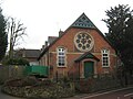
 Former church building - The Borough Canterbury - geograph.org.uk - 1987977.jpg 1,200 × 1,600; 460 KB
-
 Church converted to a business - geograph.org.uk - 70174.jpg 480 × 640; 95 KB
-
 Disused church, Long Barn Rd, Weald - geograph.org.uk - 1380214.jpg 640 × 430; 179 KB
-
 Disused Church, Walnut Tree - geograph.org.uk - 1459697.jpg 640 × 430; 79 KB
-
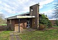
 Former People's Hall, Eccles.JPG 2,200 × 1,800; 1.01 MB
-
 Inside former Church - geograph.org.uk - 5513214.jpg 4,000 × 3,000; 3.55 MB
-
 Former Congregational Church, Union Crescent, Margate, April 2023 01.jpg 3,024 × 4,032; 3.17 MB
-
 Former Congregational Church, Union Crescent, Margate, April 2023 02.jpg 3,024 × 4,032; 3.17 MB
-
 Former Emmanuel Church Sunday School, Addington Square, Margate, November 2021.jpg 3,024 × 4,032; 2.97 MB
-
 Former Four Elms Congregational Church, Four Elms.JPG 1,800 × 1,800; 974 KB
-
 Former Leigh Evangelical Free Church, Leigh.JPG 1,800 × 2,000; 927 KB
-
 Former Mission Church, Marsh Green.JPG 1,800 × 1,600; 720 KB
-
 Former St Luke's Mission Church, Five Oak Green.JPG 2,592 × 1,944; 1.59 MB
-
 Former St Saviour's Church, Chiddingstone Causeway.JPG 2,592 × 1,944; 1.55 MB
-
 Former St Saviour's Mission Room, Tonbridge.JPG 1,900 × 1,900; 1.07 MB
-
 Former St Stephen's Mission Church, Lower Haysden.JPG 1,400 × 1,600; 822 KB
-
 Former United Church, Snodland.JPG 1,800 × 1,800; 510 KB
-
 Former United Methodist Free Church, Tonbridge.JPG 1,800 × 2,200; 1.17 MB
-
 Former Wesleyan Church, Tonbridge (NHLE Code 1069957).JPG 1,800 × 2,000; 992 KB
-
 St Andrew's Art Centre & Gallery at Bawley Bay, Gravesend.JPG 4,608 × 3,456; 4.45 MB
-
 St Andrew's Art Centre & Gallery, Bawley Bay, Gravesend.JPG 4,608 × 3,456; 3.42 MB
-
 Greenhithe, High Street - geograph.org.uk - 718987.jpg 640 × 480; 93 KB
-
 Greenhithe5362.JPG 2,048 × 1,536; 787 KB
-
 Haddon House - geograph.org.uk - 1052912.jpg 640 × 426; 100 KB
-
 Kent House, Priory St - geograph.org.uk - 1772293.jpg 640 × 413; 90 KB
-
 Lindertis House - geograph.org.uk - 1754045.jpg 3,072 × 2,304; 1.4 MB
-

-
 Old Church House - geograph.org.uk - 1321693.jpg 640 × 480; 62 KB
-
 Former Otford Lane Mission Church - geograph.org.uk - 817217.jpg 640 × 426; 115 KB
-
 Former church, Queenborough - geograph.org.uk - 2996652.jpg 4,288 × 3,216; 2.93 MB
-
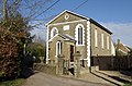
 Rainham Congregational Church - geograph.org.uk - 1073494.jpg 640 × 481; 54 KB
-
 St Edward the Confessor church, Weald - geograph.org.uk - 1778069.jpg 3,507 × 2,412; 2.4 MB
-
 St Luke's Cottages - geograph.org.uk - 1212334.jpg 640 × 480; 85 KB
-

-
 St Paulinus' Church Centre, Marlpit Hill.JPG 2,200 × 1,600; 1.08 MB
-
 Stelling Minnis chapel - geograph.org.uk - 340484.jpg 480 × 640; 282 KB
-

-

-
 Gospel Hall, Windmill Rd, Weald - geograph.org.uk - 1381339.jpg 640 × 430; 141 KB
-
 Wesleyan Chapel, Ightham - geograph.org.uk - 331341.jpg 640 × 423; 124 KB
-
 Winchet Hill Methodist Church - geograph.org.uk - 293816.jpg 640 × 427; 104 KB


.JPG)


