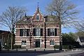
Category:Former town hall of Bunnik
| Object location | | View all coordinates using: OpenStreetMap |
|---|
 | |||||
| Upload media | |||||
| Instance of | |||||
|---|---|---|---|---|---|
| Location | Bunnik, Utrecht, Netherlands | ||||
| Street address |
| ||||
| Located on street |
| ||||
| Heritage designation |
| ||||
 | |||||
|
This is a category about rijksmonument number 511595
|
| Address |
|
Media in category "Former town hall of Bunnik"
The following 3 files are in this category, out of 3 total.
-
 Bunnik roadhuus.jpg 363 × 496; 220 KB
-
 Voormalig Raadhuis Bunnik 2.jpg 5,472 × 3,648; 13.96 MB
-
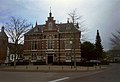 Voormalig Raadhuis Bunnik.jpg 1,536 × 1,047; 409 KB

