Category:Fort Recovery, Ohio
village in Ohio, USA   | |||||
| Upload media | |||||
| Instance of | |||||
|---|---|---|---|---|---|
| Location | Mercer County, Ohio | ||||
| Significant event |
| ||||
| Population |
| ||||
| Area |
| ||||
| Elevation above sea level |
| ||||
| official website | |||||
 | |||||
Subcategories
This category has the following 4 subcategories, out of 4 total.
F
- Fort Recovery Monument (17 F)
Media in category "Fort Recovery, Ohio"
The following 44 files are in this category, out of 44 total.
-
 1880 block P4020166.jpg 3,072 × 2,304; 1.11 MB
-
 1880 block P4020167.jpg 2,304 × 3,072; 1.06 MB
-
 1883 block P4020172.jpg 2,304 × 3,072; 1.04 MB
-
 A Schneider P4020221.jpg 3,072 × 2,304; 1.12 MB
-
 Bicentennial Mem P4020178.JPG 3,072 × 2,304; 1.51 MB
-
 Boundary Street P4020262.jpg 3,072 × 2,304; 1.12 MB
-
 Civil War P4020236.JPG 3,072 × 2,304; 1.61 MB
-
 Dr Victor Grasson (1791) P4020241.JPG 3,072 × 2,304; 1.57 MB
-
 Fort Recovery mural in Fort Recovery, Ohio.jpg 3,497 × 2,015; 1.83 MB
-
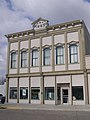
 Ft Rec Bank P4020163.jpg 3,072 × 2,304; 1.15 MB
-
 Ft Rec Bank P4020175.jpg 2,304 × 3,072; 1.13 MB
-
 Gen Butler Mem P4020171.jpg 2,304 × 3,072; 1.13 MB
-
 Greenville Treaty line Corner P4020194.JPG 3,072 × 2,304; 1.16 MB
-
 Greenville Treaty line P4020191.JPG 3,072 × 2,304; 1.45 MB
-
 Gville Treaty Line marker.jpg 3,264 × 2,448; 3.46 MB
-
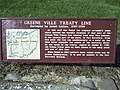 Gville Treaty Line sign.jpg 3,264 × 2,448; 3.62 MB
-
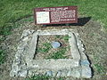 Gville Treaty Line.jpg 3,264 × 2,448; 3.53 MB
-
 H Sunderman Blk P4020161.jpg 2,304 × 3,072; 1.48 MB
-
 H Sunderman Blk P4020162.jpg 3,072 × 2,304; 1.56 MB
-
 H Sunderman P4020160.jpg 3,072 × 2,304; 1.62 MB
-
 Headwaters P4020263.jpg 2,304 × 3,072; 1.55 MB
-
 Headwaters P4020264.jpg 2,304 × 3,072; 1.47 MB
-
 Hull Bro's Bldg P4020159.jpg 3,072 × 2,304; 1.13 MB
-
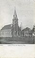 Lutheran Church (16260485656).jpg 1,963 × 3,233; 2.34 MB
-
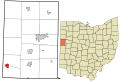
 Map of Mercer County Ohio Highlighting Fort Recovery Village.png 396 × 614; 21 KB
-
 Mary Help of Christians Church in Fort Recovery.jpg 2,816 × 1,584; 1.38 MB
-
-
 Methodist Church P4020237.jpg 3,072 × 2,304; 1.14 MB
-
 Monument in Fort Recovery, Ohio.jpg 3,543 × 4,360; 2.21 MB
-
 OHMap-doton-Fort Recovery.png 274 × 300; 10 KB
-
 Reconstructed cabin P4020215.JPG 3,072 × 2,304; 1.74 MB
-
 Schneider Bldg P4020168.jpg 2,304 × 3,072; 1.06 MB
-
 Schneider Bldg P4020169.jpg 3,072 × 2,304; 1.6 MB
-
 Schneider Bldg P4020170.jpg 3,072 × 2,304; 1.69 MB
-
 St. Mary's Church (15663982944).jpg 2,002 × 3,208; 2.37 MB
-
 Vis Ctr P4020222.jpg 3,072 × 2,304; 1.11 MB
-
 Wabash at Fort Recovery, Ohio.jpg 5,472 × 3,648; 10.06 MB
-
 Wabash River historical marker.jpg 1,536 × 2,048; 761 KB
-
 Wabash River old course.jpg 3,264 × 2,448; 3.35 MB
-
 WabashTreaty.jpg 3,264 × 2,448; 3.54 MB
-
 Wayne Street P4020164.jpg 2,304 × 3,072; 1.06 MB
-
 Wayne Street P4020173.jpg 3,072 × 2,304; 1.19 MB
-
 Wayne Street P4020174.jpg 3,072 × 2,304; 1.14 MB
-
 Waynes Victory 1794P4020177.JPG 3,072 × 2,304; 1.59 MB


_P4020241.JPG)


.jpg)


.jpg)


