Category:Freienhof (Laupen)
| Object location | | View all coordinates using: OpenStreetMap |
|---|
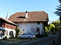
residential buildings in Laupen in the canton of Bern, Switzerland  | |||||
| Upload media | |||||
| Instance of |
| ||||
|---|---|---|---|---|---|
| Part of | |||||
| Location | Laupen, Bern-Mittelland administrative district, Bernese Mittelland administrative region, Bern, Switzerland | ||||
| Street address |
| ||||
| Has part(s) |
| ||||
| Heritage designation | |||||
 | |||||
Media in category "Freienhof (Laupen)"
The following 2 files are in this category, out of 2 total.
-
 Freienhof Laupen P1020439.jpg 3,000 × 4,000; 3.4 MB
-
 Freienhof Laupen P1020441.jpg 4,000 × 3,000; 1.77 MB
