Category:French-language maps of France
English: French language maps of France
Français : Cartes de France en français
中文(简体):法国的法文地图
中文(繁體):法國的法文地圖
Subcategories
This category has only the following subcategory.
Media in category "French-language maps of France"
The following 157 files are in this category, out of 157 total.
-
 12142-Mayran-Hydro.png 3,519 × 2,480; 2.18 MB
-
 12168-Nant-Hydro.png 3,519 × 2,480; 2.25 MB
-

-

-
 1771 Bonne Map of France - Geographicus - FranceGov-bonne-1771.jpg 3,500 × 2,536; 2.45 MB
-
 1771 Bonne Map of Guyenne and Gascony, France - Geographicus - Gascogne-bonne-1771.jpg 2,498 × 3,500; 2.94 MB
-
 1771 Bonne Map of Normandy, France - Geographicus - Normandie-bonne-1771.jpg 3,500 × 2,533; 2.94 MB
-

-
 1775 Zannoni Two Panel Map of France - Geographicus - France-zannoni-1775.jpg 3,996 × 5,000; 6.5 MB
-
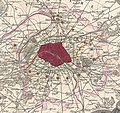
 1782 Esnauts and Rapilly Map of Paris.jpg 5,000 × 3,513; 7.61 MB
-
 1820s map - Plan géométrique de la ville de Paris.tif 12,960 × 9,853; 365.36 MB
-
 1844 Nouveau plan de Paris ou Guide aux étrangers.jpg 7,608 × 5,912; 10.49 MB
-

-
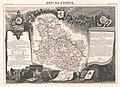
 1847 Levasseur Map of Saone et Loire, France - Geographicus - SaoneLoire-levasseur-1847.jpg 3,500 × 2,462; 2.54 MB
-
 1847 Levasseur Map of Sarthe, France - Geographicus - Sarthe-levasseur-1847.jpg 5,177 × 3,631; 4.68 MB
-

-

-

-

-
 1852 Levasseur Map of France - Geographicus - France-levasseur-1852.jpg 3,500 × 4,021; 4.68 MB
-

-

-

-

-

-
-

-

-

-

-
-
-

-
-

-

-
 57669-Théding-Routes-Hydro.png 3,507 × 2,480; 2.59 MB
-
 Alsace-lorraine.JPG 1,701 × 2,262; 3.8 MB
-
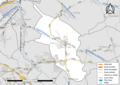
 Anciennes EPCI qui ont fusionné en CC Porte de DrômArdèche.jpg 600 × 378; 38 KB
-
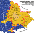 Arronidssement-Lyon-et-TCL.png 850 × 795; 242 KB
-
 Bastides - 1 - carte comtale avec limtes comté.jpg 864 × 587; 85 KB
-
 Bastides - 2 - carte alphonsine 1249 à 1259.jpg 861 × 911; 197 KB
-
 Bastides - 3 - situation en 1271.jpg 1,137 × 808; 224 KB
-
 Blagnac, sa baronnie en 1320.jpg 987 × 1,223; 262 KB
-
 Bèze river map-fr.png 594 × 594; 507 KB
-
 Canal du Rhône au Rhin (carte).jpg 542 × 251; 143 KB
-
 Carte de la France. Echelle 1 - 600.000 - Ouest - Martonne, Emm. de - btv1b105678044.jpg 12,467 × 8,976; 15.3 MB
-
 Carte de la France. Echelle 1 - 600.000 - Sud-Est - Martonne, Emm. de - btv1b10567807g.jpg 12,407 × 9,094; 18.76 MB
-

-

-

-
 Carte des crus du Cognac... - btv1b531215296.jpg 9,292 × 7,926; 10.48 MB
-

-

-
 Carte départementale - btv1b53121460f.jpg 8,758 × 8,594; 13.53 MB
-
 Carte France Chocolatine.png 942 × 1,333; 318 KB
-

-
 Carte physique simplifiée de la France.svg 1,797 × 1,796; 336 KB
-
 CRNHs map in France.PNG 640 × 619; 209 KB
-
 Côtes du Vivarais.png 667 × 908; 594 KB
-
 Départements+régions+capitales(France).png 641 × 584; 184 KB
-

-
 Elev sel Grivette 2010.png 624 × 600; 94 KB
-
 Elev sel Merinos d'Arles 2010.png 624 × 600; 102 KB
-
 1586 approx-Carte de Beauce.JPG 408 × 300; 27 KB
-
 1634-Carte du duché d'Orléans.JPG 404 × 300; 35 KB
-
-
 1747 La Feuille Map of France - Geographicus - France-ratelband-1747.jpg 2,500 × 1,691; 1.76 MB
-
 1747 La Feuille Map of Languedoc, France - Geographicus - Languedoc-lafeuille-1747.jpg 2,500 × 1,842; 1.95 MB
-
 1747 La Feuille Map of Provence, France - Geographicus - Provence-ratelband-1747.jpg 2,500 × 1,714; 1.78 MB
-

-
 1847 Levasseur Map of the Dept. Du Lot, France - Geographicus - Lot-levasseur-1847.jpg 3,000 × 2,139; 2.09 MB
-
-

-
-

-

-

-

-

-

-

-

-
-

-

-
-

-

-

-
-
-
-

-

-
-

-

-

-

-

-
 France map labour protests CPE 23-3-2006.png 760 × 800; 219 KB
-

-
 France politique... - btv1b53197270b.jpg 8,654 × 7,746; 11.68 MB
-
 France relief.png 1,000 × 961; 102 KB
-
 France.1804.jpg 1,106 × 992; 461 KB
-
 Frankish kingdoms in 628.jpg 1,239 × 1,149; 355 KB
-
 Frontière entre le Domaine royal et le comté de Champagne et localisation de Nemours.png 1,484 × 1,568; 463 KB
-
 Guide Joanne-1912-Normandie-carte d'Etretat à St Valery.jpg 4,704 × 3,672; 4.93 MB
-
 Guide Joanne-1912-Normandie-carte d'Evreux.jpg 4,571 × 3,663; 5.27 MB
-
 Guide Joanne-1912-Normandie-carte de Cabourg à Grandcamp.jpg 4,776 × 3,678; 5.84 MB
-
 Guide Joanne-1912-Normandie-carte de Caen.jpg 4,704 × 3,678; 8.19 MB
-
 Guide Joanne-1912-Normandie-carte de Cherbourg.jpg 4,436 × 3,560; 6.89 MB
-
 Guide Joanne-1912-Normandie-carte de Dieppe.jpg 4,695 × 3,663; 6.01 MB
-
 Guide Joanne-1912-Normandie-carte de Honfleur à Cabourg.jpg 4,728 × 3,672; 6.47 MB
-
 Guide Joanne-1912-Normandie-carte de Honfleur.jpg 4,719 × 3,663; 6.99 MB
-
 Guide Joanne-1912-Normandie-carte de Rouen à Quillebeuf.jpg 7,243 × 3,696; 6.14 MB
-
 Guide Joanne-1912-Normandie-carte de Rouen.jpg 4,743 × 3,671; 6.7 MB
-
 Guide Joanne-1912-Normandie-carte de Trouville & Deauville.jpg 4,795 × 3,713; 7.35 MB
-
 Guide Joanne-1912-Normandie-carte des chemins de fer.jpg 4,728 × 3,648; 6.07 MB
-
 Guide Joanne-1912-Normandie-carte du Havre-environs.jpg 4,695 × 3,653; 5.48 MB
-
 Géographie illustrée de la France et de ses colonies 057.jpg 1,191 × 751; 181 KB
-
 Géographie illustrée de la France et de ses colonies 172.jpg 1,207 × 768; 388 KB
-
 Houat en bretagne 2.jpg 374 × 245; 20 KB
-
 Houatenbretagne.jpg 998 × 653; 76 KB
-
 Kerguelen Map.png 1,964 × 1,906; 337 KB
-
 La France touristique et économique - btv1b53121240v.jpg 7,930 × 9,018; 10.7 MB
-
 Les grands itinéraires de France - btv1b53121447r.jpg 8,938 × 8,618; 9.87 MB
-
 Localisation Bureaux.jpg 2,550 × 1,766; 901 KB
-
 Lorraine1870.jpg 623 × 501; 39 KB
-
 Map of the battlefield of Lorette Hill (c. 1916).png 1,123 × 1,513; 2.3 MB
-
 Map-Bro-Dreger.png 758 × 581; 142 KB
-
 Map-Bro-Gernev.png 758 × 581; 141 KB
-
 Map-Bro-Naoned.png 758 × 581; 141 KB
-
 Map-Bro-Roazhon.png 758 × 581; 140 KB
-
 Map-Bro-Sant-Brieg.png 758 × 581; 143 KB
-
 Map-Bro-Sant-Maloù.png 758 × 581; 142 KB
-
 Map-Bro-Wened.png 758 × 581; 142 KB
-
 Map-Bro-Zol.png 758 × 581; 138 KB
-
 Ministère de l'Air. Aviation populaire. 90 km - btv1b53121108d.jpg 9,108 × 8,602; 7.71 MB
-
 Nuclear power plants map France-fr.png 1,100 × 1,100; 154 KB
-
 Peuples celtes en armorique.jpg 800 × 526; 165 KB
-

-

-
 Plan de la ville de Paris, divisé en 12 arrondissemts - Norman B. Leventhal Map Center.tif 7,626 × 5,145; 112.28 MB
-

-
 Plan de la ville et faubourgs de Paris, divisé en 12 mairies - Norman B. Leventhal Map Center.tif 8,763 × 5,903; 148.02 MB
-
 Plan de Paris avec les projets de percements - Norman B. Leventhal Map Center, original.jpg 7,740 × 5,537; 46.67 MB
-
 Plan de Paris avec les projets de percements - Norman B. Leventhal Map Center.tif 7,740 × 5,537; 122.64 MB
-
 Plan pittoresque de la ville de Paris - Flickr.jpg 2,000 × 1,270; 2.5 MB
-
 Plan pittoresque de la ville de Paris - Norman B. Leventhal Map Center, original.jpg 8,132 × 5,164; 38.24 MB
-
 Plan pittoresque de la ville de Paris - Norman B. Leventhal Map Center.tif 8,132 × 5,164; 120.17 MB
-
 Plan routier de la ville et fauxbourgs de Paris - Norman B. Leventhal Map Center, original.jpg 9,924 × 6,677; 66.76 MB
-
 Plan routier de la ville et fauxbourgs de Paris - Norman B. Leventhal Map Center.tif 9,924 × 6,677; 189.6 MB
-
 S. N. C. F. Régions et arrondissements d'exploitation - btv1b53189650d.jpg 6,806 × 7,134; 5 MB
-
 Southern France, including Corsica- handbook for travellers (1902) (14581331307).jpg 1,346 × 2,030; 935 KB
-
 Vichy 1914.jpg 807 × 1,194; 371 KB


.jpg)
%27_(11252156116).jpg)


,_France_-_Geographicus_-_Corsica-levasseur-1852.jpg)

_-_Geographicus_-_SeineEtOise-levasseur-1852.jpg)
_-_Geographicus_-_Ardennes-levasseur-1852.jpg)


_-_Geographicus_-_Correze-levasseur-1852.jpg)
_-_Geographicus_-_CoteDOr-levasseur-1852.jpg)

_-_Geographicus_-_EureEtLoir-levasseur-1852.jpg)

_-_Geographicus_-_Herault-levasseur-1852.jpg)
_-_Geographicus_-_Orne-levasseur-1852.jpg)
_-_Geographicus_-_LYonne-levasseur-1852.jpg)

_-_Geographicus_-_Seine-levasseur-1852_(d%C3%A9tail).jpg)
_-_Geographicus_-_Seine-levasseur-1852.jpg)
_-_Geographicus_-_SeineEtMarne-levasseur-1852.jpg)


.jpg)


.jpg)


_-_btv1b531985680.jpg)


_-_publi%C3%A9e_en_1905_sous_la_direction_de_M._Michel-L%C3%A9vy..._-_btv1b530667642.jpg)


.png)


,_France_-_Geographicus_-_Dauphine-ratelband-1747.jpg)


_-_Geographicus_-_Indre-levasseur-1852.jpg)


_-_Geographicus_-_Dordogne-levasseur-1852.jpg)

_-_Geographicus_-_Gironde-levasseur-1852.jpg)
_-_Geographicus_-_HauteLoire-levasseur-1852.jpg)
_-_Geographicus_-_HauteSaone-levasseur-1852.jpg)
_-_Geographicus_-_LoireInferieure-levasseur-1852.jpg)


_-_Geographicus_-_Marne-levasseur-1852.jpg)
_-_Geographicus_-_Meuse-levasseur-1852.jpg)

_-_Geographicus_-_Nievre-levasseur-1852.jpg)


_-_Geographicus_-_Vendee-levasseur-1852.jpg)

_-_Geographicus_-_HauteVienne-levasseur-1852.jpg)
_-_Geographicus_-_LoirEtCher-levasseur-1852.jpg)


_-_Geographicus_-_DeuxSevres-levasseur-1852.jpg)


.png)


_(14581331307).jpg)
