Category:Frizinghall
area in Bradford, West Yorkshire, UK | |||||
| Upload media | |||||
| Instance of | |||||
|---|---|---|---|---|---|
| Location | Bradford, West Yorkshire, Yorkshire and the Humber, England | ||||
 | |||||
Subcategories
This category has the following 4 subcategories, out of 4 total.
Media in category "Frizinghall"
The following 41 files are in this category, out of 41 total.
-
 Allotments - Canal Road - geograph.org.uk - 643275.jpg 640 × 409; 42 KB
-
 Awan's Spices - Keighley Road - geograph.org.uk - 1654638.jpg 398 × 640; 79 KB
-

-
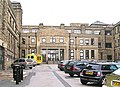
 Bradford Royal Infirmary - geograph.org.uk - 34416.jpg 640 × 480; 134 KB
-
 Buxton Lane - Frizinghall Road - geograph.org.uk - 1365497.jpg 640 × 480; 262 KB
-
 Chunky FC - Keighley Road - geograph.org.uk - 1654621.jpg 539 × 640; 95 KB
-
 Conways florist - Keighley Road - geograph.org.uk - 1654601.jpg 393 × 640; 73 KB
-
 Emm Lane - Keighley Road - geograph.org.uk - 1042843.jpg 640 × 465; 246 KB
-
-
 Football Pitch - Gaisby Lane - geograph.org.uk - 643282.jpg 640 × 415; 41 KB
-
 Footpath - Ashfield Avenue - geograph.org.uk - 2653494.jpg 480 × 640; 118 KB
-
 Footpath - Ashfield Avenue - geograph.org.uk - 2653497.jpg 480 × 640; 100 KB
-

-
 Footpath - Keighley Road - geograph.org.uk - 1042848.jpg 480 × 640; 312 KB
-

-

-
 Frizinghall, from Gaisby Lane (7269618926).jpg 3,232 × 3,232; 8.16 MB
-
 Frizley Gardens - Frizinghall Road - geograph.org.uk - 1365528.jpg 640 × 480; 316 KB
-
 Garden Lane, Heaton - geograph.org.uk - 37344.jpg 640 × 480; 122 KB
-
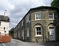
 Garden Terrace, Bradford - geograph.org.uk - 336569.jpg 640 × 496; 90 KB
-
 Hillside of Bolton Woods - geograph.org.uk - 1490961.jpg 640 × 480; 184 KB
-
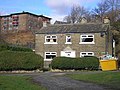 Incongruous house - geograph.org.uk - 709961.jpg 640 × 480; 110 KB
-
 Marriners Drive - Keighley Road - geograph.org.uk - 1042844.jpg 640 × 462; 238 KB
-
 Midland Terrace - Canal Road - geograph.org.uk - 643284.jpg 640 × 437; 34 KB
-
 Orlandos Ristorante - Keighley Road - geograph.org.uk - 1654605.jpg 640 × 605; 117 KB
-
 Park Grove - Buxton Lane - geograph.org.uk - 1365500.jpg 640 × 480; 281 KB
-
 Park Grove - Keighley Road - geograph.org.uk - 1050107.jpg 640 × 480; 324 KB
-
 Path leading towards Park Drive, Frizinghall - geograph.org.uk - 4960254.jpg 1,600 × 1,065; 735 KB
-
 Path leading towards Park Drive, Frizinghall - geograph.org.uk - 4960265.jpg 1,600 × 1,065; 915 KB
-
 Pizza Cottage - Bradford Road - geograph.org.uk - 1654679.jpg 313 × 640; 66 KB
-
 Rydal Avenue - Frizinghall Road - geograph.org.uk - 1365526.jpg 640 × 480; 266 KB
-

-
 South Road - Frizinghall Road - geograph.org.uk - 1365511.jpg 640 × 480; 272 KB
-

-
 St Mary's Road - North Park Road - geograph.org.uk - 1071030.jpg 640 × 465; 265 KB
-
 Stylo Hair Studio - Keighley Road - geograph.org.uk - 1654626.jpg 366 × 640; 74 KB
-
 Swan Hill - off Frizinghall Road - geograph.org.uk - 1365520.jpg 640 × 502; 242 KB
-
 The Park, Keighley Road, Bradford - geograph.org.uk - 718830.jpg 640 × 480; 206 KB
-
 Flower Haven - Haworth Road - geograph.org.uk - 643012.jpg 640 × 387; 79 KB
-

-
 Haworth Road Health Centre - geograph.org.uk - 643002.jpg 640 × 340; 67 KB


.jpg)


