Category:Froyle
village in Hampshire, England  | |||||
| Upload media | |||||
| Instance of | |||||
|---|---|---|---|---|---|
| Location | East Hampshire, Hampshire, South East England, England | ||||
 | |||||
English: Froyle, or to be more accurate, Upper and Lower Froyle, is a village and civil parish in the East Hampshire district of Hampshire, England. It is 3.6 miles (5.8 km) northeast of Alton, just off the A31 road.
Subcategories
This category has the following 3 subcategories, out of 3 total.
Media in category "Froyle"
The following 200 files are in this category, out of 254 total.
(previous page) (next page)-
 Neale(1818) p2.066 - Froyle Place, Hampshire.jpg 1,840 × 1,183; 522 KB
-
 A 31 near Upper Froyle - geograph.org.uk - 2245936.jpg 800 × 600; 104 KB
-
 A colourful lane bank - geograph.org.uk - 4573047.jpg 640 × 480; 155 KB
-
 A flowery lane bank - geograph.org.uk - 4573050.jpg 640 × 480; 170 KB
-
 A rise in Well Lane going south - geograph.org.uk - 2313753.jpg 600 × 800; 136 KB
-
 A31 approaching Alton - geograph.org.uk - 630407.jpg 640 × 477; 113 KB
-

-
 Bales and Barn - geograph.org.uk - 2349266.jpg 2,560 × 1,920; 1.83 MB
-
 Barn along footpath near Upper Froyle - geograph.org.uk - 2285617.jpg 800 × 600; 102 KB
-
 Barn Near Upper Froyle - geograph.org.uk - 2349257.jpg 2,560 × 1,920; 1.74 MB
-
 Bend in a lane - geograph.org.uk - 1978466.jpg 640 × 480; 73 KB
-

-
 Blocked path to bus stop on A31 - geograph.org.uk - 4574827.jpg 640 × 480; 118 KB
-
 Bluebells in Spollycombe Copse - geograph.org.uk - 2349217.jpg 2,560 × 1,920; 1.59 MB
-
 Blunden's House beside Gid Lane - geograph.org.uk - 4071285.jpg 3,648 × 2,736; 2.39 MB
-
 Bridleway and road junction near Well - geograph.org.uk - 2313736.jpg 800 × 600; 150 KB
-
 Bridleway Below Holybourne Down - geograph.org.uk - 2349168.jpg 2,560 × 1,920; 1.75 MB
-
 Bridleway east off Well Lane - geograph.org.uk - 2313746.jpg 600 × 800; 253 KB
-
 Bridleway going west to Well Lane - geograph.org.uk - 2313726.jpg 800 × 600; 254 KB
-
 Bridleway reaches road at Gravelly Wood - geograph.org.uk - 2312284.jpg 800 × 600; 130 KB
-
 Brockham Hill Lane - geograph.org.uk - 2285605.jpg 600 × 800; 142 KB
-
 Buildings at Crest Hill Farm - geograph.org.uk - 2313770.jpg 800 × 600; 117 KB
-
 Byway by the cemetery at Upper Froyle - geograph.org.uk - 2245905.jpg 800 × 600; 172 KB
-
 Byway near Upper Froyle (1) - geograph.org.uk - 2285725.jpg 800 × 600; 205 KB
-
 Byway near Upper Froyle (2) - geograph.org.uk - 2285730.jpg 600 × 800; 160 KB
-
 Byway to Old Odiham Road - geograph.org.uk - 4018942.jpg 640 × 480; 207 KB
-
 Carved wooden seat at Round Wood - geograph.org.uk - 5555595.jpg 4,608 × 3,456; 6.39 MB
-
 Cemetery steps, Upper Froyle - geograph.org.uk - 4573018.jpg 640 × 480; 167 KB
-
 Church of St Mary of the Assumption - geograph.org.uk - 4071231.jpg 3,648 × 2,736; 3.71 MB
-
 Coldfrey Farm - geograph.org.uk - 3479265.jpg 640 × 427; 95 KB
-
 Coldrey Farm - geograph.org.uk - 3479269.jpg 640 × 427; 91 KB
-
 College Farm - Upper Froyle - geograph.org.uk - 4900670.jpg 3,264 × 1,840; 1.65 MB
-
 Conservation Walk at Yarnhams Farm - geograph.org.uk - 2245574.jpg 600 × 800; 117 KB
-
 Cool Dude - geograph.org.uk - 2349330.jpg 2,560 × 1,920; 1.76 MB
-
 Country road near Lower Froyle - geograph.org.uk - 2245580.jpg 800 × 600; 105 KB
-
 Countryside, Froyle - geograph.org.uk - 2223345.jpg 640 × 480; 131 KB
-
 Derelict barn near Spollycombe Copse - geograph.org.uk - 2285636.jpg 800 × 600; 126 KB
-
 Descent to the railway - geograph.org.uk - 630345.jpg 640 × 469; 102 KB
-
 Downland by Spollycombe Copse - geograph.org.uk - 2349237.jpg 2,560 × 1,920; 1.87 MB
-
 Downland by Upper Froyle - geograph.org.uk - 2349063.jpg 2,560 × 1,920; 2.01 MB
-
 Downland Footpath - geograph.org.uk - 2349079.jpg 2,560 × 1,920; 1.71 MB
-
 Downland Near Alton - geograph.org.uk - 2349198.jpg 2,560 × 1,920; 1.81 MB
-
 Downland North of Holybourne - geograph.org.uk - 2431030.jpg 2,560 × 1,920; 2.04 MB
-
 Downland West of Upper Froyle - geograph.org.uk - 2349319.jpg 2,560 × 1,920; 1.73 MB
-
 Downs west of Upper Froyle - geograph.org.uk - 2349273.jpg 2,560 × 1,920; 1.7 MB
-
 Driveway on Dippenhall Road, Well - geograph.org.uk - 5250175.jpg 2,048 × 1,536; 1.59 MB
-
 Driveway to Isnage Farm - geograph.org.uk - 2313662.jpg 800 × 600; 169 KB
-
 Dwellings on Brockham Hill Lane - geograph.org.uk - 2285601.jpg 800 × 600; 103 KB
-
 Eastern edge of Spollycombe Copse - geograph.org.uk - 2285631.jpg 800 × 600; 157 KB
-
 End of driveway off Gid Lane - geograph.org.uk - 2285740.jpg 800 × 600; 158 KB
-
 Entering Spollycombe Copse - geograph.org.uk - 2349208.jpg 2,560 × 1,920; 1.77 MB
-
 Entrance at Crest Hill Farm - geograph.org.uk - 2313765.jpg 600 × 800; 101 KB
-
 Entrance to cemetery at Upper Froyle - geograph.org.uk - 2245902.jpg 800 × 600; 188 KB
-
 Entrance to field near Lower Froyle - geograph.org.uk - 4179599.jpg 640 × 427; 101 KB
-
 Estate houses at Coldrey - geograph.org.uk - 2316835.jpg 2,272 × 1,704; 2.41 MB
-
 Farm buildings, Froyle - geograph.org.uk - 2123832.jpg 640 × 480; 112 KB
-
 Farm track from Isnage Farm - geograph.org.uk - 2313651.jpg 800 × 600; 146 KB
-
 Farmland near Swaines Hill - geograph.org.uk - 3035272.jpg 2,592 × 1,944; 1.3 MB
-

-
 Farmland, Bentley - geograph.org.uk - 2123846.jpg 640 × 480; 125 KB
-
 Farmland, Froyle - geograph.org.uk - 2122869.jpg 640 × 480; 153 KB
-
 Farmland, Froyle - geograph.org.uk - 2122910.jpg 640 × 480; 154 KB
-
 Farmland, Froyle - geograph.org.uk - 2122917.jpg 640 × 480; 144 KB
-
 Farmland, Froyle - geograph.org.uk - 2123003.jpg 640 × 480; 137 KB
-
 Farmland, Froyle - geograph.org.uk - 2123717.jpg 640 × 480; 136 KB
-
 Farmland, Froyle - geograph.org.uk - 2123745.jpg 640 × 480; 131 KB
-
 Farmland, Froyle - geograph.org.uk - 2123753.jpg 640 × 480; 145 KB
-
 Farmland, Froyle - geograph.org.uk - 2123756.jpg 640 × 480; 145 KB
-
 Farmland, Froyle - geograph.org.uk - 2123855.jpg 640 × 480; 134 KB
-
 Farmland, Froyle - geograph.org.uk - 2123862.jpg 640 × 480; 159 KB
-
 Farmland, Froyle - geograph.org.uk - 2123903.jpg 640 × 480; 149 KB
-
 Farmland, Froyle - geograph.org.uk - 2123908.jpg 640 × 480; 123 KB
-
 Fern Cottage - geograph.org.uk - 2348974.jpg 2,560 × 1,920; 1.77 MB
-
 Fern Cottage, Upper Froyle.jpg 2,816 × 2,112; 1.46 MB
-
 Field by Great Wood - geograph.org.uk - 4572992.jpg 640 × 480; 142 KB
-

-
 Field near Copse Hill Farm - geograph.org.uk - 3479300.jpg 640 × 427; 116 KB
-
 Field near Gravelly Wood - geograph.org.uk - 3479247.jpg 640 × 427; 93 KB
-
 Field of oats by Gaston Copse - geograph.org.uk - 4573005.jpg 640 × 480; 121 KB
-
 Fields and flowers south west of Upper Froyle - geograph.org.uk - 5555596.jpg 4,608 × 3,456; 5.81 MB
-
 Fields and Great Wood - geograph.org.uk - 1978340.jpg 800 × 586; 102 KB
-
 Fields at Upper Froyle - geograph.org.uk - 5900194.jpg 5,184 × 3,456; 3.56 MB
-
 Fields at Upper Froyle - geograph.org.uk - 5900195.jpg 5,184 × 3,456; 3.27 MB
-
 Fields at Upper Froyle - geograph.org.uk - 5900203.jpg 5,184 × 3,456; 3.32 MB
-
 Fields by Dippenhall Road - geograph.org.uk - 5032965.jpg 2,048 × 1,536; 1.52 MB
-
 Fields near Upper Froyle - geograph.org.uk - 4900680.jpg 3,264 × 1,840; 1.94 MB
-
 Fields spoilt by pylons - geograph.org.uk - 98762.jpg 640 × 480; 80 KB
-
 Fields with Pylon - geograph.org.uk - 4900691.jpg 3,264 × 1,840; 1.89 MB
-

-
 Flowering Rapeseed Crop - geograph.org.uk - 2349053.jpg 2,560 × 1,920; 1.84 MB
-
 Footpath Into Upper Froyle - geograph.org.uk - 2349310.jpg 2,560 × 1,920; 1.85 MB
-
 Footpath near Upper Froyle - geograph.org.uk - 2245900.jpg 600 × 800; 144 KB
-
 Footpath off Gid Lane - geograph.org.uk - 2285744.jpg 800 × 600; 104 KB
-
 Footpath reaches road in Lower Froyle - geograph.org.uk - 2245542.jpg 600 × 800; 132 KB
-

-
 Footpath to Holybourne Down - geograph.org.uk - 2349175.jpg 2,560 × 1,920; 1.76 MB
-
 Forbidding gates to east of Well Lane - geograph.org.uk - 4071405.jpg 3,648 × 2,736; 3.85 MB
-
 Froyle House - geograph.org.uk - 2348657.jpg 2,560 × 1,920; 1.71 MB
-
 Froyle Mill farm - geograph.org.uk - 630422.jpg 640 × 476; 93 KB
-
 Froyle Mill farm - geograph.org.uk - 630432.jpg 640 × 477; 104 KB
-
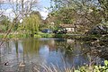
 Froyle Park Pond - geograph.org.uk - 5560553.jpg 4,608 × 3,456; 4.1 MB
-
 Froyle pressure reducing station - geograph.org.uk - 630400.jpg 640 × 477; 96 KB
-
 Froyle Primary School, Upper Froyle (May 2021).JPG 3,000 × 2,000; 1.12 MB
-
 Froyle Service Reservoir - geograph.org.uk - 4573036.jpg 640 × 480; 192 KB
-
 Gate at bottom of drive to Isnage Farm - geograph.org.uk - 2313649.jpg 800 × 600; 166 KB
-
 Gateway into High Wood - geograph.org.uk - 2313760.jpg 600 × 800; 241 KB
-
 Gid Lane - geograph.org.uk - 3479313.jpg 640 × 427; 152 KB
-
 Gothic Cottage, Upper Froyle.jpg 2,816 × 2,112; 1.44 MB
-
 Graves in Upper Froyle churchyard - geograph.org.uk - 2245917.jpg 800 × 794; 206 KB
-
 Herdwick sheep - geograph.org.uk - 630410.jpg 640 × 477; 83 KB
-
 High Wire Act - geograph.org.uk - 2349284.jpg 2,560 × 1,920; 1.73 MB
-
 Highway Cottages, Lower Froyle - geograph.org.uk - 4574763.jpg 640 × 480; 129 KB
-
 Hodges, Froyle, Hampshire - geograph.org.uk - 1369539.jpg 640 × 480; 113 KB
-
 Holybourne Down - geograph.org.uk - 2349187.jpg 2,560 × 1,920; 1.88 MB
-
 Holybourne Down, Froyle - geograph.org.uk - 2122905.jpg 640 × 480; 124 KB
-
 House in Lower Froyle - geograph.org.uk - 2245536.jpg 800 × 600; 163 KB
-
 Husseys Lane - geograph.org.uk - 4180636.jpg 640 × 480; 497 KB
-
 Husseys Lane at the junction of Dippenhall Road - geograph.org.uk - 5032970.jpg 2,022 × 1,502; 1.06 MB
-
 Industrial Past, Upper Froyle - geograph.org.uk - 2348650.jpg 2,560 × 1,920; 1.74 MB
-
 Isnage Farm seen from road - geograph.org.uk - 2313647.jpg 800 × 600; 110 KB
-
 Joining the A31, Upper Froyle - geograph.org.uk - 2955047.jpg 1,600 × 1,200; 585 KB
-
 Junction and fields near Lower Froyle - geograph.org.uk - 3035263.jpg 2,592 × 1,944; 1.22 MB
-
 Lane beside Ledgefield Plantation - geograph.org.uk - 5742454.jpg 640 × 427; 140 KB
-
 Lane by Gravelly Wood - geograph.org.uk - 4180576.jpg 640 × 480; 473 KB
-
 Lane into Lower Froyle - geograph.org.uk - 3479298.jpg 640 × 427; 126 KB
-
 Lane near Isnage Farm - geograph.org.uk - 3479261.jpg 427 × 640; 147 KB
-
 Lane near Isnage Farm - geograph.org.uk - 3479262.jpg 640 × 427; 106 KB
-
 Lane near Sutton Common - geograph.org.uk - 4179586.jpg 640 × 427; 143 KB
-
 Lane near Upper Froyle - geograph.org.uk - 5742450.jpg 640 × 427; 121 KB
-
 Lane near Yarnhams Cottages - geograph.org.uk - 4573043.jpg 640 × 480; 191 KB
-
 Lane past Brocas Farm - geograph.org.uk - 4180613.jpg 640 × 427; 132 KB
-
 Lane towards Isnage Farm - geograph.org.uk - 3479254.jpg 640 × 427; 160 KB
-

-
 Log Pile at Spollycombe Copse - geograph.org.uk - 2349228.jpg 2,560 × 1,920; 1.72 MB
-
 Logpiles by Spollycombe Copse - geograph.org.uk - 2349221.jpg 2,560 × 1,920; 1.77 MB
-
 Long Barlands - geograph.org.uk - 3479303.jpg 640 × 427; 104 KB
-
-

-
 Lower Froyle - geograph.org.uk - 4479.jpg 640 × 427; 260 KB
-
 Lower Froyle - geograph.org.uk - 4481.jpg 640 × 427; 320 KB
-
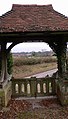 Lych gate at Upper Froyle cemetery - geograph.org.uk - 2245907.jpg 457 × 800; 104 KB
-
 Manor House, Froyle - geograph.org.uk - 2349339.jpg 2,560 × 1,920; 1.77 MB
-
 Masts near Froyle - geograph.org.uk - 2245704.jpg 800 × 600; 129 KB
-
 Minor crossroads near Froyle - geograph.org.uk - 2245598.jpg 800 × 600; 163 KB
-
 Narrow Hampshire lane - geograph.org.uk - 1978452.jpg 640 × 447; 47 KB
-
 New Rural Houses - geograph.org.uk - 4900692.jpg 3,264 × 1,840; 2.54 MB
-
 Old School in Upper Froyle - geograph.org.uk - 2348997.jpg 2,560 × 1,920; 1.81 MB
-
 Old Treloar School - geograph.org.uk - 4900674.jpg 3,264 × 1,840; 2.2 MB
-
 Old Treloar School Site Redevelopment - geograph.org.uk - 4900671.jpg 3,264 × 1,840; 1.81 MB
-
 Organ pipes in Upper Froyle church - geograph.org.uk - 2245929.jpg 800 × 600; 79 KB
-

-
 Path beside Row Wood - geograph.org.uk - 5878571.jpg 1,600 × 1,200; 1.08 MB
-
 Path beside Upper Froyle cemetery - geograph.org.uk - 5742444.jpg 640 × 427; 107 KB
-
 Path by Little Down Copse - geograph.org.uk - 5878561.jpg 1,600 × 1,200; 1.11 MB
-
 Path near Rawlings Farm - geograph.org.uk - 5878573.jpg 1,600 × 1,200; 1.09 MB
-

-
 Polite notice for walkers - geograph.org.uk - 2285616.jpg 800 × 600; 163 KB
-
 Pond at Lower Froyle - geograph.org.uk - 4179595.jpg 640 × 427; 122 KB
-
 Pond at Lower Froyle - geograph.org.uk - 4179597.jpg 640 × 427; 94 KB
-
 Power to the People - geograph.org.uk - 2349296.jpg 2,560 × 1,920; 1.9 MB
-
 Private woodlands north west of Froyle - geograph.org.uk - 2245547.jpg 600 × 800; 202 KB
-
 Puddle in a field near to Coldfrey Farm - geograph.org.uk - 5560569.jpg 4,608 × 3,456; 3.53 MB
-
 Pylon in a Field - geograph.org.uk - 2349246.jpg 2,560 × 1,920; 1.85 MB
-
 Railway line south of Upper Froyle - geograph.org.uk - 2245935.jpg 600 × 800; 112 KB
-
 Reservoir at Upper Froyle - geograph.org.uk - 2349031.jpg 2,560 × 1,920; 1.76 MB
-
 Reservoir in Upper Froyle - geograph.org.uk - 2349044.jpg 2,560 × 1,920; 1.83 MB
-
 River Wey near Froyle Mill - geograph.org.uk - 4574925.jpg 640 × 480; 161 KB
-
 Road junction, Upper Froyle - geograph.org.uk - 5555600.jpg 4,608 × 3,456; 3.64 MB
-
 Road leading north east, Upper Froyle - geograph.org.uk - 5560550.jpg 4,608 × 3,456; 5.02 MB
-
 Road to A31 - geograph.org.uk - 3479316.jpg 640 × 427; 155 KB
-

-
 Round Wood - geograph.org.uk - 2316831.jpg 2,272 × 1,704; 3.75 MB
-
 Row Wood - geograph.org.uk - 2431054.jpg 2,560 × 1,920; 2.18 MB
-
 Saint Swithun's Way - geograph.org.uk - 4900685.jpg 3,264 × 1,840; 2.07 MB
-
 Saint Swithun's Way - Near Upper Froyle Village - geograph.org.uk - 4900665.jpg 3,264 × 1,840; 2.21 MB
-
 Saint Swithun's Way - Near Upper Froyle Village - geograph.org.uk - 4900667.jpg 3,264 × 1,840; 2.08 MB
-
 Saint Swithun's Way - Near Upper Froyle Village - geograph.org.uk - 4900676.jpg 3,264 × 1,840; 3.15 MB
-
 Saintbury Hill Crossroads - geograph.org.uk - 4071308.jpg 3,648 × 2,736; 1.69 MB
-
 Sheep Farm - geograph.org.uk - 4900683.jpg 3,264 × 1,840; 2.48 MB
-
 Shelter Belt - geograph.org.uk - 2348644.jpg 2,560 × 1,920; 1.89 MB
-
 Small building, Golden Pot Radio Relay - geograph.org.uk - 4018929.jpg 640 × 480; 189 KB
-

-
 St Swithun's Way - geograph.org.uk - 2349073.jpg 2,560 × 1,920; 1.74 MB
-
 St Swithun’s Way signs, Upper Froyle - geograph.org.uk - 5555598.jpg 4,608 × 3,456; 4.37 MB
-

-

-
 Straw bales in a field off Gid Lane - geograph.org.uk - 5560561.jpg 4,608 × 3,456; 5.28 MB
-
 T-junction west of Sylvester's Farm - geograph.org.uk - 4071384.jpg 3,648 × 2,736; 2.24 MB
-
 Thatched cottage in Lower Froyle - geograph.org.uk - 2313783.jpg 800 × 600; 120 KB
-
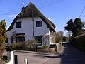
 Thatched house - geograph.org.uk - 2316834.jpg 2,272 × 1,704; 2.16 MB
-
 The A31 near Upper Froyle (1) - geograph.org.uk - 2285770.jpg 800 × 667; 168 KB
-
 The A31 near Upper Froyle (2) - geograph.org.uk - 2285775.jpg 800 × 600; 180 KB
-
 The A31, Lower Froyle - geograph.org.uk - 5044184.jpg 2,213 × 1,658; 1.07 MB
-
 The A31, Upper Froyle - geograph.org.uk - 5022272.jpg 2,304 × 1,728; 809 KB
-
 The A31, Upper Froyle - geograph.org.uk - 5022273.jpg 2,304 × 1,728; 826 KB
-
 The A31, Upper Froyle - geograph.org.uk - 5044179.jpg 2,151 × 1,613; 1.2 MB
-
 The A31, Upper Froyle - geograph.org.uk - 5044180.jpg 2,304 × 1,728; 821 KB
-
 The A31, Upper Froyle - geograph.org.uk - 5044181.jpg 2,304 × 1,728; 803 KB
-
 The Anchor Inn - Lower Froyle - geograph.org.uk - 4900689.jpg 3,264 × 1,840; 2.18 MB
-
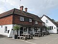 The Anchor pub near to Lower Froyle - geograph.org.uk - 5560564.jpg 4,608 × 3,456; 3.42 MB
_p2.066_-_Froyle_Place,_Hampshire.jpg)


_-_geograph.org.uk_-_2285725.jpg)
_-_geograph.org.uk_-_2285730.jpg)


.JPG)


_-_geograph.org.uk_-_2285770.jpg)
_-_geograph.org.uk_-_2285775.jpg)


