Category:Fulford, North Yorkshire
village in North Yorkshire, United Kingdom  | |||||
| Upload media | |||||
| Instance of | |||||
|---|---|---|---|---|---|
| Location | City of York, North Yorkshire, Yorkshire and the Humber, England | ||||
| Population |
| ||||
| Said to be the same as | Fulford (Wikimedia duplicated page, civil parish) | ||||
| official website | |||||
 | |||||
English: Fulford is an historic village and civil parish on the outskirts of York, England. Situated to the south of the city, on the east bank of the River Ouse, it was the site of the 11th century Battle of Fulford. Present-day Fulford is a leafy suburb which is home to many who work at the nearby University of York.
Subcategories
This category has the following 17 subcategories, out of 17 total.
B
C
D
- Designer Outlet, York (23 F)
F
- Fields in Fulford CP (89 F)
- Fulford Cemetery (5 F)
- Fulford Cross (4 F)
- Fulford Ings (43 F)
G
- Germany Beck (15 F)
H
L
M
P
- Public footpaths in Fulford CP (63 F)
S
Y
- York Motor Yacht Club (5 F)
Media in category "Fulford, North Yorkshire"
The following 39 files are in this category, out of 39 total.
-
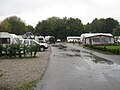 Caravan site - geograph.org.uk - 4741048.jpg 640 × 480; 75 KB
-
 Caravan Site on Mitchel's Lane, Fulford - geograph.org.uk - 4097812.jpg 1,600 × 1,064; 495 KB
-
 Connaught Court - geograph.org.uk - 255902.jpg 640 × 480; 135 KB
-
 Connaught Court - geograph.org.uk - 359981.jpg 640 × 480; 98 KB
-
 Construction at Germany Beck - geograph.org.uk - 6475269.jpg 1,024 × 683; 525 KB
-
 Cruisers moored on the River Ouse - geograph.org.uk - 3116284.jpg 640 × 480; 82 KB
-
 Cyclepath near Broadway - geograph.org.uk - 2182894.jpg 640 × 480; 209 KB
-
 Cycleway leading to Fulford, York - geograph.org.uk - 4097782.jpg 1,600 × 1,064; 716 KB
-

-
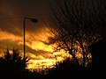 Evening sky at Fulfordgate - panoramio.jpg 2,816 × 2,120; 1.5 MB
-
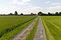
 Farm Track off Forest Lane - geograph.org.uk - 4097936.jpg 1,600 × 1,064; 783 KB
-
 Fishing the Ouse - geograph.org.uk - 1512244.jpg 640 × 480; 111 KB
-
 Fulford MF - geograph.org.uk - 2176532.jpg 480 × 640; 181 KB
-
 Fulford road sign 2011.jpg 2,592 × 1,944; 1.74 MB
-
 Landing Lane, York - panoramio.jpg 2,816 × 2,120; 1.5 MB
-
 Lingcroft Lane approaching Acres House - geograph.org.uk - 5783196.jpg 1,024 × 683; 243 KB
-
 Love Lane, Fulford - geograph.org.uk - 5498003.jpg 1,600 × 1,065; 920 KB
-
 Moon over Fulford MF - geograph.org.uk - 4454279.jpg 640 × 428; 46 KB
-
 Ordnance Survey Cut Mark - geograph.org.uk - 4821610.jpg 4,000 × 3,000; 4.62 MB
-
 Parkland path, York - geograph.org.uk - 4700464.jpg 464 × 640; 518 KB
-
 Path to Broadway West - geograph.org.uk - 4454274.jpg 640 × 428; 60 KB
-
 Path to the river - geograph.org.uk - 3850022.jpg 640 × 480; 164 KB
-
 Path towards Fulford - geograph.org.uk - 5497985.jpg 1,600 × 1,065; 1.06 MB
-
 Path towards Fulford - geograph.org.uk - 5497990.jpg 1,600 × 1,065; 785 KB
-
 Radio masts - geograph.org.uk - 3850019.jpg 480 × 640; 70 KB
-
 RAF flypast - geograph.org.uk - 1434819.jpg 640 × 479; 52 KB
-
 Riverside Park - geograph.org.uk - 2375910.jpg 3,264 × 2,448; 2.41 MB
-
 Sign for Fulford - geograph.org.uk - 6474777.jpg 1,024 × 683; 585 KB
-
 Sluice on River Ouse - geograph.org.uk - 5617908.jpg 5,376 × 3,024; 2.52 MB
-
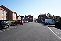
 St Oswald's Court, Fulford - geograph.org.uk - 5498080.jpg 1,600 × 1,065; 650 KB
-
 St Oswald's Court, Fulford - geograph.org.uk - 5498084.jpg 1,600 × 1,065; 631 KB
-
 St Oswald's Court, Fulford - geograph.org.uk - 5498089.jpg 1,600 × 1,065; 709 KB
-

-
 Sunset behind St. Oswalds Church, Fulford, York.jpg 1,280 × 960; 97 KB
-
 Track leading to Fulford Ings - geograph.org.uk - 5498056.jpg 1,600 × 1,065; 718 KB
-
 Works access off the B1222 - geograph.org.uk - 2648514.jpg 1,600 × 1,200; 362 KB
-
 York - Nunthorpe and Fulford - geograph.org.uk - 105331.jpg 640 × 480; 124 KB
-
 YORYM 2019 51-1.jpg 3,874 × 1,910; 359 KB
-
 YORYM 2019 51-30.jpg 4,128 × 2,122; 463 KB


