Category:Góra Strękowa (hill)
| Object location | | View all coordinates using: OpenStreetMap |
|---|
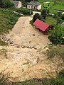
Polski: Góra Strękowa — polodowcowe wzniesienie o wysokości 126,9 m npm we wsi o tej samej nazwie
English: Góra Strękowa — post-glacial hill with a height of 126.9 m above sea level at the village of the same name
Media in category "Góra Strękowa (hill)"
The following 7 files are in this category, out of 7 total.
-
 Gora Strekowa widok.jpg 6,000 × 4,000; 10.38 MB
-
 Podlaskie - Zawady - Góra Strękowa - Bunkier; Góra Strękowa - NE - pano 360°.jpg 18,956 × 2,411; 10.85 MB
-
 Podlaskie - Zawady - Góra Strękowa - Wzgórze - NE - rozlewisko Narwi - v-E.jpg 3,565 × 2,673; 1.68 MB
-
 Podlaskie - Zawady - Góra Strękowa - wzniesienie - SE - podnóże - v-NW.JPG 3,648 × 2,736; 2.66 MB
-
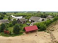 Podlaskie - Zawady - Góra Strękowa - wzniesienie - SE - rzut na wieś - v-E.JPG 3,487 × 2,615; 1.89 MB
-
 Podlaskie - Zawady - Góra Strękowa - wzniesienie - SE - zbocze - v-S.JPG 2,615 × 3,487; 2.65 MB
-
 Podlaskie - Zawady - Góra Strękowa - wzniesienie - SE - zbocze;wieś - pano-S-NNW.jpg 12,703 × 2,703; 8.57 MB


