Category:Gare de La Forêt-du-Cranou
| Object location | | View all coordinates using: OpenStreetMap |
|---|
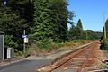
railway station in Hanvec, France _par_Cramos.JPG) | |||||
| Upload media | |||||
| Instance of | |||||
|---|---|---|---|---|---|
| Location | Hanvec, canton of Daoulas | ||||
| Owned by | |||||
| Date of official opening |
| ||||
| Date of official closure |
| ||||
| Elevation above sea level |
| ||||
| Connecting line | |||||
 | |||||
Media in category "Gare de La Forêt-du-Cranou"
The following 2 files are in this category, out of 2 total.
-
 Halte de La Forêt-du-Cranou (1) par Cramos.JPG 3,000 × 2,000; 2.54 MB
-
 Halte de La Forêt-du-Cranou (2) par Cramos.JPG 3,000 × 2,000; 2.83 MB
_par_Cramos.JPG)