<nowiki>Gare de Mouchard; 穆沙尔站; Mouchard; Gare de Mouchard; Mouchard railway station; Mouchard; 穆沙尔站; station Mouchard; stazione ferroviaria francese; estación de tren en Francia; vasútállomás Franciaországban; fervoja stacidomo en Francio; stasiun kereta api di Perancis; stacja kolejowa we Francji; залізнична станція у Франції; spoorwegstation in Frankrijk; estació de tren a França; 法国铁路车站; Bahnhof in Frankreich; gare ferroviaire française; railway station in Mouchard, France; محطة قطار في فرنسا; gară din Franța; traukinių stotis Prancūzijoje; gare de Mouchard</nowiki>


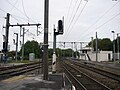 Bifurcation de la gare de Mouchard.JPG 2,560 × 1,920; 1.44 MB
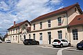 BV de Mouchard par Cramos.JPG 3,000 × 2,000; 1.78 MB
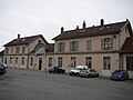 Gare de Mouchard.JPG 2,560 × 1,920; 1.25 MB
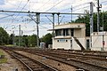 Poste de Mouchard par Cramos.JPG 3,000 × 2,000; 2.27 MB
 Quai de Mouchard direction Andelot.JPG 2,560 × 1,920; 1.46 MB
 TER desservant Mouchard.JPG 2,560 × 1,920; 1.45 MB
 Voies gare Mouchard - 39.jpg 1,136 × 852; 339 KB
 Z51593 à Mouchard par Cramos.JPG 3,000 × 2,000; 2.27 MB


