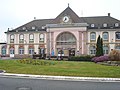
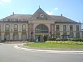
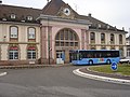
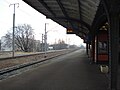
Category:Gare de Saint-Louis (Haut-Rhin)
| Object location | | View all coordinates using: OpenStreetMap |
|---|
railway station in France .JPG) | |||||
| Upload media | |||||
| Instance of | |||||
|---|---|---|---|---|---|
| Part of | |||||
| Location | Saint-Louis, Haut-Rhin, Grand Est, Metropolitan France, France | ||||
| Street address |
| ||||
| Architectural style | |||||
| Transport network | |||||
| Owned by | |||||
| Operator | |||||
| Date of official opening |
| ||||
| Elevation above sea level |
| ||||
| Connecting line |
| ||||
| Adjacent station | |||||
| Interchange station |
| ||||
 | |||||
Media in category "Gare de Saint-Louis (Haut-Rhin)"
The following 49 files are in this category, out of 49 total.
-
 Colibri SBB CFF FFS Regio S-Bahn Bâle Saint-Louis.jpg 1,600 × 1,200; 1.39 MB
-
 Distri sncf SL.jpg 2,057 × 1,385; 284 KB
-
 ETH-BIB Com FC26-0005-001 St-Louis Haut-Rhin xx0880.jpg 3,547 × 2,833; 10.08 MB
-
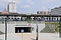
 Gare (Saint-Louis).jpg 5,472 × 2,600; 2.21 MB
-
 Gare - Arrière.jpg 2,144 × 1,424; 1.28 MB
-
 Gare - Avant.jpg 5,080 × 3,387; 2.8 MB
-
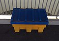 Gare de Saint-Louis (Haut-Rhin) - Bac de sel (fév 2019).jpg 3,304 × 2,347; 1.6 MB
-
 Gare de Saint-Louis (Haut-Rhin) - Distribus ligne 11 (fév 2019).jpg 4,032 × 3,016; 2.96 MB
-
 Gare de Saint-Louis (Haut-Rhin) - Escalator (fév 2019).jpg 2,889 × 3,763; 2.5 MB
-
 Gare de Saint-Louis (Haut-Rhin) - Panneau (fév 2019).jpg 3,961 × 1,854; 1.47 MB
-
 Gare de Saint-Louis (Haut-Rhin) - Passage souterrain (fév 2019).jpg 4,032 × 3,016; 2.44 MB
-
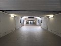 Gare de Saint-Louis (Haut-Rhin) - Passage souterrain 2 (fév 2019).jpg 4,032 × 3,016; 2.6 MB
-
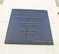
 Gare de Saint-Louis (Haut-Rhin) - Plaque incorporés de force 1939-1945 (fév 2019).jpg 2,929 × 2,622; 2.09 MB
-
 Gare de Saint-Louis (Haut-Rhin) - Plaque mémoire agents guerre 1939-1945 (fév 2019).jpg 2,747 × 3,763; 2.61 MB
-
 Gare de Saint-Louis (Haut-Rhin) - Plaque PRAF 1940-1945 (fév 2019).jpg 3,016 × 2,764; 1.9 MB
-
 Gare de Saint-Louis (Haut-Rhin) - Quai voie B (fév 2019).jpg 3,931 × 3,010; 2.83 MB
-
 Gare de Saint-Louis (Haut-Rhin) - Quais (fév 2019).jpg 4,032 × 3,016; 3.04 MB
-
 Gare de Saint-Louis (Haut-Rhin) - Toilettes et distributeur de préservatifs (fév 2019).jpg 2,913 × 3,121; 1.77 MB
-
 Gare de Saint-Louis (Haut-Rhin) - Tram ligne 3 Bâle (fév 2019).jpg 4,032 × 3,016; 3.55 MB
-
 Gare de Saint-Louis (Haut-Rhin) - Vue bâtiment depuis les quais (fév 2019).jpg 3,979 × 2,489; 2.43 MB
-
 Gare de Saint-Louis (Haut-Rhin).JPG 3,072 × 2,304; 2.8 MB
-
 Gare de Saint-Louis.JPG 1,632 × 1,224; 190 KB
-
 Gare et Bus Distribus.JPG 3,072 × 2,304; 2.9 MB
-
 Gare st-louis (quai bâle).jpg 3,072 × 2,304; 599 KB
-
 Mercedes-Benz Citaro (carénage BHNS) ligne 604 Distribus - 1.jpg 2,392 × 1,836; 1.89 MB
-
 Mercedes-Benz Citaro (carénage BHNS) ligne 604 Distribus - 2.jpg 2,869 × 2,172; 2.37 MB
-
 Mercedes-Benz Citaro (carénage BHNS) ligne 604 Distribus - 3.jpg 3,035 × 2,269; 2.36 MB
-
 Mercedes-Benz Citaro K Distribus navette EuroAirport.jpg 3,053 × 2,156; 3.87 MB
-
 Mercedes-Benz Citaro ligne 604 Distribus - 1.jpg 3,070 × 2,427; 2.71 MB
-
 Mercedes-Benz Citaro ligne 604 Distribus - 2.jpg 3,264 × 2,448; 3.42 MB
-
 Panier fraicheur gare de Saint-Louis.jpg 3,072 × 2,304; 2.75 MB
-
 Saint-Louis station 2017 1.jpg 3,648 × 2,736; 3.53 MB
-
 Saint-Louis station 2017 2.jpg 3,648 × 2,736; 3.29 MB
-
 Saint-Louis station 2017 3.jpg 3,648 × 2,736; 3.48 MB
-
 Saint-Louis station 2017 4.jpg 3,648 × 2,736; 4.83 MB
-
 Saint-Louis station 2018 1.jpg 3,648 × 2,736; 3.61 MB
-
 Saint-Louis station 2018 2.jpg 3,648 × 2,736; 3.32 MB
-
 Saint-Louis station 2023 1.jpg 5,472 × 3,648; 6.27 MB
-
 Saint-Louis station 2023 2.jpg 5,472 × 3,648; 6.28 MB
-
 Saint-Louis tram 2017 1.jpg 3,648 × 2,736; 3.91 MB
-
 Saint-Louis tram 2017 2.jpg 3,648 × 2,736; 4.1 MB
-
 Saint-Louis tram 2017 3.jpg 3,648 × 2,736; 4.42 MB
-
 Saint-Louis tram 2017 4.jpg 3,648 × 2,736; 4.65 MB
-
 Saint-Louis tram 2017 5.jpg 3,648 × 2,736; 4.03 MB
-
 Saint-Louis tram 2017 6.jpg 3,648 × 2,736; 4 MB
-
 Saint-Louis tram 2018 1.jpg 3,648 × 2,736; 3.59 MB
-
 Saint-Louis tram 2018 6.jpg 3,648 × 2,736; 3.27 MB
-
 Saint-Louis tram 2023 1.jpg 5,472 × 3,648; 5.87 MB
-
 TER 200, gare de Saint-Louis 2015.jpg 2,928 × 2,316; 3.15 MB


.jpg)


_-_Bac_de_sel_(f%C3%A9v_2019).jpg)
_-_Distribus_ligne_11_(f%C3%A9v_2019).jpg)
_-_Escalator_(f%C3%A9v_2019).jpg)
_-_Panneau_(f%C3%A9v_2019).jpg)
_-_Passage_souterrain_(f%C3%A9v_2019).jpg)
_-_Passage_souterrain_2_(f%C3%A9v_2019).jpg)
_-_Plaque_incorpor%C3%A9s_de_force_1939-1945_(f%C3%A9v_2019).jpg)
_-_Plaque_m%C3%A9moire_agents_guerre_1939-1945_(f%C3%A9v_2019).jpg)
_-_Plaque_PRAF_1940-1945_(f%C3%A9v_2019).jpg)
_-_Quai_voie_B_(f%C3%A9v_2019).jpg)
_-_Quais_(f%C3%A9v_2019).jpg)
_-_Toilettes_et_distributeur_de_pr%C3%A9servatifs_(f%C3%A9v_2019).jpg)
_-_Tram_ligne_3_B%C3%A2le_(f%C3%A9v_2019).jpg)
_-_Vue_b%C3%A2timent_depuis_les_quais_(f%C3%A9v_2019).jpg)


.jpg)
_ligne_604_Distribus_-_1.jpg)
_ligne_604_Distribus_-_2.jpg)
_ligne_604_Distribus_-_3.jpg)


