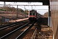
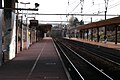
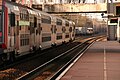
Category:Gare du Mée
| Object location | | View all coordinates using: OpenStreetMap |
|---|
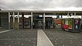
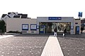
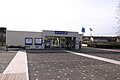
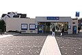
railway station in Le Mée-sur-Seine, France  | |||||
| Upload media | |||||
| Instance of |
| ||||
|---|---|---|---|---|---|
| Location | Le Mée-sur-Seine, Seine-et-Marne, Île-de-France, Metropolitan France, France | ||||
| Transport network | |||||
| Owned by | |||||
| Operator | |||||
| Date of official opening |
| ||||
| Elevation above sea level |
| ||||
| Connecting line | |||||
| Adjacent station | |||||
 | |||||
Media in category "Gare du Mée"
The following 50 files are in this category, out of 50 total.
-
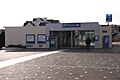
 Accès principal — gare du Mée.jpg 3,552 × 2,000; 2.09 MB
-
 Accès secondaire — gare du Mée.jpg 3,264 × 2,448; 2.26 MB
-
 BB 66000.1 — gare du Mée.jpg 3,264 × 2,448; 3.16 MB
-
 Gare de le Mee 1.jpg 800 × 531; 76 KB
-
 Gare de le Mee 2.jpg 800 × 531; 97 KB
-
 Gare du Mee IMG 0126.JPG 2,048 × 1,360; 1.65 MB
-
 Gare du Mee IMG 0129.JPG 2,048 × 1,360; 1.3 MB
-
 Gare du Mee IMG 0132.JPG 2,048 × 1,360; 1.77 MB
-
 Gare du Mee IMG 0136.JPG 2,048 × 1,360; 1.83 MB
-
 Gare du Mee IMG 0138.JPG 2,048 × 1,360; 2.1 MB
-
 Gare du Mee IMG 0147.JPG 2,048 × 1,360; 1.78 MB
-
 Gare du Mee IMG 0151.JPG 2,048 × 1,360; 1.71 MB
-
 Gare du Mee IMG 0153.JPG 2,048 × 1,360; 2.17 MB
-
 Gare du Mee IMG 0156.JPG 2,048 × 1,360; 1.81 MB
-
 Gare du Mee IMG 0161.JPG 2,048 × 1,360; 1.99 MB
-
 Gare du Mee IMG 0162.JPG 2,048 × 1,360; 1.96 MB
-
 Gare du Mee IMG 0165.JPG 2,048 × 1,360; 1.78 MB
-
 Gare du Mee IMG 0170.JPG 2,048 × 1,360; 1.86 MB
-
 Gare du Mee IMG 0171.JPG 2,048 × 1,360; 1.83 MB
-
 Gare du Mee IMG 0174.JPG 2,048 × 1,360; 2.06 MB
-
 Gare du Mee IMG 0177.JPG 2,048 × 1,360; 2.1 MB
-
 Gare du Mee IMG 0181.JPG 2,048 × 1,360; 2.02 MB
-
 Gare du Mee IMG 0184.JPG 2,048 × 1,360; 1.73 MB
-
 Gare du Mee IMG 0188.JPG 2,048 × 1,360; 1.96 MB
-
 Gare du Mee IMG 0191.JPG 2,048 × 1,360; 1.84 MB
-
 Gare du Mee IMG 0194.JPG 2,048 × 1,360; 1.91 MB
-
 Gare du Mee IMG 0195.JPG 2,048 × 1,360; 1.95 MB
-
 Gare du Mee IMG 0199.JPG 2,048 × 1,360; 2.07 MB
-
 Gare du Mee IMG 0202.JPG 2,048 × 1,360; 1.99 MB
-
 Gare du Mee IMG 0205.JPG 2,048 × 1,360; 2.09 MB
-
 Gare du Mee IMG 0208.JPG 2,048 × 1,360; 2.02 MB
-
 Gare du Mee IMG 0211.JPG 2,048 × 1,360; 2.12 MB
-
 Gare du Mee IMG 0213.JPG 2,048 × 1,360; 2.06 MB
-
 Gare du Mee IMG 0217.JPG 2,048 × 1,360; 2.05 MB
-
 Gare du Mee IMG 0219.JPG 2,048 × 1,360; 2.33 MB
-
 Gare du Mee IMG 0224.JPG 2,048 × 1,360; 2.1 MB
-
 Gare du Mee IMG 0225.JPG 2,048 × 1,360; 1.92 MB
-
 Gare du Mee IMG 0230.JPG 2,048 × 1,360; 2.11 MB
-
 Gare du Mee IMG 0231.JPG 2,048 × 1,360; 2.02 MB
-
 Gare du Mee IMG 0235.JPG 2,048 × 1,360; 2.07 MB
-
 Gare du Mee IMG 0242.JPG 2,048 × 1,360; 1.8 MB
-
 Gare du Mee IMG 0243.JPG 2,048 × 1,360; 2.01 MB
-
 Gare du Mee IMG 0246.JPG 2,048 × 1,360; 2.2 MB
-
 Gare du Mee IMG 0250.JPG 2,048 × 1,360; 1.88 MB
-
 Gare du Mee IMG 0252.JPG 2,048 × 1,360; 2.04 MB
-
 Gare du Mee IMG 0255.JPG 2,048 × 1,360; 1.93 MB
-
 Le Mée Gare.jpg 3,000 × 3,000; 3.03 MB
-
 Locotracteur TSO — gare du Mée.jpg 3,264 × 2,448; 2.2 MB
-
 Z 20500.1— gare du Mée.jpg 3,264 × 2,448; 3.03 MB
-
 Z 20500.2 — gare du Mée.jpg 3,264 × 2,448; 2.96 MB


