Category:Gargunnock
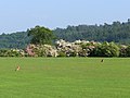
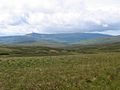
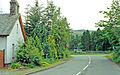
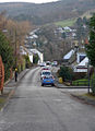
English: Gargunnock is a small village in the Stirling council area approximately seven miles west of Stirling, in Scotland. The 2001 census population was 944. It is situated on the south edge of the Carse of Stirling, at the feet of the Gargunnock Hills, part of the Campsie Fells. Gargunnock was formerly known as Gargowans and both its current and archaic name translate roughly to "oddly shaped hill" and seemingly refer to Kier Hill, an unusual knoll south of the village square and west of the kirkyard.
Simple English: Gargunnock is a small village in the Stirling council area approximately seven miles west of Stirling, in Scotland. The 2001 census population was 944.
village in Stirling, Scotland, UK  | |||||
| Upload media | |||||
| Instance of | |||||
|---|---|---|---|---|---|
| Location |
| ||||
| Population |
| ||||
| official website | |||||
 | |||||
Subcategories
This category has the following 4 subcategories, out of 4 total.
E
- Earlsburn No. 2 Reservoir (3 F)
G
- Gargunnock House (22 F)
- Gargunnock Parish Church (6 F)
H
- Hart Hill, Gargunnock (2 F)
Media in category "Gargunnock"
The following 122 files are in this category, out of 122 total.
-
 A pair of hares near Gargunnock - geograph.org.uk - 184256.jpg 640 × 478; 114 KB
-
 Crawtree Farm - geograph.org.uk - 507176.jpg 640 × 480; 89 KB
-
 Earl's Hill Transmitters - geograph.org.uk - 454004.jpg 640 × 494; 74 KB
-
 Earls Burn Bridge - geograph.org.uk - 453794.jpg 640 × 446; 78 KB
-
 Easter Cringate - geograph.org.uk - 452226.jpg 640 × 449; 110 KB
-
 Gargunnock and Campsie Fells. - geograph.org.uk - 9924.jpg 640 × 480; 66 KB
-
 Gargunnock Bridge - geograph.org.uk - 184246.jpg 640 × 478; 161 KB
-
 Gargunnock station site geograph-3556843-by-Ben-Brooksbank.jpg 2,388 × 1,492; 3.31 MB
-
 Gargunnock Village.jpg 640 × 480; 131 KB
-
 Maclagan - Keir of Gargunnock.png 849 × 613; 754 KB
-
 Meiklewood House - geograph.org.uk - 184249.jpg 640 × 478; 153 KB
-
 North East of Easter Cringate - geograph.org.uk - 453789.jpg 640 × 431; 72 KB
-
 Sheep pens - geograph.org.uk - 184166.jpg 640 × 480; 125 KB
-
 Solitary Fence Post - geograph.org.uk - 474373.jpg 640 × 479; 85 KB
-
 The Gargunnock Hills, Stirling Council area. View from the Kippen road.jpg 4,825 × 2,021; 1.42 MB
-
 Uphill Gargunnock - geograph.org.uk - 639606.jpg 463 × 640; 94 KB
-
 Walker's Rest - geograph.org.uk - 639610.jpg 640 × 480; 110 KB
-
 Above Black Craig - geograph.org.uk - 343867.jpg 640 × 480; 127 KB
-
 Above the Earl's Burn - geograph.org.uk - 1471563.jpg 640 × 480; 82 KB
-
 Arnieve - geograph.org.uk - 185338.jpg 640 × 478; 106 KB
-
 Attention - geograph.org.uk - 474387.jpg 547 × 640; 124 KB
-

-
 B8075, Kirk Lane - geograph.org.uk - 184262.jpg 640 × 478; 137 KB
-
 B8075, Kirk Lane - geograph.org.uk - 185336.jpg 640 × 478; 100 KB
-
 Back West towards Easter Cringate - geograph.org.uk - 453817.jpg 640 × 448; 67 KB
-
 Bannock Burn - geograph.org.uk - 180020.jpg 640 × 480; 115 KB
-
 Baston Burn valley - geograph.org.uk - 184836.jpg 640 × 478; 110 KB
-
 Below the Gargunnock Hills - geograph.org.uk - 366018.jpg 640 × 480; 147 KB
-
 Bield Farm - geograph.org.uk - 390507.jpg 640 × 480; 79 KB
-
 Birkenwood Farm - geograph.org.uk - 395033.jpg 640 × 480; 90 KB
-
 Black Craig - geograph.org.uk - 366003.jpg 640 × 480; 144 KB
-
 Blairdrummond Moss - geograph.org.uk - 185337.jpg 640 × 478; 117 KB
-
 Break in Touchadam Forest - geograph.org.uk - 474415.jpg 640 × 478; 55 KB
-
 Burnside Cottage - geograph.org.uk - 639608.jpg 640 × 480; 134 KB
-
 Cairnoch Hill trig - geograph.org.uk - 125454.jpg 640 × 480; 99 KB
-
-
 Cottages South of Birkenwood Farm - geograph.org.uk - 395042.jpg 640 × 480; 80 KB
-
 Craigbrock Burn - geograph.org.uk - 184852.jpg 640 × 478; 161 KB
-
 Cringate Law - geograph.org.uk - 343812.jpg 640 × 480; 154 KB
-
 Cut line, Garshelloch Woods. - geograph.org.uk - 9919.jpg 640 × 480; 103 KB
-
 Doocot , Touch Muir - geograph.org.uk - 9921.jpg 640 × 448; 89 KB
-
 Downie's Loup - geograph.org.uk - 184261.jpg 478 × 640; 210 KB
-
 Earl's Burn - geograph.org.uk - 343788.jpg 640 × 480; 163 KB
-
 Earl's Burn - geograph.org.uk - 343789.jpg 640 × 480; 194 KB
-
 Earl's Burn - geograph.org.uk - 343790.jpg 640 × 480; 201 KB
-
 Earl's Burn - geograph.org.uk - 343792.jpg 640 × 480; 179 KB
-
 Earls Burn Sheep - geograph.org.uk - 453807.jpg 640 × 444; 93 KB
-
 Earls Burn Waterfall and Pool - geograph.org.uk - 453798.jpg 640 × 447; 90 KB
-
 Earlsburn No. 1 Reservoir - geograph.org.uk - 184875.jpg 640 × 478; 132 KB
-
 Earlsburn No. 1 Reservoir - geograph.org.uk - 184883.jpg 640 × 478; 144 KB
-
 Earlsburn No. 1 Reservoir - geograph.org.uk - 184884.jpg 640 × 478; 120 KB
-
 Earlsburn No. 1 Reservoir - geograph.org.uk - 185381.jpg 640 × 478; 143 KB
-
 East to the Ochils - geograph.org.uk - 184169.jpg 640 × 480; 103 KB
-
 Farmland at Chalmerston - geograph.org.uk - 183803.jpg 640 × 478; 111 KB
-
 Farmland near Gargunnock - geograph.org.uk - 184243.jpg 478 × 640; 117 KB
-
 Farmland next to the Forth - geograph.org.uk - 185293.jpg 640 × 478; 160 KB
-
 Forest Edge, Touch Muir - geograph.org.uk - 184881.jpg 640 × 478; 141 KB
-
 Forest edge, Touch Muir - geograph.org.uk - 185380.jpg 478 × 640; 140 KB
-
 Forest, Touch - geograph.org.uk - 185384.jpg 640 × 478; 125 KB
-
 Forest, Touch Muir - geograph.org.uk - 184878.jpg 478 × 640; 135 KB
-
 Further West into the Forest - geograph.org.uk - 474394.jpg 640 × 487; 79 KB
-
 Gargunnock Burn - geograph.org.uk - 366036.jpg 640 × 480; 148 KB
-
 Gargunnock Burn - geograph.org.uk - 366046.jpg 640 × 480; 185 KB
-
 Gargunnock Burn Waterfall - geograph.org.uk - 81485.jpg 234 × 400; 46 KB
-
 Gargunnock Hills approaching Carleatheran - geograph.org.uk - 366012.jpg 640 × 480; 148 KB
-
 Hay-meadow, Coldoch - geograph.org.uk - 192729.jpg 478 × 640; 202 KB
-
 Hill road - geograph.org.uk - 180003.jpg 640 × 480; 81 KB
-
 Hill road - geograph.org.uk - 180017.jpg 640 × 480; 102 KB
-
 Kepdarroch - geograph.org.uk - 185341.jpg 640 × 478; 119 KB
-
 Knock O' Ronald - geograph.org.uk - 507178.jpg 640 × 480; 62 KB
-
 Mast on Earl's Hill - geograph.org.uk - 101660.jpg 640 × 480; 73 KB
-
 Moorland on Earl's Hill - geograph.org.uk - 101662.jpg 640 × 480; 100 KB
-
 Mosslaird - geograph.org.uk - 185301.jpg 640 × 478; 137 KB
-
 Nether Carse - geograph.org.uk - 191770.jpg 640 × 478; 102 KB
-
 North East from Touchadam Forest - geograph.org.uk - 474444.jpg 640 × 468; 51 KB
-
 North side of Cairnoch Hill - geograph.org.uk - 125456.jpg 640 × 480; 103 KB
-
 One of the Touch Reservoirs - geograph.org.uk - 184855.jpg 640 × 478; 130 KB
-
 One of the Touch Reservoirs - geograph.org.uk - 184859.jpg 640 × 478; 118 KB
-
 One of the Touch Reservoirs - geograph.org.uk - 184879.jpg 640 × 478; 112 KB
-
 One of the Touch Reservoirs - geograph.org.uk - 185378.jpg 640 × 478; 142 KB
-
 Pasture and mown meadow near Gargunnock - geograph.org.uk - 184321.jpg 640 × 478; 146 KB
-
 Road at Easter Cringate - geograph.org.uk - 180012.jpg 640 × 480; 96 KB
-
 Robertson Lane Farm - geograph.org.uk - 183808.jpg 640 × 478; 131 KB
-
 Rossburn Lane - geograph.org.uk - 183816.jpg 640 × 478; 113 KB
-
 Scout Hill trig - geograph.org.uk - 101656.jpg 640 × 480; 134 KB
-
 Shaw of Touch - geograph.org.uk - 183801.jpg 640 × 478; 129 KB
-
 Sheep and turbine, Hart Hill - geograph.org.uk - 343803.jpg 640 × 480; 85 KB
-
 Sheep in the winter - geograph.org.uk - 507199.jpg 640 × 427; 74 KB
-
 Shooting butt, Carleatheran - geograph.org.uk - 343871.jpg 640 × 480; 115 KB
-
 Sommer's Lane - geograph.org.uk - 183820.jpg 640 × 478; 153 KB
-
 South Coldoch - geograph.org.uk - 184266.jpg 640 × 478; 101 KB
-
 South from Touchadam Muir - geograph.org.uk - 474365.jpg 640 × 481; 45 KB
-
 South Woodlane and a curlew - geograph.org.uk - 184268.jpg 640 × 478; 151 KB
-
 T1, Earlsburn - geograph.org.uk - 343874.jpg 480 × 640; 62 KB
-
 T13 and T12, Cringate Law - geograph.org.uk - 343818.jpg 480 × 640; 86 KB
-
 T14, Cringate Law - geograph.org.uk - 343816.jpg 640 × 480; 86 KB
-
 The craggy slope of Gargunnock Hills - geograph.org.uk - 184259.jpg 640 × 478; 141 KB
-
 The Offers Farm - geograph.org.uk - 185339.jpg 640 × 478; 125 KB
-
 The River Forth - geograph.org.uk - 184253.jpg 640 × 478; 133 KB
-
 The River Forth - geograph.org.uk - 184265.jpg 478 × 640; 147 KB
-
 The River Forth - geograph.org.uk - 185342.jpg 640 × 478; 146 KB
-
 The River Forth - geograph.org.uk - 185348.jpg 640 × 478; 151 KB
-
 Touch Hills - geograph.org.uk - 184839.jpg 640 × 478; 134 KB
-
 Touch Muir - geograph.org.uk - 184877.jpg 640 × 478; 113 KB
-
 Touch Muir - geograph.org.uk - 185382.jpg 640 × 478; 147 KB
-
 Touch Muir - geograph.org.uk - 9920.jpg 640 × 480; 88 KB
-
 Touchadam Miniature Pond - geograph.org.uk - 474385.jpg 640 × 478; 110 KB
-
 Touchadam Muir Forestry track - geograph.org.uk - 474380.jpg 640 × 488; 69 KB
-
 Touchadam Quarried Stone - geograph.org.uk - 474391.jpg 640 × 480; 105 KB
-
 Track to Gargunnock Hills - geograph.org.uk - 366053.jpg 640 × 480; 139 KB
-
 Track to Knock-o-Ronald - geograph.org.uk - 366007.jpg 640 × 480; 120 KB
-
 Trap - geograph.org.uk - 9923.jpg 640 × 407; 65 KB
-
 Turbine and hut, Hart Hill - geograph.org.uk - 343805.jpg 480 × 640; 81 KB
-
 Turbines and a halo, Hart Hill - geograph.org.uk - 343775.jpg 640 × 480; 55 KB
-
 Turbines, Cringate Law - geograph.org.uk - 343822.jpg 480 × 640; 72 KB
-
 View from Carletheran - geograph.org.uk - 9925.jpg 640 × 407; 46 KB
-
 Waterfall, Gargunnock Burn - geograph.org.uk - 185349.jpg 478 × 640; 192 KB
-
 Waterfall, Touch Burn - geograph.org.uk - 185383.jpg 478 × 640; 141 KB
-
 Waterfall, Touch Glen - geograph.org.uk - 184843.jpg 478 × 640; 178 KB
-
 Who Shed I Had Too Much - geograph.org.uk - 455593.jpg 640 × 472; 128 KB
-
 Wind turbine, Earlsburn - geograph.org.uk - 343807.jpg 640 × 480; 82 KB
-
 Wind turbines, Hart Hill - geograph.org.uk - 343810.jpg 480 × 640; 63 KB


