Category:Garsdale, Cumbria

valley and civil parish in Cumbria, England, UK  | |||||
| Upload media | |||||
| Instance of | |||||
|---|---|---|---|---|---|
| Located in protected area | |||||
| Location |
| ||||
 | |||||
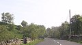
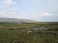
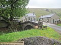
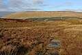
English: Garsdale is a civil parish occupying a narrow populated valley in Cumbria, England. It is on the western slopes of the Pennines, between Baugh Fell to the north, and Rise Hill to the south. The main hamlet, called “The Street” lies on the A684 road, six miles (9 km) east of Sedbergh, and ten miles (16km) west of Hawes. The other hamlet in Garsdale is Garsdale Head, also called Hawes Junction, the old name for Garsdale railway station, after the former Wensleydale branch on the famous Settle to Carlisle railway.
Subcategories
This category has the following 8 subcategories, out of 8 total.
B
D
- Dandra Garth (2 F)
- Dandry Mire viaduct (32 F)
E
- East Rackenthwaite (3 F)
G
H
J
R
- Rise Hill Tunnel (1 F)
Media in category "Garsdale, Cumbria"
The following 200 files are in this category, out of 629 total.
(previous page) (next page)-
 'Cairn' on Acraband, Aye Gill Pike - geograph.org.uk - 3473538.jpg 800 × 600; 161 KB
-
 'Clough View' beside A684 at Clough Bridge - geograph.org.uk - 3797218.jpg 1,024 × 683; 245 KB
-
 'The tale of Ruswarp' - geograph.org.uk - 2615989.jpg 960 × 721; 228 KB
-

-
 A feeder of Grisedale Beck - geograph.org.uk - 3670919.jpg 640 × 480; 108 KB
-
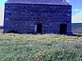
 A Grisedale barn - geograph.org.uk - 3370765.jpg 1,024 × 768; 184 KB
-

-
 A Pennine Journey at Flust - geograph.org.uk - 4370156.jpg 1,024 × 768; 160 KB
-
 A Pennine Journey below Grisedale Brow - geograph.org.uk - 4370162.jpg 1,024 × 768; 155 KB
-
-
 A stone bridge on Garsdale Common - geograph.org.uk - 3415176.jpg 1,024 × 684; 187 KB
-
 A West Riding railway hamlet - geograph.org.uk - 3370675.jpg 1,024 × 768; 153 KB
-
 A684 and northern parapet of Scar Foot Bridge - geograph.org.uk - 3577218.jpg 683 × 1,024; 318 KB
-
 A684 at 'Parringtons' - geograph.org.uk - 3576376.jpg 1,024 × 683; 164 KB
-
 A684 at Cross Thwaite - geograph.org.uk - 3577145.jpg 1,024 × 683; 206 KB
-
 A684 at Cross Thwaite - geograph.org.uk - 3587474.jpg 640 × 464; 53 KB
-
 A684 at Dandra Garth - geograph.org.uk - 4004952.jpg 640 × 379; 77 KB
-
 A684 at entrance to 'Aye Gill' - geograph.org.uk - 3576384.jpg 1,024 × 683; 200 KB
-
 A684 at entrance to Blades Farm - geograph.org.uk - 4004967.jpg 640 × 388; 150 KB
-
 A684 at entrance to lane for station - geograph.org.uk - 4004193.jpg 640 × 397; 42 KB
-
 A684 at Hard Ing - geograph.org.uk - 2360463.jpg 640 × 480; 102 KB
-
 A684 at Hard Ing - geograph.org.uk - 4004182.jpg 640 × 317; 29 KB
-
 A684 at Hard Ing Bridge - geograph.org.uk - 3128820.jpg 1,024 × 683; 195 KB
-
 A684 at Ingheads Bridge over Clough River - geograph.org.uk - 3795339.jpg 1,024 × 683; 235 KB
-
 A684 at Long House - geograph.org.uk - 3577171.jpg 1,024 × 683; 234 KB
-
 A684 at Low Scale bridge over the Clough River - geograph.org.uk - 3797116.jpg 1,024 × 683; 230 KB
-
 A684 at Mill Bridge - geograph.org.uk - 3795275.jpg 1,024 × 683; 249 KB
-
 A684 at Ray Gill - geograph.org.uk - 4003919.jpg 640 × 496; 129 KB
-
 A684 at Slack Cottage - geograph.org.uk - 3587489.jpg 640 × 481; 54 KB
-
 A684 at Street Chapel, Garsdale - geograph.org.uk - 2358987.jpg 640 × 480; 116 KB
-
 A684 at West Little Town - geograph.org.uk - 4003910.jpg 640 × 420; 81 KB
-
 A684 east of Dandra Garth - geograph.org.uk - 3587476.jpg 640 × 458; 105 KB
-
 A684 entering Garsdale 30 limit - geograph.org.uk - 4004777.jpg 640 × 410; 116 KB
-

-
 A684 Road past Garsdale Head - geograph.org.uk - 1962218.jpg 640 × 423; 58 KB
-

-

-
 A684 west through Garsdale - geograph.org.uk - 2960896.jpg 640 × 490; 69 KB
-
 Above Dandra Garth - geograph.org.uk - 754450.jpg 640 × 480; 108 KB
-
 Above Garsdale - geograph.org.uk - 754461.jpg 640 × 480; 84 KB
-
 Above Rawthey Gill, Baugh Fell - geograph.org.uk - 2218446.jpg 800 × 600; 182 KB
-
 Access to the forest - geograph.org.uk - 699718.jpg 640 × 480; 87 KB
-
 Across Grisedale - geograph.org.uk - 4168516.jpg 1,500 × 893; 1.14 MB
-
 Along the fence on White Birks Common - geograph.org.uk - 5799131.jpg 1,600 × 1,200; 551 KB
-
 Animal Snare - geograph.org.uk - 2381657.jpg 640 × 480; 151 KB
-
 Approaching Aye Gill Pike - geograph.org.uk - 3626521.jpg 1,600 × 1,200; 371 KB
-
 Approaching Bents Lathe - geograph.org.uk - 4512125.jpg 3,264 × 2,448; 2.08 MB
-
 Approaching Garsdale - geograph.org.uk - 5703056.jpg 640 × 470; 84 KB
-
 Approaching Garsdale station - geograph.org.uk - 2209901.jpg 640 × 417; 74 KB
-
 Approaching Garsdale station - geograph.org.uk - 2879716.jpg 3,072 × 2,304; 1.12 MB
-
 Approaching Grouse Hall - geograph.org.uk - 6019341.jpg 5,184 × 3,456; 5.88 MB
-
 Approaching Swarth Fell Pike from the southeast - geograph.org.uk - 5799136.jpg 1,600 × 1,200; 570 KB
-
 Approaching the former Hawes Junction - geograph.org.uk - 6274858.jpg 1,024 × 683; 137 KB
-
 Aye Gill on A684 - geograph.org.uk - 4004984.jpg 640 × 409; 96 KB
-
 Banks - geograph.org.uk - 418114.jpg 640 × 480; 133 KB
-
 Banks Bridge, Garsdale.jpg 1,600 × 1,200; 743 KB
-
 Barn at Flust - geograph.org.uk - 1924689.jpg 768 × 1,024; 210 KB
-
 Barn beside A684 at Potgill Holme - geograph.org.uk - 3575544.jpg 1,024 × 683; 189 KB
-
 Barn conversion beside the A684 at Whit Beck - geograph.org.uk - 3575586.jpg 1,024 × 683; 173 KB
-
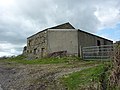
 Barn in Garsdale - geograph.org.uk - 2383969.jpg 640 × 480; 93 KB
-
 Barn in Grisedale - geograph.org.uk - 1926669.jpg 1,024 × 768; 213 KB
-
 Barn near Fea Fow - geograph.org.uk - 1922191.jpg 1,024 × 768; 215 KB
-
 Barn south of Moor Rigg - geograph.org.uk - 5799108.jpg 1,600 × 1,200; 417 KB
-
 Barn west of Bents Lathe - geograph.org.uk - 2358906.jpg 640 × 480; 185 KB
-
-
 Barn, Low House Farm, Garsdale.jpg 1,024 × 683; 301 KB
-
 Barn, West Little Town, Garsdale.jpg 1,024 × 683; 185 KB
-
 Battered Caravan at Low Scale - geograph.org.uk - 6019371.jpg 5,184 × 3,456; 6.33 MB
-
 Beck House, Grisedale - geograph.org.uk - 3370736.jpg 1,024 × 768; 154 KB
-
 Benchmark at Hugh's Moss - geograph.org.uk - 1916627.jpg 480 × 640; 135 KB
-
 Benchmark on 'Parringtons' - geograph.org.uk - 3576369.jpg 683 × 1,024; 297 KB
-
 Benchmark on 'Swarthgill House' - geograph.org.uk - 3576343.jpg 683 × 1,024; 191 KB
-
 Benchmark on barn at Low House - geograph.org.uk - 3576421.jpg 683 × 1,024; 264 KB
-
 Benchmark on Clough Bridge - geograph.org.uk - 3797201.jpg 683 × 1,024; 305 KB
-
 Benchmark on Clough Bridge over centre of river - geograph.org.uk - 3797495.jpg 1,024 × 683; 283 KB
-
-
 Benchmark on Coal Road gatepost - geograph.org.uk - 1917775.jpg 480 × 640; 121 KB
-
 Benchmark on Coal Road wall - geograph.org.uk - 1914770.jpg 640 × 480; 136 KB
-
 Benchmark on converted barn at Whit Beck - geograph.org.uk - 3575572.jpg 1,024 × 683; 346 KB
-

-
 Benchmark on derelict barn, Grisedale Brow - geograph.org.uk - 1923293.jpg 768 × 1,024; 247 KB
-
 Benchmark on garage next to 'Rose Cottage' - geograph.org.uk - 3576827.jpg 683 × 1,024; 298 KB
-
 Benchmark on Garsdale Methodist Chapel - geograph.org.uk - 3576452.jpg 712 × 1,024; 343 KB
-
 Benchmark on Low Scale Bridge - geograph.org.uk - 1923065.jpg 768 × 1,024; 197 KB
-
 Benchmark on railway bridge at Garsdale Station - geograph.org.uk - 4590051.jpg 1,024 × 644; 318 KB
-
 Benchmark on rock outcrop beside Coal Road - geograph.org.uk - 2979126.jpg 1,024 × 683; 316 KB
-
 Benchmark on SE parapet of Ingheads Bridge - geograph.org.uk - 3795384.jpg 1,024 × 683; 327 KB
-
 Benchmark on step at Pyke Hill footpath - geograph.org.uk - 3576161.jpg 683 × 1,024; 321 KB
-

-

-

-
 Benchmark on top of Scar Foot Bridge parapet - geograph.org.uk - 3577192.jpg 1,024 × 683; 252 KB
-

-
 Benchmark on wall at Dandra Garth - geograph.org.uk - 3576905.jpg 1,024 × 683; 286 KB
-
 Benchmark on wall at side entrance to 'Birkrigg' - geograph.org.uk - 3576250.jpg 683 × 1,024; 263 KB
-

-
 Benchmarked rock in the verge of the Coal Road - geograph.org.uk - 3228240.jpg 1,024 × 683; 174 KB
-
 Bend of dry stone wall - geograph.org.uk - 4168778.jpg 1,500 × 733; 1.16 MB
-
 Bents Lathe - geograph.org.uk - 2358895.jpg 640 × 480; 119 KB
-
 Bents Lathe - geograph.org.uk - 2358901.jpg 640 × 480; 139 KB
-
 Bill Moore's memorial, 1920 - 2006 - geograph.org.uk - 3880071.jpg 1,024 × 768; 198 KB
-
 Black Horse on Garsdale Head - geograph.org.uk - 4004763.jpg 640 × 446; 40 KB
-
 Blake (or Black) Mire - geograph.org.uk - 3672734.jpg 640 × 480; 105 KB
-
 Blake Mire - geograph.org.uk - 3372522.jpg 1,024 × 768; 159 KB
-
 Boulders, Garsdale Common - geograph.org.uk - 3880084.jpg 1,024 × 768; 135 KB
-
 Bridge 115 - geograph.org.uk - 4701214.jpg 3,008 × 2,000; 2.7 MB
-
 Bridge at Low Scar on A684 - geograph.org.uk - 4004138.jpg 640 × 354; 119 KB
-
 Bridge on the bridleway near Black Hill Moss - geograph.org.uk - 3626459.jpg 1,600 × 1,200; 411 KB
-
 Bridge over Clough River (geograph 5083571).jpg 1,600 × 1,200; 513 KB
-

-

-
 Bridge to Aye Gill and Cloughside - geograph.org.uk - 2960915.jpg 640 × 480; 110 KB
-
 Bridge, East Scale.jpg 640 × 480; 181 KB
-
 Bridleway descending into Garsdale - geograph.org.uk - 6018271.jpg 5,184 × 3,456; 7.26 MB
-
 Bridleway descending Northwards into Garsdale - geograph.org.uk - 6017814.jpg 5,184 × 3,456; 5.74 MB
-
 Bridleway on Will's Hill - geograph.org.uk - 6017801.jpg 5,184 × 3,456; 6.14 MB
-
 Bridleway to Dandra Garth - geograph.org.uk - 254413.jpg 640 × 480; 115 KB
-
 Bridleway towards Rowan Tree Side from Grisedale Common - geograph.org.uk - 5799122.jpg 1,600 × 1,200; 494 KB
-
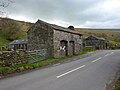
 Buildings on The Street (A684) - geograph.org.uk - 3576860.jpg 1,024 × 683; 197 KB
-
 Bungalow cottage at Garsdale Head - geograph.org.uk - 2611177.jpg 640 × 480; 109 KB
-
 By Ceaseat Beck - geograph.org.uk - 2348878.jpg 640 × 480; 72 KB
-
 Cairn above Garsdale - geograph.org.uk - 3473281.jpg 800 × 600; 155 KB
-
 Cairn and fence on Swarth Fell Pike - geograph.org.uk - 5491640.jpg 1,024 × 683; 153 KB
-
 Cairn on Rise Hill above Garsdale - geograph.org.uk - 3474926.jpg 600 × 800; 158 KB
-
 Cairn on Swarth Fell Pike - geograph.org.uk - 3445769.jpg 3,872 × 2,592; 4.82 MB
-
 Cairn overlooking Garsdale - geograph.org.uk - 1312204.jpg 640 × 480; 81 KB
-
 Cairn, Swarth Fell Pike - geograph.org.uk - 734248.jpg 640 × 480; 71 KB
-
 Cancelled benchmark on Long House - geograph.org.uk - 3577154.jpg 683 × 1,024; 300 KB
-
 Caravan Coat Weggs - geograph.org.uk - 744383.jpg 640 × 480; 120 KB
-
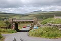
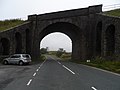 Carlisle-Settle Railway crosses A684, near Garsdale Head - geograph.org.uk - 3660315.jpg 4,320 × 3,240; 2.87 MB
-
 CAROLINE gets a push from managers at Garsdale - geograph.org.uk - 2124796.jpg 1,024 × 686; 244 KB
-
 Cartmire Gill - geograph.org.uk - 744450.jpg 640 × 480; 70 KB
-
 Cattle grid at Riggs - geograph.org.uk - 3370685.jpg 1,024 × 768; 113 KB
-
 Cattle Grid on Garsdale Old Road - geograph.org.uk - 2120535.jpg 640 × 480; 54 KB
-
 Caution Red Squirrels - geograph.org.uk - 2802569.jpg 1,024 × 768; 129 KB
-
 Ceaseat Beck - geograph.org.uk - 744414.jpg 640 × 480; 87 KB
-
 Ceaseat Mire - geograph.org.uk - 744803.jpg 640 × 480; 100 KB
-
 Climbing Baugh Fell - geograph.org.uk - 4006945.jpg 1,600 × 1,200; 483 KB
-
 Clough Bridge - geograph.org.uk - 6274929.jpg 1,024 × 683; 168 KB
-
 Clough Bridge - January 2019 - geograph.org.uk - 6040991.jpg 7,247 × 4,756; 4.53 MB
-
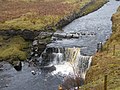 Clough Force - geograph.org.uk - 2281565.jpg 3,264 × 2,448; 3.03 MB
-
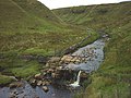 Clough Force - geograph.org.uk - 3672763.jpg 800 × 600; 174 KB
-
 Clough Force, on Grisedale Beck - geograph.org.uk - 3372536.jpg 1,024 × 768; 144 KB
-
 Clough River - geograph.org.uk - 2339731.jpg 1,024 × 768; 204 KB
-
 Clough River - geograph.org.uk - 255489.jpg 640 × 480; 158 KB
-
 Clough River - geograph.org.uk - 437353.jpg 640 × 480; 99 KB
-
 Clough River - geograph.org.uk - 744129.jpg 640 × 480; 137 KB
-
 Clough River - geograph.org.uk - 744846.jpg 640 × 480; 144 KB
-
 Clough River from Aye Gill - geograph.org.uk - 2960922.jpg 640 × 480; 182 KB
-
 Clough River in Garsdale - geograph.org.uk - 1913961.jpg 480 × 640; 101 KB
-
 Clough River in Garsdale - geograph.org.uk - 1914266.jpg 640 × 480; 95 KB
-
 Clough River over SE parapet of Hard Ing Bridge - geograph.org.uk - 3797149.jpg 1,024 × 683; 286 KB
-

-
 Clough River waterfalls - geograph.org.uk - 2808440.jpg 640 × 415; 94 KB
-
 Clough River, Garsdale - geograph.org.uk - 719580.jpg 640 × 480; 160 KB
-
 Clough View - geograph.org.uk - 2339782.jpg 1,024 × 768; 197 KB
-
 Coal Road at Galloway Gate - geograph.org.uk - 5120455.jpg 1,024 × 683; 245 KB
-
 Coal Road at Hugh's Moss - geograph.org.uk - 2979077.jpg 1,024 × 683; 158 KB
-
 Coal Road descending over Garsdale Common - geograph.org.uk - 6016763.jpg 5,184 × 3,456; 7.28 MB
-
 Coal Road NE of Limekiln Quarry - geograph.org.uk - 5120250.jpg 1,024 × 683; 182 KB
-
 Coal Road near Hugh's Moss - geograph.org.uk - 1916665.jpg 640 × 480; 53 KB
-

-
 Coal Road towards Garsdale at Edwin's Fell - geograph.org.uk - 4714299.jpg 683 × 1,024; 276 KB
-
 Coal Road towards Garsdale Head at Hugh's Moss - geograph.org.uk - 5120092.jpg 1,024 × 683; 249 KB
-
 Coat Weggs - geograph.org.uk - 744390.jpg 640 × 480; 82 KB
-
 Cold work on the Coal Road - geograph.org.uk - 3879966.jpg 1,023 × 768; 122 KB
-
 Coming down the Coal Road in the snow - geograph.org.uk - 4370542.jpg 1,024 × 768; 167 KB
-
 Communications mast - geograph.org.uk - 3812175.jpg 640 × 480; 80 KB
-
 Compound benchmark on barn at Potgill Holme - geograph.org.uk - 3575533.jpg 683 × 1,024; 328 KB
-
 Cote Gill - geograph.org.uk - 437363.jpg 640 × 480; 124 KB
-
 Cottages at Moor Rigg - geograph.org.uk - 1924589.jpg 1,024 × 768; 165 KB
-
 Cottages, upper Garsdale - geograph.org.uk - 2611243.jpg 640 × 480; 142 KB
-
 Culvert under the Settle ^ Carlisle - geograph.org.uk - 2339021.jpg 1,024 × 768; 221 KB
-

-
 Dandry Mire - geograph.org.uk - 3882768.jpg 1,024 × 768; 180 KB
-

-
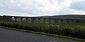
 Dandrymire Viaduct - geograph.org.uk - 4055913.jpg 3,648 × 2,736; 4.11 MB
-
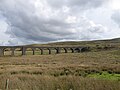 Dandrymire Viaduct - geograph.org.uk - 5172206.jpg 1,600 × 1,200; 756 KB
-
 Dandrymire Viaduct - geograph.org.uk - 5274520.jpg 3,368 × 1,678; 4.39 MB
-
 Dandrymire Viaduct - geograph.org.uk - 5779860.jpg 1,600 × 1,200; 469 KB
-
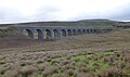 Dandrymire Viaduct - geograph.org.uk - 5954259.jpg 1,600 × 944; 217 KB
-
 Dandrymire Viaduct - geograph.org.uk - 6306376.jpg 1,600 × 900; 252 KB
-
 Dandrymire viaduct near Garsdale - geograph.org.uk - 4654671.jpg 1,024 × 511; 379 KB
-
 Danny Bridge over Clough River - geograph.org.uk - 2358882.jpg 640 × 480; 189 KB
-
 Danny Brow - geograph.org.uk - 2358910.jpg 640 × 480; 128 KB
-
 Derelict barn on the Old Road, Garsdale - geograph.org.uk - 3626416.jpg 1,600 × 1,200; 575 KB
-
 Derelict lime kiln - geograph.org.uk - 5957812.jpg 1,200 × 1,800; 552 KB
-
 Derelict sheepfold - geograph.org.uk - 5957805.jpg 1,600 × 1,067; 219 KB
-
 Descending Swarth Fell - geograph.org.uk - 163918.jpg 640 × 480; 121 KB
-
 Descending Swarth Fell Pike - geograph.org.uk - 734250.jpg 640 × 480; 100 KB
-
 Descending towards Garsdale Station - geograph.org.uk - 6016722.jpg 5,184 × 3,456; 6.65 MB
-

-
 Disused lime kiln, alongside the Coal Road - geograph.org.uk - 3880097.jpg 1,024 × 768; 200 KB
-

-
 Double Hole Bridge - geograph.org.uk - 1923214.jpg 1,024 × 768; 179 KB
-
 Dover Gill - geograph.org.uk - 254357.jpg 640 × 480; 124 KB
-
 Dover Gill Lower Cave entrance - geograph.org.uk - 3672181.jpg 480 × 640; 197 KB
-
 Dry stone wall and cotton grass - geograph.org.uk - 1926806.jpg 1,024 × 768; 170 KB
-

-


_Mire_-_geograph.org.uk_-_3672734.jpg)


.jpg)


_-_geograph.org.uk_-_3576860.jpg)


_-_geograph.org.uk_-_3880471.jpg)


,_Garsdale_-_geograph.org.uk_-_5545266.jpg)


_-_geograph.org.uk_-_4599478.jpg)


