Category:Gasthof Ruedihaus
| Object location | | View all coordinates using: OpenStreetMap |
|---|
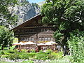
building in Kandersteg in the canton of Bern, Switzerland  | |||||
| Upload media | |||||
| Instance of | |||||
|---|---|---|---|---|---|
| Part of | |||||
| Location | Kandersteg, Frutigen-Niedersimmental administrative district, Oberland administrative region, Bern, Switzerland | ||||
| Street address |
| ||||
| Heritage designation | |||||
| Inception |
| ||||
 | |||||
Media in category "Gasthof Ruedihaus"
The following 9 files are in this category, out of 9 total.
-
 Kandersteg01.jpg 1,492 × 1,052; 1.85 MB
-
 Ruedihus 01.jpg 4,000 × 3,000; 2.11 MB
-
 Ruedihus 02.jpg 4,000 × 3,000; 2.26 MB
-
 Ruedihus 03.jpg 4,000 × 3,000; 2.37 MB
-
 Ruedihus 04.jpg 3,000 × 4,000; 2.7 MB
-
 Ruedihus 05.jpg 4,000 × 3,000; 2.32 MB
-
 Ruedihus in August 2012.jpg 3,264 × 2,448; 1.85 MB
-
 Ruedihus.jpg 3,264 × 2,448; 3.93 MB
-
 Zij- en kopgevel - Unknown - 20513418 - RCE.jpg 1,200 × 900; 210 KB


