Category:Gavinton
English: Gavinton is a small settlement in the Scottish Borders.
village in Scottish Borders, Scotland, UK  | |||||
| Upload media | |||||
| Instance of | |||||
|---|---|---|---|---|---|
| Location |
| ||||
 | |||||
Media in category "Gavinton"
The following 16 files are in this category, out of 16 total.
-
 Bee hives close to the old railway line - geograph.org.uk - 252013.jpg 640 × 480; 185 KB
-
 Farmland near Gavinton, Duns - geograph.org.uk - 252023.jpg 640 × 441; 200 KB
-
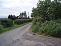
 Gavinton Church.jpg 640 × 480; 49 KB
-
 Gavinton Kirk.jpg 428 × 480; 72 KB
-
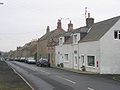 Gavinton.jpg 640 × 480; 52 KB
-
 Duns Wood - geograph.org.uk - 9016.jpg 640 × 480; 119 KB
-
 Easter Wood near Charterhall - geograph.org.uk - 195452.jpg 640 × 480; 143 KB
-
 Farm road near Duns - geograph.org.uk - 199702.jpg 640 × 480; 109 KB
-
 Farmland near Nisbet Rhodes, Duns - geograph.org.uk - 252019.jpg 640 × 441; 189 KB
-
 Galvanise. - geograph.org.uk - 118808.jpg 640 × 480; 61 KB
-
 Gavinton, the long straight road. - geograph.org.uk - 118818.jpg 640 × 480; 52 KB
-
 Grueldykes. - geograph.org.uk - 118799.jpg 640 × 480; 35 KB
-
 Howe Burn - geograph.org.uk - 118820.jpg 640 × 502; 54 KB
-
 Langtonlees and ponies - geograph.org.uk - 322170.jpg 640 × 353; 79 KB
-
 Plendernethy Hill - geograph.org.uk - 329158.jpg 640 × 480; 110 KB
-
 Pouterlynie Burn - geograph.org.uk - 118797.jpg 640 × 480; 68 KB


