Category:Gayton, Norfolk
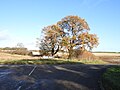
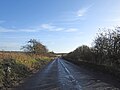
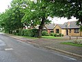
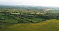
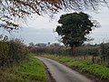
English: Gayton is a small village in the west of the English county of Norfolk. It is 7.3 miles east of the town of King's Lynn, and 10.1 miles north-west of the town of Swaffham. The Gaywood River has its source just north of the village at Derby Fen. The village sides astride of the B1145 Kings Lynn to Mundesley road that dissects North Norfolk west to east.
village and civil parish in Norfolk, UK  | |||||
| Upload media | |||||
| Instance of | |||||
|---|---|---|---|---|---|
| Location | King's Lynn and West Norfolk, Norfolk, East of England, England | ||||
| Population |
| ||||
| Area |
| ||||
| official website | |||||
 | |||||
Subcategories
This category has the following 2 subcategories, out of 2 total.
H
- Gayton Hall, Norfolk (1 F)
N
Media in category "Gayton, Norfolk"
The following 200 files are in this category, out of 300 total.
(previous page) (next page)-
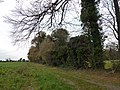
 A blustery day - farmland NE of Gayton - geograph.org.uk - 2590818.jpg 640 × 480; 141 KB
-
 A deep ditch west of Gayton - geograph.org.uk - 1324034.jpg 483 × 637; 177 KB
-

-

-

-
 A MUIOOF Lodge War Memorial in Gayton church - geograph.org.uk - 4590398.jpg 2,592 × 3,456; 3.01 MB
-
 A pond west of Gayton - geograph.org.uk - 1324038.jpg 640 × 426; 163 KB
-
-
 A stack of seasoned logs in Norfolk - geograph.org.uk - 2720093.jpg 4,320 × 3,240; 5.87 MB
-
 A well-maintained path - geograph.org.uk - 1322386.jpg 640 × 480; 132 KB
-
 A wooded corner west of Gayton - geograph.org.uk - 1322691.jpg 640 × 426; 159 KB
-
 Approaching Long Belt - geograph.org.uk - 6637587.jpg 1,024 × 768; 213 KB
-
 Approaching Soigné Wood - geograph.org.uk - 6603697.jpg 1,024 × 768; 216 KB
-
 B1145 from Old Norwich Road - geograph.org.uk - 5990172.jpg 4,608 × 3,456; 6.81 MB
-
 B1145 towards Litcham - geograph.org.uk - 5539958.jpg 640 × 480; 70 KB
-
 B1145 towards Litcham - geograph.org.uk - 5539964.jpg 640 × 480; 59 KB
-
 B1145 towards Litcham - geograph.org.uk - 5539976.jpg 640 × 480; 73 KB
-
 B1145 towards Litcham - geograph.org.uk - 5539990.jpg 640 × 480; 65 KB
-
 B1145, down into the bottom of the valley - geograph.org.uk - 5990396.jpg 4,160 × 3,120; 2.09 MB
-
 B1145, Gayton - geograph.org.uk - 5539946.jpg 640 × 480; 55 KB
-
 B1153 between Gayton and East Walton - geograph.org.uk - 2289741.jpg 760 × 570; 125 KB
-
 Barley ripening - geograph.org.uk - 873892.jpg 450 × 640; 67 KB
-
 Base of tower, St. Mary's church, Gayton Thorpe - geograph.org.uk - 6638713.jpg 768 × 1,024; 323 KB
-
 Bend in the B1145 towards Litcham - geograph.org.uk - 5539951.jpg 640 × 480; 42 KB
-
 Bend in the byway - geograph.org.uk - 6637581.jpg 1,024 × 768; 169 KB
-
 Brass WW1 Memorial plaque in Gayton Thorpe church - geograph.org.uk - 4590411.jpg 3,456 × 2,592; 3.79 MB
-
 Bridge House from Winch Road, Gayton - geograph.org.uk - 2289689.jpg 760 × 570; 334 KB
-
 Bridleway alongside a strip of woodland - geograph.org.uk - 6638674.jpg 1,024 × 768; 296 KB
-
 Bridleway alongside The Larches - geograph.org.uk - 6638662.jpg 1,024 × 768; 146 KB
-
 Bridleway by Green Hill Wood, Gayton - geograph.org.uk - 2590834.jpg 640 × 480; 241 KB
-

-
 Bridleway near Greenland Barn - geograph.org.uk - 6638658.jpg 1,024 × 768; 156 KB
-
 Bridleway to the B1145 - geograph.org.uk - 6637989.jpg 1,024 × 768; 126 KB
-
 Bridleway towards Gayton - geograph.org.uk - 6638076.jpg 1,024 × 768; 139 KB
-
 Bridleway towards Greenland Barn - geograph.org.uk - 6638680.jpg 1,024 × 768; 156 KB
-
 Bridleway towards Square Covert - geograph.org.uk - 6638665.jpg 1,024 × 768; 143 KB
-
 Bridleway, strawstacks and woodland - geograph.org.uk - 6630162.jpg 1,024 × 768; 164 KB
-
 Bungalows on Winch Road - geograph.org.uk - 1323806.jpg 640 × 480; 110 KB
-
 Bus shelter, Lynn Road, Gayton - geograph.org.uk - 5981959.jpg 1,600 × 1,203; 627 KB
-
 Byway and Green Hill Wood - geograph.org.uk - 6630146.jpg 1,024 × 768; 280 KB
-
 Byway and Long Belt - geograph.org.uk - 6637593.jpg 1,024 × 768; 204 KB
-
 Byway near Gayton - geograph.org.uk - 6637557.jpg 1,024 × 768; 213 KB
-
 Byway near Gayton - geograph.org.uk - 6637563.jpg 1,024 × 768; 242 KB
-
 Byway on Massingham Heath - geograph.org.uk - 6629206.jpg 1,024 × 768; 178 KB
-
 Byway to Gayton Thorpe - geograph.org.uk - 6600769.jpg 1,024 × 768; 239 KB
-
 Byway to Gayton Thorpe - geograph.org.uk - 6603710.jpg 1,024 × 768; 184 KB
-
 Byway to Great Massingham - geograph.org.uk - 6630142.jpg 1,024 × 768; 219 KB
-
 Byway to Great Massingham - geograph.org.uk - 6630148.jpg 1,024 × 768; 186 KB
-
 Byway to Great Massingham - geograph.org.uk - 6630150.jpg 1,024 × 768; 142 KB
-
 Byway to Great Massingham - geograph.org.uk - 6630154.jpg 1,024 × 768; 192 KB
-
 Byway to Great Massingham - geograph.org.uk - 6637554.jpg 1,024 × 768; 207 KB
-
 Byway to Great Massingham - geograph.org.uk - 6637567.jpg 1,024 × 768; 182 KB
-
 Byway to Great Massingham - geograph.org.uk - 6637576.jpg 1,024 × 768; 266 KB
-
 Byway to Great Massingham - geograph.org.uk - 6637580.jpg 1,024 × 768; 180 KB
-
 Byway to Great Massingham - geograph.org.uk - 6637598.jpg 1,024 × 768; 208 KB
-
 Byway to Great Massingham - geograph.org.uk - 6637606.jpg 1,024 × 768; 169 KB
-
 Byway to Great Massingham - geograph.org.uk - 6637610.jpg 1,024 × 768; 181 KB
-
 Byway towards Gayton - geograph.org.uk - 6637604.jpg 1,024 × 768; 214 KB
-
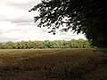
 Cereal crop near Gayton Thorpe - geograph.org.uk - 3991501.jpg 4,320 × 3,240; 6.01 MB
-
 Common Lane, south of Gayton - geograph.org.uk - 5981957.jpg 1,600 × 1,200; 941 KB
-
 Cottages in Gayton Thorpe - geograph.org.uk - 1745935.jpg 640 × 447; 128 KB
-
 Country lane to Gayton Thorpe, Norfolk - geograph.org.uk - 2768958.jpg 4,320 × 3,240; 5.45 MB
-
 Cow parsley (Anthriscus sylvestris) - geograph.org.uk - 1322423.jpg 640 × 480; 97 KB
-
 Crop field, Massingham Heath - geograph.org.uk - 5539984.jpg 640 × 480; 60 KB
-
 Deserted medieval village of Well - geograph.org.uk - 6630139.jpg 1,024 × 768; 143 KB
-
 Distant view over a field of maize - geograph.org.uk - 6603695.jpg 1,024 × 768; 195 KB
-
 Dodd's Gorse - geograph.org.uk - 6638661.jpg 1,024 × 768; 164 KB
-
 Downhill lane to Gayton Thorpe in Norfolk - geograph.org.uk - 2720117.jpg 4,320 × 3,240; 6.01 MB
-

-

-
 East Walton Common, aerial 2015 - geograph.org.uk - 4485166.jpg 640 × 334; 44 KB
-
 Eastgate Drove - geograph.org.uk - 6638690.jpg 1,024 × 768; 248 KB
-
 Eastgate Drove - geograph.org.uk - 6638692.jpg 1,024 × 768; 236 KB
-
 Eastgate Drove - geograph.org.uk - 6638699.jpg 1,024 × 768; 400 KB
-
 Eastgate Drove south of the Old Workhouse - geograph.org.uk - 2719345.jpg 4,320 × 3,240; 5.61 MB
-
 Empty pigsties near Ten Acre Plantation - geograph.org.uk - 6600776.jpg 1,024 × 768; 163 KB
-
 End of a hedge near Green Hill - geograph.org.uk - 6637559.jpg 1,024 × 768; 283 KB
-
 English cottage garden in Gayton - geograph.org.uk - 5850641.jpg 1,600 × 1,067; 551 KB
-
 Farm buildings near Gayton Thorpe - geograph.org.uk - 6600772.jpg 1,024 × 768; 228 KB
-

-
 Farm track near Gayton - geograph.org.uk - 6630165.jpg 1,024 × 768; 252 KB
-
 Farm track near Gayton Thorpe - geograph.org.uk - 6638677.jpg 1,024 × 768; 151 KB
-
 Farm track off the B1145 - geograph.org.uk - 6629156.jpg 1,024 × 768; 178 KB
-
 Farm track with avenue of trees - geograph.org.uk - 6638696.jpg 1,024 × 768; 184 KB
-
 Field boundary - geograph.org.uk - 6600993.jpg 1,024 × 768; 209 KB
-
 Field gate by Well Hall Farm - geograph.org.uk - 1322381.jpg 640 × 480; 93 KB
-
 Field gate with a postcode - geograph.org.uk - 2289739.jpg 760 × 570; 146 KB
-
 Field in process of being sown near The Larches - geograph.org.uk - 6638669.jpg 1,024 × 768; 152 KB
-
 Field of oilseed rape, Gayton Heath - geograph.org.uk - 6637596.jpg 1,024 × 768; 174 KB
-
 Field of oilseed rape, Gayton Heath - geograph.org.uk - 6637599.jpg 1,024 × 768; 196 KB
-
 Field of sugar beet off Well Hall Lane - geograph.org.uk - 6630138.jpg 1,024 × 768; 260 KB
-
 Field-woodland boundary, Gayton - geograph.org.uk - 2590837.jpg 640 × 480; 233 KB
-
 Footbridge over Gaywood River - geograph.org.uk - 6472863.jpg 4,608 × 3,456; 5.92 MB
-
 Footpath alongside Long Belt - geograph.org.uk - 6637590.jpg 1,024 × 768; 282 KB
-
 Former chapel, Gayton - geograph.org.uk - 4127114.jpg 4,320 × 3,240; 2.92 MB
-
 Former gravel pit - geograph.org.uk - 6637574.jpg 1,024 × 768; 250 KB
-

-
 G VI R postbox No PE32 318 - geograph.org.uk - 2289708.jpg 450 × 600; 196 KB
-
 Gate on Massingham Heath - geograph.org.uk - 6629203.jpg 1,024 × 768; 237 KB
-
 Gayton church - geograph.org.uk - 4750788.jpg 531 × 800; 126 KB
-
 Gayton church - geograph.org.uk - 4750792.jpg 531 × 800; 110 KB
-
 Gayton Hall Norfolk - southern boundary - geograph.org.uk - 2720130.jpg 4,320 × 3,240; 5.54 MB
-
 Gayton Mill - geograph.org.uk - 2289715.jpg 760 × 570; 141 KB
-
 Gayton Mill - geograph.org.uk - 4127159.jpg 4,320 × 3,240; 3.65 MB
-
 Gayton Mill - geograph.org.uk - 5539944.jpg 640 × 480; 51 KB
-
 Gayton Mill.jpg 545 × 639; 95 KB
-
 Gayton Social Club - geograph.org.uk - 4750796.jpg 800 × 531; 109 KB
-
 Gayton St. Nicholas' church - geograph.org.uk - 3917974.jpg 640 × 480; 71 KB
-
 Gayton Thorpe Common, aerial 2015 - geograph.org.uk - 4485198.jpg 640 × 427; 48 KB
-
 Gayton Thorpe St. Mary's church - geograph.org.uk - 3917977.jpg 640 × 480; 64 KB
-
 Gayton Thorpe village sign (detail) - geograph.org.uk - 4589216.jpg 1,024 × 768; 285 KB
-
 Gayton Thorpe Village Sign - geograph.org.uk - 5412274.jpg 640 × 480; 109 KB
-
 Gayton Thorpe village sign near the village pond - geograph.org.uk - 4589214.jpg 1,024 × 768; 345 KB
-
 Gayton Thorpe, Norfolk - St Mary's Church - geograph.org.uk - 5621227.jpg 5,184 × 2,920; 1.25 MB
-
 Gayton Village Sign - geograph.org.uk - 5412252.jpg 480 × 640; 76 KB
-
 Gayton Village Sign.png 411 × 360; 145 KB
-
 Gently smouldering rubbish - geograph.org.uk - 6602487.jpg 1,024 × 768; 199 KB
-
 Green Hill not living up to its name - geograph.org.uk - 5989861.jpg 4,608 × 3,456; 6.74 MB
-
 Green Hill small quarry - geograph.org.uk - 2032766.jpg 1,536 × 2,048; 1 MB
-
 Green Hill Wood - geograph.org.uk - 873601.jpg 640 × 480; 51 KB
-
 Greenland Barn - geograph.org.uk - 6638089.jpg 1,024 × 768; 120 KB
-
 Grimston Road - geograph.org.uk - 6391890.jpg 800 × 533; 148 KB
-
 Gulf filling station, Gayton - geograph.org.uk - 5981962.jpg 1,600 × 1,066; 593 KB
-
 Halfmoon Belt and remains of a farm - geograph.org.uk - 6602510.jpg 1,024 × 768; 198 KB
-

-
 Harvested field by Brink Hill, Gayton - geograph.org.uk - 2590795.jpg 640 × 480; 141 KB
-
 Harvested field by Long Belt, Gayton - geograph.org.uk - 2590812.jpg 640 × 480; 201 KB
-
-
 Heath Belt - geograph.org.uk - 6600813.jpg 1,024 × 768; 179 KB
-
 Heath Belt - geograph.org.uk - 6629037.jpg 1,024 × 768; 284 KB
-
 Heronhill Belt - geograph.org.uk - 6603453.jpg 1,024 × 768; 240 KB
-
 House on Lynn Road, Gayton - geograph.org.uk - 2889697.jpg 4,320 × 3,240; 5.68 MB
-
 Houses and mill, Gayton - geograph.org.uk - 5539939.jpg 640 × 480; 49 KB
-
 Inquisitive horse near Gayton Thorpe - geograph.org.uk - 2889701.jpg 4,320 × 3,240; 5.83 MB
-
 Junction of tracks, Gayton Heath - geograph.org.uk - 6637616.jpg 1,024 × 768; 286 KB
-
 K6 telephone box and postbox - geograph.org.uk - 1745943.jpg 480 × 640; 165 KB
-
 Laden hawthorn - geograph.org.uk - 6637585.jpg 1,024 × 768; 224 KB
-
 Lane from Green Hill to Eastgate Drove - geograph.org.uk - 2719368.jpg 4,320 × 3,240; 5.83 MB
-
 Lane to Gayton Thorpe, Norfolk - geograph.org.uk - 2768913.jpg 4,320 × 3,240; 5.88 MB
-
 Lane to Green Hill which can be seen on the horizon - geograph.org.uk - 5989860.jpg 4,400 × 3,300; 2.67 MB
-
 Lane to Soigne Farm, Gayton Thorpe - geograph.org.uk - 3991484.jpg 4,320 × 3,240; 5.96 MB
-
 Lane up to Green Hill - geograph.org.uk - 2719380.jpg 4,320 × 3,240; 5.68 MB
-
 Life after death in Gayton, Norfolk - geograph.org.uk - 2768972.jpg 4,320 × 3,240; 5.16 MB
-
 Line of beech trees, Gayton Heath - geograph.org.uk - 6637615.jpg 1,024 × 768; 138 KB
-
 Logs by a remote track in Norfolk - geograph.org.uk - 2720098.jpg 4,320 × 3,240; 5.91 MB
-
 Logs in Long Plantation - geograph.org.uk - 3991902.jpg 4,320 × 3,240; 5.59 MB
-
 Lynn Road (B1145), Gayton - geograph.org.uk - 5539617.jpg 640 × 480; 63 KB
-
 Lynn Road, Gayton - geograph.org.uk - 5850650.jpg 1,600 × 1,035; 308 KB
-
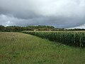 Maize crop, Massingham Heath - geograph.org.uk - 5539955.jpg 640 × 480; 63 KB
-
 Maize field by the B1145 - geograph.org.uk - 6629158.jpg 1,024 × 768; 216 KB
-
 Marl pit on Massingham Heath - geograph.org.uk - 2768850.jpg 4,320 × 3,240; 5.58 MB
-
 Massingham Heath - geograph.org.uk - 6629024.jpg 1,024 × 768; 197 KB
-
 Middle Belt - geograph.org.uk - 6637578.jpg 1,024 × 768; 146 KB
-
 Mud, mud, glorious mud - geograph.org.uk - 6638687.jpg 1,024 × 768; 182 KB
-
 Narrow lane near Gayton in Norfolk - geograph.org.uk - 2720103.jpg 4,320 × 3,240; 6.02 MB
-
 Norfolk countryside - geograph.org.uk - 763072.jpg 640 × 480; 71 KB
-
 Norfolk countryside east of Gayton - geograph.org.uk - 2768901.jpg 4,320 × 3,240; 5.47 MB
-
 Norfolk green - geograph.org.uk - 3991495.jpg 4,320 × 3,240; 5.94 MB
-
 Not normal for Norfolk - geograph.org.uk - 2719628.jpg 4,320 × 3,240; 5.54 MB
-
 Old Norwich Road rising from the valley floor - geograph.org.uk - 5990459.jpg 4,072 × 3,054; 3.84 MB
-
 On the edge of Gravelpit Plantation - geograph.org.uk - 4088020.jpg 4,320 × 3,240; 5.98 MB
-
 Overgrown marl pit on Massingham Heath - geograph.org.uk - 2768890.jpg 4,320 × 3,240; 6.02 MB
-

-

-
 Pampas grass by a plantation - geograph.org.uk - 6637607.jpg 1,024 × 768; 211 KB
-
 Permissive footpath near Gayton Thorpe - geograph.org.uk - 3991491.jpg 4,320 × 3,240; 5.58 MB
-
 Permissive path - geograph.org.uk - 6603445.jpg 1,024 × 768; 319 KB
-
 Permissive path - geograph.org.uk - 6603451.jpg 1,024 × 768; 357 KB
-
 Permissive path alongside Halfmoon Belt - geograph.org.uk - 6602490.jpg 1,024 × 768; 321 KB
-
 Permissive path near Greenland Barn - geograph.org.uk - 6630156.jpg 1,024 × 768; 138 KB
-
 Permissive path to Gayton Thorpe - geograph.org.uk - 6602508.jpg 1,024 × 768; 242 KB
-
 Permissive path to Gayton Thorpe - geograph.org.uk - 6603459.jpg 1,024 × 768; 218 KB
-
 Permissive path to Greenland Barn - geograph.org.uk - 6637612.jpg 1,024 × 768; 163 KB
-
 Permissive path to Greenland Barn - geograph.org.uk - 6637613.jpg 1,024 × 768; 165 KB
-
 Permissive path to Greenland Barn - geograph.org.uk - 6637621.jpg 1,024 × 768; 278 KB
-
 Permissive path to Honeypot Drove - geograph.org.uk - 6602500.jpg 1,024 × 768; 200 KB
-
 Permissive path to Honeypot Drove - geograph.org.uk - 6603476.jpg 1,024 × 768; 205 KB
-
 Permissive path to Honeypot Drove - geograph.org.uk - 6603686.jpg 1,024 × 768; 250 KB
-
 Pig food hoppers beside the Old Norwich Road - geograph.org.uk - 5990397.jpg 4,608 × 3,456; 3.45 MB
-
 Pigs near Halfmoon Belt - geograph.org.uk - 6602495.jpg 1,024 × 768; 163 KB
-
 Ploughing in February - geograph.org.uk - 4343023.jpg 640 × 480; 311 KB
-
 Pond by Greenland Barn - geograph.org.uk - 6638092.jpg 1,024 × 768; 313 KB
-
 Prepared field near Gayton - geograph.org.uk - 6637562.jpg 1,024 × 768; 300 KB
-
 Pssing through Long Belt - geograph.org.uk - 6637591.jpg 1,024 × 768; 293 KB
-
 Public footpath to Well Hall Lane - geograph.org.uk - 1322392.jpg 640 × 480; 110 KB
-
 Pumping Station north of Gayton - geograph.org.uk - 5990067.jpg 4,608 × 3,456; 5.95 MB
-
 Rapeseed stubble near Gravelpit Plantation - geograph.org.uk - 4088070.jpg 4,320 × 3,240; 6.06 MB
-
 Remains of a dead tree on woodland edge - geograph.org.uk - 1323840.jpg 640 × 480; 130 KB
-
 Restricted byway east of Gayton Thorpe - geograph.org.uk - 2890897.jpg 4,320 × 3,240; 5.69 MB
-
 Restricted byway to Gayton Thorpe - geograph.org.uk - 6603681.jpg 1,024 × 768; 238 KB
-
 Restricted byway to West Acre - geograph.org.uk - 6603690.jpg 1,024 × 768; 209 KB
-

-
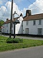
 Road passing through Gayton - geograph.org.uk - 4750803.jpg 1,024 × 680; 263 KB
-
 Road to Soigne Farm - geograph.org.uk - 3991471.jpg 4,320 × 3,240; 5.91 MB
-
 Road under water near Gayton Thorpe - geograph.org.uk - 6638686.jpg 1,024 × 768; 178 KB
-
 Rougham Belt - geograph.org.uk - 5539967.jpg 640 × 480; 57 KB
-
 Seed drilling near Square Covert - geograph.org.uk - 6630159.jpg 1,024 × 768; 157 KB
-
 Seven sacrament font, Gayton Thorpe - geograph.org.uk - 6638711.jpg 768 × 1,024; 120 KB
-

-
 Sign for the Crown Inn, Gayton - geograph.org.uk - 5539625.jpg 512 × 640; 43 KB


_-_geograph.org.uk_-_1322423.jpg)


_-_geograph.org.uk_-_4589216.jpg)


,_Gayton_-_geograph.org.uk_-_5539617.jpg)


