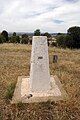
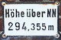
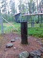
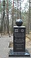
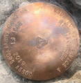
Category:Geodetic control points
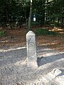
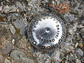
English: Geodetic control points or survey markers are markers used for surveying; Benchmarks are used for precise levelling and altitudes (Z), Trig points are geodetic reference points and monuments (XYZ)
object placed to mark a point  | |||||
| Upload media | |||||
| Subclass of |
| ||||
|---|---|---|---|---|---|
| Said to be the same as | Benchmark (levelling) | ||||
| |||||
Subcategories
This category has the following 5 subcategories, out of 5 total.
A
B
D
T
Pages in category "Geodetic control points"
This category contains only the following page.
Media in category "Geodetic control points"
The following 200 files are in this category, out of 200 total.
-
 2016 Fort Tryon Park survey marker.jpg 2,399 × 2,613; 3.14 MB
-
 4 Corners, Canada, Obelisk.jpg 2,592 × 1,936; 3.09 MB
-
 An old earth mound with three peaks (distant view).jpg 1,655 × 993; 208 KB
-
 AR-LA-TX tripoint.jpg 4,416 × 3,312; 10.6 MB
-
 Austro-Hungarian trigonometrical pyramid at Kevi, Vojvodina, Serbia.JPG 2,562 × 1,678; 456 KB
-
 BarnstableSandwichHighStreetBoundaryMarker.jpg 680 × 1,024; 332 KB
-
 BarnstableSandwichHighStreetBoundaryMarker2.jpg 1,024 × 680; 346 KB
-
 BarnstableSandwichRaceLaneBoundaryMarker.jpg 680 × 1,024; 314 KB
-
 Berntsen, Bridge of Orchy - geograph.org.uk - 1327058.jpg 640 × 480; 92 KB
-
 Border point.JPG 4,928 × 3,264; 4.09 MB
-
 Borne de nivellement Kriegstor.JPG 2,272 × 1,704; 1.1 MB
-
 Boundary stone Maesglase.jpg 900 × 1,200; 367 KB
-
 Bunker and trigonometric pole.JPG 2,225 × 1,099; 259 KB
-
 Canada-United States Border, Northwest Angle, Minnesota (42165559660).jpg 5,184 × 3,888; 20.67 MB
-
 Canada-United States Border, Northwest Angle, Minnesota (43925981272).jpg 5,184 × 3,888; 8.2 MB
-
 Csallóközaranyos031.JPG 2,592 × 1,944; 1.41 MB
-
 Csóványos lookout tower.JPG 2,128 × 2,832; 1.02 MB
-
 David Henry Thoreau.jpg 640 × 640; 141 KB
-
 Deutsches Schwerenetz 1962 Wolfenbüttel.jpg 2,048 × 1,536; 708 KB
-
 Disk on top of Obelisk at 4 Corners Canada 2.JPG 1,758 × 1,632; 2.08 MB
-
 Downtown Mountain View, AR 012.jpg 2,322 × 4,128; 4.03 MB
-
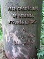
 Eindpaal Geodetische Basis Kempen.jpg 4,608 × 3,456; 7.73 MB
-
 Elpital.jpg 1,024 × 768; 186 KB
-
 Flickr - archer10 (Dennis) - DSCN1865B.jpg 3,264 × 2,448; 5.89 MB
-
 Flickr - archer10 (Dennis) - Guatemala-1865.jpg 1,280 × 960; 364 KB
-
 Four Corners Monument Marker 2012.jpg 640 × 640; 293 KB
-
 FourCornersByPhilKonstantin.jpg 1,842 × 1,674; 704 KB
-
 Földmérési alappont, prizma 1.jpg 4,032 × 2,268; 3.52 MB
-
 Földmérési alappont, prizma 2.jpg 4,032 × 2,268; 3.82 MB
-
 Földmérési alappont, prizma 3.jpg 4,032 × 2,268; 3.75 MB
-
 Földmérési alappont, prizma 4.jpg 4,032 × 2,268; 3.24 MB
-
 Földmérési alappont, prizma 5.jpg 4,032 × 2,268; 3.01 MB
-
 Fülöpszállásszintezésipont.JPG 2,048 × 1,536; 1.41 MB
-
 G0674 - Muiravonside Second geodetic levelling, Scotland.jpg 700 × 420; 48 KB
-
 Gaotou - on the top of Jin Mt - survey mark - DSCF3301.JPG 2,048 × 1,536; 1.4 MB
-
 Gaotou - on the top of Jin Mt - survey mark - DSCF3303.JPG 1,536 × 2,048; 1.36 MB
-
 Geodesy students Gdansk University of Technology.jpg 2,592 × 1,944; 3.61 MB
-
 Geodesy students Gdansk University of Technology1.jpg 1,944 × 2,592; 2.99 MB
-
 Geodetic Center.jpg 921 × 691; 431 KB
-
 Geodetic Control Mark.jpg 1,600 × 1,200; 449 KB
-
 Geodetic control points Winniki (Ukraine).JPG 3,072 × 2,304; 3.44 MB
-
 Geodetic control points, Group I., Bosnyak Square, 2017 Zuglo.jpg 2,272 × 1,704; 984 KB
-
 Geodetic marker Machu Picchu, Peru.jpg 5,184 × 3,456; 4 MB
-
 Geodetic observation tower in tsukuba.JPG 2,000 × 3,008; 2.72 MB
-
 Geodetic point Pas-Bayard Wéris 395m.jpg 2,560 × 1,920; 2.54 MB
-
 Geodetic point Pas-Bayard Wéris.jpg 2,560 × 1,920; 2.45 MB
-
 Geodetic Survey Marker Northern Minnesota MnDOT 15807802015.jpg 2,064 × 3,131; 5.05 MB
-
 Geodetic survey marker on University of Washington campus.jpg 6,000 × 4,000; 14.09 MB
-
 Geodeticsurveypicwickenburg.jpg 768 × 1,024; 375 KB
-
 Geodetisch punt Gc45 Relegem Asse Belgium.jpg 1,920 × 2,560; 1.81 MB
-
 Geodetisch punt Leopoldsburg Militair domein.jpg 2,592 × 4,608; 5.17 MB
-
 Geodezyjny punkt pomiarowy.jpg 4,000 × 3,000; 3.53 MB
-
 Geodätischer Messpunkt am Untreusee 20210808 HOF02683.jpg 9,504 × 6,336; 37.35 MB
-
 Geodätischer Messpunkt am Untreusee 20210808 HOF02684.jpg 6,336 × 9,504; 38.51 MB
-
 Geoodeetiline punkt.jpg 1,536 × 2,048; 565 KB
-
 Grenzmarken-modern.jpg 450 × 600; 111 KB
-
 Gros Cap geodesic survey reference 2.JPG 2,560 × 1,920; 810 KB
-
 Gville Treaty Line marker.jpg 3,264 × 2,448; 3.46 MB
-
 Gville Treaty Line.jpg 3,264 × 2,448; 3.53 MB
-
 Gúta 2010, katolikus templom, vízrajzi magasságjegy.jpg 3,648 × 2,736; 2.6 MB
-
 Harbor East Geodetic Disk in H. G. Dreyer & Co. Packing Box building.jpg 3,024 × 4,032; 4.55 MB
-
 Harbor East Geodetic Disk under SUITS sign.jpg 3,024 × 4,032; 4.05 MB
-
 Harbor East Geodetic Disk.jpg 4,032 × 3,024; 6.09 MB
-
 Hasbala Lake boundary marker 1959.jpg 2,048 × 1,536; 1.47 MB
-
 Historischer Nivellements-Grenzpfeiler 5873 (Höhenfestpunkt).jpg 886 × 1,181; 1.44 MB
-
 Historischer Nivellements-Grenzpfeiler 6950 (Detailansicht).jpg 1,920 × 2,560; 2.49 MB
-
 Historischer Nivellements-Grenzpfeiler 6950 (Lageansicht).jpg 2,048 × 1,536; 1.26 MB
-
 Historischer Nivellements-Grenzpfeiler 8632 (Detailansicht).jpg 1,920 × 2,560; 3.52 MB
-
 Historischer Nivellements-Grenzpfeiler 8632 (Lageansicht).jpg 2,560 × 1,920; 3.77 MB
-
 Historischer Nivellements-Grenzpfeiler Nieuweschans (NL) - Bunde (DE).jpg 1,200 × 1,600; 571 KB
-
 Hito-1° misión geodésica -OAQ.jpg 3,024 × 4,032; 1.61 MB
-
 HitoGeográfico.JPG 2,592 × 1,728; 3.09 MB
-
 IGNbornecroix.jpg 4,320 × 3,240; 5.58 MB
-
 IJzeren Paal Kerkhoven.jpg 2,941 × 3,921; 3.09 MB
-
 IJzeren Paal Pijnven.jpg 2,099 × 3,997; 2.13 MB
-
 Indiana land survey marker.png 2,000 × 3,000; 10.45 MB
-
 Jelenia Góra 2013 (1).jpg 1,552 × 2,592; 1.52 MB
-
 Jgb-Footsteps in Time - 20050503.jpg 1,067 × 1,600; 1.12 MB
-
 Jgb-Plaque Closeup - 20050503.jpg 1,067 × 1,600; 1.04 MB
-
 Juozapinė, Aukštojo kalno taškas.JPG 3,888 × 5,184; 7.44 MB
-
 Kandikó.JPG 1,200 × 1,600; 1.1 MB
-
 Kolar (kocsis) halom.jpg 3,001 × 1,998; 1.94 MB
-
 Kolarska humka, trig point.jpg 3,656 × 2,433; 2.37 MB
-
 Kolarska humka, trigonometrijska kota.jpg 3,001 × 2,086; 1.49 MB
-
 Kurgan cut by a road, near Stanisic, Serbia (top view).jpg 1,948 × 742; 462 KB
-
 Kurgan near Idjos, Serbia.jpg 2,973 × 2,005; 373 KB
-
 Kurgan near Novi Knezevac, Serbia (the thistly top).jpg 1,255 × 690; 388 KB
-
 Kurgan No.1 near Idjos in Serbia closer.JPG 1,985 × 819; 205 KB
-
 Kurgan No.1 near Idjos in Serbia.JPG 2,000 × 1,338; 217 KB
-
 Kurgan No.9 Idjos, Serbia (samller).jpg 1,337 × 839; 144 KB
-
 Kurgan No.9 Idjos, Serbia.jpg 1,649 × 801; 221 KB
-
 Kurgan Three peaks hill in Kanjiza, Vojvodina (front view).jpg 1,363 × 827; 151 KB
-
 Kurgan Three peaks hill in Kanjiza, Vojvodina (panorama).jpg 1,262 × 767; 174 KB
-
 Kurgan Tri Ante, digiscoped.JPG 1,217 × 724; 101 KB
-
 Kurgan Zabina humka (Beka halom), Serbia.JPG 2,011 × 1,336; 281 KB
-
 La pirámide de Oyambaro 01.jpg 5,520 × 4,140; 10.33 MB
-
 La pirámide de Oyambaro 02.jpg 5,520 × 4,140; 10.27 MB
-
 La pirámide de Oyambaro 03.jpg 5,520 × 4,140; 10.74 MB
-
 La pirámide de Oyambaro 04.jpg 5,520 × 4,140; 9.27 MB
-
 Lagoa Azul-Rede geodésica de 1ª ordem (São Tomé and Príncipe).jpg 3,154 × 3,154; 2.45 MB
-
 Lisboa Zamek sw Jerzego 23.jpg 4,000 × 6,000; 9.39 MB
-
 M.T. 1899., Bosnyák tér, 2017 Alsórákos.jpg 1,704 × 2,272; 981 KB
-
 Marco geodésico IBGE 1084E, Santa Rosa, Aracruz.JPG 4,288 × 3,216; 4.46 MB
-
 Marco geodésico no Campus Litoral Norte da UFRGS.jpg 1,996 × 1,979; 1.04 MB
-
 Marking point carved in rocks.JPG 4,928 × 3,264; 3.99 MB
-
 Markscheideplatte Zeche Hannibal.jpg 1,536 × 1,024; 352 KB
-
 Markscheiderstein.jpg 1,521 × 1,040; 130 KB
-
 Meetpunt.jpg 652 × 832; 147 KB
-
 Mesa Grande 2011-03-19 3804.JPG 1,944 × 2,592; 1.92 MB
-
 Montmany.jpg 4,128 × 3,096; 8.58 MB
-
 Moorong Geodetic Station.jpg 997 × 1,500; 690 KB
-
 Mount Sanford CT Summit 1970 US Coast and Geodetic Survey Reference Mark.jpg 2,448 × 3,264; 4.33 MB
-
 New South Wales State Survey Mark 102399 (SSM 102399).jpg 4,000 × 3,000; 8.89 MB
-
 Nn altenhasungen.jpg 992 × 649; 152 KB
-
 Norman, AR 009.jpg 4,561 × 2,566; 4.36 MB
-
 Northwest of Martin Luther King Jr Dr SW & Pryor St SW.jpg 1,600 × 1,200; 631 KB
-
 Nullpegelmarke Amsterdam.jpg 470 × 352; 51 KB
-
 Old triangulation pyramid, Doline.jpg 1,297 × 854; 215 KB
-
 Old triangulation pyramid, from Austro-Hungarian times.jpg 2,594 × 1,701; 498 KB
-
 Pametni tabule prvniho vyskoveho bodu ve Lvove 01.jpg 2,443 × 1,282; 661 KB
-
 Pegel Genua hinten.jpg 2,448 × 3,264; 1.73 MB
-
 Pegel Genua.jpg 2,448 × 3,264; 1.74 MB
-
 Peil De Veen- en Geestlanden.jpg 1,400 × 2,100; 1.83 MB
-
 PGPlazaAzcuenaga.jpg 4,000 × 2,248; 3.36 MB
-
 Pilot Rock Survey Marker.JPG 4,320 × 3,240; 5.47 MB
-
 Pivar kurgan, near Tornjoš in Serbia.JPG 2,891 × 1,301; 1.32 MB
-
 Pivar kurgan, Serbia, panoramic other.JPG 3,024 × 1,199; 1,021 KB
-
 Pivar kurgan, Serbia, panoramic.JPG 3,635 × 896; 1.05 MB
-
 Point culminant du pic d'Agou au Togo (986 m) selon les Français.jpg 4,224 × 5,632; 9.42 MB
-
 Point Reno highpoint marker.jpg 2,811 × 2,110; 1.51 MB
-
 Polygonpunkt.JPG 2,448 × 3,264; 4.22 MB
-
 Precise Level Benchmark, Singapore.jpg 3,024 × 4,032; 5.43 MB
-
 Puigmontmany - 20221119 131419.jpg 3,096 × 4,128; 7.54 MB
-
 Punto geodetico.jpg 4,160 × 3,120; 5.8 MB
-
 Punto-geodetico.jpg 1,200 × 1,154; 785 KB
-
 Pyramide Tranchot.jpg 683 × 911; 255 KB
-
 Pyramidensignubogurp.jpg 1,699 × 1,437; 835 KB
-
 Pyramidensignugurp.jpg 2,087 × 1,658; 995 KB
-
 Q150 Survey Mark at Calliope River Historical Village, 2014.jpg 1,080 × 1,920; 439 KB
-
 Remains of an old earth mound with a cross (detail).jpg 1,193 × 804; 190 KB
-
 Remains of an old earth mound with a cross.jpg 1,472 × 935; 215 KB
-
 Repère de nivellement (INCT).jpg 3,120 × 4,160; 2.95 MB
-
 Repère de nivellement.jpg 4,160 × 3,120; 2.2 MB
-
 Santa Barbara Island Control Point.png 857 × 865; 1.27 MB
-
 Senyal Geodèsic - Castell de la Suda.JPG 4,288 × 2,848; 5.54 MB
-
 Senyal geodèsic 289081017 - Ribes Altes - Cementiri.JPG 4,896 × 3,672; 6.53 MB
-
 Senyal geodèsic ICC Sant Elm.jpg 709 × 698; 502 KB
-
 Senyal geodèsic-289081016-Ribes Altes-Verge Neus.JPG 4,896 × 3,672; 6.56 MB
-
 Sermilik station 08.jpg 6,000 × 4,000; 11.64 MB
-
 Southwest Corner of MLK and Central.JPG 1,024 × 768; 210 KB
-
 Spit-2.jpg 1,409 × 1,086; 273 KB
-
 Standard baseline pillar.jpg 2,448 × 3,264; 4.74 MB
-
 State tripoint, Arkansas side.jpg 4,000 × 3,000; 3.76 MB
-
 Stene svete Ane, geodetic control point.jpg 3,472 × 4,640; 9.01 MB
-
 Struve Geodetic Arc point Tchekutsk in Belarus.jpg 1,160 × 2,196; 1.92 MB
-
 Survey marker at Burns Point (14941257557).png 1,000 × 666; 1.5 MB
-
 Survey Marker by Salmon River in Humboldt County California USA.jpg 4,000 × 3,000; 2.42 MB
-
 Survey Marker.jpg 3,264 × 2,448; 3.85 MB
-
 Survey point Kilmacoliver Hill.png 3,000 × 1,500; 6.32 MB
-
 SurveyCottonSpindleSpike1.jpg 2,576 × 1,986; 773 KB
-
 Tambo Survey Marker.JPG 3,888 × 2,592; 4.98 MB
-
 Tecumseh Marker.png 719 × 755; 593 KB
-
 Tecumseh Summit Marker.png 707 × 728; 561 KB
-
 Tekst op IJzeren Paal Kerkhoven.jpg 3,000 × 4,000; 5.15 MB
-
 The Katymar geodetic tower, from this side of the border.JPG 2,124 × 725; 259 KB
-
 The Stanisic-kurgan, panoramic view from east.JPG 2,100 × 747; 338 KB
-
 The Stanisic-kurgan, the top with elevation cylinder.JPG 2,160 × 854; 642 KB
-
 The Stanisic-kurgan, thistly top with the trigonometric cylinder.JPG 2,215 × 665; 614 KB
-
 The Stanisic-kurgan, view from distance east.JPG 2,344 × 1,076; 557 KB
-
 The triple top kurgan (Harmashalom) in Kanjiza, Vojvodina.jpg 1,235 × 854; 269 KB
-
 Triangulation station of Mount Katsuragi 20120910.jpg 1,920 × 1,280; 1.75 MB
-
 Triangulation Station.jpg 4,153 × 2,769; 2.61 MB
-
 Triangulierungs Pyramide aus Militär Landesaufnahmen.jpg 1,290 × 861; 245 KB
-
 Triangulációs piramis (Triangulierungs Pyramide) a katonai felmérés idejéből.jpg 1,992 × 1,322; 302 KB
-
 Trigonometrischer Punkt auf der Hainleite.jpg 539 × 660; 44 KB
-
 Trigpole at Doline, Serbia.jpg 2,594 × 1,737; 644 KB
-
 Trigpole at Pecesor, Serbia (panoramic view).jpg 3,615 × 1,586; 1.12 MB
-
 Untitled - panoramio - Nuno Bispo.jpg 1,024 × 684; 143 KB
-
 US-Canada border monument no. 919.jpg 1,646 × 2,234; 614 KB
-
 Vandalised Central Mapping Authority geodetic station on Willans Hill.jpg 1,330 × 2,000; 2.84 MB
-
 Velika humka, Potporanj, kota.jpg 2,387 × 1,594; 1.3 MB
-
 View through optical plummet.jpg 3,264 × 2,448; 2.28 MB
-
 VK UV1 001.jpg 1,920 × 1,440; 2.74 MB
-
 Vértice geodésico do chazo.jpg 3,120 × 4,160; 2.94 MB
-
 Wardhausen festpunkt 01.jpg 4,140 × 2,930; 8.63 MB
-
 Wardhausen festpunkt 02.jpg 3,216 × 3,208; 5.66 MB
-
 Wat Pho Nimit Surat Thani marker stone top.jpg 2,260 × 3,390; 2.44 MB
-
 Wat Pho Nimit Surat Thani marker stone.jpg 2,592 × 3,888; 2.78 MB
-
 Waterpeil Friese boezem.jpg 800 × 743; 59 KB
-
 Webster–Ashburton Treaty -- Monument in Ottawa, ON.jpg 2,376 × 3,594; 2.35 MB
-
 Wesseling Germany Geodetic-Control-Point-01.jpg 4,258 × 2,839; 7.92 MB
-
 Wesseling Germany Geodetic-Control-Point-02.jpg 1,727 × 2,590; 2.97 MB
-
 What's the point.jpg 5,184 × 3,456; 10.09 MB
-
 William G. Wallace Jr. Memorial Survey Marker.jpg 5,000 × 4,000; 3.62 MB
-
 Wisconsin-Michigan-Minnesota Joint Survey Commission marker Ridges Door County.jpg 3,872 × 2,592; 4.39 MB
-
 Zengő kilátó.JPG 1,850 × 2,467; 1.28 MB
-
 Zum Born 10 - panoramio.jpg 2,592 × 1,936; 2.92 MB
-
 Геотопографска пирамида.jpg 1,711 × 1,147; 264 KB
-
 Енбекшиказахский район, плато Ассы, геодезическая метка.jpg 4,523 × 3,392; 1.44 MB
-
 Опорный пункт "А-Б". Геодезический знак..JPG 3,888 × 2,592; 4.9 MB


.jpg)


.jpg)
.jpg)


_-_DSCN1865B.jpg)
_-_Guatemala-1865.jpg)


.JPG)


.jpg)
.jpg)
.jpg)
.jpg)
.jpg)
_-_Bunde_(DE).jpg)


.jpg)


_halom.jpg)


.jpg)


.jpg)

.jpg)
.jpg)

,_Serbia.JPG)


.jpg)


.jpg)


_selon_les_Fran%C3%A7ais.jpg)


.jpg)

.jpg)


.png)


_in_Kanjiza,_Vojvodina.jpg)


_a_katonai_felm%C3%A9r%C3%A9s_idej%C3%A9b%C5%91l.jpg)


.jpg)


.jpg)