Category:Geography of Alabama
States of the United States: Alabama · Alaska · Arizona · Arkansas · California · Colorado · Connecticut · Delaware · Florida · Georgia · Hawaii · Idaho · Illinois · Indiana · Iowa · Kansas · Kentucky · Louisiana · Maine · Maryland · Massachusetts · Michigan · Minnesota · Mississippi · Missouri · Montana · Nebraska · Nevada · New Hampshire · New Jersey · New Mexico · New York · North Carolina · North Dakota · Ohio · Oklahoma · Oregon · Pennsylvania · Rhode Island · South Carolina · South Dakota · Tennessee · Texas · Utah · Vermont · Virginia · Washington · West Virginia · Wisconsin · Wyoming – District of Columbia: Washington, D.C.
insular area of the United States: American Samoa · Guam · Northern Mariana Islands · Puerto Rico · United States Virgin Islands – Baker Island · Howland Island · Jarvis Island · Johnston Atoll · Kingman Reef · Midway Atoll · Navassa Island · Palmyra Atoll · Wake Island
insular area of the United States: American Samoa · Guam · Northern Mariana Islands · Puerto Rico · United States Virgin Islands – Baker Island · Howland Island · Jarvis Island · Johnston Atoll · Kingman Reef · Midway Atoll · Navassa Island · Palmyra Atoll · Wake Island
geographical features of Alabama | |||||
| Upload media | |||||
| Instance of |
| ||||
|---|---|---|---|---|---|
| Subclass of | |||||
| Facet of | |||||
| Location |
| ||||
| |||||
Subcategories
This category has the following 18 subcategories, out of 18 total.
+
C
- County lines in Alabama (10 F)
E
F
- Fields in Alabama (5 F)
G
- Grasslands of Alabama (1 F)
L
P
R
S
T
U
Media in category "Geography of Alabama"
The following 9 files are in this category, out of 9 total.
-
 1994piedmont.jpg 368 × 334; 10 KB
-
 35th parallel US.svg 959 × 593; 67 KB
-
 AlabamaBlackBelt.png 294 × 442; 6 KB
-
 Appalachian map.jpg 432 × 613; 31 KB
-
Belle Fontaine.ogg 1.4 s; 20 KB
-
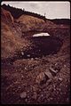 EFFECT OF A STRIP MINING OPERATION OFF ROUTE 269 NEAR BIRMINGHAM - NARA - 545529.jpg 2,015 × 3,000; 1.05 MB
-
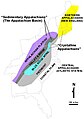
 Floridan Aquifer USGS.gif 402 × 408; 19 KB
-

-
 Physio-al.jpg 230 × 353; 74 KB


_(14781628202).jpg)
