Category:Geography of Bheemunipatnam
Subcategories
This category has the following 4 subcategories, out of 4 total.
B
E
G
P
Media in category "Geography of Bheemunipatnam"
The following 13 files are in this category, out of 13 total.
-
 A View of Bheemunipatnam Hilltop Visakhapatnam.jpg 1,590 × 1,200; 393 KB
-
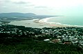
 Bheemili over view.jpg 1,280 × 678; 495 KB
-
 Bheemili overview 2.jpg 960 × 855; 572 KB
-
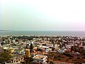 Bheemunipatnam Town View from Hilltop.jpg 1,280 × 960; 293 KB
-
 Evening scenic view at Bheemili Visakhapatnam.jpg 1,595 × 956; 221 KB
-
 Far view of Pavurallakonda and Bheemunipatnam town.jpg 1,200 × 656; 517 KB
-
 Hilltopview of Bheemunipatnam (bhimili) town.jpg 1,280 × 960; 105 KB
-
 Road towards Visakhapatnam at Bheemunipatnam.JPG 4,000 × 2,658; 4.87 MB
-
 Rural road near Bheemunipatnam.jpg 1,600 × 1,200; 454 KB
-
 Rural road near Bheemunipatnam01.jpg 1,600 × 1,200; 470 KB
-
 View of a Road near Bheemunipatnam1.JPG 3,153 × 2,056; 3.18 MB
-
 View of Bheemili Town from Pavuralakonda.jpg 1,600 × 1,200; 683 KB
-
 View of Gosthani Estuary into Bay of Bengal.jpg 1,600 × 1,048; 902 KB


_town.jpg)


