Category:Geography of Bhubaneswar
Subcategories
This category has the following 6 subcategories, out of 6 total.
B
- Bindusagar Lake (37 F)
M
- Maps of Bhubaneswar (2 F)
N
- Nayapalli (16 F)
- Niladri Vihar (10 F)
S
- Sikharchandi (1 F)
U
Media in category "Geography of Bhubaneswar"
The following 6 files are in this category, out of 6 total.
-
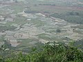 A view from Barunei Hill - panoramio.jpg 2,048 × 1,536; 1.52 MB
-
 Bhubaneshwar - Bindu Sagar pond with Brahma temple - view to Ananta Vasudeva Temple.jpg 4,000 × 3,000; 893 KB
-
 Bhubaneshwar - Bindu Sagar pond.jpg 4,000 × 3,000; 1.26 MB
-
 Gosagaresvara Tank.jpg 448 × 334; 23 KB
-
 Jayadev Vatika Bhubaneswara3.jpg 3,000 × 4,000; 3.45 MB
-
 Maa Dhakulei Peetha - panoramio.jpg 5,184 × 3,456; 5.76 MB


